

MJOatleast7
-
Posts
321 -
Joined
-
Last visited
Content Type
Profiles
Blogs
Forums
American Weather
Media Demo
Store
Gallery
Posts posted by MJOatleast7
-
-
Yeah, I just took the pup out for the evening walk. It's impressive how warm it is for 11:00pm, just stifling.
I remember a 4th of July overnight period sometime in the 90s where Central Park station was 91 F at 1:30 AM. There was a power warning in effect. Guess they issue those when the grid is in danger of collapsing.
. -
7/3/66, hottest day I've experienced (8/2/75 the only day even close). However, CON records begin in 1921 so no numbers for July 1911 when ASH hit 106.
8/2/75 is my #1…IIRC a couple of places in MA hit 107
.-
 2
2
-
-
27 minutes ago, dryslot said:
Going to hit the Flemish Cap.
Hey, why not Portugal while we're at it?
-
 3
3
-
-
That's crazy, thought I read that town doesn't usually get a lot of snow, its east of Sapporo.
The real snow bullseye is Sukayu Onsen (mineral baths) in the northern part of Honshu in Aomori Prefecture. Annual snowfall 660” or thereabouts.
.-
1
-
-
Flakes nixing in here on Winchester, just north of Boston. Too bad rates went to pot at the same time.
.-
1
-
-
14 hours ago, klw said:
Well it has snowed almost non stop here for the last 3 weeks. The sad part is despite this, our total accumulation is exceeded by Pensacola in this period.
The kind of snow grains they get for weeks on end in eastern Europe and western Russia.
-
1 minute ago, MJOatleast7 said:
I remember a spectacular outbreak in Middlebury, VT, when I was a student there, I think it was in the winter of 1981-82. Looking straight up the curtains, they were tilted to the south about 15 degrees from overhead. Fast washes of color would rush down the curtains every couple of minutes and really gave them an electric feeling. I was a fan of Pat Metheny at the time and remember thinking his piece "As Falls Wichita, So Falls Wichita Falls", especially the harp glissandi, would go great as a soundtrack with the aurora.
-
Pretty late 90 possible on the GFS 6z. Within three days of joining the exclusive 90 in October Club (has happened in BOS 3 times)
-
2
-
 1
1
-
 1
1
-
-
18 minutes ago, Great Snow 1717 said:
..far too many kids are treated like fragile glass. Just talk to hs football coaches, they will all tell you that once the "cold" hits in October kids begin to quit....parents complain about there not being an indoor practice facility....we both know that SNE becomes the Yukon in October... a player could freeze to death running around a football field....
Or this could happen...
https://www.businessinsider.com/olympic-skier-says-his-penis-froze-frostbite-during-race-pain-2022-2
-
4
-
-
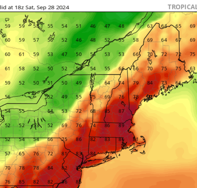
even Barrow Alaska or whatever they call it now reached 66 with a dew of 55 on the 26th that's nuts for them
Utqiagvik is the Inuit name they use now
. -
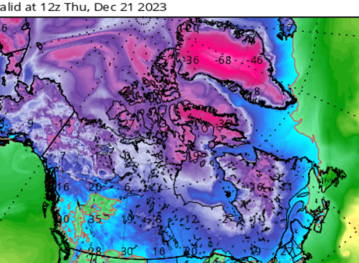
Interesting also that the band of heaviest snow is almost exactly parallel to ( but about 50 miles south of) the path of totality of the eclipse in 2 weeks.
.
Actually the northern edge in this pic tracks the northern edge of totality almost exactly.
. -
Interesting that parts of the St Lawrence River Valley is also bare on the north side of the storm.

Interesting also that the band of heaviest snow is almost exactly parallel to ( but about 50 miles south of) the path of totality of the eclipse in 2 weeks.
. -
What a total bon€r killer for BOS/SE
Glad we don’t live there (BOS). Unless you’re Tom Hanks doing a relaunch of The Terminal.
.-
1
-
-
1 minute ago, dendrite said:
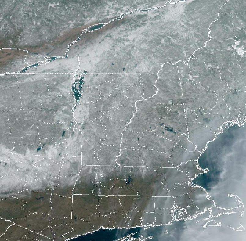
Well we’re not getting much snow, but I wouldn’t call this the 80s either. My ground would maybe be brown, but it would be frozen 2 feet deep.
Somewhere between the '80s and the mid-Pliocene (Global SSTA +2-3 deg C, Arctic +8 deg C) I'd call it.
-
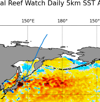
Oh my...Fukushima Daiichi nuc wastewater surge again?
") from 12/27 NOAA NESDIS
from 12/27 NOAA NESDIS
-
1
-
-
Meanwhile in Greenland:
-
1 hour ago, weatherwiz said:
Really not sure what to think of it. I mean when you look at how 500mb evolves, the scenario is a plausible one, doesn't mean it's likely but at this stage you can't really discount anything.
The PWAT anomalies are absolutely insane. 5+ SD across a large area

Some Hunga Tonga water in there too I feel
-
1
-
-
7 minutes ago, CoastalWx said:
Haha Occasional. OCNL is used in weather. My bad.
Not occlusional?
-
1
-
-
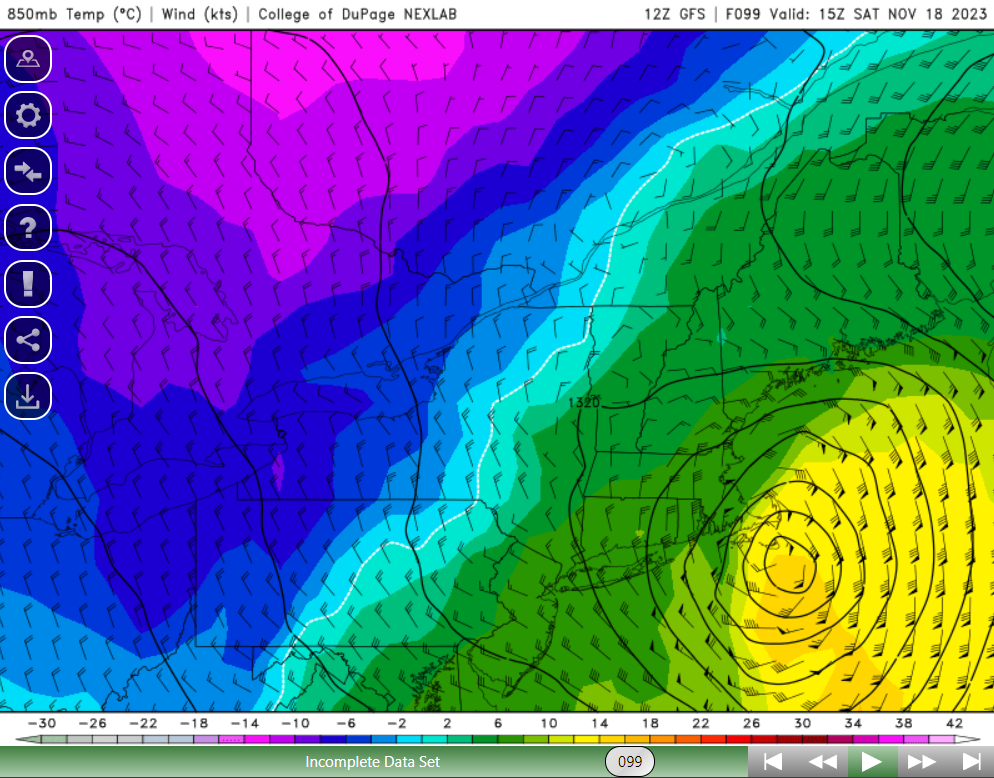
1 hour ago, weatherwiz said:
Pretty decent warm core. +15C or so at 850

Meh...typical July values.
-
 1
1
-
-
13 hours ago, powderfreak said:
Had a classic November hunters vibe at sun down at 1500ft. Stick season, cold, with a skiff of snow. The forest had a very strong nostalgic vibe for how you envision November.

Blair Witch vibe.
-
2
-
-
38 minutes ago, bwt3650 said:
Some know the temps for thanksgiving, so two weeks should be easy.
.Are they factoring in the Typhoon Bolaven recurve in the N Pac?
-
1
-
-
4 minutes ago, Go Kart Mozart said:
Are you thinking HM is Henry Margusity?
I thought it was.
-
1
-
-
This is kinda weather related but I get on twitter occasionally and HM or Anthony Masiello hasn't been on recently. Does anyone know have an idea why? Think his last post there was end of August. I always follow his insights about weather patterns
It’s hopefully finally sunk in for HM that there’s absolutely no basis for him to forecast an above-normal snow winter. He really has nothing to talk about this time.
. -
29 minutes ago, Typhoon Tip said:
Still ... for me, I like seeing the 540s hydrostats atop -2C at 800 mbs arriving on the NAM/FOUS grid.
Hearkens the spirit of the season.
Bring it.


June 2025 Obs/Disco
in New England
Posted
Sea fog flirting with us here in Swampscott, MA. Nice and comfy at 73 F here.
.