

MGorse
-
Posts
2,110 -
Joined
Content Type
Profiles
Blogs
Forums
American Weather
Media Demo
Store
Gallery
Posts posted by MGorse
-
-
1 hour ago, anthonyweather said:

Friend got my pic lol
.Do you have a wing plow on that?
-
1 hour ago, Blizzard of 93 said:
The CTP website says daily climate summary as of 5 pm.
I see that you are a Meteorologist & your name sounds familiar. Do you work for the National Weather Service?
If you have any contacts at CTP, I would love to know if this is their official total for MDT or will they adjust it tonight with the final Daily Climate Summary overnight?

I work at NWS Mount Holly. When we run our late afternoon climate, the daily snowfall is through 18z.
-
 1
1
-
-
28 minutes ago, Blizzard of 93 said:
This is an absolute joke…!
How in the heck did MDT only record 2.0 inches of snow today at the 5 pm summary.
They had .42 of precip through 5 pm.
Did someone look out of the air traffic control tower & phone in to CTP & say, “it looks like 2 inches Bob”!?!??!
Hopefully this gets corrected on the official oversight daily summary. There is absolutely no darn way they had 2 inches of snow MDT on .42 of precip.

That may have been the total through 18z (1 PM).
-
2 minutes ago, Blizzard of 93 said:
Also, more fake news is the snow depth of 0 at 5 pm!
The snow depth in the climate report is at 12z (7 AM).
-
 1
1
-
-
Squeezed out a tenth of an inch of snow early this afternoon, then a cold nasty rain.
-
1
-
1
-
-
41 minutes ago, Newman said:
Storms like this make me glad I didn't choose to go the forecasting route
Oh come on, you miss it.
")
-
1
-
 2
2
-
-
4 minutes ago, Newman said:
Mount Holly just re-issued the WWA for Berks, Lehigh, Hunterdon as 3-6" now
It was 3-5 inches earlier, so not a significant change.
-
3
-
-
I dislike this storm!
-
1
-
5
-
-
I wonder if the Winter Storm Watch gets expanded to include at least Berks and Lehigh counties.
-
1
-
-
1 hour ago, Hurricane Agnes said:
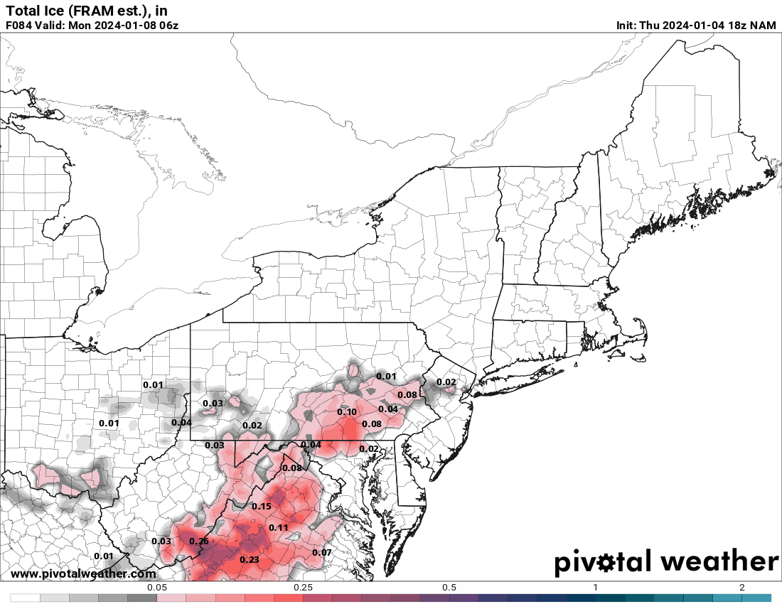
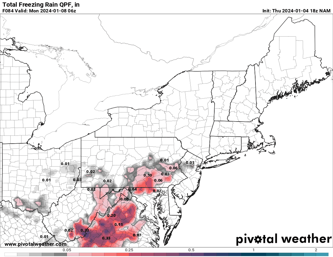
Note the NAM ice & ZR maps.
18z GFS is running but the 19z NBM ain't buying what the NAM is selling.


Since the NBM is a blend of many models, it won’t completely tip to one model such as the NAM.
-
3
-
-
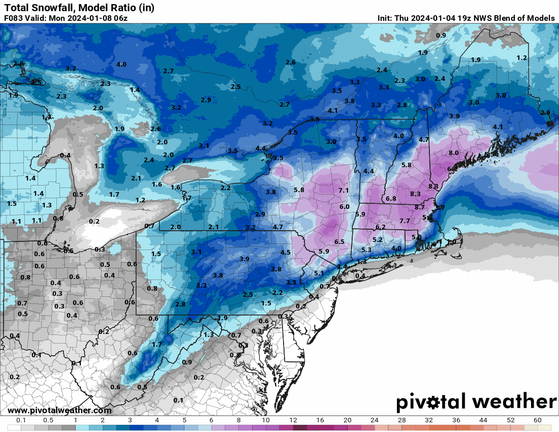
3 hours ago, Kevin Reilly said:
4-12" LOL quite a spread! I see he still likes Penn State!
T-4” LOL
-
2
-
-
2.25 inches of total rain. If it mixed with or ended as some wet snow, I missed it.
-
1
-
-
I found this site for Mexico radars. Looks like the nearest radar is rather far inland from Acapulco. I think the Acapulco radar is not in service.
https://smn.conagua.gob.mx/es/observando-el-tiempo/radares-meteorologicos-separador/visor-radares-v3
-
1
-
-
After another downpour late this afternoon, my two day total is 3.66 inches. It’s wet!
-
1
-
-
Dumping here. Up to 1 inch for the day and counting.
-
 1
1
-
-
Finally got into the rain action. 0.51 inches today (0.08 inches yesterday).
-
I am just enjoying the anvil clouds now above me from all the convection to my west and southwest.

-
1
-
-
Picked up 0.08 inches. Better than 0.
-
1
-
1
-
-
5 hours ago, famartin said:
Paul… you’re fighting this is tiresome, that’s why the “name calling”. Your data is simply garbage, like most of your related “climate change” posts. I’ve proven that pretty well just now. But obviously you have an agenda. Obviously if your a rich snob in east nantmeal then I guess overall, it doesn’t suck to be you, but your numbers are trash. Too bad, so sad.
Wow Ray!!
-
Still dry here, but at least the outflow blew through and cooled it down significantly. Rain would certainly be nice though!
-
Very eerie looking outside with a yellowish glow.
-
1
-
-
2023 Precipitation Departures from normal (in inches) through 5/27:
Allentown, PA (ABE): -2.37
Reading, PA (RDG): -3.99
Mount Pocono, PA (MPO): -1.48
Philadelphia, PA (PHL): -4.10
Trenton, NJ (TTN): -3.71
Atlantic City, NJ (ACY): -1.68
Atlantic City Marina, NJ (55N): -3.53
Wilmington, DE (ILG): -5.21
Georgetown, DE (GED): 2.06
-
1
-
-
Many trees down in my town (Delran, NJ). The roar was quite evident before the massive wind hit.
-
2
-
1
-
-
52 minutes ago, Hurricane Agnes said:
Last tweet with the summary graphic caps it at 12" up north at the higher elevations -
The 2 feet of snow mention was from much earlier today.


January 6-7 Winter Storm
in Philadelphia Region
Posted
You need to work on making that happen then.")