paweather5
-
Posts
455 -
Joined
-
Last visited
Content Type
Profiles
Blogs
Forums
American Weather
Media Demo
Store
Gallery
Everything posted by paweather5
-
Central PA - Winter 2020/2021
paweather5 replied to MAG5035's topic in Upstate New York/Pennsylvania

-
Central PA - Winter 2020/2021
paweather5 replied to MAG5035's topic in Upstate New York/Pennsylvania

-
Central PA - Winter 2020/2021
paweather5 replied to MAG5035's topic in Upstate New York/Pennsylvania
-
Central PA - Winter 2020/2021
paweather5 replied to MAG5035's topic in Upstate New York/Pennsylvania
Ukie was better then I thought.
-
Central PA - Winter 2020/2021
paweather5 replied to MAG5035's topic in Upstate New York/Pennsylvania
ukie is ugly when does the west trend stop.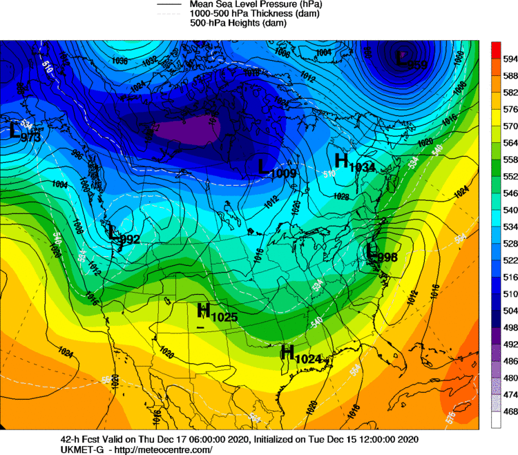
-
Central PA - Winter 2020/2021
paweather5 replied to MAG5035's topic in Upstate New York/Pennsylvania
-
Central PA - Winter 2020/2021
paweather5 replied to MAG5035's topic in Upstate New York/Pennsylvania
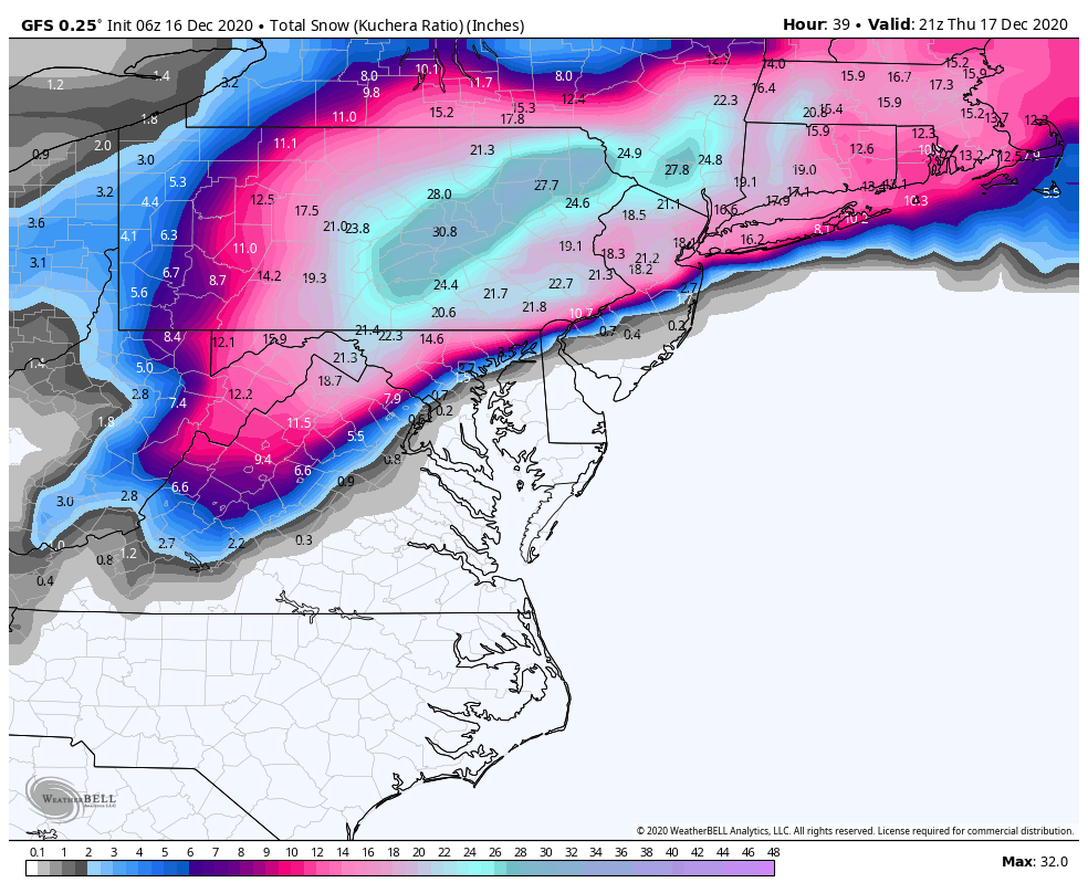
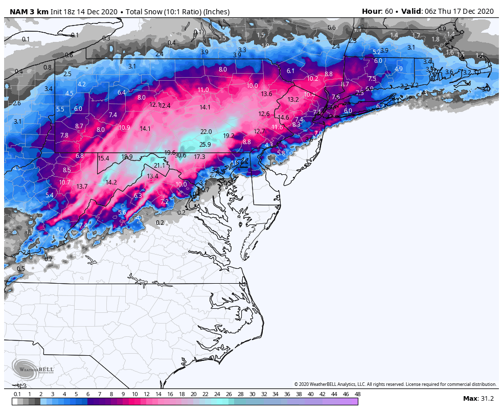
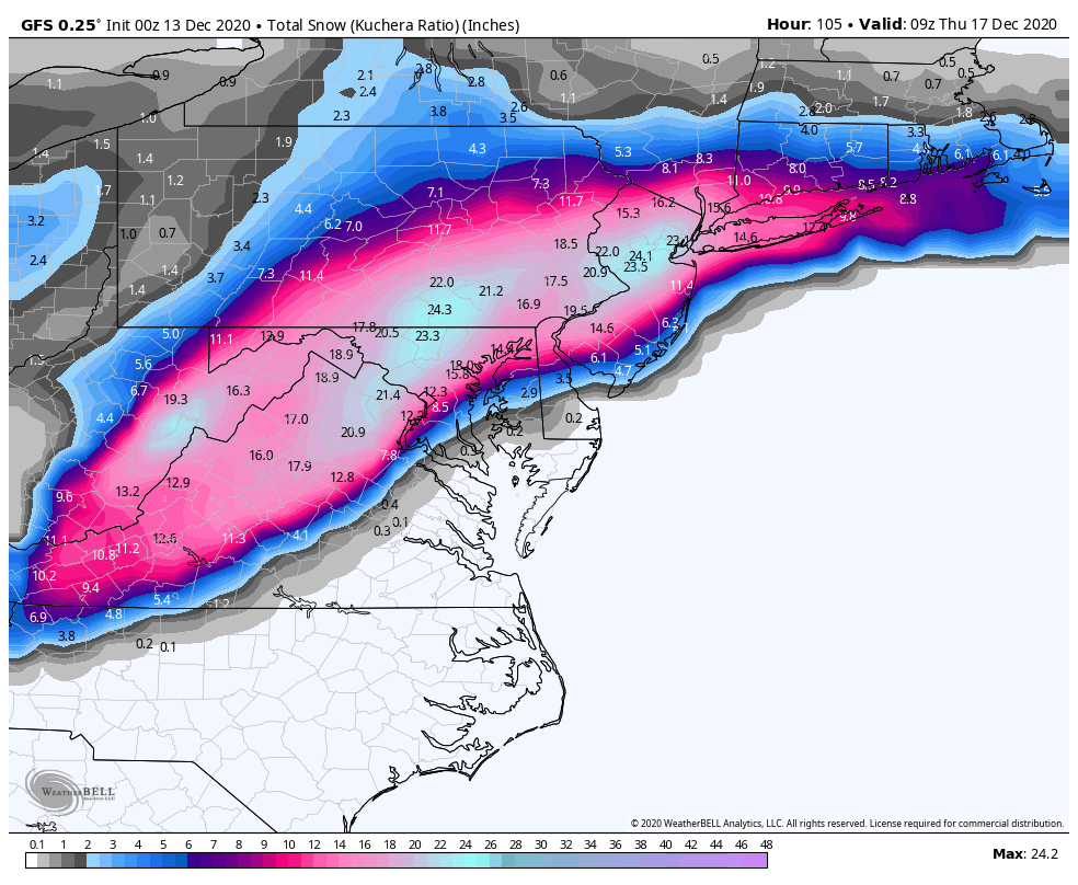
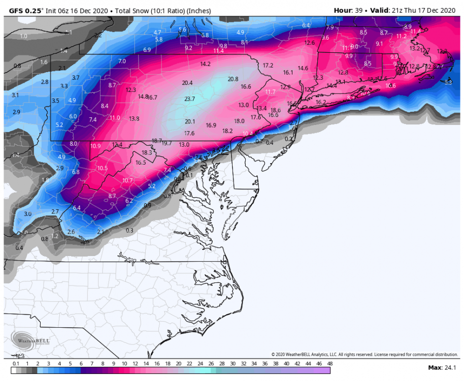
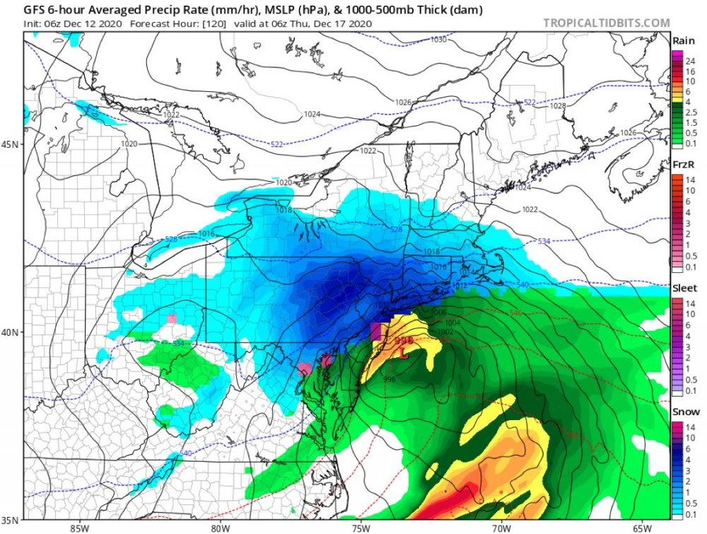
Insane 3k run
-
Central PA - Winter 2020/2021
paweather5 replied to MAG5035's topic in Upstate New York/Pennsylvania
-
Central PA - Winter 2020/2021
paweather5 replied to MAG5035's topic in Upstate New York/Pennsylvania
-
Central PA - Winter 2020/2021
paweather5 replied to MAG5035's topic in Upstate New York/Pennsylvania
-
Central PA - Winter 2020/2021
paweather5 replied to MAG5035's topic in Upstate New York/Pennsylvania

-
Central PA - Winter 2020/2021
paweather5 replied to MAG5035's topic in Upstate New York/Pennsylvania
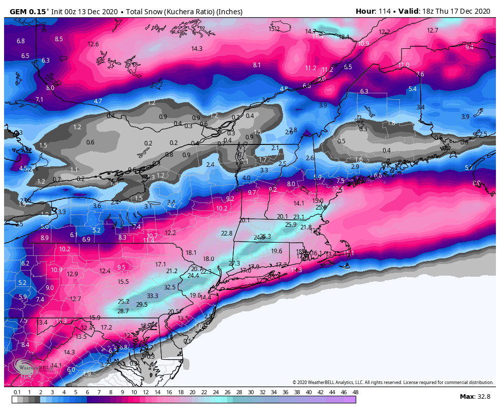
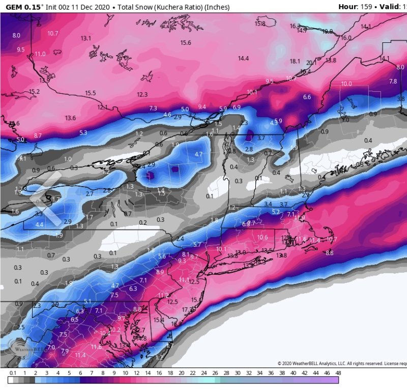
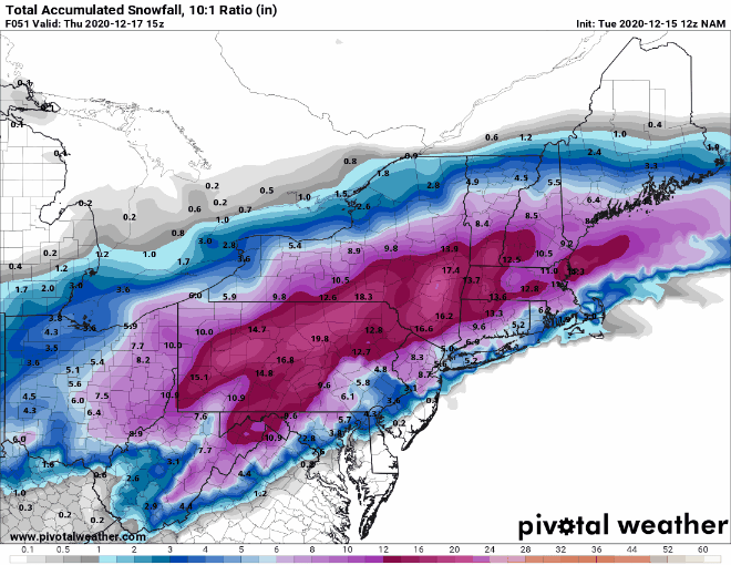
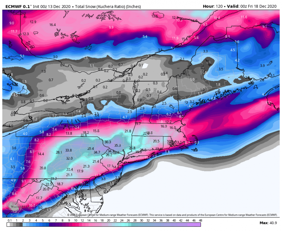
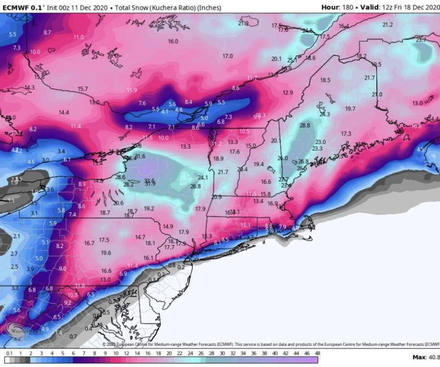
While we wait for the euro, just going to drop this gem.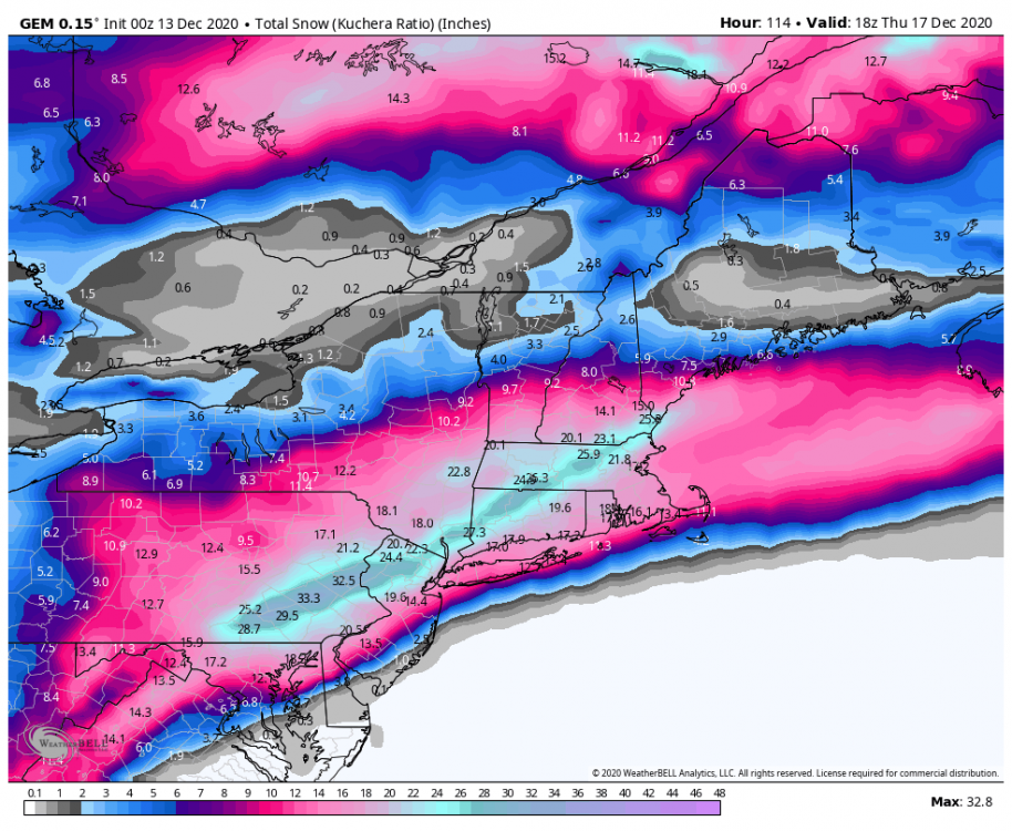
-
Central PA - Winter 2020/2021
paweather5 replied to MAG5035's topic in Upstate New York/Pennsylvania
That’s a good point. With the low pressure and high pressure should be some good winds I would think. I know it will change next few days but what’s the start time looking like. -
Central PA - Winter 2020/2021
paweather5 replied to MAG5035's topic in Upstate New York/Pennsylvania

-
Central PA - Winter 2020/2021
paweather5 replied to MAG5035's topic in Upstate New York/Pennsylvania
Shouldn’t do this but ohh well haha.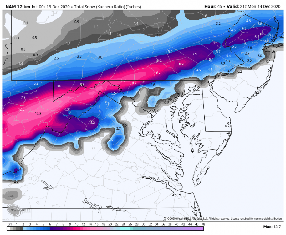
-
Central PA - Winter 2020/2021
paweather5 replied to MAG5035's topic in Upstate New York/Pennsylvania
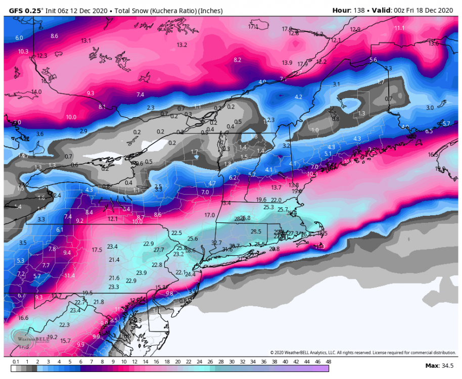
Boy is this nice to see.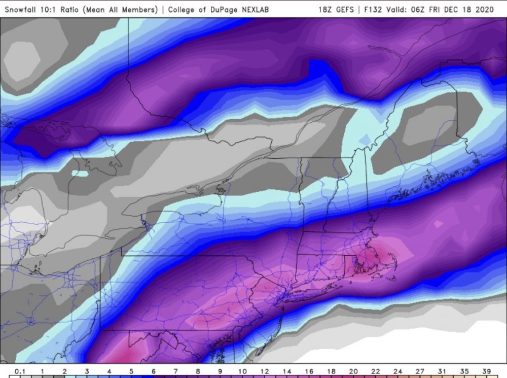
-
Central PA - Winter 2020/2021
paweather5 replied to MAG5035's topic in Upstate New York/Pennsylvania
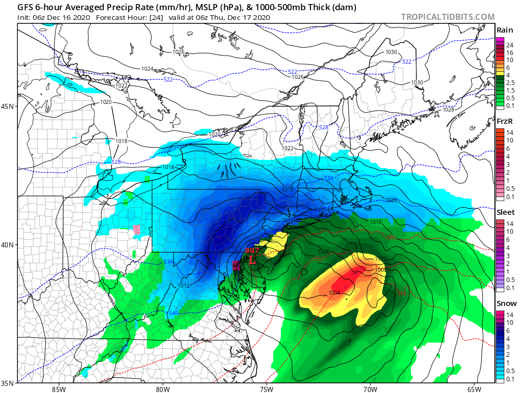
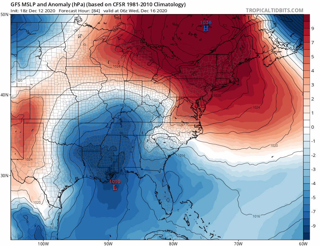
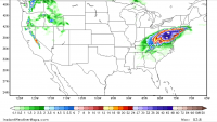
Saw this and thought it needed to be shared. You can see the weird jump northwest with the low. It’s own ens don’t support the op.
-
Central PA - Winter 2020/2021
paweather5 replied to MAG5035's topic in Upstate New York/Pennsylvania
-
Central PA - Winter 2020/2021
paweather5 replied to MAG5035's topic in Upstate New York/Pennsylvania

-
Central PA - Winter 2020/2021
paweather5 replied to MAG5035's topic in Upstate New York/Pennsylvania
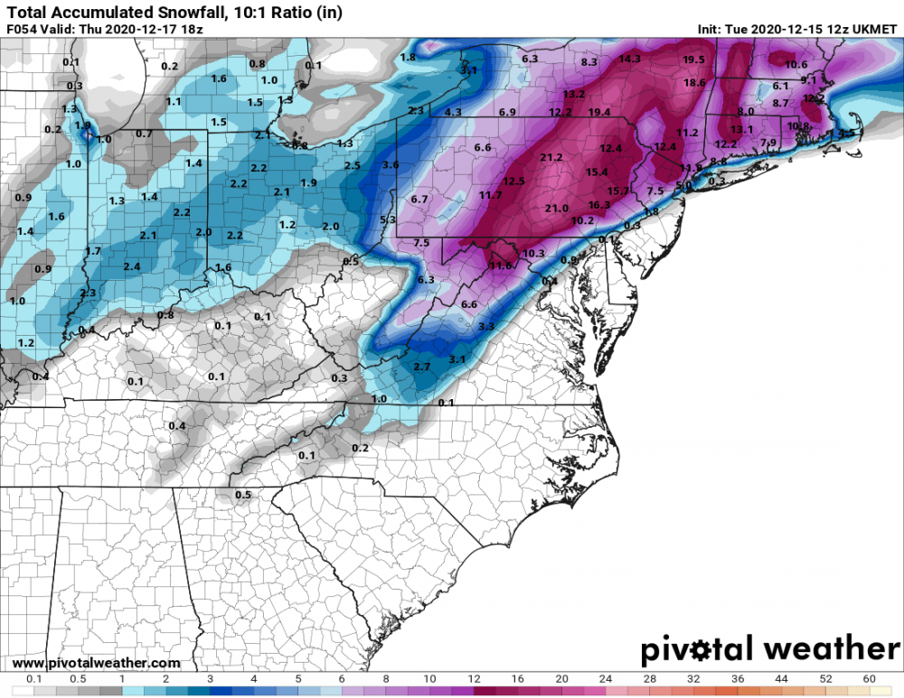
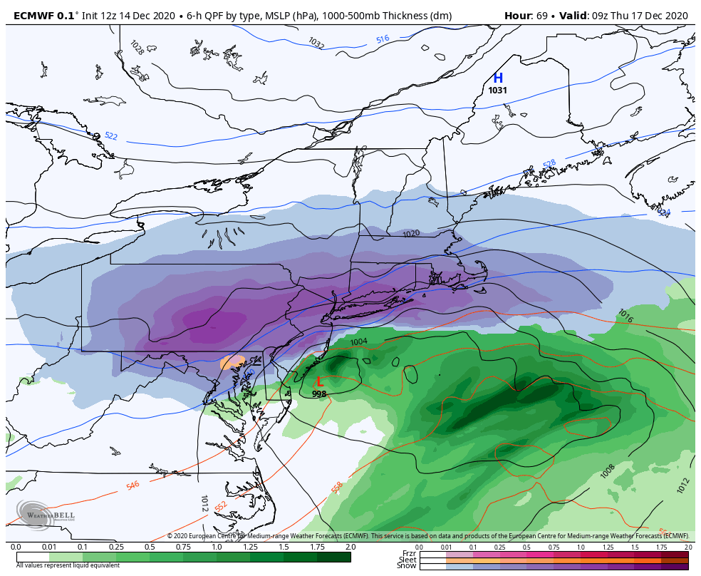
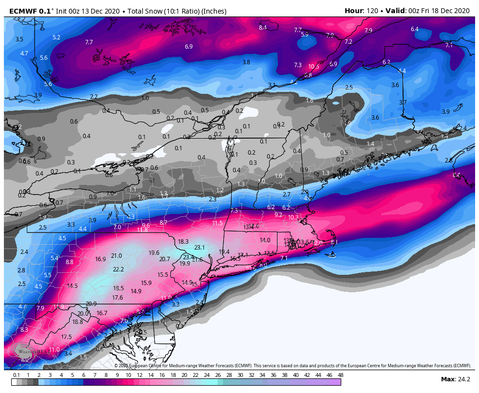
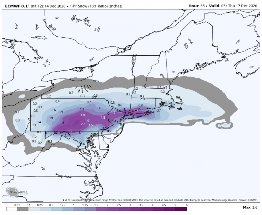
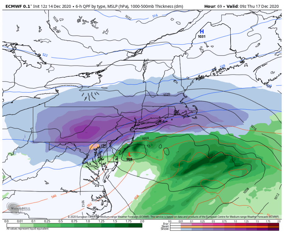
Euro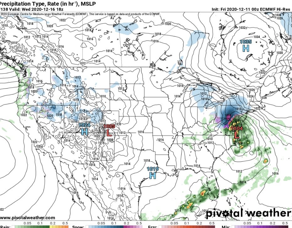
-
Central PA - Winter 2020/2021
paweather5 replied to MAG5035's topic in Upstate New York/Pennsylvania
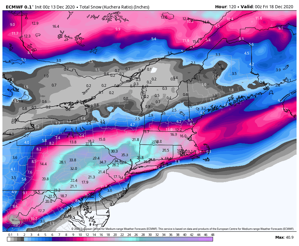
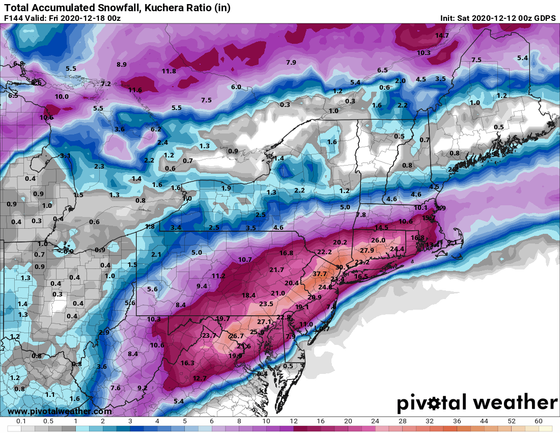
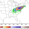
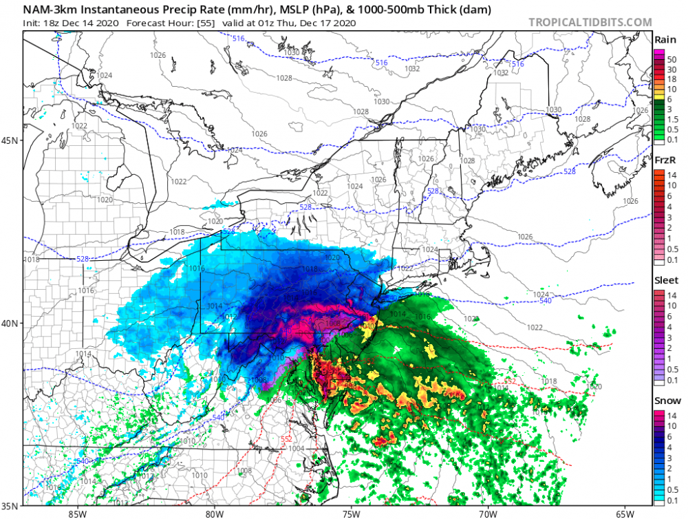
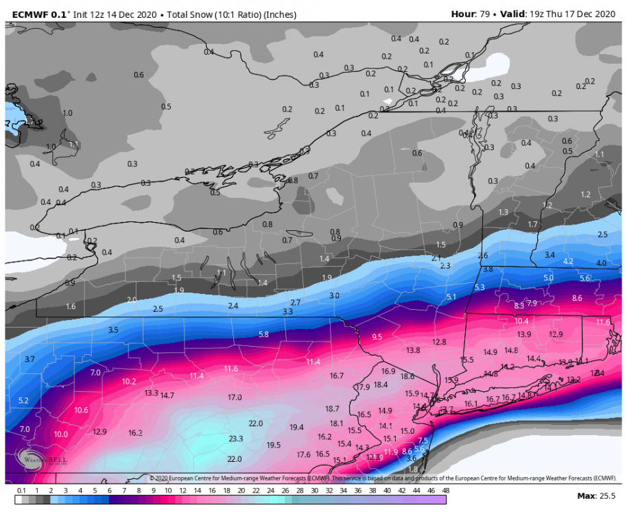
Cmc
-
Central PA 2020 Fall - The Hope begins
paweather5 replied to paweather's topic in Upstate New York/Pennsylvania
Now I would take this, last summer weekend hot in the pool right into winter. That’s amazing to change that fast.