MD Snow
-
Posts
1,875 -
Joined
-
Last visited
Content Type
Profiles
Blogs
Forums
American Weather
Media Demo
Store
Gallery
Posts posted by MD Snow
-
-
13 minutes ago, Maestrobjwa said:
While my first reaction to that was a primal scream, I do wonder if the cold would be enough to setup an overrunning event or something...But, let's just see if that general look stays there or not.
IMO the last few runs of the GFS and even the GEFS show hope for us being on the right side of the boundary at least once in the next 10 days. Past that anything can happen even with Ens. Overall I'm pretty encouraged this morning.
-
 1
1
-
-
It's an op run but the 18z gfs shows something similar to what the eps was showing with a displacement of the pv south/hudson bay. Actually has legit cold here starting around Sunday, Feb 16. Interesting to see if the GEFS starts to hint at this moving over the next couple of days.
-
 1
1
-
-
17 minutes ago, showmethesnow said:
You better hope the EPS is more right then the GEFS. GEFS was ugly. EPS doesn't look so great either as of right now it probably argues for the boundary to mostly be north of us.
Yup. Given this winter, it's a real long shot. But it's our only shot at this point. Much is stacked against us. There's still a chance and as long as there's a chance, i'll stay interested. 6z GEFS (sucks) seems to be getting us on the right side toward the end of it's run. GEPS seems to get the boundary south of us for a period between Feb 14-18.
-
CMC sniffed out that Saturday was pretty much a non event a couple days ago. Was a big red flag for me, especially considering how good it's been of late. Feb 13-14 are the dates I have in my mind at a possible flip to a more favorable pattern. There are some signs that we may be on the right side of the boundary. If we see this trend badly over the next week or so, then bring on spring!
-
CMC hasn’t shown anything for 2 runs in a row now. It’s the second best model. Definitely a red flag. Still plenty of time.
-
 1
1
-
-
1 minute ago, Ji said:4 minutes ago, MD Snow said:Gfs has another system with frozen to rain next Wednesday night.
It has shown it once a day for the past week and then the very next run is all rain and 60
Worth keeping an eye on. Could our fortunes be turning finally?
-
Gfs has another system with frozen to rain next Wednesday night.
-
I’m not buying the weekend thing until the Canadian gets back on board. To many whiffs showing up in the Ens still. Canadian had a big storm 2 nights ago and has completely lost it over the last 48hrs.
-
7 minutes ago, Bob Chill said:
We go around in this circle every.single.year. It can be in the 50s for a week straight and snow will stick easily at 32-33. Happens every single time
Not to mention that this particular event has the potential to be coming in at night time in early February.
-
7 minutes ago, Weather Will said:
Agreed, but do you really think that inch is going to accumulate on ground this warm? It is not realistic.

Aren't we talking about the potential next Sunday? That's in like 6 days. Totally different airmass.
This is saturday morning. Before precip moves in saturday night.
-
14 minutes ago, BristowWx said:
Here he comes to wreck the daaayyy! Just kidding reality bites. Thanks for posting
On the positive side, about 12/20 get at least an inch to or around the cities. At a 6 day lead, I'm more interested in that. Don't tell me at this point we all wouldn't be very happy to wake up to an inch of the white stuff on Sunday morning.
-
 2
2
-
-
13 minutes ago, Bob Chill said:
Snowmaps come in all flavors and their usefulness is heavily debated on the regular. However, I really like the EPS 24hr snow meteos. Give you quite a bit of important data at a single glance. Most importantly it provides concise data irt timing or shotgunning. Whenever digital events are splattered over time with no consensus it means there is no discrete threat at all. However, when members start ganging up in a tight time window it's very meaningful. I actually really like the 12z eps for Sun/Mon. This is one of the best inside d7 looks we've had. D10+ is a scatterbrain shotgun blast but not next weekend... Let's see if this can trend right for once.
ETA: 35 out of 50 show some sort of frozen precip Sun/Mon. I can't think of a single event at this range where it had nearly 75% agreement on some sort of winter wx.
Seriously, thank you for posting something other than just some percentage color shades while saying, "Still no real shot at anything for another 10 days..."
-
 8
8
-
-
12 minutes ago, BristowWx said:
A fly just landed on my windshield. I will take whatever I can get because I am in no position to be choosy. All in for mood flakes.
At this point, i'm chasing snow flakes, ice pellets, rain that freezes, whatever little bit of winter this despicable winter can muster.
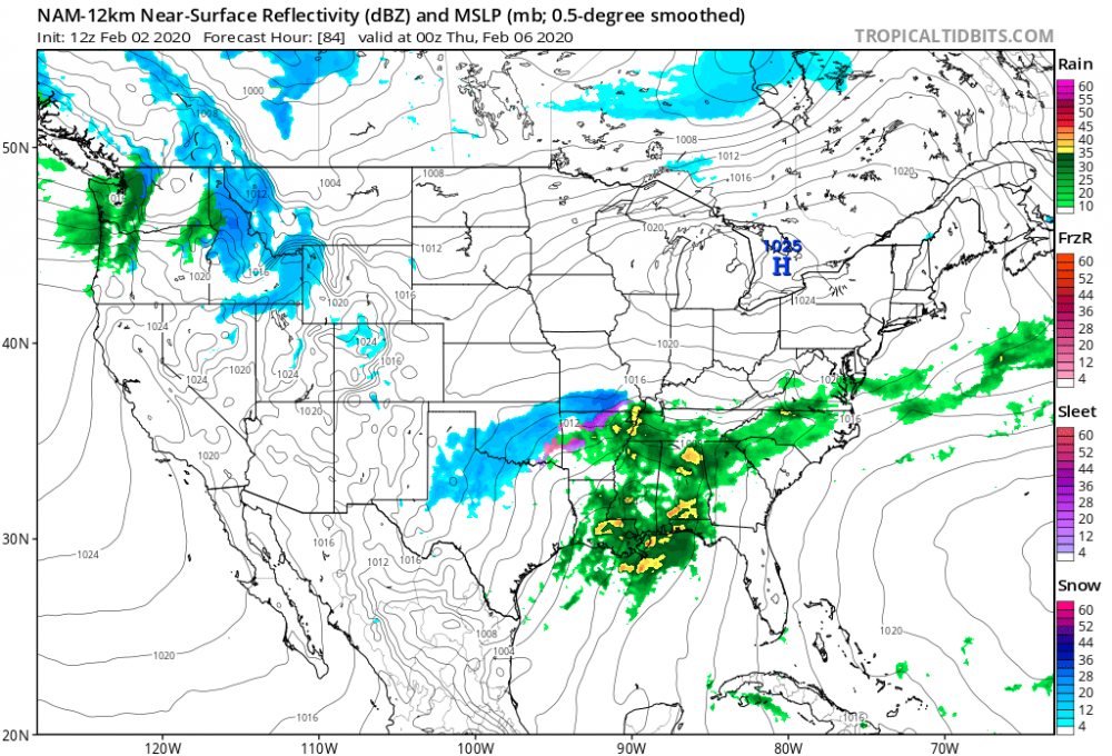
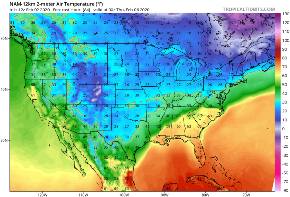
18z 12k nam has a slightly better cold push Wednesday night for areas north and west. Not a lot of precip though until the cold erodes.
-
CMC on board as well. Too early to hash out details. Lot's of weather going on this week and it will have an impact on what the weekend system has to offer us.
-
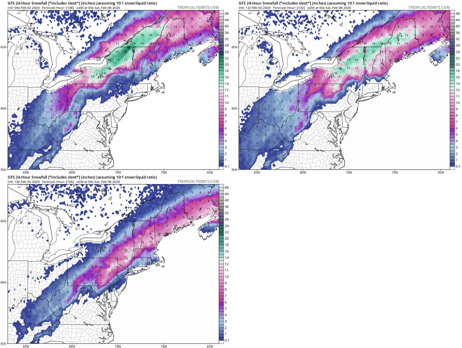
Saturday night/Sunday system shows up on the 12z gfs. HPC is sliding off the east coast as system gets to the MA. Not ideal. Still time for that to change. Any other winter and we'd be excited about this possible event.
I'd imagine that if you slowed the NS down a bit it would allow the HPC to hang on longer thus allowing for more of a fresh cold air source. By the time the system gets to us, it's an old/stale cold air mass.
-
My attention is quickly turning to next Sundays potential.
Go take a peak at hr180 of the 0z cmc. Gfs has something trying to get going in this timeframe as well along with the euro.
-
 1
1
-
-
Incoming on 0z 12k NAM at the end of its run.
-
-
-
-
Call me the eternal optimist but I could see how we could at least land a decent event between now and the middle of the month. There’s cold nearby. Multiple waves. All it would take is for the boundary to be south of us for one wave. I know it’s unlikely given the trend this winter. I think we’re probably at the height of our skepticism so far this year. Which will make it all the better if we actually can land an event.
-
-
10 minutes ago, stormtracker said:
3 blips in a trend.
At this point in this winter, nothing is a trend until we actually have some wintry precip falling from the sky.
-
 1
1
-
-
Gfs gets mix even into cities Wednesday evening.


February Medium/Long Range Discussion
in Mid Atlantic
Posted
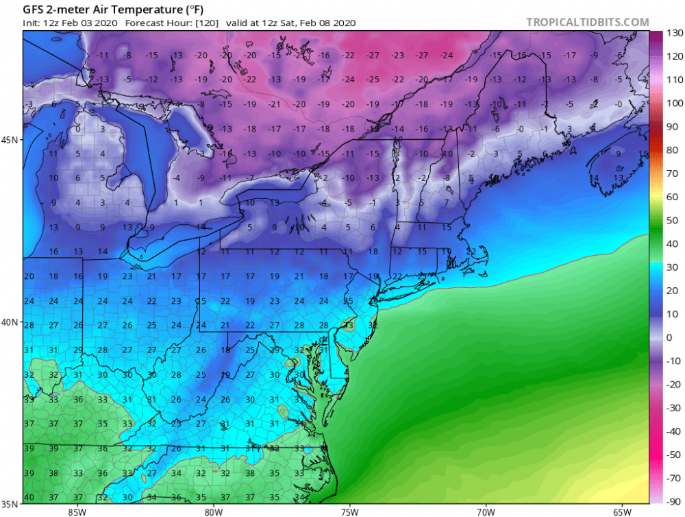
Call it just a blip but as next week is getting closer the looks both at 500 and at the surface are improving across guidance.