powderfreak
-
Posts
83,819 -
Joined
-
Last visited
2 Followers

About powderfreak

-

Augdewst 2026: Summer's Last Stand
powderfreak replied to Prismshine Productions's topic in New England
Yeah nothing abnormal. We’ve seen a few up here.
-
Augdewst 2026: Summer's Last Stand
powderfreak replied to Prismshine Productions's topic in New England
Our standards seem to be getting high if 1.5” of rain is the barometer of worthy rain. A half inch will soak in nicely. -
Augdewst 2026: Summer's Last Stand
powderfreak replied to Prismshine Productions's topic in New England
The only trees that fall are ones near power lines in CT. -
Cold season with warm season daylight would be ideal, ha.
-
At this point I almost have to check myself that you aren’t running some AI prompt “Remove radar echoes on this image when they get near the chicken.”
-
I’m with ya today. Would’ve swallowed an uzi in January lol.
-
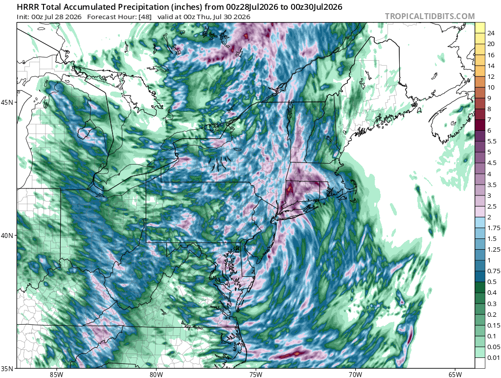
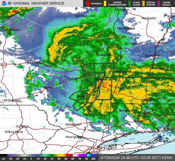
Does not look to be stopping anytime soon. 12z HRRR has it ripping through 00z/8pm tonight at least with another 2-3".
-
Some 7-8” amounts on CoCoRAHS just south of Albany in the Hudson Valley. That’s decent water for 24-hr period.
-
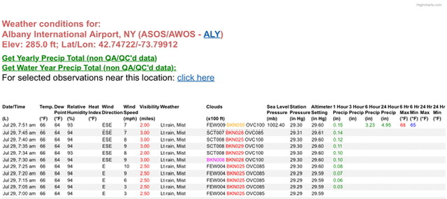
ALB with 4.95” so far.
-
Peels all the soil off Mt Tolland…
-
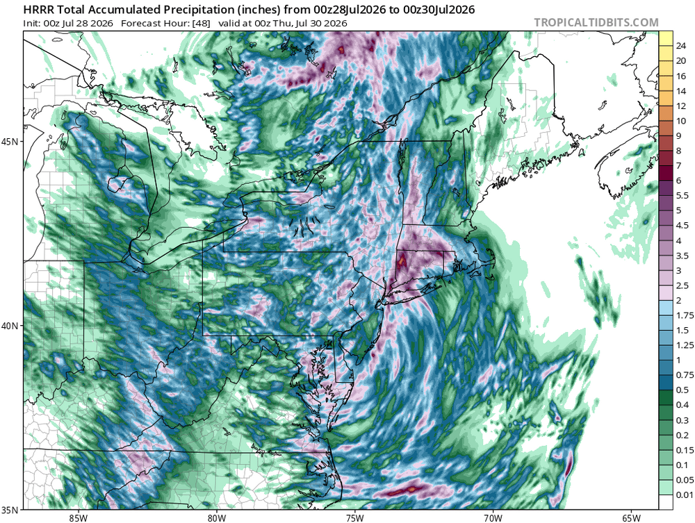
Another convective round to go in eastern areas. Healthy run.
-
What happens after that? No way there’s zero rain further east. Edit: Whoops, should’ve read the next few posts, ha. Folks have it covered.
-
The good news with that set up is you pump humid air out ahead of it with good pwats and it won’t take much to tally up some quick appreciable rainfall in New England as the front lifts NEward. Though I haven’t looked close enough to see if it’s occluded by that point.
-
Stick with the 6z Euro in the paper bag.
-
Yeah looks like another good soaker on the way down there.