WeatherX
-
Posts
2,714 -
Joined
-
Last visited
Content Type
Profiles
Blogs
Forums
American Weather
Media Demo
Store
Gallery
Everything posted by WeatherX
-
Watching closely .. February 1-3rd for moderate to major coastal event
WeatherX replied to Typhoon Tip's topic in New England
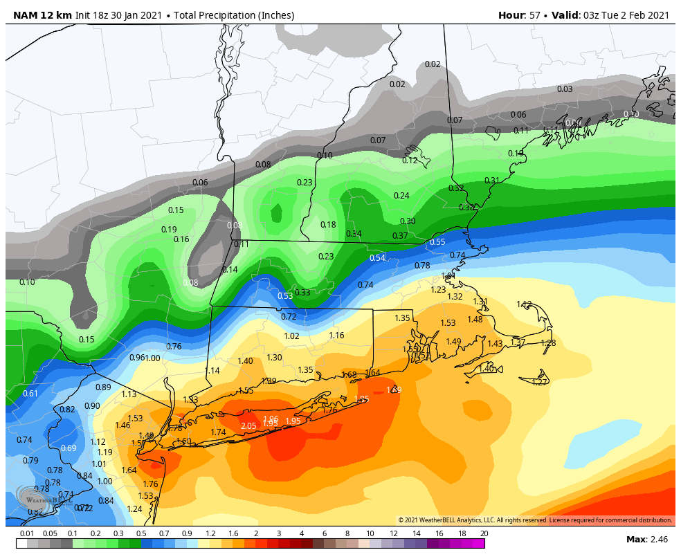
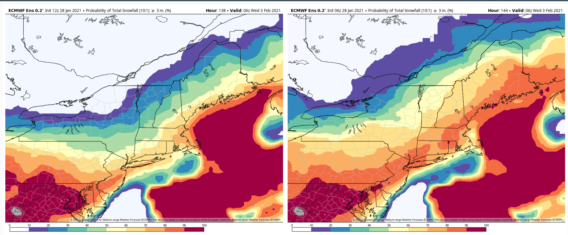
RGEM might actually be a bigger hit than the NAM -
Watching closely .. February 1-3rd for moderate to major coastal event
WeatherX replied to Typhoon Tip's topic in New England
North American Model IPA blend baby! -
Watching closely .. February 1-3rd for moderate to major coastal event
WeatherX replied to Typhoon Tip's topic in New England
What a crush job for CT on the Nammy through 54. Nice to see it ramped versus dampened -
Watching closely .. February 1-3rd for moderate to major coastal event
WeatherX replied to Typhoon Tip's topic in New England
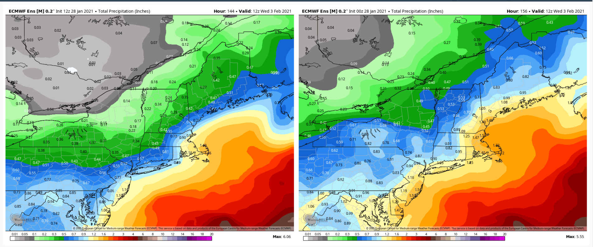
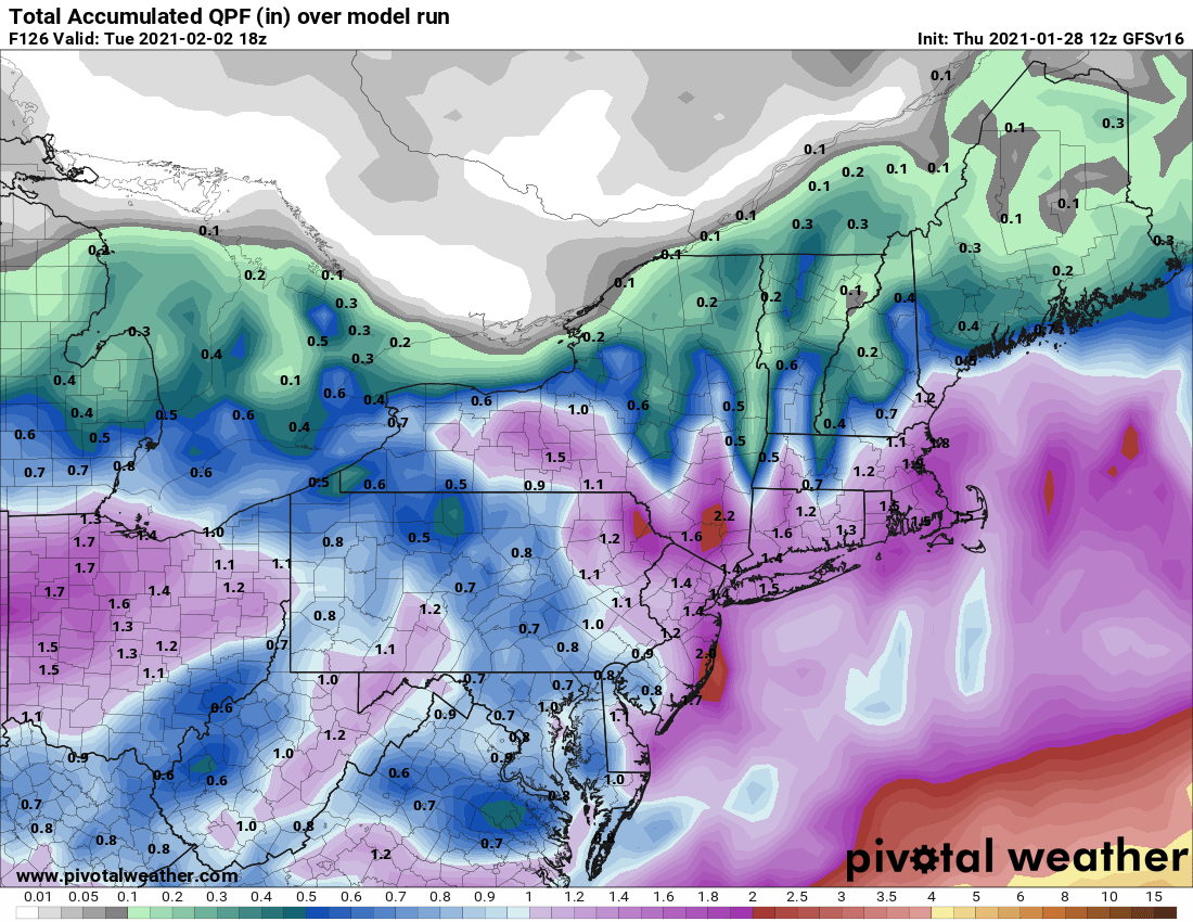
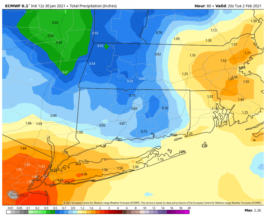
Yup pretty clear now on qpf maxes. Dynamics and other short term players still TBD. . -
Watching closely .. February 1-3rd for moderate to major coastal event
WeatherX replied to Typhoon Tip's topic in New England
-
Watching closely .. February 1-3rd for moderate to major coastal event
WeatherX replied to Typhoon Tip's topic in New England
Has to be sipping some Canadian mist and coke -
Watching closely .. February 1-3rd for moderate to major coastal event
WeatherX replied to Typhoon Tip's topic in New England
Starting to look that way. LaLa lock it in tomorrow on the 12z runs if the same? -
Watching closely .. February 1-3rd for moderate to major coastal event
WeatherX replied to Typhoon Tip's topic in New England
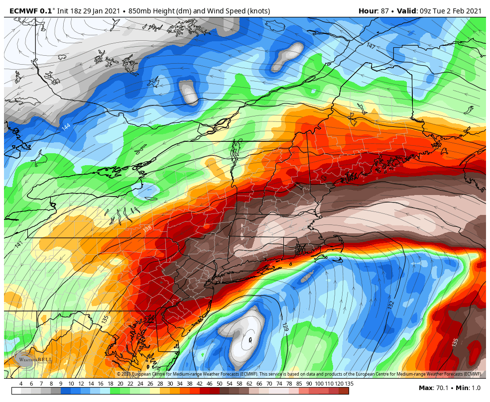
Jacktastic at 87 hours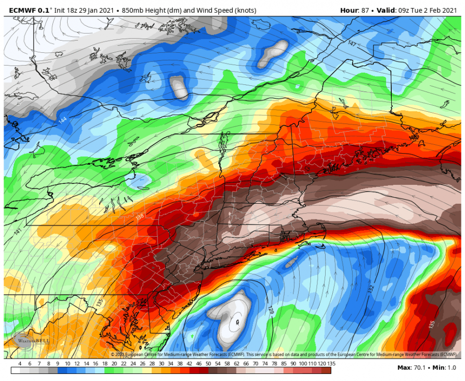
-
Watching closely .. February 1-3rd for moderate to major coastal event
WeatherX replied to Typhoon Tip's topic in New England
Would definitely be a good start for the new version if it verifies
-
Watching closely .. February 1-3rd for moderate to major coastal event
WeatherX replied to Typhoon Tip's topic in New England
Shrinkage in a couple different ways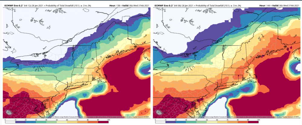
-
Watching closely .. February 1-3rd for moderate to major coastal event
WeatherX replied to Typhoon Tip's topic in New England
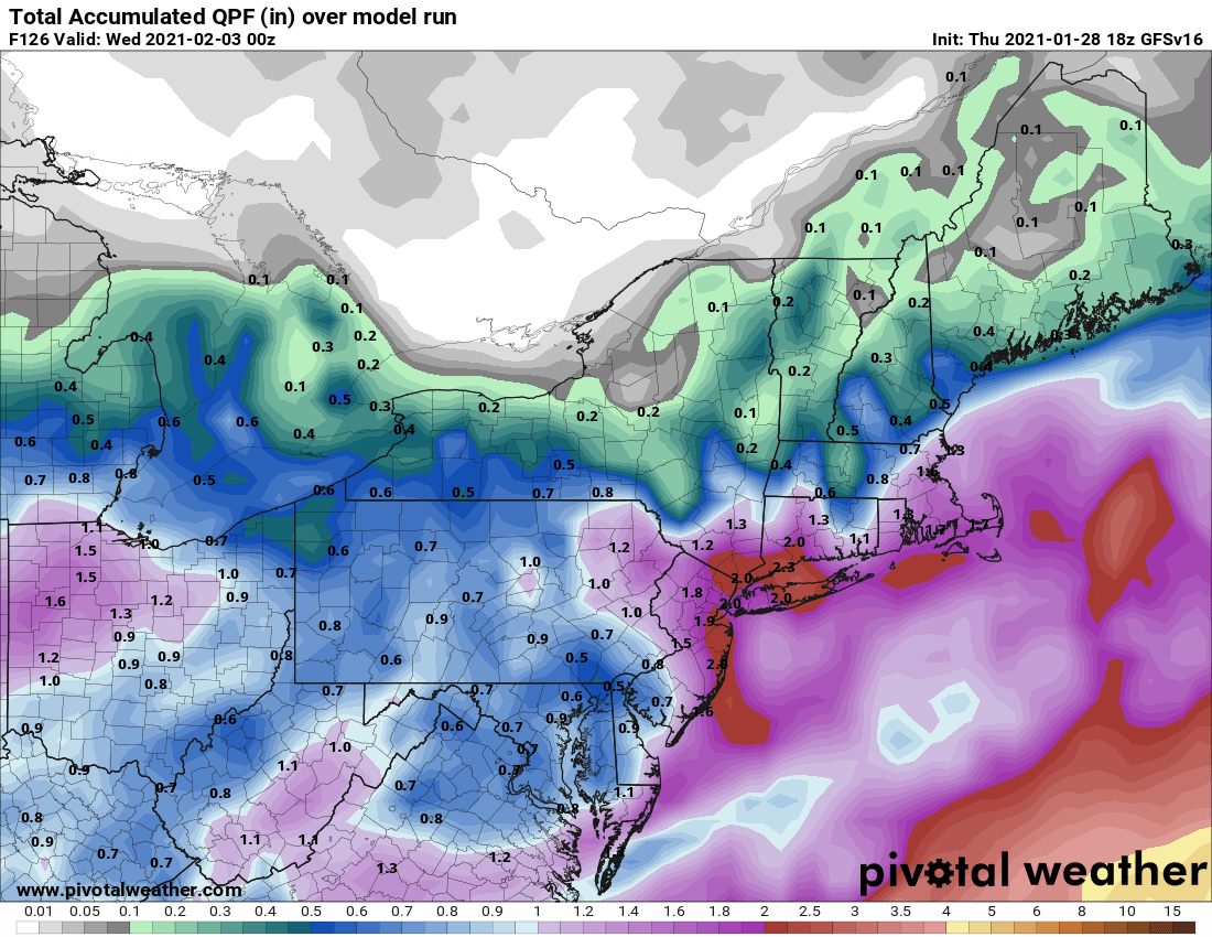
Pretty big cut back from the 0z run
-
Watching closely .. February 1-3rd for moderate to major coastal event
WeatherX replied to Typhoon Tip's topic in New England
My Tip decoder suggests humor and also material for the eventual weather novel You sniffed this one out from long range yet again, nice work. -
Watching closely .. February 1-3rd for moderate to major coastal event
WeatherX replied to Typhoon Tip's topic in New England
I got you Tip. I may have misunderstood your use of the cosmic in previous Tip posts 12z GGEM Ensemble looks pretty good IMO
-
Watching closely .. February 1-3rd for moderate to major coastal event
WeatherX replied to Typhoon Tip's topic in New England
I ran this through the Tip decoder and it basically suggests that the cosmic dildo might be running low on batteries. Am I right? -
Watching closely .. February 1-3rd for moderate to major coastal event
WeatherX replied to Typhoon Tip's topic in New England
Takes care of a bunch of snowfall issues for most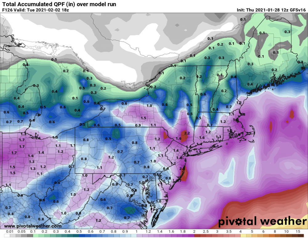
-
Watching closely .. February 1-3rd for moderate to major coastal event
WeatherX replied to Typhoon Tip's topic in New England
No, have disrobed though Best looking system at this range in a few years. Looking forward to it -
Watching closely .. February 1-3rd for moderate to major coastal event
WeatherX replied to Typhoon Tip's topic in New England
Meh, next -
Dingle pingers?
-
1/2" down so far 30/25
-
Of course. Doesn't take much more than a few flakes these days
-
Coming down nicely here now. First flakes were small and had grains. Pleasant site to see .
-
Steady light snow here 32/22
-
Radar is coming in hot down here it appears, will report when it arrives
-
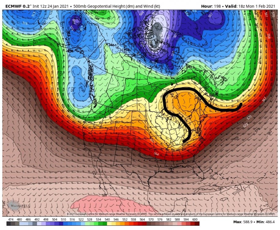
This one is not a classic Omega block, but close. Maybe you are thinking about a banana high? That would be much better and have much colder air to work with. At any rate, it might make the storm move slowly and provide more precip assuming the Euro has the right idea.