

burrel2
-
Posts
2,388 -
Joined
-
Last visited
Content Type
Profiles
Blogs
Forums
American Weather
Media Demo
Store
Gallery
Posts posted by burrel2
-
-
If the Euro comes in with a similar look as the ICON/Ukmet then we're definitely cooking with gas on this one. An all snow event is pretty much out of the question, but lots of folks are definitely still in the game for a decent front end snow hit before sleet/freezing take over.
-
 6
6
-
-
This threat is looking really promising, imo. GFS seems like it's on the most amped/warm side of guidance but it's still a solid crippling ice storm for CAD regions. Ukmet and ICON aren't as strong with the shortwave and looks to be setting up for possible front end snow hit before going to sleet/freezing in CAD regions, (signficant winter storm). Canadian and last night's Euro are cold enough for all snow for lots of folks, but just a little too weak/surpressed with the shortwave to throw precip back our way.
-
3
-
 1
1
-
-
ukmet is setting up for a nice winter storm at hr 144... finger of precip breaking out and extending through gainesville, GA. Soundings look like it would start as snow in the Upstate before switching to sleet.
-
1
-
-
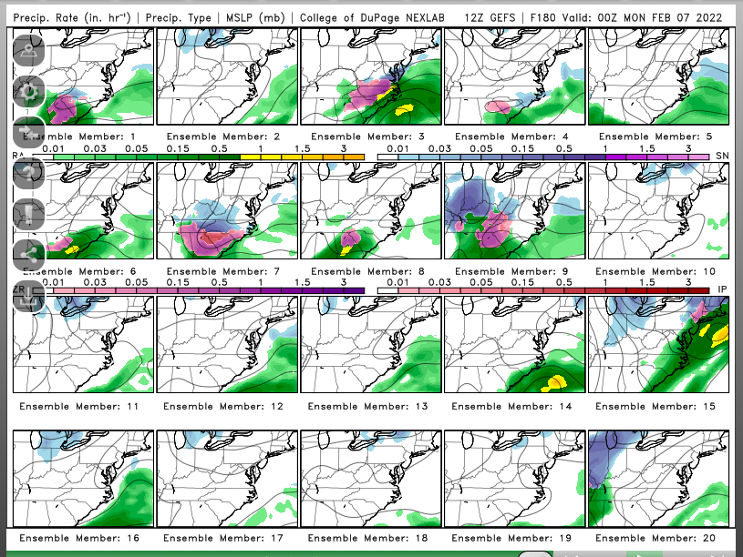
11 of 20 gfs ensemble members shown on cod weather website show a significant winter storm for upstate South Carolina from hr 168-180. That’s an improvement from 7 of 20 on the 12z run.
-
1
-
 3
3
-
-
I'll put it this way... if the models are showing you getting 6 inches of snow with surface temps in the upper 20's... are you going to say, "ah, forget it! the ground temps are warm from the previous warm weather! That snow will be melted off the roads and sunny spots within 2 days!"
Maybe you do? I don't worry myself with something like that.
-
4
-
1
-
-
9 minutes ago, PackGrad05 said:
Explain?
Models are showing a total of like 36hrs(or less) of above 55-60(and cloudy) on Thursday/Friday before the front comes through and we're cold again... We've been cold for three straight weeks prior to that. I don't think our ground temperatures are going to be scorching.
Secondly, who cares if they are warm... it really has little effect on anything other than snow and ice accumulation on pavement and potentially how long any ground accumulations hang around. Of the things to worry about with a winter storm/set up... ground temperatures are last on the list,(shouldn't even be on the list at all really).
-
4
-
-
7/20 ensemble members have a winter storm at hr180 on Cod weather.
-
1
-
-
12z icon has the winter storm at hr 168. So for those counting the current euro, gfs, icon all have the day 7 winter storm. Only the cmc is suppressed.
-
1
-
-
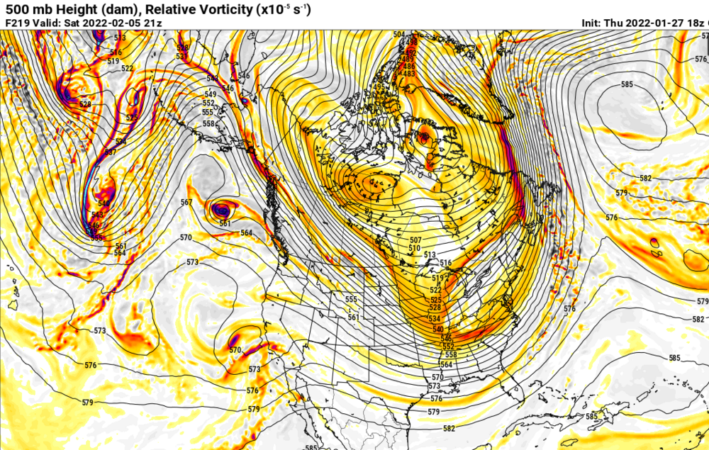
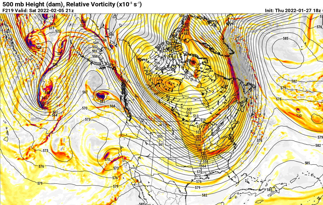
The ice/CAD signal is huge for this storm. Euro would have been a doozy too but it splits the ball of energy in the southwest in to two separate vorts that both amp and tilt as they approach the south east ridge… but bc they’ve been split they don’t have enough oomph to get a storm brewing for us. That splitting seems odd and I doubt it plays out that way.
-
2
-
-
I’m out of storage bandwidth. Looks like 9 out of 20 members on cod weather have a significant winter storm for CAD area’s day 8-9. Lots of ice… some have good snow on the northern fringe.
-
1
-
-
My god the 18z gfs ensemble members are absolutely loaded with hits around day 8/9.
-
4
-
-
3 hours ago, eyewall said:
Neither the Euro or GFS shows anything promising in the foreseeable future. It appears the SE ridge is going to strengthen and kill us. The clock is ticking so hopefully that trends weaker as we go on.
Are we looking at different models? Long range literally looks as or more promising than it has all winter.
-
4
-
-
14 minutes ago, eyewall said:
Not sure if we will see any more chances this year looking at the models this morning. There are some cold shots but no real winter storms at the moment. 1 and 3 is better than 0 and 3 I guess. Obviously once you pass mid Feb it gets much harder to get a good one in here. It was a good year for VA Beach and western areas but as of now it isn't memorable for the Triangle as we would end below normal in snowfall if no other chances materialize.
00z Euro is showing a snow storm on day 9??? cmc has the same storm it's just a little suppressed. GFS has it too just too amped.
-
2
-
1
-
-
35 minutes ago, Met1985 said:
The forcing coming out of the NW is impressive. As Ward mentioned this looks to becoming an exceptional setup.
Becoming? It's been advertised on the modeling as an exceptional NW flow setup all along. lol
-
22 minutes ago, wncsnow said:
I think BL temps are gonna waste most of the moisture for Piedmont folks
need the convective stuff... storms just starting to pop around GSP.. folks in the heavy stuff will get accumulations.
-
Trends look a little better for the triangle. Backside band holding together a little better and moving more east instead of southeast
-
1
-
-
you won't see a better 8-14 outlook from CPC than this for Southeast snow storms.
https://www.cpc.ncep.noaa.gov/products/predictions/814day/index.php
-
4
-
-
This run finds a way to not produce a huge winter storm for us, but if it's right with the large scale features then we are locked loaded with tons of potential starting after the front passes on day 7.
-
4
-
-
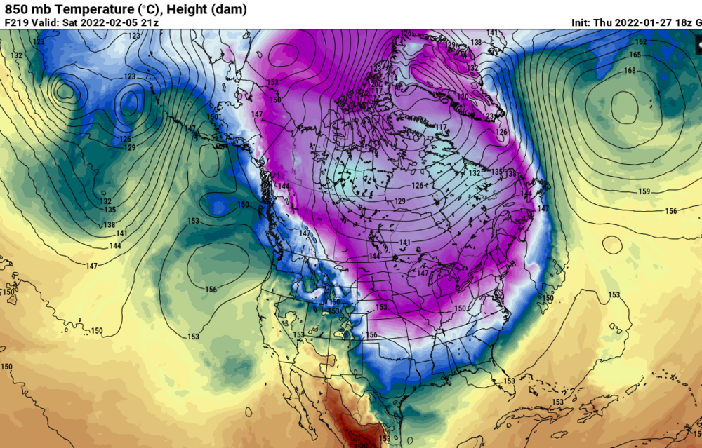
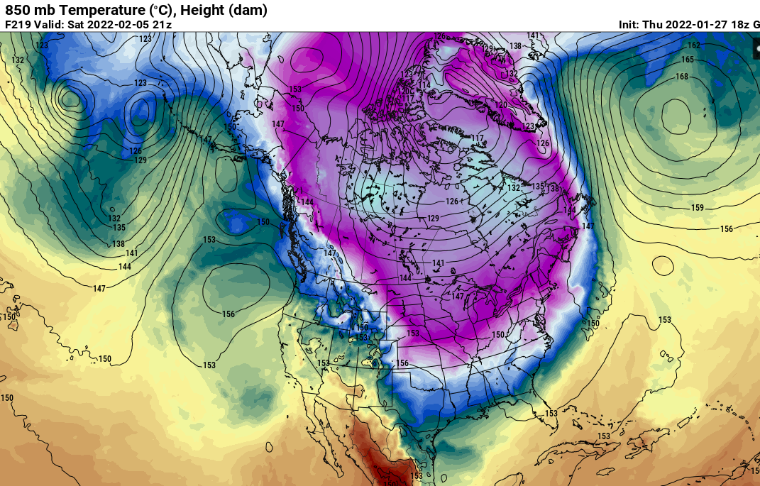
-50 F surface temp around the Canada/US border.... whew! It's been a long long time since we've seen -50 or colder temps there, pretty sure it hasn't happened since I was a kid.
-
2
-
-
so much for a February pattern flip to a torch...

-
2
-
 2
2
-
-
Too suppressive for the first storm chances but my god what a pattern setting up...
-
4
-
-
Looking at all the guidance, I'm pretty confident that Coastal area's of South Carolina from somewhere between Charleston and Myrtle Beach will probably see a dusting to an inch. Most of the Hi-RES models send the meat of the meso-low remnants through that area late Friday Night/Early Saturday morning.
-
2
-
-
lmao, there's 100 posts about the 12km NAM in the NYC forum... not a single one mentioning the 3km output yet. lolz
-
1
-
-
1 minute ago, PantherJustin said:
Ik you can’t speak for anyone but you… but Think GSP thinks even with limited QPF in general what we do see we will waste trying to get to 30-32? (CLT Metro) . I could see that outcome leaving us high n dry more than it just never occurs but I’m not an expert by any means
Just look at the totals for the February 16, 2013 event for a high-end realistic expectation. thermal profiles were similar for that event too. If you get convective/possible thundersnow... the surface will be sub-32 within a minute or two. If you only get 5/100th of liquid from a fringe band... sure, probably not adding up. But if you get 1/2 inch of liquid in an hour or two right under a heavy band... it'll pile up fast.
-
1
-
1
-
Mid to Long Range Discussion ~ 2022
in Southeastern States
Posted
Euro is so close to a straight up snow storm. Super cold column just little suppressed. Verbatim it's a decent snow for Central Georiga and Central South Carolina though.
I like where we're sitting at this point. Always good to be more worried about suppression 6 days out instead of temps.