dendrite
-
Posts
73,158 -
Joined
Content Type
Profiles
Blogs
Forums
American Weather
Media Demo
Store
Gallery
Everything posted by dendrite
-
 Pounding huge dendies right now.
-
Growth picking up with the mid-level goodies starting to crank.
-
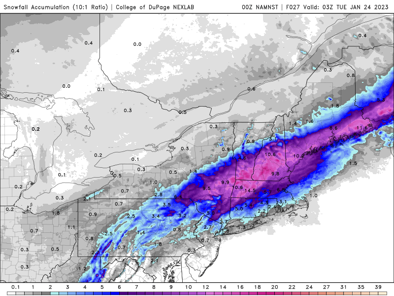
Melted 7am core was 5.1”/0.45” That weenie Northfield cocorahs guy can gtfo here with that 7.2”/0.52”.
-
A hair over 5”. Melting down a core now. 27.9° -SN
-
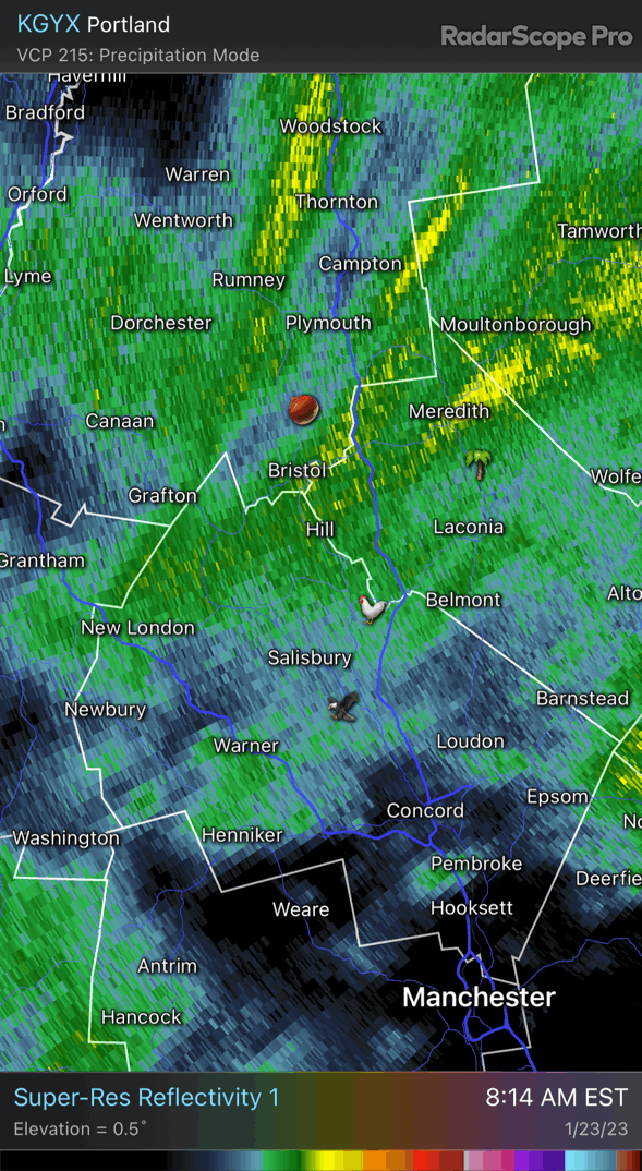
Looks like the mix line is running roughly from AQW-EEN-CON-DAW-PWM-RKD
-
Good luck with the hormones. Have your pronouns changed?
-
NAM going for a wild finish in MA and Kev’s area now.
-
28.0° SN 1.8”
-
Kraft ignoring CT at the last second just like 30 years ago.
-
Nice bump north on the 3k
-
NAM still crushing here.
-
GTA Winter 2022-23 Metfan down
-
28.7° -SN
-
As usual, the outliers usually lose this close in.
-
WAA status quo. Mid levels SE. You could see it happening early on in the run back toward N PA.
-
Snowing at BOS @18z
-
There it is… pounding Worcester county by 15z tomorrow
-
It looks like the hrrr through 21hr. I think the flash to snow in Mass will be better.
-
This should be more Krafty than 6z
-
It’ll come south as usual.
-
Meteorologically or emotionally?
-
He radiates. Lowel COOP has a normal min of 15° today. Point is it’s near normal. Just another indicator of how pathetic this winter has been… when a near normal low feels frigid. lol Got down to 12.6° here. CON 9°. Still haven’t been below 9° yet here. So weird.
-
Isn’t that still above normal? lol
-
NAM north. GFS south.