
SACRUS
-
Posts
13,077 -
Joined
-
Last visited
Content Type
Profiles
Blogs
Forums
American Weather
Media Demo
Store
Gallery
Posts posted by SACRUS
-
-
Yesterdays highs - the wet park 4 degrees below the major stations
TEB: 69
PHL: 69
BLM: 68
ACY: 68
EWR: 67
LGA: 67
New Brnswck: 67
JFK: 67
TTN: 67
ISP: 63
NYC: 63 -
The next 7 days dries out stays near normal overall once to Monday with the main areas of heavy rain south of here.

-
 1
1
-
-
23 hours ago, SACRUS said:
Cool period dep
EWR:
5/19: 73 / 52 (-1)
5/20: 71/50 (-3)
5/21: 59 / 50 (-10)
5/22: 53 / 50 (-13)
5/23: 67 / 48 (-7)
NYC:
5/19: 69 /51 (-4)
5/20: 67 / 49 (-6)
5/21: 59 / 49 (-11)
5/22: 51 / 48 (-15)
5/23: 63 / 47 (-10)
LGA:
5/19: 70 / 52 (-4)
5/20: 68 / 50 (-6)
5/21: 59 / 49 (-11)
5/22: 53 / 48 (-15)
5/23: 67 / 48 (-8)
JFK:
5/19: 74 / 53 (+3)
5/20: 69 / 50 (-3)
5/21: 58 / 50 (-8)
5/22: 55 / 49 (-10)
5/23: 67 / 48 (-5)-
 1
1
-
-
Records:
Highs:
EWR: 93 (1964)
NYC: 93 (1975)
LGA: 91 (1964)
JFK: 86 (1964)
Lows:
EWR: 40 (1963)
NYC: 39 (1963)
LGA: 41 (1963)
JFK: 41 (1963)
Historical:1877: Heavy snows occurred over parts of the northeast and New England. 4 inches of snow fell in Berkshire County, Massachusetts.
1894 - Six inches of snow blanketed Kentucky. Just four days earlier as much as ten inches of snow had fallen across Kentucky, Tennessee and Virginia. Six days earlier a violent storm had wrecked nine ships on Lake Michigan. (David Ludlum)
1930 - A tornado touched down near the town of Pratt, KS, and traveled at the incredibly slow speed of just 5 mph. (The Weather Channel)
1940 - Hail fell near Ada OK to a depth of six to eight inches, and rainfall runoff left drifts of hail up to five feet high. (The Weather Channel)
1987 - Severe thunderstorms in southwest Texas spawned a couple of tornadoes near Silverton, and produced golf ball size hail east of the town of Happy. Thunderstorms also produced large hail and damaging winds in Louisiana and Texas. (Storm Data) (The National Weather Summary)
1988 - Thunderstorms produced severe weather in the southeastern U.S. Thunderstorm winds gusted to 88 mph at Columbia, NC. Baseball size hail was reported near Tifton GA. (The National Weather Summary) (Storm Data)
1989 - Thunderstorms developing ahead of a cold front produced severe weather across the Upper Midwest through the day and night. Thunderstorms spawned 30 tornadoes, and there were 158 reports of large hail and damaging winds. A strong (F-3) tornado caused five million dollars damage at Corning, IA, and a powerful (F-4) tornado caused five million dollars damage at Traer, IA. Thunderstorm winds gusting to 88 mph killed one person and injured five others at Stephensville, WI. (The National Weather Summary) (Storm Data)
1990 - Severe thunderstorms spawned two dozen tornadoes from Montana to Oklahoma. Four tornadoes carved a 109-mile path across central Kansas. The third of the four tornadoes blew 88 cars of an 125-car train off the track, stacking them three to four cars high in some cases, and the fourth tornado caused 3.9 million dollars damage. The third tornado injured six persons who were trying to escape in vehicles. A woman was "sucked out" of a truck and said that at one time she was "airborne, trying to run but my feet wouldn't touch the ground". She also saw a live deer "flying through theair". (The National Weather Summary) (Storm Data)
-
57 / 43 partly cloudy - mostly cloudy today mid 60s but looks dry. Warming Sunday to the low 70s and mid 70s with sunny conditions on Monday - memorial day. Warmer Tuesday ahead of next trough digging in could approach 80 in the warmer spots with enough sunshine. Clouds lingering around Wed/Thu with next chance of rain - which looks mainly light and staying south. brief warmup next weekend before trough returns 5/31 - 6/2. Warmth and heat from the west moves north and east with heights rising by the 5h for a much warmer mirgation.
5/24 - 5/26 : Cooler to normal / mainly dry
5/27 : Brief warm up to near / slighy above normal
5/28 - 5/29 : Clouds some light rain <0.50
5/30: 1 day warm upp ahead of trough
5/31 - 6/4 : Cooler than normal to normal
6/5 - beyond : Much warmer - potential first 90
-
 3
3
-
-
-
Made it to 67 today with some breaks in the clouds. Spotty showers now as the ULL swings around.
-
 1
1
-
-
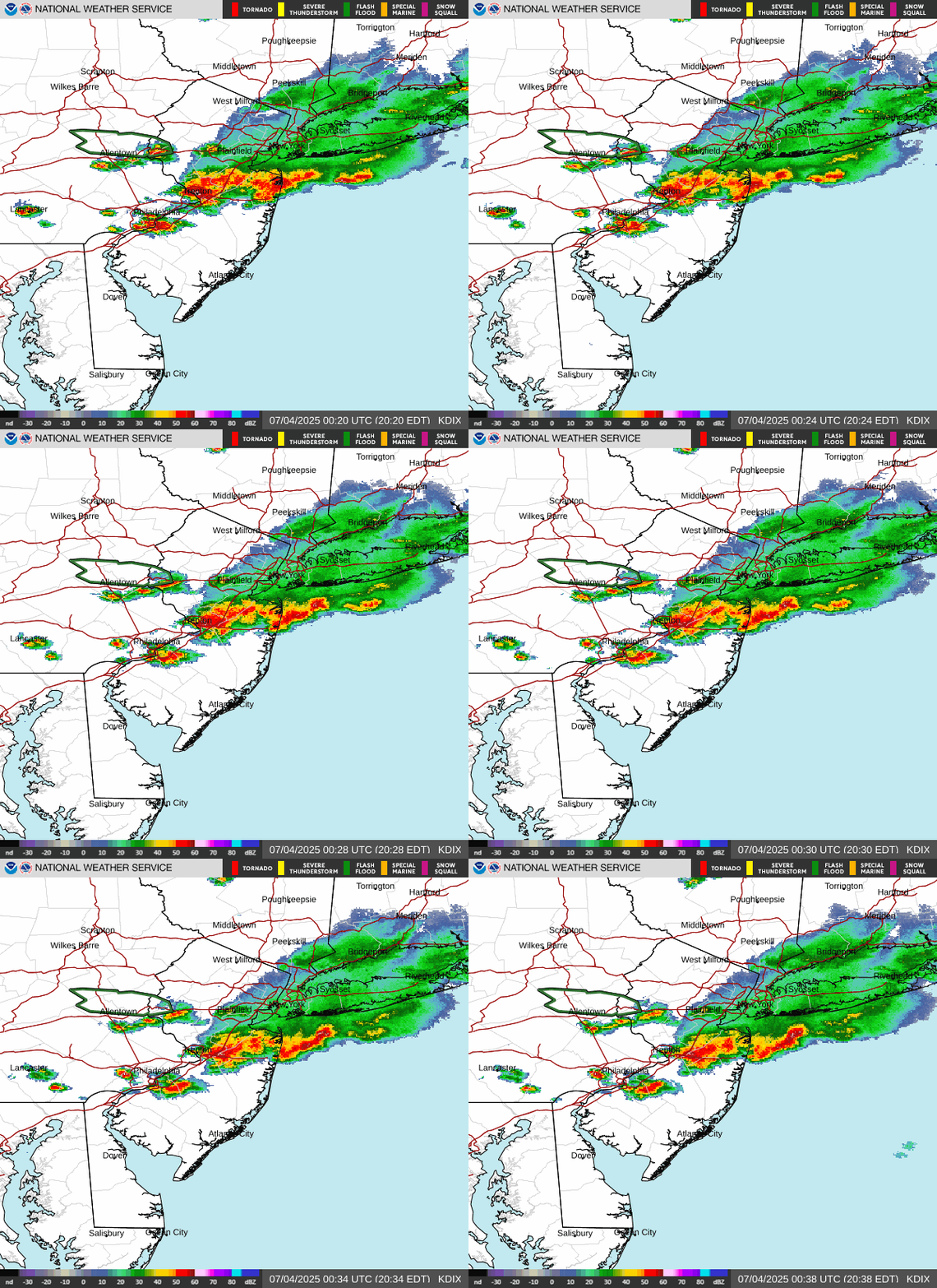
NNJ light rain / showers lingering
-
39 minutes ago, LibertyBell said:
Yes, I think this is accurate. Monday is the best day but the other two days are pretty good too and at least partly sunny.
Clouds stingy to break up but getting brighter. Im not sold on mostly sunny tomorrow or Sunday with piece of energy ejecting out of the GL mostly dry but could cloudy things up and even some spotty showers later in the evening. Monday should go mostly sunny. Hoping its sunnier of course.
getting there

-
 1
1
-
-
Rain totals 5/21 - 5/23 (9AM)
New Brnswck: 1.75
EWR: 1.13
NYC: 1.09
JFK: 1.01
LGA: 0.79-
 1
1
-
-
23 hours ago, SACRUS said:
Cool period dep
EWR:
5/19: 73 / 52 (-1)
5/20: 71/50 (-3)
5/21: 59 / 50 (-10)
5/22: 53 / 50 (-13)
NYC:
5/19: 69 /51 (-4)
5/20: 67 / 49 (-6)
5/21: 59 / 49 (-11)
5/21: 51 / 48 (-15)
LGA:
5/19: 70 / 52 (-4)
5/20: 68 / 50 (-6)
5/21: 59 / 49 (-11)
5/21: 53 / 48 (-15)
JFK:
5/19: 74 / 53 (+3)
5/20: 69 / 50 (-3)
5/21: 58 / 50 (-8)
5/21: 55 / 49 (-10)-
 1
1
-
-
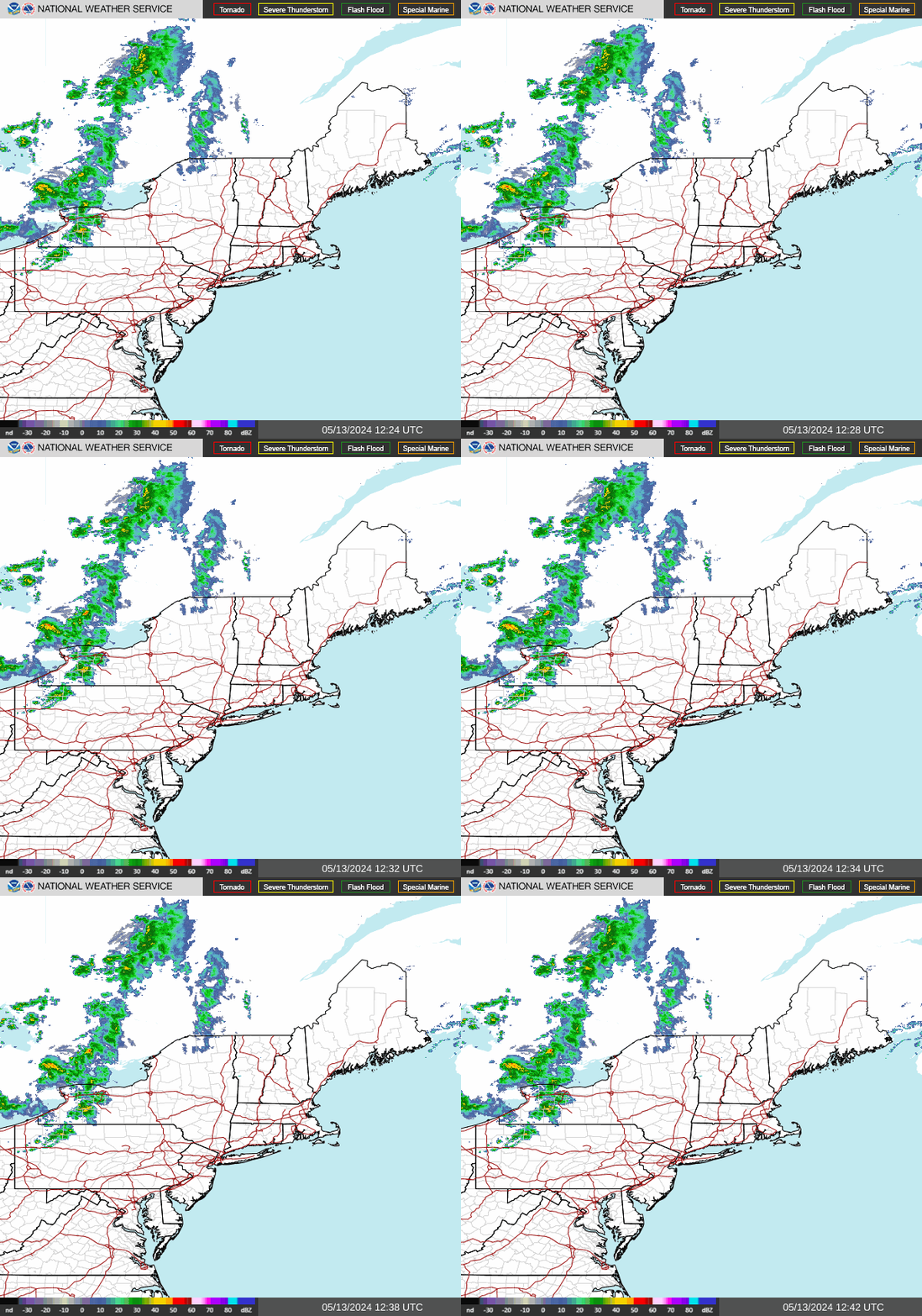
Coastal pulling away and lingering rain into NY
-
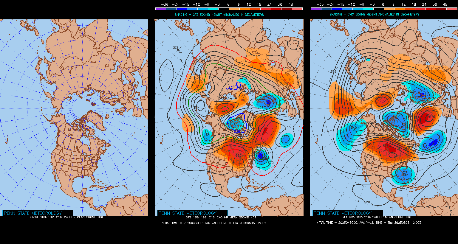
Euro still not updating there but it is more similar to the GFS with trough still clinging to the northeast (ish) 5/30 - 6/1). Heights poised to rise in the 6/5 - beyond.
-
Coastal low slowly pulling away in the northeast and pronounces breaks and clearing into PA. Perhaps by noon we can get into breaks of sun or better - heres hoping

-
 1
1
-
-
Records:
Highs:
EWR: 96 (1964)
NYC: 94 (1964)
LGA: 94 (1964)
JFK: 92 (2021)
Lows:
EWR: 43 (1931)
NYC: 43 (1963)
LGA: 45 (1963)
JFK: 33 (2022)
Historical:1882 - An unusual late season snow blanketed eastern Iowa, with four to six inches reported around Washington. (David Ludlum) (The Weather Channel)
1953 - The temperature at Hollis OK soared from a morning low of 70 degrees to an afternoon high of 110 degrees to establish a state record for the month of May. (The Weather Channel)
1987 - It was a busy day for thunderstorms in the central U.S. Thunderstorms produced wind gusts to 65 mph at Shreveport LA and golf ball size hail at Marfa, TX. Hobart, OK, received 3.55 inches of rain in the morning, and another 4.03 inches of rain that evening. Thunderstorms in Nebraska produced 8.5 inches of rain in two hours north of Potter, and 7.5 inches of rain in ninety minutes north of Minatare. Thunderstorms in Colorado produced five inches of hail at Greeley. (The National Weather Summary) (Storm Data)
1988 - Thunderstorms produced severe weather across much of the eastern U.S. Golf ball size hail was reported in Georgia, Maryland, North Carolina, South Carolina and Ohio. (Storm Data) (The National Weather Summary)
1989 - Severe thunderstorms developing along a cold front resulted in 98 reports of large hail and damaging winds in the Northern Plains and Upper Mississippi Valley. Golf ball size hail caused a million dollars damage around Buffalo City, WI, baseball size hail was reported at Northfield and Randolph, MN, and thunderstorm winds gusted to 95 mph at Dunkerton, IA. (The National Weather Summary) (Storm Data)
1989 - Unseasonably hot weather continued in the south central U.S. Pueblo, CO, equalled their May record with a high of 98 degrees, and the high of 106 degrees at Midland, TX, marked a record six straight days of 100 degree heat. (The National Weather Summary)
1990 - A cold front crossing the western U.S. produced snow over parts of Oregon, California, Nevada, Idaho and Utah, with five inches reported at Austin NV, and four inches at Crater Lake National Park in Oregon. Strong winds behind the cold front sharply reduced visibilities in blowing dust over central California, and two multi-vehicle accidents resulted in one death and eighteen injuries. In northern Idaho, a cloud-burst washed tons of topsoil, and rocks as large as footballs, into the valley town of Culdesac. (The National Weather Summary) (Storm Data)
2002: A Pacific storm system brought some much needed snow to the Colorado Mountains and foothills with a mix of rain on the Plains. Snowfall totals included: 13 inches at Coal Creek Canyon, 11 inches near Evergreen, CO. The former Stapleton International Airport at Denver reported less than an inch. Three temperature records were set. The morning low temperature of 31° was a record low; as was the morning low of 32° the following morning. The high temperature of only 48° equaled the record low maximum.
-
 1
1
-
-
50 / 48 misty / light rain and drizzle. Hour 60 of what should be 96 hours of clouds / mostly cloudy conditions, but this could extend into Sunday approaching 100 hours. Light showers rain becoming isolated mostly cloudy although there could be some breaks in the clouds stuck near 60. Tomorrow the ULL is over the the northeast and clouds lingering - a bit warmer / drier low - mid 60s. Sunday piece of energy over the GL dives south and could trigger some scattered showers and additional cloud cover - mainly dry / warmer near 70. Monday looks to break the streak fully with partly cloudy skies and temps neareer to normal low - mid 70s.
Beyond there the trough remains into the Northeast with the month closing out near normal / perhaps a warm day or day / half 29-30 or 30-31. Still lingering trough and tendency for low cutting off from the trough before the warmth in heat goes north and east by the end of the first week of next month in the way beyond:
5/21 - 5/25 : Much cooler - cloudy wet
5/26 - Memorial day slavaged 70s and dry - partly - sunny
5/27 - 5/29 : Near normal - southern system may bring light rain
5/30 - 5/31: could end with a brief warmup
Way beyond : warmer into the the 6/5 - beyond period (perhaps much warmer and hotter)
-
11 minutes ago, Poker2015 said:
Didn't the usual warm spots already hit 90?
I thought we did a few weeks ago when it was hot for a few days.
88 has been the high in the warmest spots
-
 1
1
-
-
coastal low spin somewhat visible

-
 4
4
-
-
-
2 minutes ago, winterwarlock said:
1.28 two day storm total imby
Similar here at 1.26 but still some lingering light showers and drizzle.
-
On 5/21/2025 at 8:43 AM, SACRUS said:
Cool period
EWR:
5/19: 73 / 52 (-1)
5/20: 71/50 (-3)
5/21: 59 / 50 (-10)
NYC:
5/19: 69 /51 (-4)
5/20: 67 / 49 (-6)
5/21: 59 / 49 (-11)
LGA:
5/19: 70 / 52 (-4)
5/20: 68 / 50 (-6)
5/21: 59 / 49 (-11)
JFK:
5/19: 74 / 53 (+3)
5/20: 69 / 50 (-3)
5/21: 58 / 50 (-8) -
Records:
Highs:
EWR: 98 (1992)
NYC: 96 (1941)
LGA: 94 (1992)
JFK: 94 (2021)
Lows:
EWR: 44 (2002)
NYC: 42 (1907)
LGA: 47 (1950)
JFK: 43 (1990)Historical:
1876 - Denver CO was drenched with 6.53 inches of rain in 24 hours, an all-time record for that location. (The Weather Channel)
1911 - The temperature at Lewiston ME soared to 101 degrees. It was the hottest temperature ever recorded in New England during the month of May. (David Ludlum)
1987 - A powerful tornado virtually wiped the small southwest Texas community of Saragosa off the map. The twister destroyed eighty- five percent of the structures in the town killing thirty persons and injuring 121 others in the town of population 183. The tornado hurled trucks and autos through adobe and wood- frame homes, with some vehicles blown 500 feet. (The National Weather Summary) (Storm Data)
1988 - Thunderstorms produced severe weather over the Central Gulf Coast States. Tennis ball size hail was reported at Ripley MS. Showers and thunderstorms in southern Missouri produced 3.20 inches of rain at Springfield to easily surpass their rainfall record for the date. (The National Weather Summary) (Storm Data)
1989 - Unseasonably hot weather continued in southern Texas and parts of the southwestern U.S. Seven cities reported record high temperatures for the date, including El Paso TX with a reading of 100 degrees. Presidio TX was the hot spot in the nation with a high of 111 degrees. (The National Weather Summary)
1990 - Late afternoon and evening thunderstorms developing ahead of a cold front in the north central U.S. produced severe weather from northwestern Kansas to central Minnesota and southeastern North Dakota. There were twenty-nine reports of damaging winds, or dime to golf ball size hail. Strong thunderstorm winds gusted to 69 mph at Alexandria, MN. Showers and thunderstorms over eastern North Carolina soaked Wilmington with 2.91 inches of rain, which established a record for the date. (The National Weather Summary) (Storm Data)
2011: The Joplin Tornado was reported to have developed directly over Joplin with the first report of the tornado in Joplin at 5:41 pm CDT, 5/22. Latest reports from mid-day Tuesday 5/24 indicate an estimated 118 fatalities and several hundred injured in the Joplin, MO area. The Joplin tornado is the deadliest since modern record keeping began in 1950 and is ranked 8th among the deadliest tornadoes in U.S. history. The tornado surpassed the June 8, 1953, tornado that claimed 116 lives in Flint, Mich., as the deadliest single tornado to strike the U.S. since modern tornado record keeping began in 1950. The deadliest tornado on record in the U.S. was on March 18, 1925.
-
50/48 cloudy and light rain (1.02 in the bucket through 9AM here in CNJ). Hour 36 of what will amount to 96 hours of clouds. Coolest day of the next, perhaps till October. Lingering light rain, showers and clouds through Friday becoming isolated. Clouds still clinging on Saturday but drier. Should clear up later Saturday but remaining cool (60s). Sunday and Monday - Memorial day look mainly dry outside some isolated showers Saturday night / Sunday morning - otherwise near normal.
Trough still into the northeast and potential cutoff in the 5/28 - 5/30 period with next round of clouds/rain.
Warmth/heat from the west heads northeast and trough backs west with a warmer open to next month and later the end of thet first week.

-
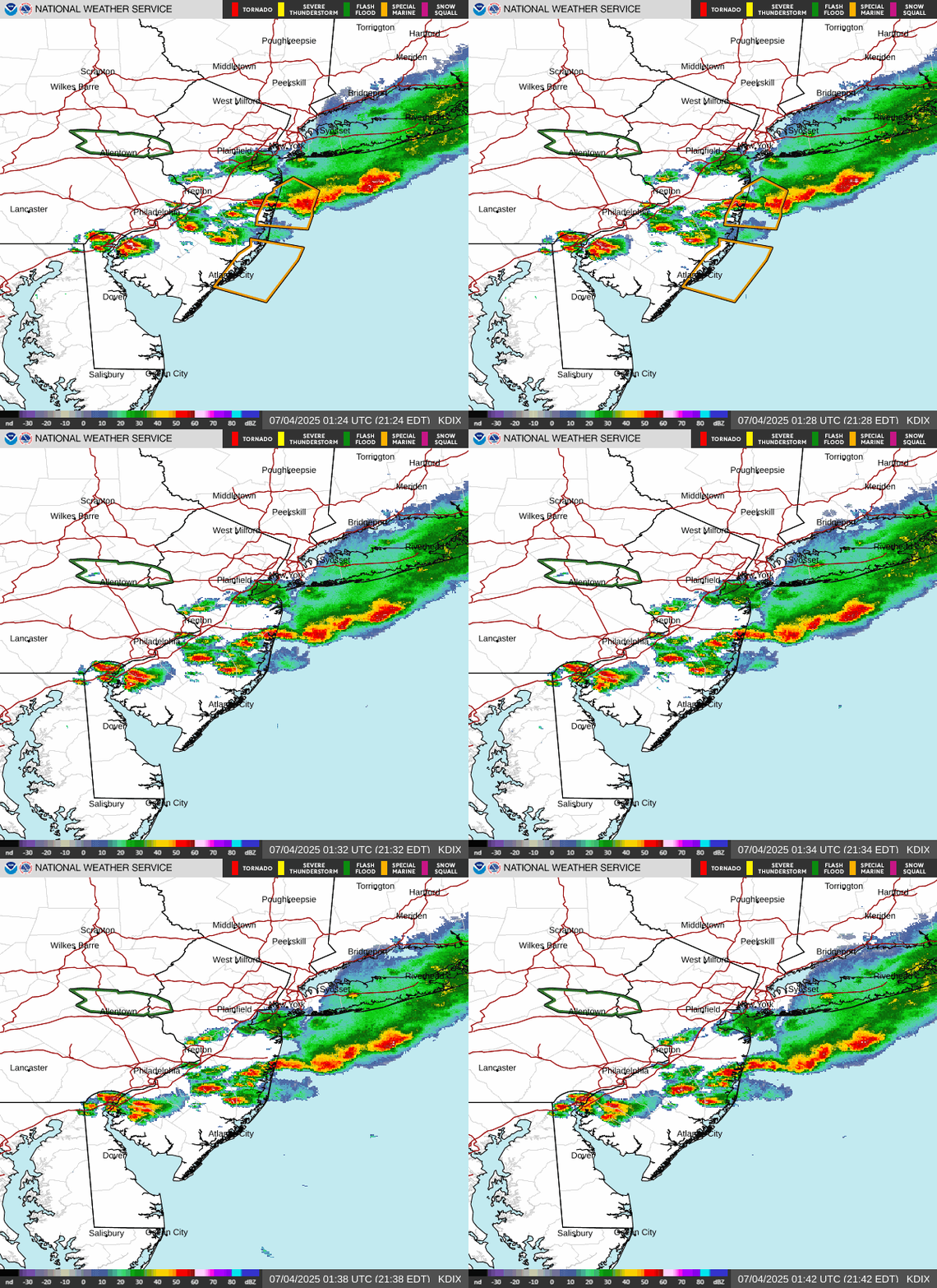
Rain building into PA and on the doorsteps of SNJ


May 2025
in New York City Metro
Posted
Yes for NYC