ValpoVike
-
Posts
507 -
Joined
-
Last visited
Content Type
Profiles
Blogs
Forums
American Weather
Media Demo
Store
Gallery
Everything posted by ValpoVike
-
I may finally break the streak of 3" snows. Jinxed it, I'm sure.
-
My assumption has been that out further west they had a really good early season with some huge storms. Would be interesting to see the seasonal data, as I predict that it may be opposite....out west looking ok, but along the front range we would be pretty far behind.
-
Only about 4" up here. We have seen quite a few 3"-4" snows here this season, but yet to see a true dump.
-
It is trending up again. NWS Boulder also had a nice write up in this morning’s AFD on the case for high snow ratios.
-
I kind of doubt the northern amounts, but the models are all pretty close on a decent hit for foothills and palmer.
-
Wow, it is really slick out there. At least it is up here, but I am also reading that areas adjacent to the foothills have a coating.
-
I don't know about you, but my best memories as a kid (and later with my kids) mostly involve big snow events.
-
Exactly my thoughts last night looking at radar. The presentation reminded me of my years in Geauga county Ohio and the lake effect bands. However, the banding gods did not smile upon us here, with a meager 3". I'll take it though. Hopefully the areas east of the foothills got more as they need it much, much more....
-
18z NAM ramped up the snow for Fort Collins, now over 8". A pretty sizeable increase over the 12z run. Cheyenne get's buried. Larimer foothills look to be in a snow hole, wedged between good amounts in both the mountains and the flatlands.
-
12z doubled down on the nuttiness. QPF is now up to 0.7" in the Ft Collins to Cheyenne area....and now showing over 16" snow for Ft Collins, so it is staying with it's very high ratios. Meanwhile the Euro only shows 0.3" QPF.
-
Radar is filling in nicely as the upslope kicks in. Definitely feels like a solid snow setting up as banding is also evident and started a few hours ago with the band that roughly set up from Boulder to Greeley.
-
I hope I don't jinx it, but some impressive accumulations on the models and the NWS forecasts for areas west of I25. Including the snow-cursed city of Ft Collins.
-
Both the GFS and Euro agree with you.
-
As of this morning I am sitting at 15.59" for the year. The closest climo data to me is Estes Park which shows around 14" annual average precip. Not too bad...but we did have a good monsoon up here this year, followed by a very dry fall. It is remarkable just how different a situation it is just a few miles to the east.
-
Yesterday my home was a frustrating 200' below the snow line. This morning we awoke to a surprise 1.5". We are calling it the meteorological miracle
-
Something really strange is in the air today. There are tiny moist particles falling from the sky...I actually had to turn on my windshield wipers to push it aside.
-
That's really quite interesting. Up here in the Larimer foothills, there seems to be a real lack of climatological data however my experience over the past 8 years is that mid to late January is typically the coldest. This is very similar to what I experienced in my years of living in Ohio and Indiana. I wonder if there is something inherently different (altitude, LOL) in the short distance between Loveland and 7k+ feet up...or if the past 8 years have generally been anomalous up here. Not the first or last time that I wish there was good climate data up here.
-
LOL I spoke too soon and clocked 87MPH at 3:25pm. There is a nice Davis station a bit further up in the neighborhood that hit 93MPH around the same time. Pretty intense.
-
I recorded a 68MPH gust up here at 11:08am. So far (and thankfully) a rather run of the mill winter wind event up in this part of the foothills. I think it is perhaps a bit different story from Boulder and points south, like Bailey and Evergreen areas. It would be interesting to see more reports from down in that area.
-
About an inch up here so far this evening. It's crazy to be excited about that, but here we are.
-
Yep, Hwy 34 on my drive up to Glen Haven. I saw those records on a Facebook post and it is shocking.
-
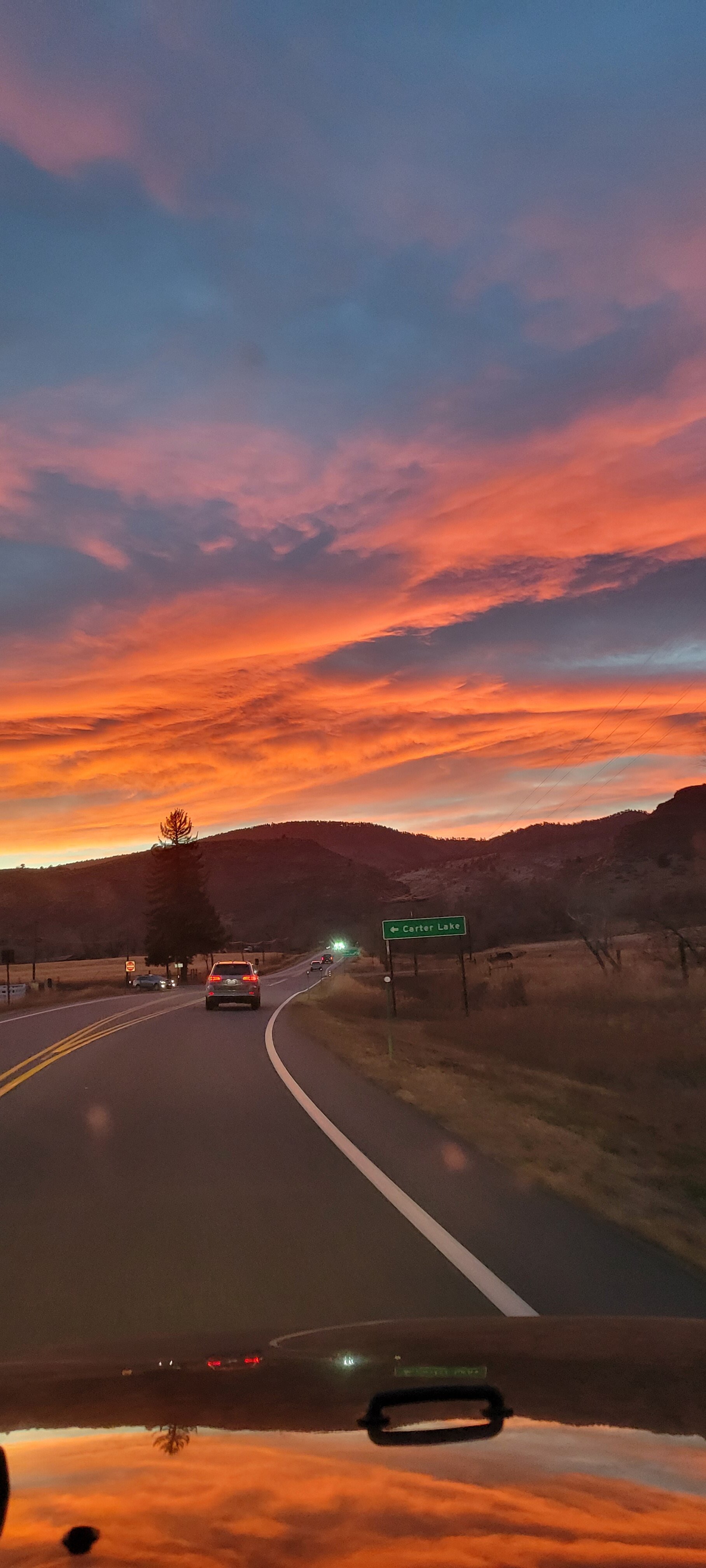
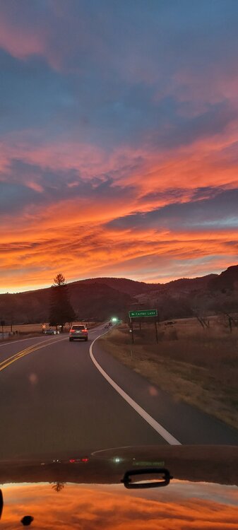
Off topic, but what a sunset this evening along the front range. I captured this photo on my way back home from the airport today. After 7 long days away, the mountains were a welcome sight.
-
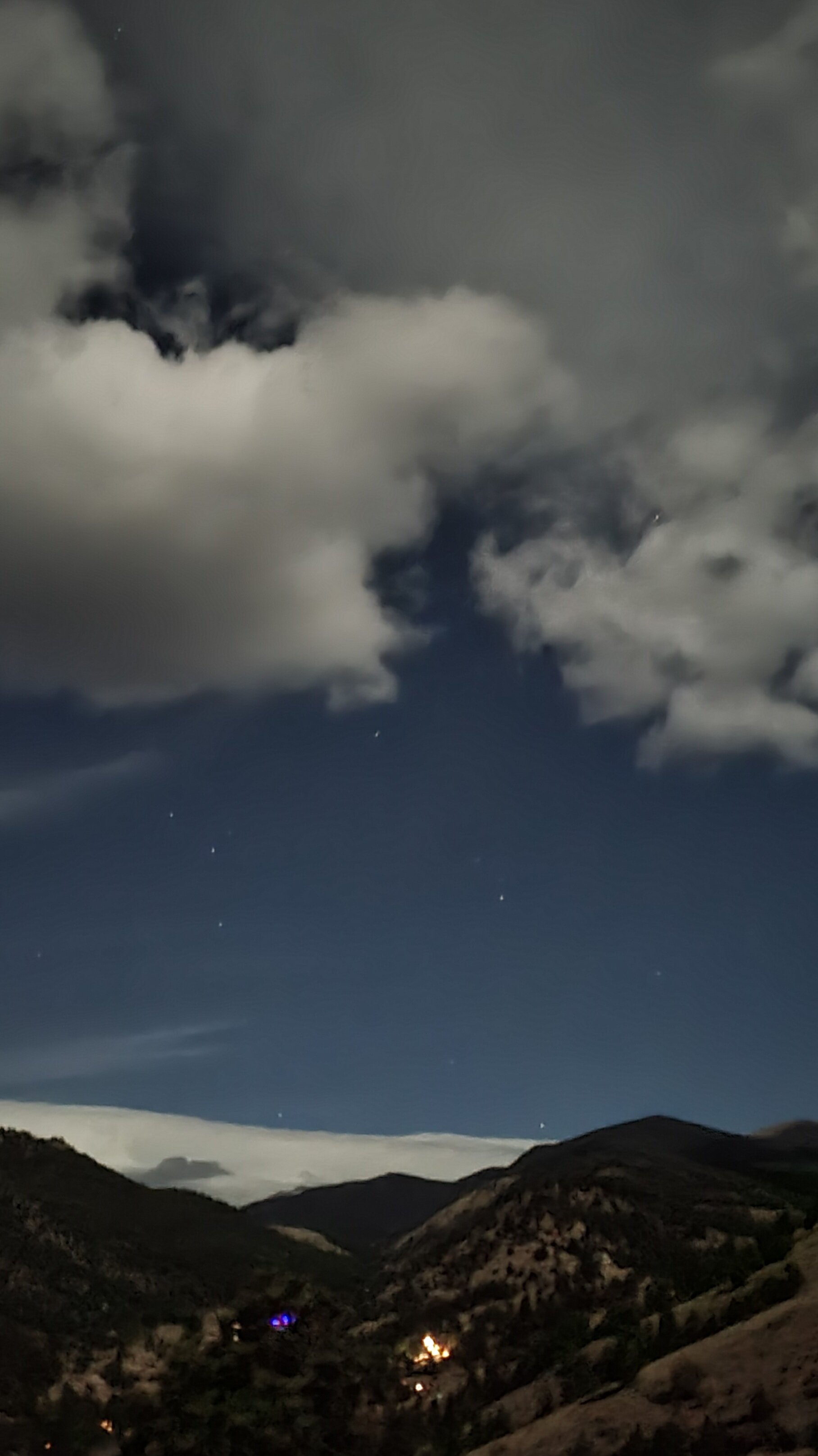
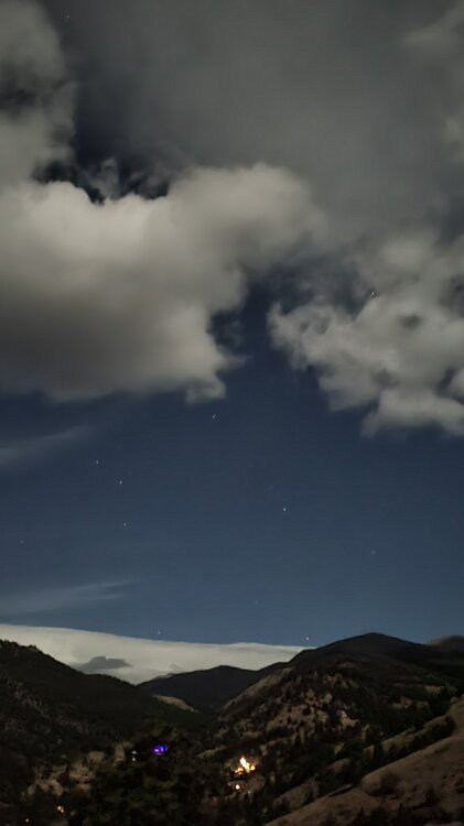
Tonight a weak mountain wave has developed overhead and has been reforming continuously. The full moon makes it an even more amazing sight.
-
Or super overcooked right up to the final days....like what it did last spring in the 90"+ storm for the Front Range that turned out to be 2'-3'.
-
I'll believe there may be a storm if it still shows early next week, but the GFS is overboard usually...especially at this range. I wouldn't take any of it verbatim.