hazwoper
-
Posts
3,489 -
Joined
-
Last visited
About hazwoper

-

E PA/NJ/DE Winter 2025-26 Obs/Discussion
hazwoper replied to LVblizzard's topic in Philadelphia Region
Anyone know why the huge amount of ground clutter at Ft Dix/McGuire the past few days? Looks like what you see around a wind farm.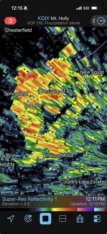
-
Radio towers by Conshy and buildings downtown
-
RadarScope. It’s an app
-
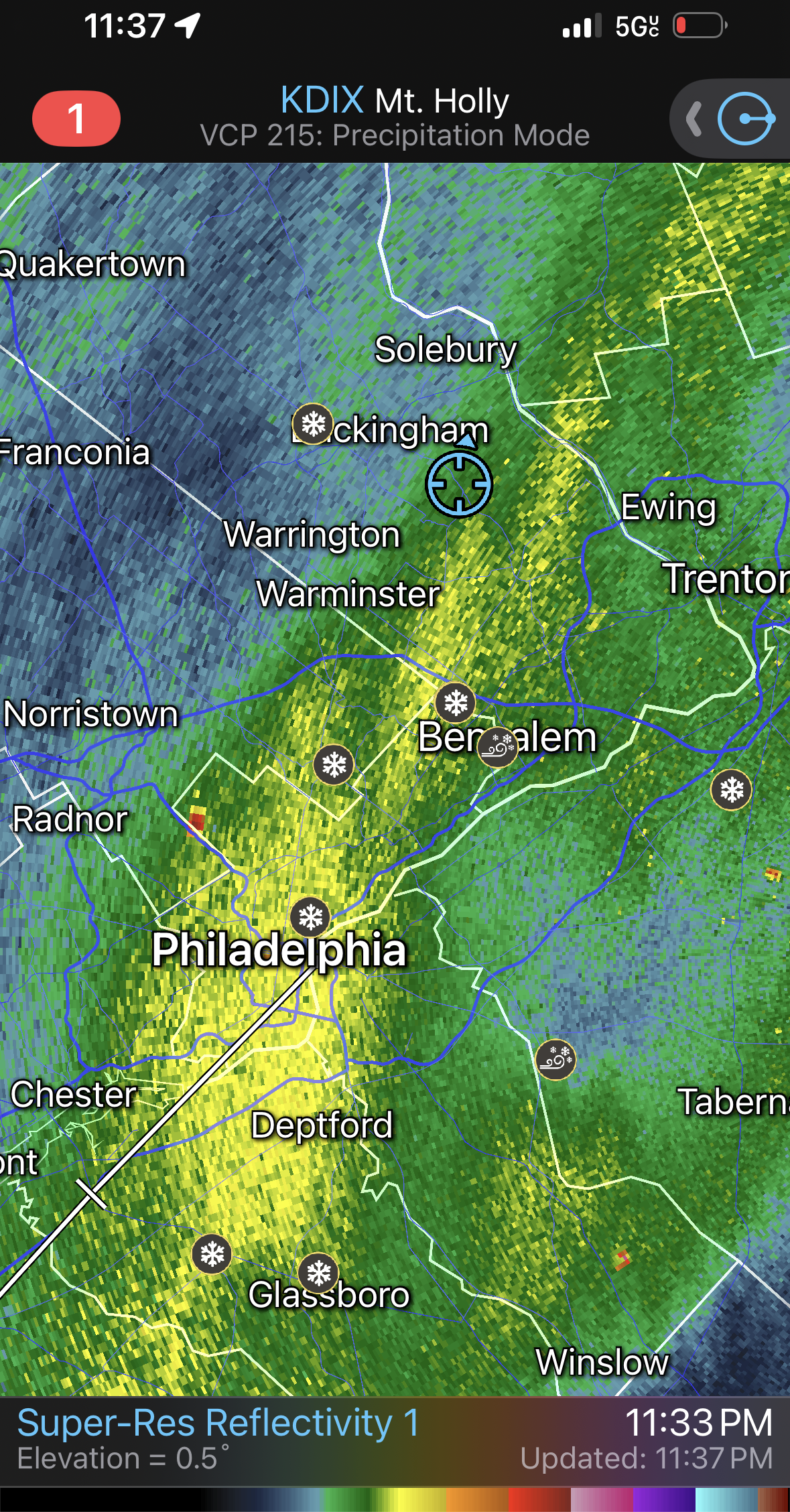
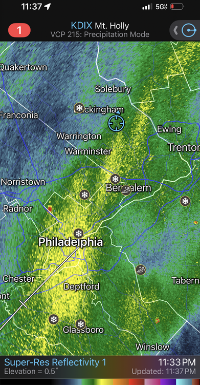
One of the largest deform bands I can possibly remember
-
8” here. 29 and mod/heavy snow
-
Damn! The radar is blowing up!!!
-
That’s what I have in Wrightstown
-
-
Yeah. Ralph I think your measurement is off. I am just over 7”
-
Where r u located now?
-
It’s expanding over Philly
-
May run the ATV plow before calling it a night later. Too wet I think to wait till tomorrow
-
Where did you “see” this?
-
33 Lawn already covered and driveway caving here in Wrightstown PA
-
The Jan 31 Potential: Stormtracker Failure or 'Tracker Trouncing
hazwoper replied to stormtracker's topic in Mid Atlantic