

Jebman
-
Posts
9,396 -
Joined
-
Last visited
Content Type
Profiles
Blogs
Forums
American Weather
Media Demo
Store
Gallery
Posts posted by Jebman
-
-
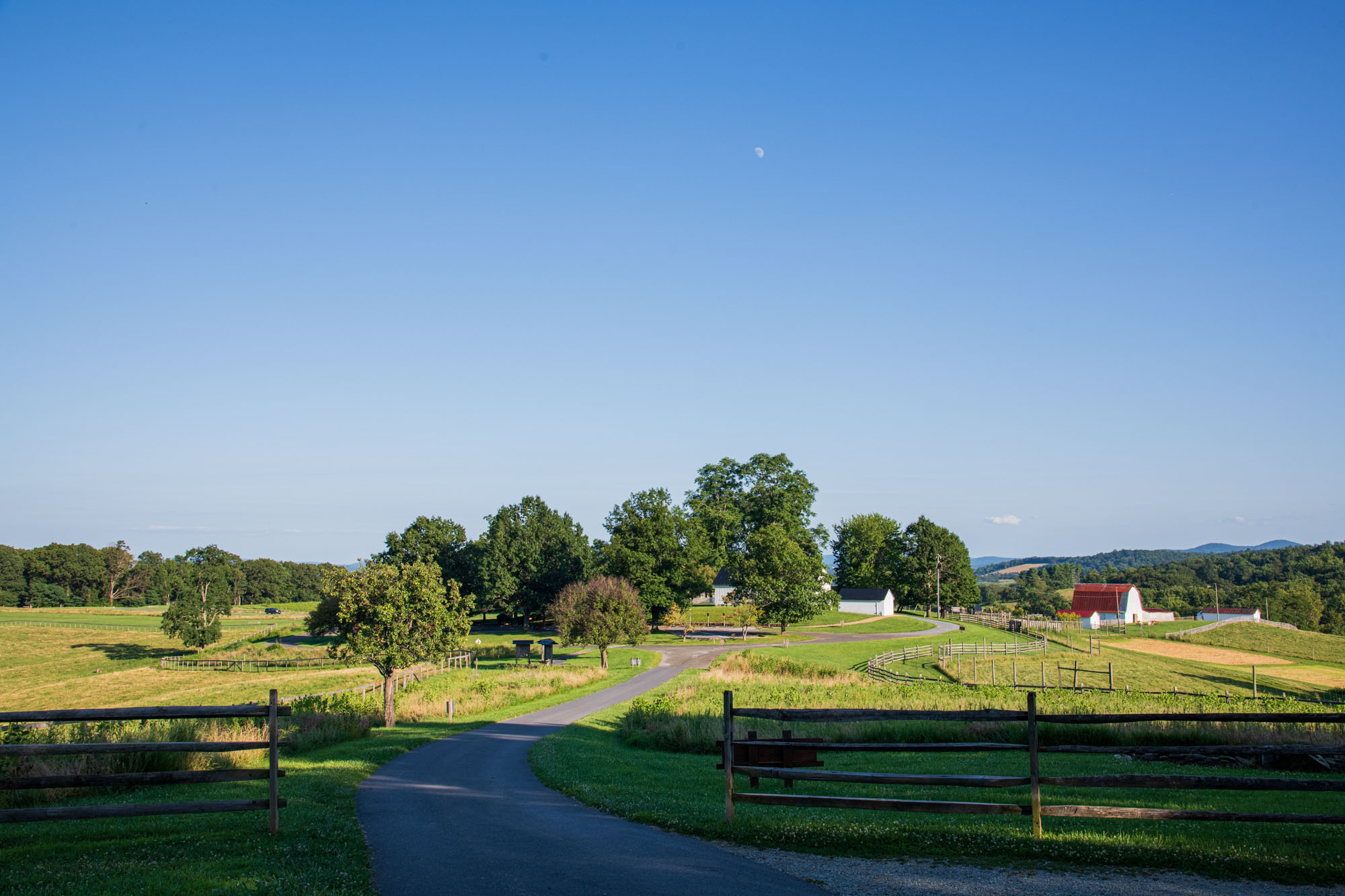
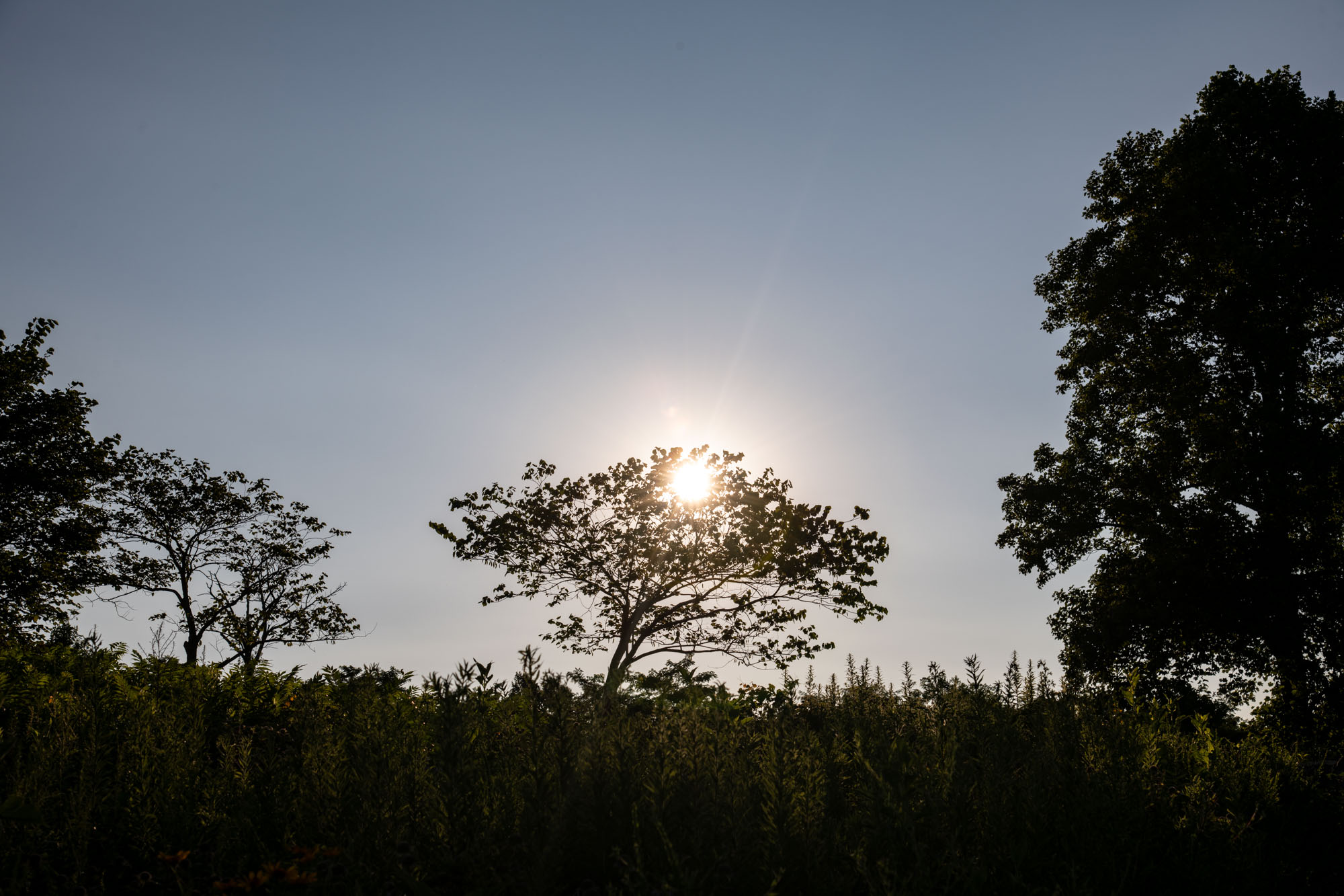
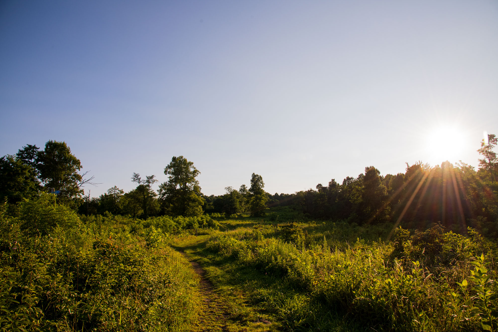
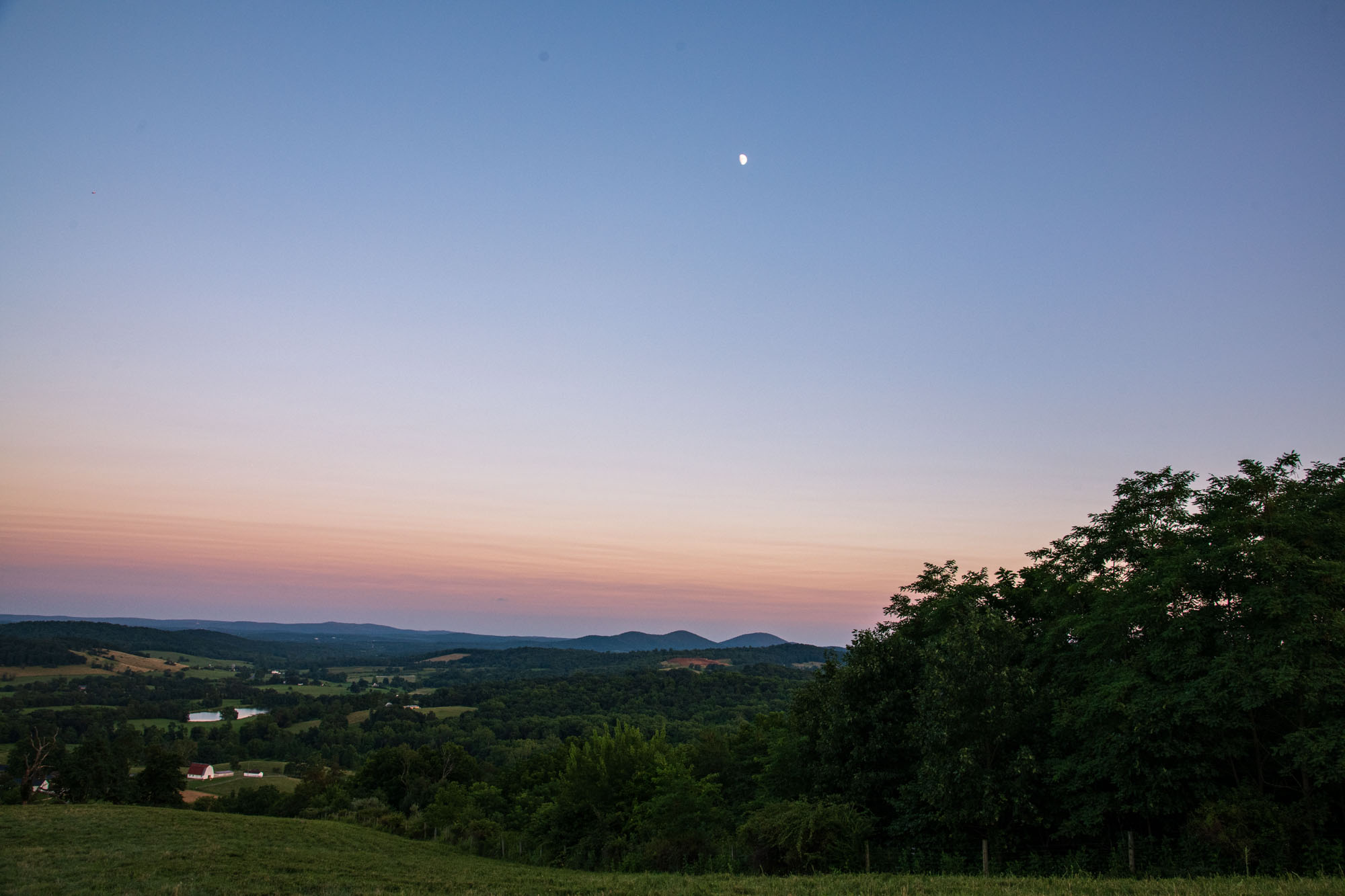
1 hour ago, SnowenOutThere said:
Took advantage of the excellent weather yesterday to hike sky meadows. Only an hour ride from NOVA and nearly a straight shot on 66 West. Wasn't expecting too much, but was blown away by the views it offered. Highly recommend to anyone wanting to go on a relatively easy escape into nature. Best part of course was the weather. Mid to low 70s in the forest with nice dewpoints too. Also had the moon as nice friend the whole hike!


You guys are making me so jealous! It wont get this cool for me til November down here.
-
 1
1
-
-
It's 3.15am Texas time today July 24 2026 and we have light rain from Bertha.
Guess all that SHEAR wasn't quite as strong as had been thought, huh?
This is Jeb, reporting to you LIVE from Buda, Texas where we ARE getting some light rain from Bertha's remnants. Temperature 79 degrees, dewpoint 77. Winds NE about 4 mph.
-
1
-
-
Some of Bertha's rains are only 30 miles to my east right now!!!!!!
The NWS is wrong about the shear. Some of us ARE going to see rain from Bertha!
Read 'em and weep, Texans who are too far north for rain lol.
NWS needs to update the grids in my region. Ha ha degreed mets are falling behind on local Bertha impacts LMAO!!!
Ha ha ha ha ha ha ha ha ha ha ha ha ha ha heh!
BRING IT BERTHA BRING IT!!!
This will be an autumn and a winter long-remembered, for devastating floods all over the south and eastern US, probably for generations! I'll be blasting 1960s, 1970s, 1980s, 1990s, 2000s, 2010s and Gen Z tracks at 110 decibels as I conduct epic jebwalks to measure water rises in my local region during all the excessive, extreme rain events throughout the monster Nino!
Jebman, the Texan Flood Chaser lol!
-
There are flash flood warnings just west of Bertha's position right now, for 3-5 inches of life-giving rain! Maybe Bertha will get just east of Buda and gift me with 5 inches of flood-provoking rain!!
The El Nino is getting so monstrous that I am really looking forward to this autumn and winter with incredible amounts of rain!!!! That subtropical jet is gonnabe LOADED with quintillions of tons of tropical moisture!
The title to the Nino on the main sub on this board should be changed to 2026-2017 Brobdingnagian El Nino.
We have never seen a Nino like this since this globe cooled.
This is NOT a Super Nino. It's well beyond that now, this thing is an all-time historic monster.
-
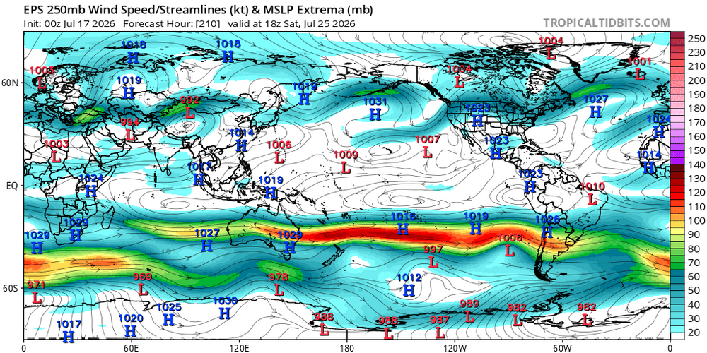
15 hours ago, snowman19 said:

As strong El Niño as it gets…..
And the subsurface heat/DWKW is reloading and strengthening under the 30C warm pool and is going to get pushed to the South American coast in the next month by the DWKWs and WWBs. The thermocline depression is ridiculous
Edit: @LakePaste25 The lines are showing the 20C isotherm depth vs climatology 20C isotherm depth in the thermoclineThe excellent news keeps on coming! We are gonna have such an exciting very rainy fall/winter here in Texas! Bring on that MONSTER NINO and the Brobdingnagian subtropical jet!!!!!!! And, bring on highly abnormal moisture feeds from the deep tropics, straight into South Central Texas!!!! Bring on moisture soundings over my region with water content 25 deviations above normal!
This place is soon gonnabe flood central!!!! Lookin forward to some truly EPIC jebwalks near where the waters are rising, while I use my old snow ruler to measure the water depth just like the old days back in the DMV!
-
1
-
 1
1
-
 1
1
-
-
6 hours ago, SnowenOutThere said:
Beautiful morning out. On ffx county parkway where it overpasses 50 could finally see past the blue ridge way to the distant mountains. Otherwise, mid 60s and low humidity means I get to wear a jacket today to coach!
I am jealous of your cool July weather!
-
On 6/15/2026 at 5:55 PM, MillvilleWx said:
You give me that hemispheric look and I'll take my chances
You'll take your chances. You'll get up the next morning and have to tunnel out your window because of all the snow! That's what we mean by getting JanuBuried lol
-
On 7/19/2026 at 10:29 AM, WxUSAF said:
09-10 was modiki (west based). Best we can hope for this year is probably basin wide.
2009 - 2010 was unbelievable. I never saw so much snow in Dale City back when I lived there, and I got to go to Charles Town back in 2009-10 and I got to see SO DAMN MUCH SNOW IT WAS RIDICULOUS! I was taking so many pictures of it with my phone! I was also 'stealing other people's snow' at 3am over there, jebwalking in drifts literally over my head and wallowing around like a true blue snow weenie! This obsessive walking is one reason why I am so crippled today, I can barely walk anymore.
-
1
-
 1
1
-
-
Houston is getting storms originating from Bertha's circulation. Maybe this bodes better for Buda in a few days! Those organized storms are only 130 miles East-southeast from Buda!!!!!!
I want my flooding rains BAD, far BADDER than Michael Jackson!!
I crave to see that water level rise so bad!
-
Hey meteorologists on here, I would like to politely request that EWX consider going ahead and hoisting an Extreme Heat Warning for North Hays County in Texas just for July 23, tomorrow. Highs will top out 100 degrees and dewpoints may well be in the lower to middle 70s. Today, July 22, we topped out at 102 degrees and it turned out that our dewpoint was 76. This means that locally here in Buda at the height of the heat this afternoon it felt like at least 119 degrees, perhaps the very low end of the 120s. This is serious heat even down here and we have hundreds of construction workers at it all day in Buda and Kyle, especially seeing that our region is now developing faster than places like Dubai in the UAE. The tech boom will be centered in Austin Texas and soon this region will have millions more people, especially as we really ramp up the Optimus iterations 3 - 5 General AI and Super AI robots in 2 years. Just a request. If there is an Extreme Heat package in place sometimes they will let those workers off earlier. (Maybe).
-
1 hour ago, katabatic said:
A beautiful evening to see a free Fleetwood Mac knockoff band at Wisp. 70 with a breeze - heading to the upper 40s tonight. Yes please and thank you.

I am jealous! Because of the weather, and because I grew up with Fleetwood Mac tracks! Many of them remind me of big snowstorms!
-
Buda is currently 100 degrees with a 76 degree dewpoint. This means it feels like it's 116 degrees in the shade! It topped out at 102 degrees, which means then the heat index felt like 119 or 120 degrees earlier!
-
1
-
-
5 hours ago, Typhoon Tip said:
It's placement geographically is beside the point.
The mechanism for it's persistence/necessity in the science of CC attribution et al, or for whatever reason, gets in the way of the NAO/tripole assumption. That is the point.
Thus, relying on it as a predictor for atmospheric behavior tendencies/correlations therein, are riskier - because those are driven by disparate total physical processes. The NAO/tripole physics are different than the AMOC for it being a ( possible ) geologic permanent change.
I'm not saying the AMOC is collapsing, per se. Maybe it is. Maybe it isn't. However, just advising that it is being scienced as occurring for that reason. So We'll see... But, if so ...the cold blob reflects the AMOC changes... not an NAO forcing (necessarily).
Put even simpler... cold blog exists, NAO is biased positive. Tough cookies.
The other aspect, the longer term correlation between the Pacific and NAO is transmitted through the N/A via the PNA. It's positive. Which means, when the PNA is positive, the NAO tends to be positive, and vice versa. So ...I'm not sure how a positive ENSO/+PNA correlation favors that -NAO ... it doesn't based on that. But that may not be the whole story - there may be something specific to El Nino that gets that anti-correlation to realize more frequently, during the El Nino winter? These kinds of exceptions exist in principle... worth looking for that. I kind of doubt it though. In the meantime, it makes intuitive sense that a +PNA jives with a +NAO and vice versa, because of winter planetary wave lengths and the speed of the basal flow. It would be hard to maintain a western N/A highly curvaceous flow and then expect the flow to bend back around into block over the D. Straight region, when flow is necessarily screwing along at ludicrous speeds due to the hemispheric gradient during DJF. Fast flow does not like curved surfaces... that's just physics. Curving the flow increases centrifugal -acceleration; and so as the flow speeds up that force is trying to cancel the curvature and flatten out. Ex, in April the flow tends to close off vortices; there is deceleration in the as the geopotential gradient is collapsing. The flow folds in on itself with the loss of basal velocity.
That's probably why a latter March thru early May -NAO boat ride isn't that uncommon. Because the flow collapses and the excessive wave transport gets stranded and loads that region.
4 hours ago, Typhoon Tip said:I'm suspecting that we're heading for a troughy/humid end game myself.
If so ... that would lower the "big heat" transport circumstances, blocked by ongoing synoptic balancing. Doesn't mean it can't happen... talking 'tendency' here ( sorry, not you per se but the common reader tends to formulate extremes in their interpretation .. failing idiosyncratic nuance and/or 'lean' )
We'll see... but there's a leitmotif in the major ensemble sources to pin a trough here regardless of the Pacific. Ex, over the next 7 days the eastern Pac passes through an impressive -PNA for mid summer... but we don't see heights rising much E of Chicago. Proooobably this is owing to the shortened wave lengths of summer in general - how that gets away with that. But here's the rub... that positive anomaly over the N-NE Pac decays, and the pattern moves ends up with trough anyway. So we're fucked either way, is what the modeling argues. Okay - Altho some folks have a more toxic relationship with heat expectations so for them, this is probably the opposite of fucked intimation haha
Typhoon, Please post a hell of a lot more!
I have always enjoyed reading your discourses!
Love it! Post a LOT more!
-
CONGRATS everyone!
-
2
-
-
Houston better look out for lots of rain. Buda, not so much. Bertha's center of circulation is now progged to pass well east of me. This means no rain and highs around 108 degrees ambient, not counting humidity. Better build a lot of Arks Houston and Louisiana! You're gonna need 'em!
Not to worry. We got us a record Nino on tap and strengthening and I'll get plenty of flooding rains between now and May 2027.
-
As of 121am Texas time July 21, Bertha is disorganized. Most of the precip is south of the center of circulation. This puppy needs to be monitored. With any luck she will reach hurricane status and continue lumbering slowly westward toward Texas where I hope she will move in and take up a happy productive residence swirling around for a week about 40-50 miles southwest of Buda. We are parched and need more rain. I'd love it if Bertha would please spin me up some highly efficient tropical rainbands then train them right over the Austin/Buda Corridor for days on end. I'd love to see the Plum Creek rise right over Rt 1626 and 967. I'd walk down there with my old snow ruler and take water level readings, while blasting the latest Gen Z tracks on my headphones! Another thing I crave for is to get so much heavy efficient tropical rain, that all the water storage facilities scattered all over Buda and Kyle would get filled right to the brim, even overflowing and running down the streets! I'd definitely enjoy a truly EPIC jebwalk!
-
 1
1
-
-
Come ON, Bertha. Get nice and strong. Get overloaded with tons of tropical moisture from the Gulf. Move nice and slow, lumber along then make a beautiful landfall in Texas then come to rest southwest of Buda, about 40 miles away. Then pull those graceful, water-laden rainbands right over Buda, enable me to enjoy torrential ultra-efficient rainfall to pile up inches in a very short time over ground that has really not had time to dry out. Take your time weakening, and if you can, please pretty please pull a Harvey on us in Texas right over Buda!!!!!!!! This is a wonderful place for you to visit, Bertha, and you're VERY welcome here!
Come to papa......
I love El Nino with all my rain weenie heart!
-
I hope that TD2 now in the Gulf of Mexico tracks west right into south central Texas then gets stuck about 40 miles SW of Buda, then proceeds to pull in feeder bands of torrential training rains in off the Gulf for days. ESPECIALLY WHEN YOU CONSIDER HARDLY ANY MEANINGFUL GROUND DRYING WILL HAVE A CHANCE! Already, I have seen water catchment depressions carrying water all over the landscape!!!!!!!!!!!
Yeah baby! We are going to have a BIG year for lots of rains in Texas!!!!
I am a SICK PUP. But I crave a 50 degree Celsius El Nino.
It's starting!
-
2 hours ago, Stormchaserchuck1 said:
Come on let's crush the records with this thing!
Hell Yeah! Let's go set us a 300,000 year record with this Nino!
I want to get so much rain in Texas! I want moisture feeds straight from the Equator and storm systems to just stall over south central Texas for days and days and days and days!
I want a truly BROBDINGNAGIAN amount of rain from this thru June 2027!
-
1
-
 1
1
-
-
4 hours ago, LakePaste25 said:
Jet extension is going full steam in the southern hemisphere winter, with copious amounts of snow in the Andes:
Man I wish they had a live webcam - They make Mammoth Ski Resort look like the DMV in a La Nada winter.
I am SOOOOOOOO damn Jealous of all their snow.
I'd love to kick back on a Texas lawn chair on their ski parking lot and watch that snow pile up all around me lol.
-
2
-
1
-
-
4 hours ago, RDM said:
Took our trash out about an hour ago. Our driveway is very long so I use a helmet flashlight to light the way. Could see the smoke and other suspended particulates drifting in the air. Looked like the mist of a dense fog, but with smell.
i hope you guys get some rain to knock that crap down.
-
2 hours ago, PhiEaglesfan712 said:
This was a textbook frontloaded warm/backloaded cold winter. If we continued this into spring, I believe April 1983 was the coldest April on record CONUS. That one had a major freeze/snow event in the Eastern half of the country (impacting the midwest on the 13th-16th, and North Carolina northward on the 19th-22nd).
February 11 1983 Dale City got to enjoy 17 inches of fresh snow! I remember jebwalking in it to my immense delight!
-
1
-
-
Just for shits and giggles: How strong can El Nino get? Can it reach 7 degrees Celsius above the ENSO benchmark, or whatever it is called? I want a 15 degree Celsius Brobdingnagian Nino!!!!!!
Why? Because huge amounts of rain is so much fun!
I am a rain weenie, lol!
For the record: We ended up with 5.9 inches in this storm cycle, I call the Mid July 2026 Storm Cycle. I might start naming the cycles, because we will have so many of them in this Uber Nino! We are now up to 34.3 inches of rain on the year! Normal FOR THE ENTIRE YEAR is 30.0.
-
 1
1
-
-
On 7/14/2026 at 10:59 AM, csnavywx said:
We're at the point where this event catches up to '97 and passes it handily.


CSNavyWx, are you saying here that this particular Nino event is now getting stronger than the 97-98 Nino?
I remember N VA getting so damn much rain that winter!
What could this possibly mean for south central Texas? Man WE ARE ALREADY 33 INCHES FOR THE YEAR! This is only mid-July! Aren't Nino summers supposed to be hot and dry, especially in Texas?
I'd be fairly quick to run for the Mountains, but Record Mega Nino-induced orographic rains are NOT THE ANSWER!
Although the rains may not be the problem this winter in the mountains, especially the high Sierra. Places like Mammoth Ski Resort may get completely buried ALIVE in meters and meters and meters of wet Sierra Cement! Even the gondola pylons may be buried under about 200 feet of snow.


2026-2027 Super El Nino
in Weather Forecasting and Discussion
Posted
I love your thinking, snowman! I want tons of rain! I want transport of moisture from the deep tropics, too! This is a monster Nino! I want monster rains this autumn and winter and in Spring 2027!