

Snowncanes
-
Posts
169 -
Joined
-
Last visited
Content Type
Profiles
Blogs
Forums
American Weather
Media Demo
Store
Gallery
Everything posted by Snowncanes
-
Freezing rain squall line anyone?
-
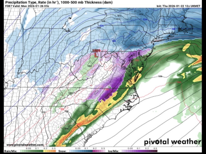
Crazy how we went from a super suppressed drawn out storm to a miller B plowing right up the apps in a matter of 24 hours. Also, GFS barely gets us (RDU) above freezing for the foreseeable future. Will be interesting to see how that plays out based on if we get IP or ZR
-
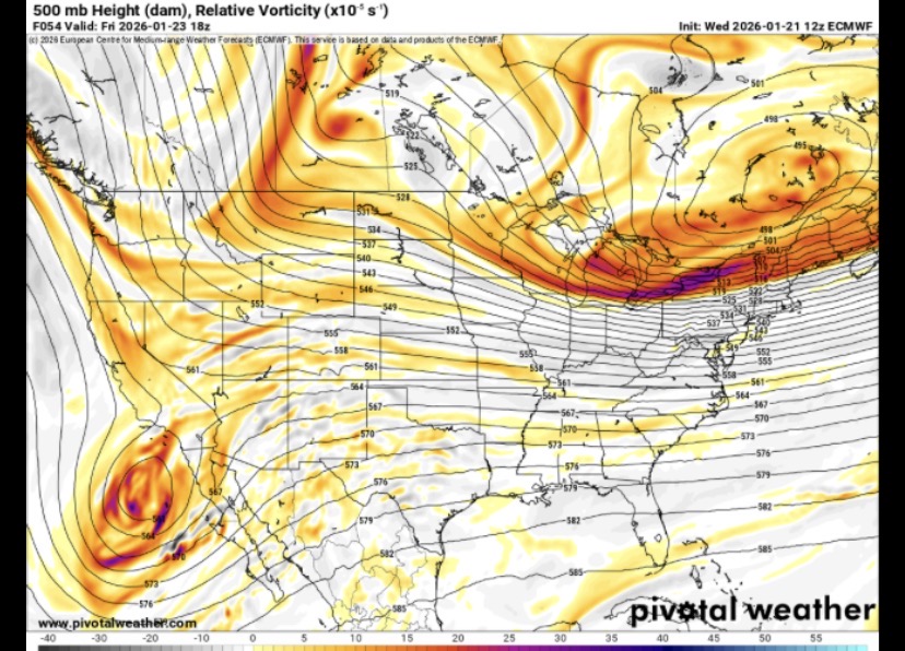
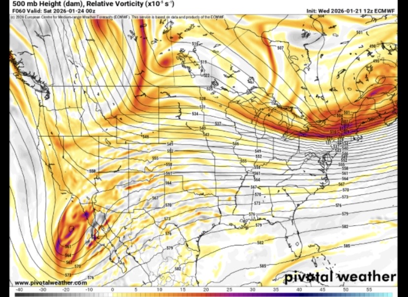
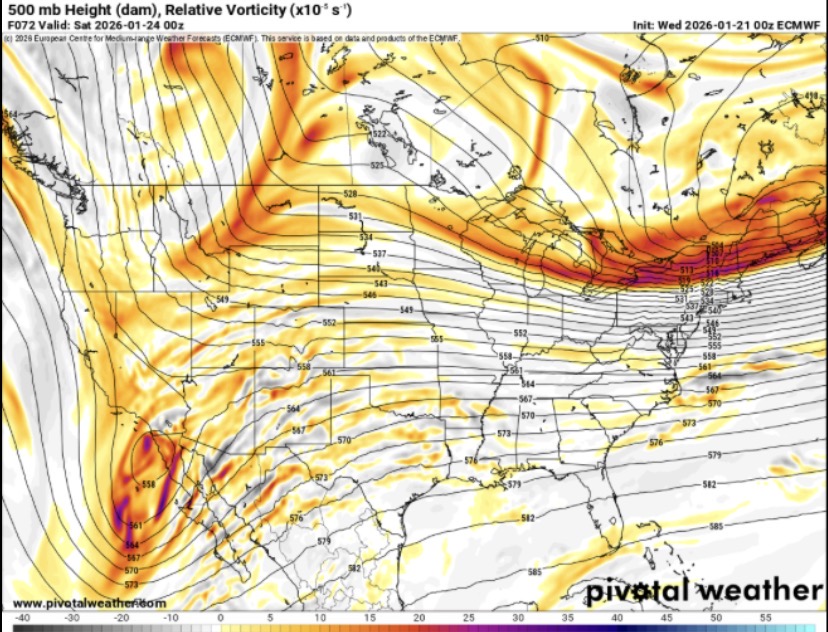
Euro looks nearly identical to 12z at 42 on the 500vort
-
Well… GFS definitely caved. Snow all the way up to Toronto at hr96. Definitely needs to be a study to how literally every model was so wrong.
-
Yeah that’s what I read too… but interesting they both jumped stronger and south this run.
-
If the NAM and ICON both got the HH data, the Baja low looks to be a decent bit stronger. Closed isobars much longer and a little more south on both. Not sure how this will look downstream though
-
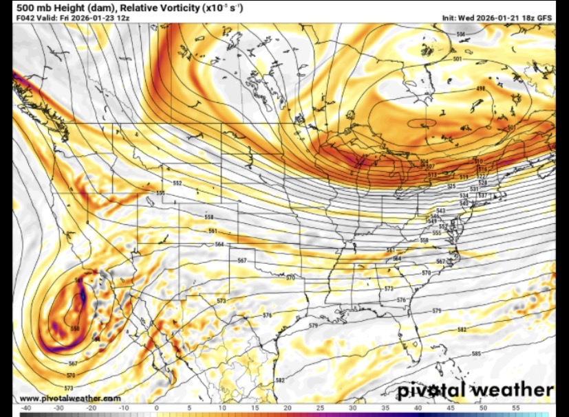
Worlds different through H51. No phase whatsoever yet


-
Completely agree. Check out the 500 vort map of the last 8 euro runs. Crazy inconsistent up there. https://x.com/contentwxguy/status/2014137831522742310?s=46
-
https://x.com/brandonlanewx/status/2014119481144955012?s=46 An interesting little trend. I know the precip/clown maps aren’t what we want to see but worth keeping an eye on, especially after more data gets ingested tonight.
-
Oops accidentally grabbed the 12z GFS. Here’s 18z same time.
-
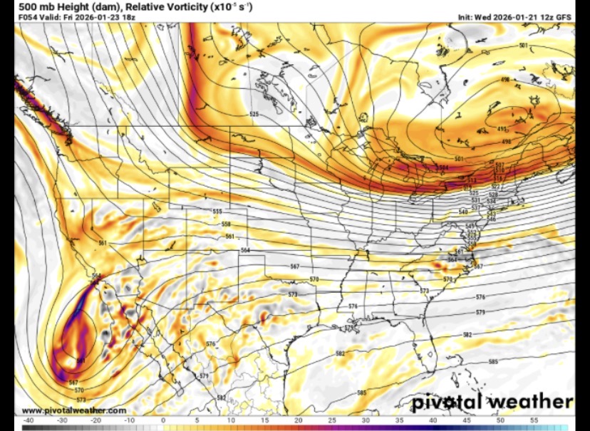
Huge difference at hr54 in regards to the northern stream energy. Much more progressive and beats the Baja low east. A difference of almost the entire state of Montana lol. Looks like the Baja low may be slightly more south on gfs as well. Definitely something to watch as the models come in tonight.
-
Maybe im just being stubborn but to my untrained eye the euro trended slightly better with the Baja low and northern stream but still delivered the same result. Maybe someone more experienced could enlighten. I just find it hard to believe a HP that strong with some decent blocking retrogrades that quick with a low thats not all that strong.
-
Euro with a little less interaction at H60
-
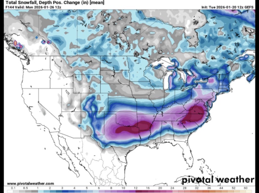
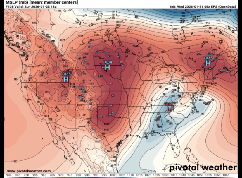
GEFS snow depth mean. Obviously this is not all snow, and probably mostly sleet for southern sections but still a big winter storm no matter how you slice it. Hopefully we can stay out of the ZR
-
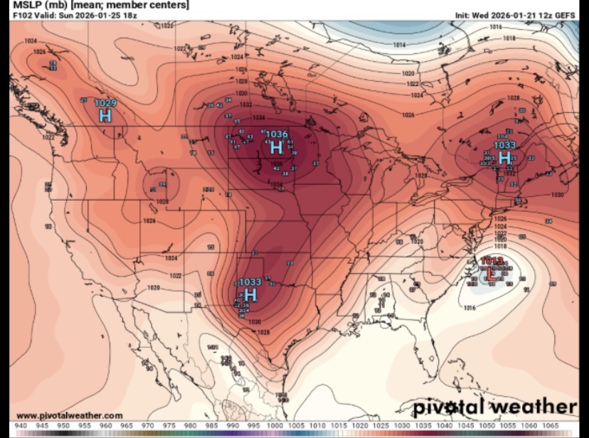
GEFS vs EPS low locations. Obviously the amped/miller b solution is not good for us but synoptically they’re pretty similar wrt SLP locations for the high pressure. Looks like the high over the dakotas is a bit stronger on the GEFS which allows less room for the LP to ride up the apps. Im no pro but will be really interesting to see how this all plays out. I don’t think it takes much to change outcomes (either way) with this setup. I think we will get a much better handle when all the players are sampled (northern stream vort, high strength, Baja low) so looking forward to this evenings runs.
-
Long time lurker first time poster. ICON a looks a little better with regards to the phasing out west. IMO thats our biggest player at the moment. HP is here and even though it’s a bit transient at the end, still cold enough. We just need the storm to phase less/slower out west. Little differences out there make big differences here.

