TalcottWx
-
Posts
28,808 -
Joined
Content Type
Profiles
Blogs
Forums
American Weather
Media Demo
Store
Gallery
Everything posted by TalcottWx
-
Mesoscale Precipitation Discussion 0854 NWS Weather Prediction Center College Park MD 401 PM EDT Tue Aug 23 2022 Areas affected...Southern New England Concerning...Heavy rainfall...Flash flooding possible Valid 232000Z - 240100Z SUMMARY...Thunderstorms displaying occasional training characteristics could produce localized flash flooding, particularly in more heavily urbanized communities. DISCUSSION...18Z surface analysis showed a frontal boundary draped across southern New England while southwesterly 850mb flow continued to intersect the boundary. 850-300mb mean winds are in a fairly uniform SW flow pattern aloft as well, which favors the potential for training thunderstorms. According to SPC RAP mesoanalysis, PWs across southern New England ranges between 1.6-1.75" and MLCAPE is 1,000-1,500 J/kg as of 19Z. The front will lift north gradually throughout the evening and the storms will propagate northeast closer to the Boston metro area. MRMS instantaneous rates have been above 2.5"/hr within the heaviest storms, and FLASH CREST max unit streamflow has generated 200-600 cfs/smi in the Providence area. Local observations near Taunton and west of Springfield have reported >1.5" over the last hour. The latest HRRR shows several more hours worth of storms possible, which given the persistent southwesterly flow intersecting the front, gives reason to believe the potential for training storms will linger into the evening rush hour. Localized flash flooding is possible in the more heavily urbanized areas and in low lying, poor drainage spots.
-
Yes but stronger cells have easterly component look at the Hadley cell
-
Getting breaks of sun in Dorchester now
-
The real juice has been pulsing and moving east along the front which suggests you get hit from the west
-
Cells might train over the east later?
-
Sent you a dm
-
Rotation looks broad
-
Can you send this to me? [email protected]
-
Almost looks like a coastal front?
-
If u look at how it's pivoting I'd say pretty darn wet for both of us
-
It's just a summer noreaster with 30mph winds.... Water the lawn and plants at night... Hide from the community watering police... Save the coastal for winter
-
What Even is this thing warm core?
-
Why bother coming at Ray on a nice day like this get out and be happy
-
Sneaky warm tongue
-
https://youtu.be/iTHYRO0J9AY
-
Nice where'd u eat.
-
Beautiful day at west Dennis Beach near his old home
-
Hey guys, having an issue on the cape. I think it's ants? Big piles of sand in my flower bed. This has happened elsewhere on cape last few weeks.
-
Pretty ugly look out there. I missed a lot of the heat wave. Came back to bad drought. Lawns gone around here.
-
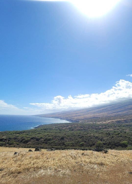
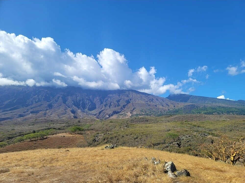
Check this out. This volcano makes up the entire eastern part of Maui. https://en.m.wikipedia.org/wiki/Haleakalā
-
Just a mile or two has such drastic difference in yearly rainfall. It's overwhelming. I was young last time. This time I had some knowledge under my belt from this forum, it was beyond cool.
-
Big humidity difference too!
-
Thanks everyone, can't wait to go back again soon. Wife went from maybe we'll fly this far again in 5+ years to maybe next year once she experienced Maui... Feel like I've drank for 3 straight weeks. Time to get back into a shape. I am a shape right now. Round. Overwhelmingly more hot here.
-