
WeatherGeek2025
-
Posts
1,689 -
Joined
-
Last visited
Content Type
Profiles
Blogs
Forums
American Weather
Media Demo
Store
Gallery
Everything posted by WeatherGeek2025
-
First Legit Storm Potential of the Season Upon Us
WeatherGeek2025 replied to 40/70 Benchmark's topic in New England
pictures or it didn't happen -
Storm potential January 17th-18th
WeatherGeek2025 replied to WeatherGeek2025's topic in New York City Metro
i would look for that high circled in red to either become stronger or move west if we have any chances of this going west! -
Storm potential January 17th-18th
WeatherGeek2025 replied to WeatherGeek2025's topic in New York City Metro
it's probably snowman19 with his 2nd account! -
Storm potential January 17th-18th
WeatherGeek2025 replied to WeatherGeek2025's topic in New York City Metro
-
aren't you upstate?
-
First Legit Storm Potential of the Season Upon Us
WeatherGeek2025 replied to 40/70 Benchmark's topic in New England
GM it'll go west gfs is king in my ok no opinion. Euro isn't as good as before they made that upgrade -
First Legit Storm Potential of the Season Upon Us
WeatherGeek2025 replied to 40/70 Benchmark's topic in New England
give us that and everyone will be happy -
Storm potential January 17th-18th
WeatherGeek2025 replied to WeatherGeek2025's topic in New York City Metro
i want gfs 12z but 50 miles west! this one is for @snowman19 -
First Legit Storm Potential of the Season Upon Us
WeatherGeek2025 replied to 40/70 Benchmark's topic in New England
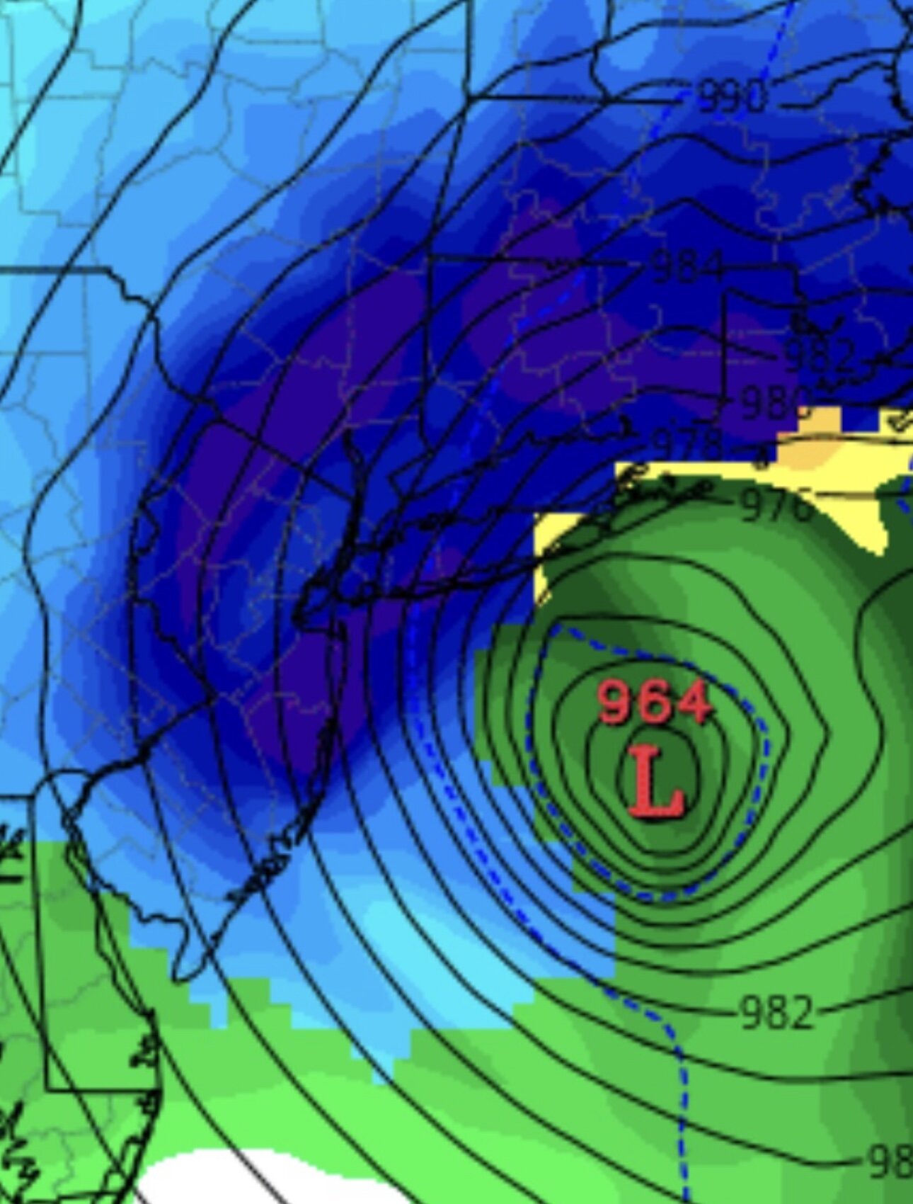
the europeans have lost the weather forecasting plot since the euro update years ago and gfs taking king since nemo in my opinion! Euro models will whiff and be stubborn while good models like gfs and cmc will hit and probably expand its precip shield by another 50-100 miles by making a bm track and making the storm stronger to around 985-990 millibars. i think anybody north west of Yarmouth and up to Worcester and west of Montauk up to Poughkeepsie is getting a dumping. -
Storm potential January 17th-18th
WeatherGeek2025 replied to WeatherGeek2025's topic in New York City Metro
thanks Franklin, those ensembles look conservative with the clown maps, i think 80% of those ensembles look like good hits, a couple of inland runners which is probably not gonna happen and a couple of whiffs. We are looking good, knock on wood! -
First Legit Storm Potential of the Season Upon Us
WeatherGeek2025 replied to 40/70 Benchmark's topic in New England
uncle? -
Storm potential January 17th-18th
WeatherGeek2025 replied to WeatherGeek2025's topic in New York City Metro
does it show a stronger storm? -
First Legit Storm Potential of the Season Upon Us
WeatherGeek2025 replied to 40/70 Benchmark's topic in New England
no high to our north or east, this could trend another 50-100 miles west -
First Legit Storm Potential of the Season Upon Us
WeatherGeek2025 replied to 40/70 Benchmark's topic in New England
uncle? -
how far does that go? 84 hours
-
First Legit Storm Potential of the Season Upon Us
WeatherGeek2025 replied to 40/70 Benchmark's topic in New England
canadian shows a much earlier start time around 1am sunday morning, and it's outta here by 7pm sunday meanwhile gfs shows snow starts around 1pm sunday and it snow until about 6am monday. That's a huge difference timeframe wise! -
Storm potential January 17th-18th
WeatherGeek2025 replied to WeatherGeek2025's topic in New York City Metro
canadian shows a much earlier start time around 1am sunday morning, and it's outta here by 7pm sunday meanwhile gfs shows snow starts around 1pm sunday and it snow until about 6am monday. That's a huge difference timeframe wise! -
can you pin the storm thread and call it crusha 2026 or at least just pin it please sir
-
First Legit Storm Potential of the Season Upon Us
WeatherGeek2025 replied to 40/70 Benchmark's topic in New England
how much for philly -
Storm potential January 17th-18th
WeatherGeek2025 replied to WeatherGeek2025's topic in New York City Metro
cmc 999 bm -
First Legit Storm Potential of the Season Upon Us
WeatherGeek2025 replied to 40/70 Benchmark's topic in New England
999 bm -
January 2026 Medium/Long Range Discussion
WeatherGeek2025 replied to snowfan's topic in Mid Atlantic
cmc? -
Storm potential January 17th-18th
WeatherGeek2025 replied to WeatherGeek2025's topic in New York City Metro
so gfs says basically no snow for saturday for the city i don't mind can we get this trend another 50-100 miles precip expansion and bm track and we are golden -
January 2026 Medium/Long Range Discussion
WeatherGeek2025 replied to snowfan's topic in Mid Atlantic
i'd go with another 50-100 miles expansion with precip and low right at bm -
First Legit Storm Potential of the Season Upon Us
WeatherGeek2025 replied to 40/70 Benchmark's topic in New England
the west trend is not done i feel it other models will be stubborn but gfs will keep locking gains towards west! big snows coming in my opinion reminds me of nemo instead of east it's the west trend




