WeatherGeek2025
-
Posts
1,682 -
Joined
-
Last visited
Content Type
Profiles
Blogs
Forums
American Weather
Media Demo
Store
Gallery
Everything posted by WeatherGeek2025
-

Storm potential January 17th-18th
WeatherGeek2025 replied to WeatherGeek2025's topic in New York City Metro
i think euro caves tonight and shows at least a few inches for sunday for the city -
Storm potential January 17th-18th
WeatherGeek2025 replied to WeatherGeek2025's topic in New York City Metro
i think this will over perform tomorrow, sunday looks like a flop look at all that moisture -
Storm potential January 17th-18th
WeatherGeek2025 replied to WeatherGeek2025's topic in New York City Metro
this one is not anti welcome... -
Storm potential January 17th-18th
WeatherGeek2025 replied to WeatherGeek2025's topic in New York City Metro
that's fair, what's funny to me is he trolls us we all know it he gets a kick out of it cause he's probably young. Keep on trolling snowman if you're reading this! you anti snow you! on another note, hopefully tomorrow over performs cause it looks like Sunday is gone -
Storm potential January 17th-18th
WeatherGeek2025 replied to WeatherGeek2025's topic in New York City Metro
so he got one storm right in 10 years -
Storm potential January 17th-18th
WeatherGeek2025 replied to WeatherGeek2025's topic in New York City Metro
i'd focus on rap and hrrr now -
First Legit Storm Potential of the Season Upon Us
WeatherGeek2025 replied to 40/70 Benchmark's topic in New England
what's navgem show for tomorrow and sunday? -
First Legit Storm Potential of the Season Upon Us
WeatherGeek2025 replied to 40/70 Benchmark's topic in New England
i can't find that anymore, isn't it discontinued? -
First Legit Storm Potential of the Season Upon Us
WeatherGeek2025 replied to 40/70 Benchmark's topic in New England
if my JUNO theory is correct, GFS makes a hard western move tonight and so does the Euro! -
Storm potential January 17th-18th
WeatherGeek2025 replied to WeatherGeek2025's topic in New York City Metro
1-3 saturday, nothing sunday -
Storm potential January 17th-18th
WeatherGeek2025 replied to WeatherGeek2025's topic in New York City Metro
uncle!? -
Worst weather models, and best models in your opinion long range, mesos? Best Long range Model: GFS Worst Long range Model: Icon Best Meso: Reggie Worst Mesi: Nam What do you guys think?
-
First Legit Storm Potential of the Season Upon Us
WeatherGeek2025 replied to 40/70 Benchmark's topic in New England
i'm hoping the Ai models score this one, otherwise ai is overrated! -
First Legit Storm Potential of the Season Upon Us
WeatherGeek2025 replied to 40/70 Benchmark's topic in New England
doesn't GGEM rank better than GFS? -
January 2026 regional war/obs/disco thread
WeatherGeek2025 replied to Baroclinic Zone's topic in New England
reggie? -
Storm potential January 17th-18th
WeatherGeek2025 replied to WeatherGeek2025's topic in New York City Metro
nam has got to be the worst model there is. No wonder they're discontinuing it -
First Legit Storm Potential of the Season Upon Us
WeatherGeek2025 replied to 40/70 Benchmark's topic in New England
gm euro should come in on board by 0z run tonight -
Storm potential January 17th-18th
WeatherGeek2025 replied to WeatherGeek2025's topic in New York City Metro
euro has 2-3 inches of snow for saturday for the city and north sunday shows a graze better but still not there. euro will inch west and than make a big move. I don't think the west trend is done on gfs and the other models. The storm will trend stronger and more amped therefore it'll bring more moisture westerly in my opinion! -
First Legit Storm Potential of the Season Upon Us
WeatherGeek2025 replied to 40/70 Benchmark's topic in New England
euro will stubbornly not budge in my opinion until tomorrow night! -
@BxEngine@Rjayanyway one of guys can change the thread date to Jan 17-18th
-
Storm potential January 17th-18th
WeatherGeek2025 replied to WeatherGeek2025's topic in New York City Metro
i don't think euro caves, this is like juno all over except its the west trend that wins instead of east. euro caves in 24 hours -
Storm potential January 17th-18th
WeatherGeek2025 replied to WeatherGeek2025's topic in New York City Metro
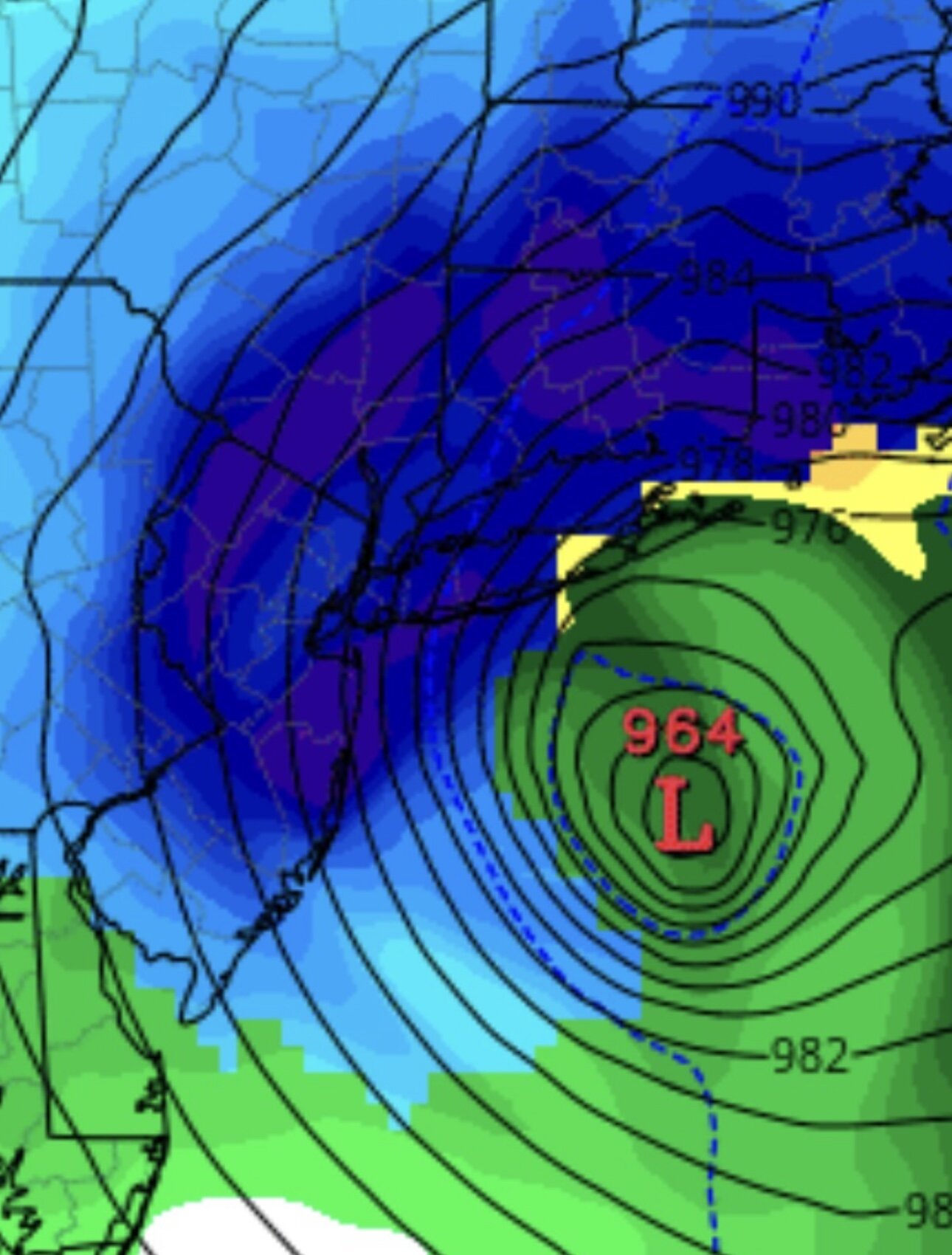
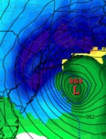
snowstorm from reggie -
First Legit Storm Potential of the Season Upon Us
WeatherGeek2025 replied to 40/70 Benchmark's topic in New England
reggie way west and shows rain for us in the beginning -
First Legit Storm Potential of the Season Upon Us
WeatherGeek2025 replied to 40/70 Benchmark's topic in New England
it's a little west but sucks that we lost saturday's event now -
Storm potential January 17th-18th
WeatherGeek2025 replied to WeatherGeek2025's topic in New York City Metro
nam is west


