Dustin
-
Posts
69 -
Joined
-
Last visited
Content Type
Profiles
Blogs
Forums
American Weather
Media Demo
Store
Gallery
Everything posted by Dustin
-
Let’s talk winter!! Ohio and surrounding states!! 24'-25'
Dustin replied to buckeye's topic in Lakes/Ohio Valley
I saved the receipts on that one, Pondo...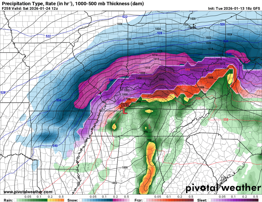

-
2022 Short/Medium Range Severe Weather Discussion
Dustin replied to Chicago Storm's topic in Lakes/Ohio Valley
One of the storms further south in Madison County (20 or so miles SW of Franklin County). Same storm has some significant damage reports from about a half hour before this shot. Overturned campers and power poles snapped. You be the judge on this one...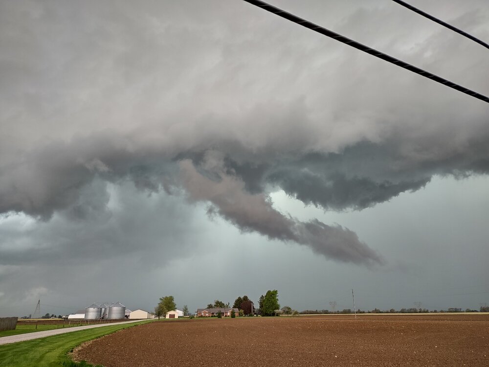
-
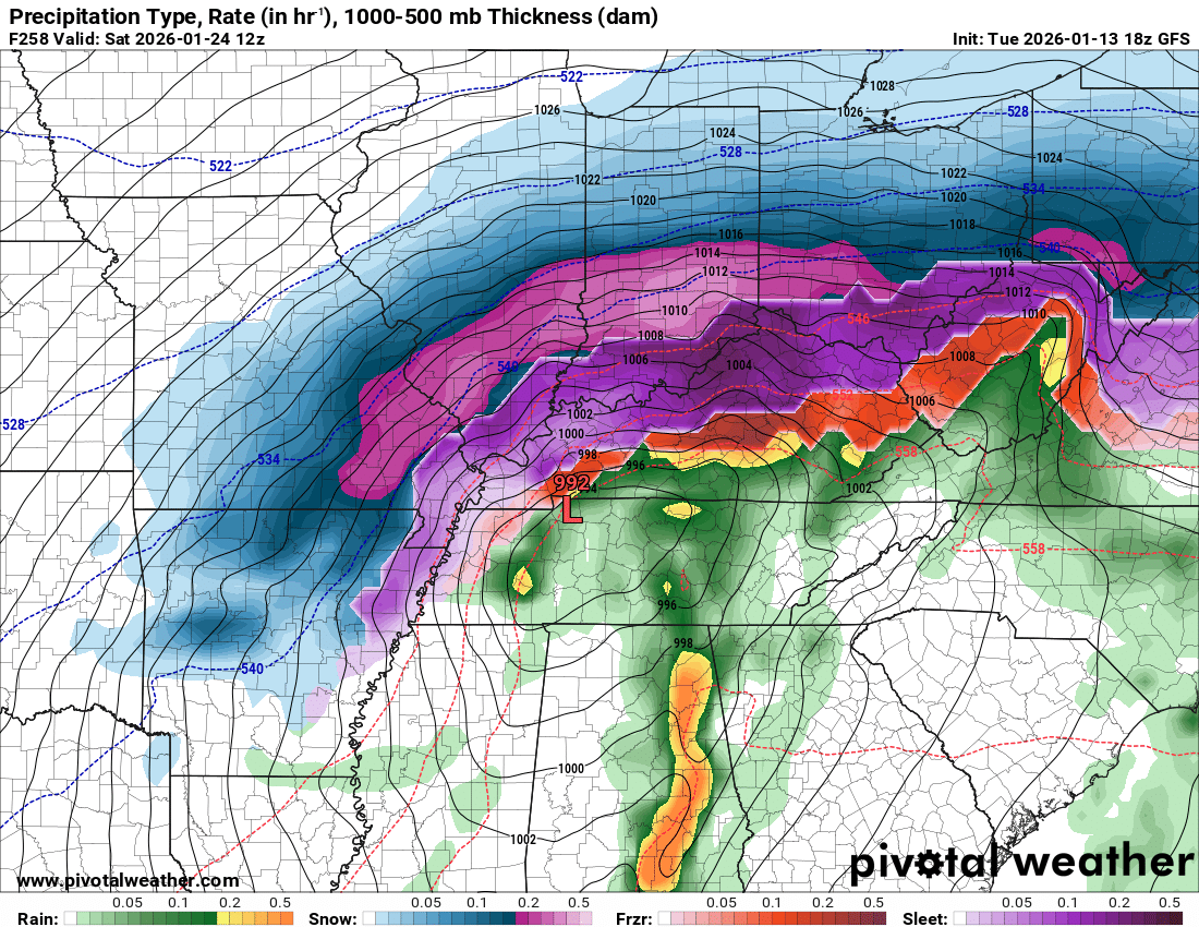
It's amazing how much panic there is in this thread from members who the HRRR show picking up 8-10 inches over the next 24 hours. Thinking there's going to be a narrow zone of deformation in the early AM hours that is really going to rip. Still, the HRRR forecast sounding along that line bring the warm tongue right to the 0C isotherm, and the HRRR and GFS certainly missed the depth and intensity of the warm layer this morning. If you look at ILNs sounding from this morning, and check out the NAM's soundings from yesterday's run, it modelled the column incredibly well for today. Those who are upset or not understanding the extent of ZR and sleet this afternoon selectively choose to ignore that in the modelling and sampling. Did we get rid of the weenie tag?
-
Some of the forecast soundings for the HRRR more closely resemble the GFS, with a razor thin above freezing layer where sleet is depicted. Normally for our area, I wouldn't underestimate how much sleet will fall, but there are some factors in this storm that have me believing it could easily trend towards higher snow amounts and higher freezing rain amounts, with the extent of the swath of sleet being a bit overdone (ala what the GFS has been showing). Historically, I'd want to hedge towards the NAM doing a better job of handling the northerly extent and depth of the warm tongue, but just the depth and height of the melting layer depicted have had me a bit suspicious of how much sleet will actually fall. The fact that some sleet is mixing a little ahead of forecast in some areas has me wondering if there will be an earlier switch to snow. Honestly, though, I'd not be surprised if it goes the opposite way and the extent of freezing rain is much more northward. This is the type of nightmare to forecast the makes me glad I veered away from the professional forecaster route. Much more fun to track when you've got nothing at stake
-
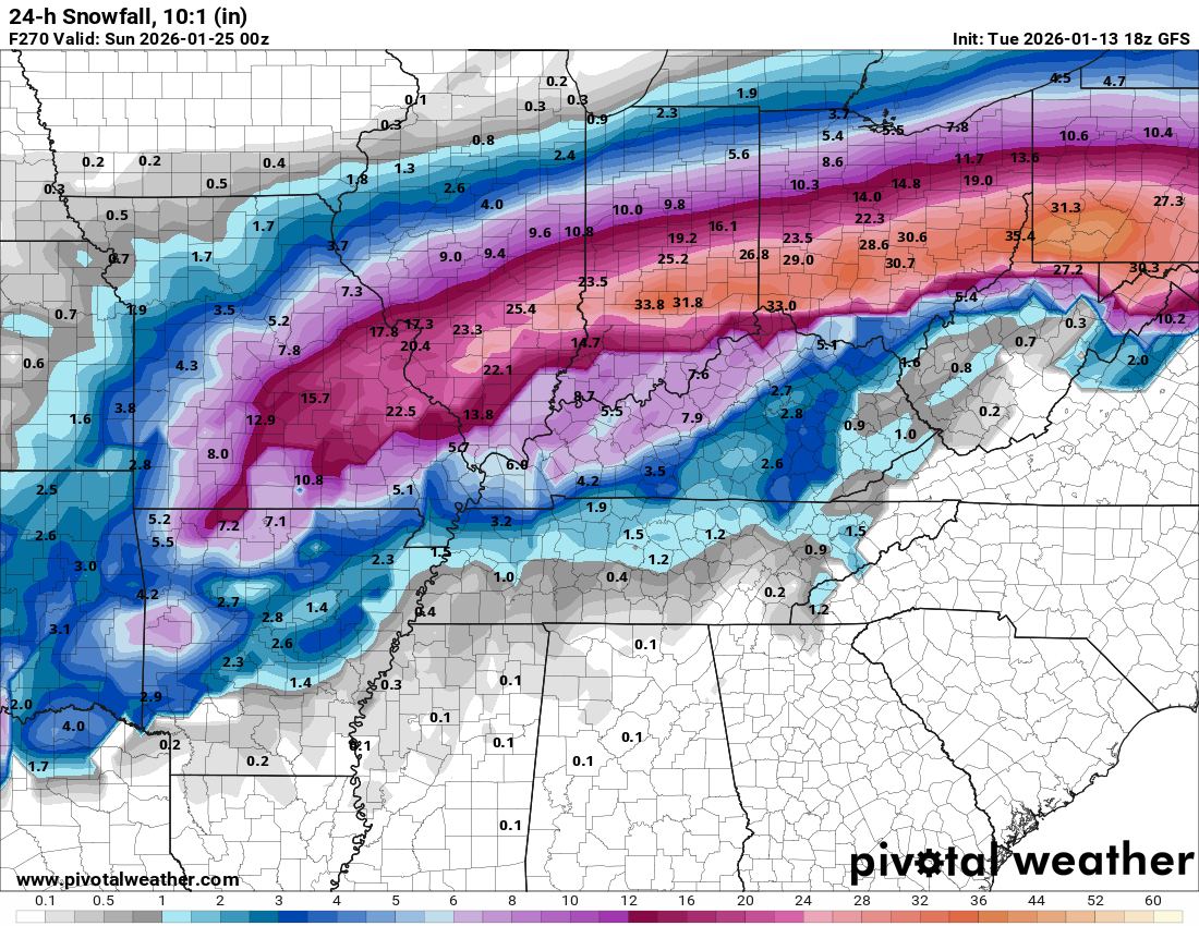
Rough for sure, but even worse are the parts of the MO boot heel that the GFS had ranging from 20 to 30 inches a few days ago that are looking at an inch or two now.
-
The different between the ECMWF and GFS at 0z is downright disturbing. We're talking 20in discrepancies near the MO boot heel (Poplar Bluff). I'd hate to be a forecaster for that region. That being said, there's good reason to buy the GFS solution but there's also be pretty solid ensemble support for the Euro solution. Gonna be a fun couple of days.
-
I wonder how many broadcast mets read the AFDs? There could be some downstream impact on public perception.
-
CC drop between Dotham and Enterprise AL this morning.
-
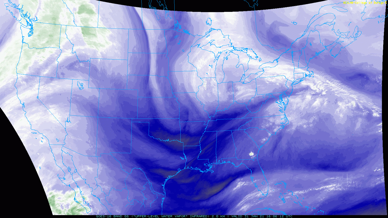
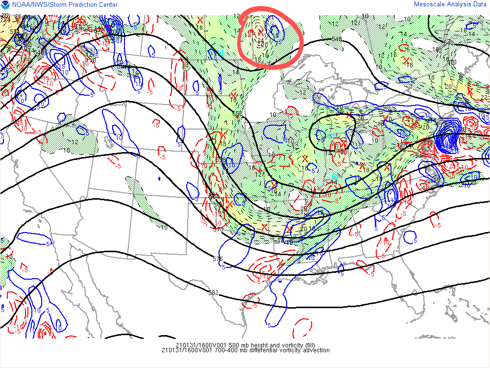
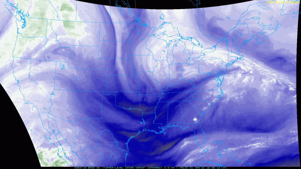
This isn't really the typical backside snow that under-preforms here (not to say this won't under-perform, but there is reason to think otherwise). There is a second vorticity max that forecast to deepen and crash down over the lakes. You can see it nicely on water vapor: PVA from this feature seems to provide ample lift to sustain snow showers across the region into Tuesday morning. I can see some lake moisture enhancement creating some lollipops of 3+ over the course of the next 24-36 hours.
-
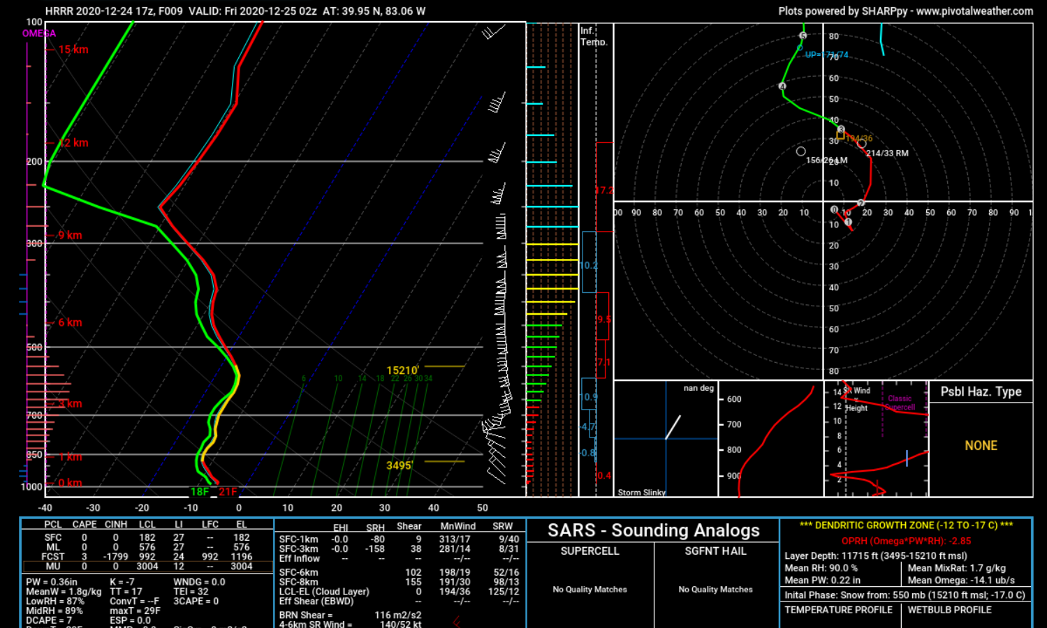
HRRR is trending back west, and spitting out some much better numbers for CMH. Picking up on some good lift through a nice deep DGZ. I'm thinking we see a couple of hours of nice ratio snow, maybe not 5+ inches some models are suggesting, but I think a nice surprise snow could be in the works.