

Bill in MS
-
Posts
15 -
Joined
-
Last visited
About Bill in MS

-
February 2024 mid/ long range
Bill in MS replied to Holston_River_Rambler's topic in Tennessee Valley
We have had great winters the last three years in North Mississippi... 4-6 inch storm last month, 2 inches and then a pretty significant ice storm in 2022- 2023 and 12 inches in one week in 2021-2022. This has been a great set up for the Western half of the forum.- 750 replies
-
- 3
-

-
- snow elk
- wooly worm
- (and 1 more)
-
Mid to Long Range Discussion ~ 2024
Bill in MS replied to buckeyefan1's topic in Southeastern States
Blocking is good for something in the Spring... lots of overcast days with temps struggling to get into the 40's and a large upper low that won't move for two or three weeks. And then a hard freeze on the last night because the sky finally clears about 6 PM... Just in time for radiational cooling to set in. -
Late frost/ freezes are a common occurrence in non-water protected areas in the Eastern, Central, and Southern USA. They vary from year to year in severity and damage. Most native trees suffer very little or no noticeable damage until temps get below 28F degrees and even then it depends upon how far along they are in their growing cycle. Duration is also a key factor. I have seen it go below 28F several nights in a row with highs in the 40's and 50's and there was no discernible damage due to the freeze being only 4 or 5 hours long each night. The bad years are when it is below freezing by say 10 pm and remains there until 8 or 9 am the next morning. So 28 degrees for 2-4 hours is no big deal but 28 degrees for 8-10 hours+ can do real damage. My Mother always said that the purpose of a late freeze is to give the trees - fruits, nuts, mast crop - a needed break from over-fruiting and this is a normal part of nature's cycle. That being said... every 50 years or so we get a devastating late freeze like April, 2007 that actually kills down to the wood. I hate those types of years.
-
Daffodils, Red Maples, and Elm in full bloom over here in North Mississippi. Forsythia about to bloom. Tulip Magnolias showing large pink buds.
-
January 15th-17th 2024 Arctic Blast/Snow Event
Bill in MS replied to John1122's topic in Tennessee Valley
3.5 inches in Hernando total. Got an inch from this band in about 1.5 hours. .. but back edge coming quick. Points 20-50 miles south of me, in the WSW-ENE band around Batesville, MS to Oxford and then Northeast to just below Corinth seeing at least 1 to 1.5 inch an hour rates with huge flakes. Maybe two inch an hour rates. Also, heavy sleet in some of that banding. -
January 15th-17th 2024 Arctic Blast/Snow Event
Bill in MS replied to John1122's topic in Tennessee Valley
Some good bands still over Arkansas. You may still do well. That being said, the heavier returns right now are setting up east of you on radar. The Euro and the NBM did really well with their 3-4 inch predictions for my county. Thee HRR and NAM etc...were way off. -
January 15th-17th 2024 Arctic Blast/Snow Event
Bill in MS replied to John1122's topic in Tennessee Valley
Most Mesoscale models were way off the mark for Desoto County, Mississippi. Despite snowing all night I have just between 1.5-2 inches. Many models showed us reaching 7 and 8 inches already. I will be suprised if we get a storm total of 3 inches. -
January 15th-17th 2024 Arctic Blast/Snow Event
Bill in MS replied to John1122's topic in Tennessee Valley
-
January 15th-17th 2024 Arctic Blast/Snow Event
Bill in MS replied to John1122's topic in Tennessee Valley
Yes. And these sleet showers seem almost convective. They are much bigger pellets now and I can here them pouring on the roof. I hope I don't lose much QPF to sleet. -
January 15th-17th 2024 Arctic Blast/Snow Event
Bill in MS replied to John1122's topic in Tennessee Valley
Moderate sleet under these returns in North MS 30 minutes south of Memphis.. Very little snow. Looks like all the snow is along and north of I-40. Sleet showers to the south. -
January 15th-17th 2024 Arctic Blast/Snow Event
Bill in MS replied to John1122's topic in Tennessee Valley
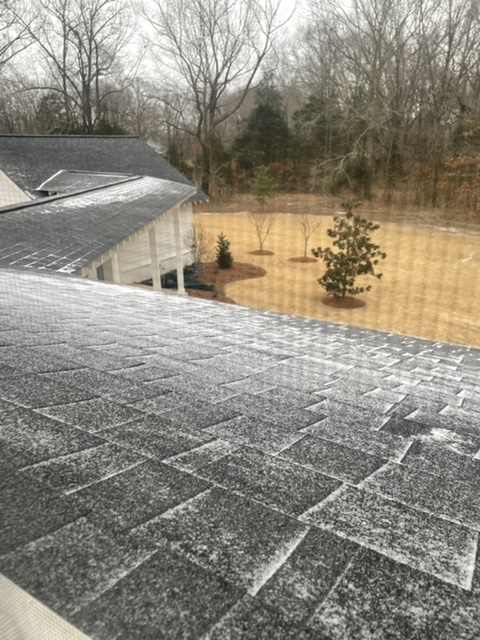
Yes, sir! Keeps trying to change back to sleet/ snow grains. Looks like table salt size bouncing on the shingles. -
January 15th-17th 2024 Arctic Blast/Snow Event
Bill in MS replied to John1122's topic in Tennessee Valley
23F. -
January 15th-17th 2024 Arctic Blast/Snow Event
Bill in MS replied to John1122's topic in Tennessee Valley
Light, fluffy snow falling now.
-
January 15th-17th 2024 Arctic Blast/Snow Event
Bill in MS replied to John1122's topic in Tennessee Valley
Very fine sleet/ice pellets falling here in Hernando, MS. -
January 15th-17th 2024 Arctic Blast/Snow Event
Bill in MS replied to John1122's topic in Tennessee Valley
Concerning to see the Euro spitting out lower snow totals in the Memphis, North MS., and E. AR area over the past day and a half. Wonder if sleet or freezing rain will put a dent into snow totals in the second half of the storm.


