

Summit Snow
-
Posts
141 -
Joined
-
Last visited
Content Type
Profiles
Blogs
Forums
American Weather
Media Demo
Store
Gallery
Everything posted by Summit Snow
-
Central PA Fall Discussions and Obs
Summit Snow replied to ChescoWx's topic in Upstate New York/Pennsylvania
31 currently with flurries. Feels like mid-December up here. -
Central PA Fall Discussions and Obs
Summit Snow replied to ChescoWx's topic in Upstate New York/Pennsylvania
First flurries today! -
Central PA Fall Discussions and Obs
Summit Snow replied to ChescoWx's topic in Upstate New York/Pennsylvania
First mention of flakes for the winter on Weather Underground! 11/10 High of 37 Low 23 with Rain/Snow -
Central PA Fall Discussions and Obs
Summit Snow replied to ChescoWx's topic in Upstate New York/Pennsylvania
23 up here. Bottom dropped out! -
Central PA Fall Discussions and Obs
Summit Snow replied to ChescoWx's topic in Upstate New York/Pennsylvania
Low of 29 up here.. -
Central PA Fall Discussions and Obs
Summit Snow replied to ChescoWx's topic in Upstate New York/Pennsylvania
33 last night and 53 currently. 30 the forecasted low tonight. -
Closing in on 2.4" for the day. Last line is a gusher up here.
-
1.49 since 7AM with more to come.
-
64 windy and drizzle?! This AM feels like Scotland during the summer.
-
Last storm moving through up here. 1.81" overnight. Flood Watch up for later today.
-
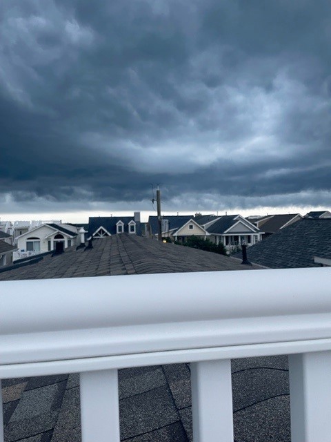
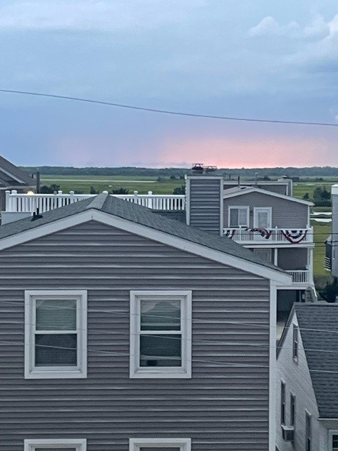
Storms rolling in last night to Ocean City NJ on the rooftop deck. Was crazy. Back in Clarks Green.
-
Hate to say to many of you- 62 and breezy. Sweatshirt on the deck with a cigar. 100 miles makes a big difference.
-
BULLETIN - EAS ACTIVATION REQUESTED Flash Flood Warning National Weather Service Binghamton NY 346 PM EDT Thu Jun 26 2025 The National Weather Service in Binghamton has issued a * Flash Flood Warning for... Central Lackawanna County in northeastern Pennsylvania... * Until 645 PM EDT. * At 346 PM EDT, Doppler radar indicated thunderstorms producing heavy rain across the warned area. Between 1 and 2 inches of rain have fallen. Additional rainfall amounts up to 1 inch are possible in the warned area. Flash flooding is ongoing or expected to begin shortly. HAZARD...Flash flooding caused by thunderstorms. SOURCE...Radar. IMPACT...Flash flooding of small creeks and streams, urban areas, highways, streets and underpasses as well as other poor drainage and low-lying areas. * Some locations that will experience flash flooding include... Scranton, Dunmore, Dickson City, Olyphant, Clarks Summit, Clarks Green, Elmhurst, Mount Cobb, Taylor, Throop, Glenburn and West Scranton.
-
Had heavy rain and storms all morning. .94 in precip. One less day of hot weather up here. Doubt I see 90 today.
-
Yeah. I thought we missed and then got .75 with the storms to the north of you.
-
6.14" since May 1st. Now above PY. for YTD. Last two years were significantly above prior year. Any drought talk should be limited to the Southern Tier. Crazy the difference north of Rt 80 and south.
-
Heavy rain in the NE corner of the state this AM. .74" since 4AM and now 2.53" since Saturday AM.
-
Light snow this morning with cars and grass covered-LOL. Ready for the 60's! Last flakes of 2024-25 winter?????
-
Snowing moderately currently and 33.
-
WWAs just to the east of me up here. Current forecast now shows the potential for 2-5 inches of dense, wet snow over higher elevations (> 1900 feet) in Delaware, Sullivan, Pike and Wayne counties by the time the precipitation winds down Saturday afternoon.
-
Rain before midnight, then rain and snow likely. Low around 34. Southeast wind around 10 mph, with gusts as high as 20 mph. Chance of precipitation is 80%. Little or no snow accumulation expected.
-
30 Currently. January Weather! Tonight is parka weather. Today Isolated snow showers after 2pm. Mostly cloudy, with a high near 34. Breezy, with a northwest wind around 23 mph, with gusts as high as 36 mph. Chance of precipitation is 20%. Tonight Partly cloudy, with a low around 21. Northwest wind 14 to 18 mph, with gusts as high as 28 mph.
-
Tonight, a subtle 500 mb shortwave moves into the Northeast bringing another round of precipitation. Recent trends in towards a flatter wave and a little farther south. There is enough cold air in place and with the precipitation occurring overnight, snow is the likely ptype. With the flatter wave, the favorable dynamics for snow banding is less likely so snowfall rates are expected to be on the lighter side, likely a half inch per hour or less. Snow amounts were also shifted south so the Southern Tier, Catskills, and NEPA are the areas that will see some light snow accumulations tonight.
-
BGM 340 AM update... The short term is looking wintry as a long wave trough moves into the Northeast with cold air advecting in. Models are honing in on a quick moving 500 mb shortwave Sunday night that could bring some widespread light snow. A strong 250 mb jet overhead along with low level frontogenesis indicates that there could be some banding with the overnight snow leading to some locally higher snowfall rates though with the speed of the flow, the high rates may only last a few hours before moving off to the NE.
-
Snow showers currently and 36.


