

Summit Snow
-
Posts
137 -
Joined
-
Last visited
Content Type
Profiles
Blogs
Forums
American Weather
Media Demo
Store
Gallery
Everything posted by Summit Snow
-
Central PA Spring 2026 Discussion/Obs Thread
Summit Snow replied to Voyager's topic in Upstate New York/Pennsylvania
Maybe for you down there! -
Central PA Spring 2026 Discussion/Obs Thread
Summit Snow replied to Voyager's topic in Upstate New York/Pennsylvania
https://www.tornadotalk.com/may-31-1998-pa-ny-tornado-outbreak/ For those new to PA I remember this like yesterday. Those three days were off the charts in terms of storm potential. I was Tornado warned twice on 6/2 with the second warning being the Lake Carey tornado that killed two and injured dozens. -
Central PA Winter 25/26 Discussion and Obs
Summit Snow replied to MAG5035's topic in Upstate New York/Pennsylvania
Actually got more snow last night - 2"- not forecasted from a lake effect plume vs the storm of the century to our NE. You can't make this shit up!!! -
Central PA Winter 25/26 Discussion and Obs
Summit Snow replied to MAG5035's topic in Upstate New York/Pennsylvania
BUST. Wow if you told me here in Clarks Green that we would get 2" from this set-up I wouldn't have believed you. Thought low end was 6-10. Brutal. -
Central PA Winter 25/26 Discussion and Obs
Summit Snow replied to MAG5035's topic in Upstate New York/Pennsylvania
-1 currently. -
Central PA Winter 25/26 Discussion and Obs
Summit Snow replied to MAG5035's topic in Upstate New York/Pennsylvania
Detailed Forecast Today A chance of snow after 2pm. Mostly cloudy, with a high near 27. Calm wind becoming southwest around 6 mph in the afternoon. Chance of precipitation is 40%. Total daytime snow accumulation of less than a half inch possible. Tonight bGM-Waverly Forecast Snow likely, mainly between 11pm and 4am. Areas of blowing snow after 3am. Cloudy, with a low around 4. Wind chill values as low as -6. Southwest wind 5 to 10 mph becoming northwest 12 to 17 mph after midnight. Winds could gust as high as 30 mph. Chance of precipitation is 70%. New snow accumulation of around an inch possible. Saturday A chance of snow, mainly before 7am, then a slight chance of snow showers after 2pm. Areas of blowing snow. Mostly cloudy and cold, with a high near 5. Wind chill values as low as -19. Blustery, with a northwest wind around 23 mph, with gusts as high as 40 mph. Chance of precipitation is 30%. New snow accumulation of less than a half inch possible. Saturday Night A slight chance of snow showers after 1am. Areas of blowing snow after 1am. Mostly cloudy, with a low around -1. Wind chill values as low as -21. Blustery, with a northwest wind 16 to 22 mph, with gusts as high as 36 mph. Chance of precipitation is 20%. Sunday Mostly sunny, with a high near 12. Northwest wind around 15 mph, with gusts as high as 29 mph. -
Central PA Winter 25/26 Discussion and Obs
Summit Snow replied to MAG5035's topic in Upstate New York/Pennsylvania
sued: 12:49 AM Feb. 5, 2026 – National Weather Service ...EXTREME COLD WATCH IN EFFECT FROM LATE FRIDAY NIGHT THROUGH SUNDAY AFTERNOON... * WHAT...Dangerous wind chills colder than 20 below zero possible. * WHERE...All of central New York and northeast Pennsylvania. * WHEN...From late Friday night through Sunday afternoon. * IMPACTS...The dangerously cold wind chills as low as 30 below zero could cause frostbite on exposed skin in as little as 30 minutes. Frostbite and hypothermia will occur if unprotected skin is exposed to these temperatures. * ADDITIONAL DETAILS...An arctic front will bring cold air and strong winds to the region Saturday morning. Below normal temperatures and blustery winds will result in wind chills dropping well below zero Saturday morning. Wind chills will remain below zero through the rest of the weekend. -
Central PA Winter 25/26 Discussion and Obs
Summit Snow replied to MAG5035's topic in Upstate New York/Pennsylvania
Currently -7 and got down to -10. Brutal cold. -
Central PA Winter 25/26 Discussion and Obs
Summit Snow replied to MAG5035's topic in Upstate New York/Pennsylvania
Don't get above 20 through Sunday up here. EURO and ICON have coastal bomb for next Sunday. -
Central PA Winter 25/26 Discussion and Obs
Summit Snow replied to MAG5035's topic in Upstate New York/Pennsylvania
Moderate to Heavy Snow continues up here and just pushed over 10" with a good deal to go. BGM was very bullish on sleet this AM cutting down totals in parts of NEPA but just threw in the towel with the latest update with most areas here and the southern tier of NY getting 15-20" before ending. Balmy 5 degrees. -
Central PA Winter 25/26 Discussion and Obs
Summit Snow replied to MAG5035's topic in Upstate New York/Pennsylvania
Over 2" up here and still snowing. Nice surprise! -
Central PA Winter 25/26 Discussion and Obs
Summit Snow replied to MAG5035's topic in Upstate New York/Pennsylvania
Crazy today. Left Clarks Summit with snow on the ground and mood flakes and drove to Mt Pocono to pick up a car. Once I passed Gouldsboro on 380 it was like I drove into a bad winter storm. Cars off the road everywhere and 4-5'' of heavy snow. Got back and we might have go 2" but in Mt Pocono they were close to 6". -
Central PA Winter 25/26 Discussion and Obs
Summit Snow replied to MAG5035's topic in Upstate New York/Pennsylvania
Have over achieved so far this year and have a had a great start to winter so was do for an under. Precipitation came in as a wall of sleet and snow and is 80/20 sleet which wasn't even mentioned in the higher elevations this far NE until this AM and even then it was to be a gradual mix. Current temp is 18 with heavy sleet currently. -
Central PA Winter 25/26 Discussion and Obs
Summit Snow replied to MAG5035's topic in Upstate New York/Pennsylvania
URGENT - WINTER WEATHER MESSAGE National Weather Service Binghamton NY 119 PM EST Wed Dec 24 2025 NYZ025-044-045-055>057-062-PAZ039-040-044-048-072-250630- /O.NEW.KBGM.WS.A.0013.251226T1800Z-251227T1700Z/ Tompkins-Cortland-Chenango-Tioga-Broome-Delaware-Sullivan- Susquehanna-Northern Wayne-Lackawanna-Pike-Southern Wayne- Including the cities of Owego, Honesdale, Norwich, Waverly, Hallstead, Equinunk, Delhi, Milford, Binghamton, Damascus, Cortland, Ithaca, Montrose, Scranton, Walton, and Monticello 119 PM EST Wed Dec 24 2025 ...WINTER STORM WATCH IN EFFECT FROM FRIDAY AFTERNOON THROUGH SATURDAY MORNING... * WHAT...Heavy snow possible. Total snow accumulations between 5 and 10 inches possible. * WHERE...In New York, Broome, Chenango, Cortland, Delaware, Sullivan, Tioga, and Tompkins Counties. In Pennsylvania, Lackawanna, Northern Wayne, Pike, Southern Wayne, and Susquehanna Counties. * WHEN...From Friday afternoon through Saturday morning. * IMPACTS...Travel could be very difficult. The hazardous conditions could impact the Friday evening commute. PRECAUTIONARY/PREPAREDNESS ACTIONS... Monitor the latest forecasts for updates on this situation. -
Central PA Winter 25/26 Discussion and Obs
Summit Snow replied to MAG5035's topic in Upstate New York/Pennsylvania
URGENT - WINTER WEATHER MESSAGE National Weather Service Binghamton NY 107 PM EST Mon Dec 22 2025 PAZ043-044-047-230615- /O.NEW.KBGM.WW.Y.0033.251223T0600Z-251223T2100Z/ Wyoming-Lackawanna-Luzerne- Including the cities of Tunkhannock, Scranton, Hazleton, and Wilkes-Barre 107 PM EST Mon Dec 22 2025 ...WINTER WEATHER ADVISORY IN EFFECT FROM 1 AM TO 4 PM EST TUESDAY... * WHAT...Snow and mixed precipitation expected. Total snow accumulations between 1 and 4 inches and ice accumulations around a light glaze. * WHERE...Lackawanna, Luzerne, and Wyoming Counties. * WHEN...From 1 AM to 4 PM EST Tuesday. * IMPACTS...Plan on slippery road conditions. The hazardous conditions could impact the Tuesday morning commute. * ADDITIONAL DETAILS...The higher end totals are expected across the higher elevations, where localized amounts around 5 inches are possible. Expect 3" inches up here and probably 1" at AVP. Crazy Friday afternoon when we had entire snowpack wiped out and then change to heavy sleet and then snow until 7PM. Cars everywhere as the roads were a sheet of ice. Had ice and an 1 1/2" of snow while Scranton had nothing. Cut-off was nuts less than 5 miles south. -
Central PA Winter 25/26 Discussion and Obs
Summit Snow replied to MAG5035's topic in Upstate New York/Pennsylvania
Agree-another 4" inches last night. Brief warm-up midweek and then we see what happens with the cold just North of us. 19" so far this year with three payments to the plow truck! -
Central PA Winter 25/26 Discussion and Obs
Summit Snow replied to MAG5035's topic in Upstate New York/Pennsylvania
Picked up another 3" up here yesterday. No rain mix due to elevation. Snow squalls and snow showers incoming. Definitely has been an old fashioned start to winter along the Northern Tier this December.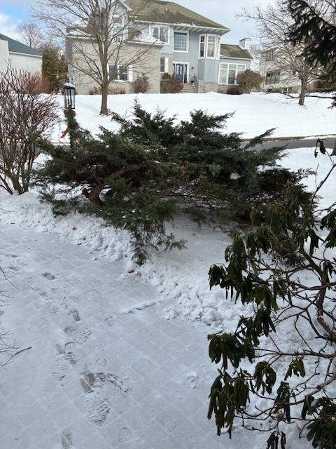
-
Central PA Fall Discussions and Obs
Summit Snow replied to ChescoWx's topic in Upstate New York/Pennsylvania
URGENT - WINTER WEATHER MESSAGE National Weather Service Binghamton NY 1219 PM EST Mon Dec 1 2025 PAZ038>040-043-044-047-048-072-020530- /O.UPG.KBGM.WS.A.0010.251202T0600Z-251203T0300Z/ /O.EXB.KBGM.WW.Y.0026.251202T0700Z-251202T2300Z/ Bradford-Susquehanna-Northern Wayne-Wyoming-Lackawanna-Luzerne- Pike-Southern Wayne- Including the cities of Towanda, Tunkhannock, Honesdale, Hazleton, Damascus, Montrose, Milford, Scranton, Wilkes-Barre, Hallstead, Sayre, and Equinunk 1219 PM EST Mon Dec 1 2025 ...WINTER WEATHER ADVISORY IN EFFECT FROM 2 AM TO 6 PM EST TUESDAY... * WHAT...Snow expected. Total snow accumulations between 3 and 6 inches. * WHERE...Bradford, Lackawanna, Luzerne, Northern Wayne, Pike, Southern Wayne, Susquehanna, and Wyoming Counties. * WHEN...From 2 AM to 6 PM EST Tuesday. * IMPACTS...Travel could be very difficult. The hazardous conditions could impact the Tuesday morning and evening commutes. * ADDITIONAL DETAILS...Localized amounts around 7 inches possible over the higher elevation, especially in Pike and Wayne counties. Snowfall rates around 1 inch per hour are expected during the morning hours. -
Central PA Fall Discussions and Obs
Summit Snow replied to ChescoWx's topic in Upstate New York/Pennsylvania
Bizarre. Lake effect band just came through with a burst of snow and thunder! WTF -
Central PA Fall Discussions and Obs
Summit Snow replied to ChescoWx's topic in Upstate New York/Pennsylvania
Ended up with about 3" up here in Clarks Green/Waverly ...Lackawanna County... Cortez 3.6 in 1250 PM 11/11 Public 1 NW Jessup 2.2 in 0400 PM 11/11 Scranton 2.2 in 0500 PM 11/11 Public -
Central PA Fall Discussions and Obs
Summit Snow replied to ChescoWx's topic in Upstate New York/Pennsylvania
I'm dreaming of a white....
-
Central PA Fall Discussions and Obs
Summit Snow replied to ChescoWx's topic in Upstate New York/Pennsylvania
31 currently with flurries. Feels like mid-December up here. -
Central PA Fall Discussions and Obs
Summit Snow replied to ChescoWx's topic in Upstate New York/Pennsylvania
First flurries today! -
Central PA Fall Discussions and Obs
Summit Snow replied to ChescoWx's topic in Upstate New York/Pennsylvania
First mention of flakes for the winter on Weather Underground! 11/10 High of 37 Low 23 with Rain/Snow -
Central PA Fall Discussions and Obs
Summit Snow replied to ChescoWx's topic in Upstate New York/Pennsylvania
23 up here. Bottom dropped out!


