windycutter
-
Posts
55 -
Joined
-
Last visited
About windycutter

-
Gfs like
-
Now at 12z
-
Not sure if this was posted from last night.
-
January/February Mid/Long Range Disco IV: A New Hope
windycutter replied to stormtracker's topic in Mid Atlantic
On the above gif, It appears that the High comes in to late with a low pushing through the north of New England. Wouldn't the Low be problematic? -
January/February Mid/Long Range Disco IV: A New Hope
windycutter replied to stormtracker's topic in Mid Atlantic
18z Icon no go -
January/February Mid/Long Range Disco IV: A New Hope
windycutter replied to stormtracker's topic in Mid Atlantic
I would think that we want the low to be open on the CMC? Not sure though. -
Central PA Winter 2022/2023
windycutter replied to Blizzard of 93's topic in Upstate New York/Pennsylvania
In my area, just west of the Laurels, at the base of the mountain, wind is a major problem as well. Just yesterday, we had numerous trees down and multiple power outages. Just about anytime a storm cuts to my west, the southerly winds gusts (even sustained) are very strong. -
Horrible wind and it continues. Trees down all over and multiple power outages.
-
January/February Mid/Long Range Disco IV: A New Hope
windycutter replied to stormtracker's topic in Mid Atlantic
-
The way that this winter has occurred with the western lows, I would not be surprised if several areas get hit with the WAA (especially west of the Laurels). My area of SW PA never does well. It seems that some of the Meso models are either dry slotting or forcing the warmth.
-
January/February Mid/Long Range Disco IV: A New Hope
windycutter replied to stormtracker's topic in Mid Atlantic
I do agree, however, a majority of time this winter lows have transitioned west and then continue west or cut. -
January/February Mid/Long Range Disco IV: A New Hope
windycutter replied to stormtracker's topic in Mid Atlantic
Ya, gut punch. -
January/February Mid/Long Range Disco IV: A New Hope
windycutter replied to stormtracker's topic in Mid Atlantic
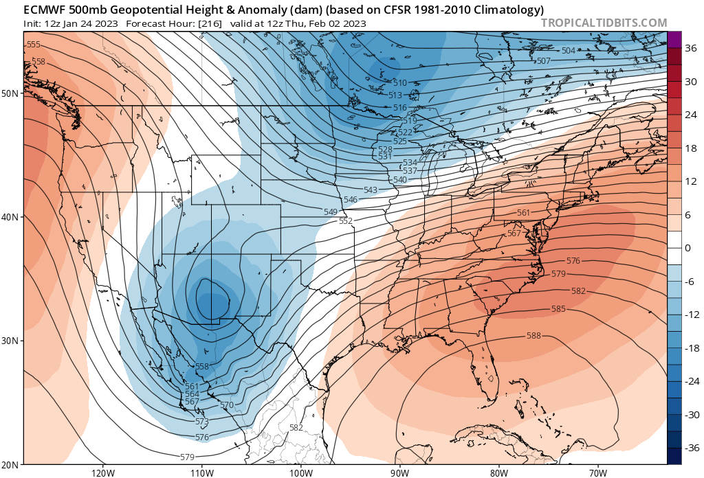
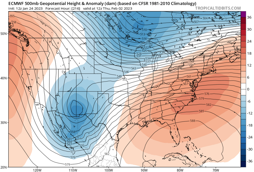
I think that possibly Joe B was hinting around to this type of cold a day or so ago. I believe that it was the Euro, but showing 850 temps in the sub zero range. -
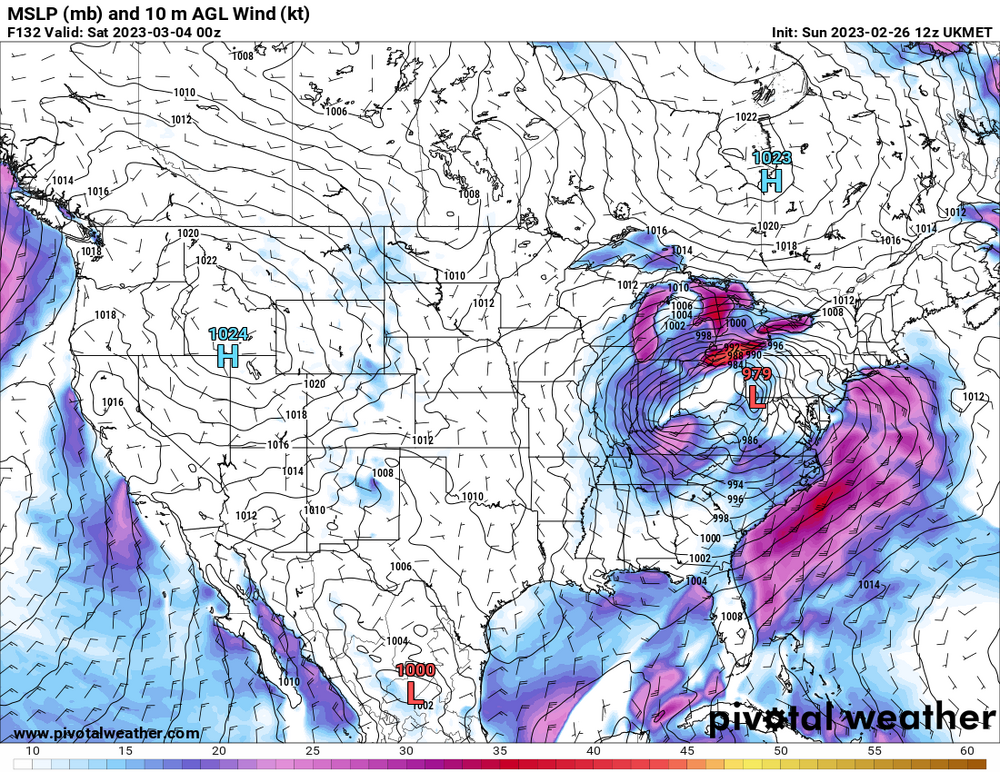
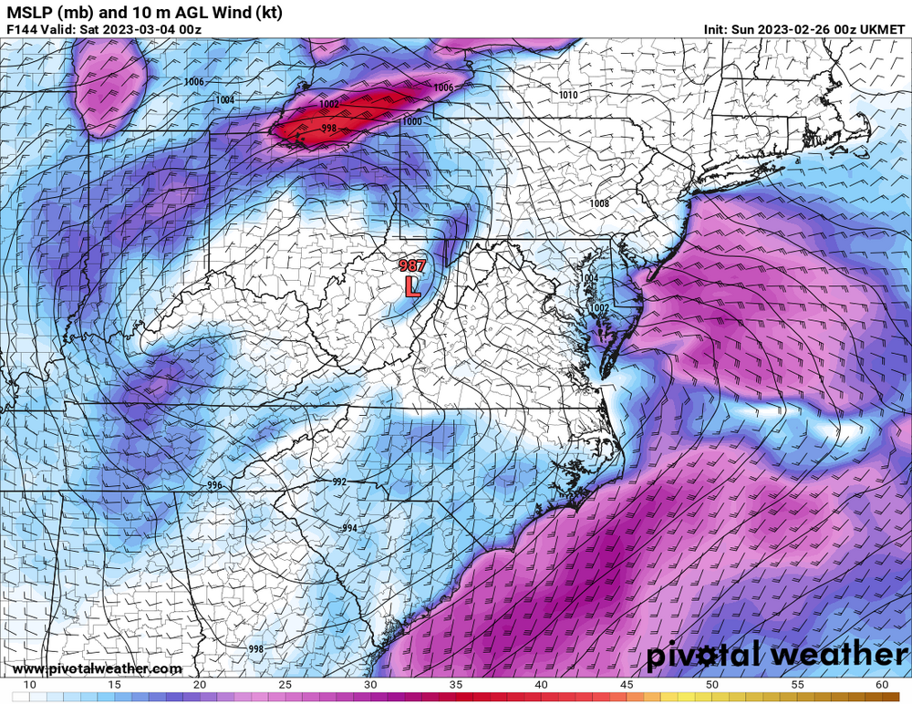
Latest track of the Globals seem to push the WAA for PItt and south (obviously more south). 850's inch up as the low approaches the area. You can see the southerlies heading straight up through WV.
-
Thanks. Kinda new here.