

Hurricane Agnes
-
Posts
8,612 -
Joined
Content Type
Profiles
Blogs
Forums
American Weather
Media Demo
Store
Gallery
Posts posted by Hurricane Agnes
-
-
PNS as of just after midnight -
Quote000
NOUS41 KPHI 070510
PNSPHI
DEZ001>004-MDZ012-015-019-020-NJZ001-007>010-012>027-PAZ054-055-060>062-070-
071-101>106-071710-
Public Information Statement
National Weather Service Mount Holly NJ
1210 AM EST Sun Jan 7 2024
...SNOWFALL REPORTS AS OF MIDNIGHT 1/7/24...
Location Amount Time/Date Provider
...Delaware...
...New Castle County...
New Castle County Airport T in 0700 PM 01/06 ASOS
...New Jersey...
...Hunterdon County...
Whitehouse Station 4.5 in 0822 PM 01/06 Trained Spotter
High Bridge 4.4 in 0745 PM 01/06 Public
1 SW Three Bridges 3.4 in 0800 PM 01/06 Trained Spotter
Readington Twp 3.2 in 0730 PM 01/06 Trained Spotter
Flemington 2.5 in 0807 PM 01/06 Trained Spotter
Bartles Corners 2.0 in 0715 PM 01/06 Trained Spotter
...Mercer County...
Woodsville 2.0 in 0850 PM 01/06 Public
Trenton Mercer Airport 1.0 in 0700 PM 01/06 ASOS
...Middlesex County...
North Brunswick 2.0 in 1000 PM 01/06 Public
Metuchen 2.0 in 0700 PM 01/06 Public
...Morris County...
Lake Hopatcong 6.0 in 0914 PM 01/06 Trained Spotter
Chester 5.0 in 0810 PM 01/06 Public
1 WNW Long Valley 5.0 in 0805 PM 01/06 Trained Spotter
1 SSW Brookside 4.8 in 1040 PM 01/06 Trained Spotter
Randolph 4.7 in 0930 PM 01/06 Cocorahs
Butler 4.0 in 0920 PM 01/06 Trained Spotter
Montville 3.4 in 0900 PM 01/06 Trained Spotter
Chatham 3.0 in 0805 PM 01/06 Public
...Somerset County...
3 SSE Far Hills 5.0 in 1130 PM 01/06 Public
Warren 4.5 in 0950 PM 01/06 Public
Bernardsville 4.0 in 0739 PM 01/06 Trained Spotter
Green Brook Twp 3.0 in 0905 PM 01/06 Trained Spotter
3 NNW Bridgewater 2.5 in 0800 PM 01/06 Trained Spotter
Somerville 2.3 in 0600 PM 01/06 Trained Spotter
2 ENE Montgomery Twp 2.1 in 0700 PM 01/06 Trained Spotter
Manville 2.0 in 0721 PM 01/06 Trained Spotter
Belle Mead 2.0 in 0710 PM 01/06 Trained Spotter
Middlebush 1.2 in 1042 PM 01/06 Trained Spotter
...Sussex County...
4 WSW Wantage Twp 11.5 in 1030 PM 01/06 Trained Spotter
Wantage Twp 10.5 in 1100 PM 01/06 Public
Glenwood 9.0 in 1100 PM 01/06 Trained Spotter
1 SSW High Point 9.0 in 1000 PM 01/06 Emergency Mngr
3 W Vernon Valley 9.0 in 0950 PM 01/06 Broadcast Media
1 ESE Kittatinny Lake 9.0 in 0938 PM 01/06 Public
Hampton Twp 9.0 in 0920 PM 01/06 Public
Sparta 5.5 in 0950 PM 01/06 Emergency Mngr
Andover 5.0 in 0850 PM 01/06 Public
...Warren County...
Blairstown 10.5 in 0930 PM 01/06 Broadcast Media
Liberty Twp 5.9 in 0921 PM 01/06 Public
Hackettstown 5.0 in 0805 PM 01/06 Trained Spotter
1 SSW Hackettstown 4.6 in 0920 PM 01/06 Public
...Pennsylvania...
...Berks County...
Mertztown 5.3 in 0715 PM 01/06 Trained Spotter
Bernville 5.1 in 0644 PM 01/06 Trained Spotter
Earl Twp 4.7 in 0630 PM 01/06 Trained Spotter
Birdsboro 4.1 in 0629 PM 01/06 Public
Huffs Church 3.0 in 0530 PM 01/06 Trained Spotter
Wernersville 2.5 in 0345 PM 01/06 Trained Spotter
Reading Regional Airport 2.4 in 0700 PM 01/06 Trained Spotter
Union Twp 1.5 in 0612 PM 01/06 Public
...Bucks County...
East Rockhill Twp 2.3 in 0835 PM 01/06 Trained Spotter
New Hope 2.0 in 0622 PM 01/06 Trained Spotter
1 SSE Lumberville 1.9 in 0804 PM 01/06 Trained Spotter
Jamison 1.5 in 0317 PM 01/06 Public
Trumbauersville 1.3 in 0355 PM 01/06 Trained Spotter
Fricks 1.1 in 0400 PM 01/06 NWS Employee
...Carbon County...
Jim Thorpe 11.1 in 1020 PM 01/06 Trained Spotter
Mahoning Twp 10.0 in 1120 PM 01/06 Public
Lehighton 9.1 in 0915 PM 01/06 Trained Spotter
Albrightsville 9.0 in 0830 PM 01/06 Public
1 WNW Palmerton 8.5 in 1020 PM 01/06 Trained Spotter
3 WSW East Penn Twp 7.5 in 0800 PM 01/06 Public
2 ENE Palmerton 6.5 in 1000 PM 01/06 Trained Spotter
...Chester County...
East Coventry Twp 3.0 in 0601 PM 01/06 Trained Spotter
Spring City 2.3 in 0700 PM 01/06 CO-OP Observer
2 E Warwick Twp 2.0 in 0849 PM 01/06 Mesonet
East Nantmeal Twp 2.0 in 0250 PM 01/06 Trained Spotter
Glenmoore 1.3 in 0230 PM 01/06 Trained Spotter
...Lehigh County...
New Tripoli 7.5 in 0815 PM 01/06 Broadcast Media
Germansville 7.3 in 0800 PM 01/06 Public
Whitehall Twp 6.5 in 0745 PM 01/06 Public
Lehigh Valley International 5.3 in 1200 AM 01/07 ASOS
Salisbury Twp 5.1 in 0750 PM 01/06 Trained Spotter
Macungie 5.0 in 0821 PM 01/06 Trained Spotter
Coplay 5.0 in 0738 PM 01/06 Public
Center Valley 4.5 in 0726 PM 01/06 Trained Spotter
Emmaus 4.0 in 0735 PM 01/06 Trained Spotter
Schnecksville 4.0 in 0700 PM 01/06 Public
...Monroe County...
Stroudsburg 12.0 in 1100 PM 01/06 Public
Blakeslee 12.0 in 1045 PM 01/06 Public
2 WSW Jackson Twp 11.1 in 1045 PM 01/06 Trained Spotter
2 SW Scotrun 10.0 in 0950 PM 01/06 Public
Pocono Pines 8.8 in 1130 PM 01/06 Public
...Montgomery County...
New Hanover Twp 2.6 in 0600 PM 01/06 Trained Spotter
1 SSE Trappe 2.0 in 0400 PM 01/06 Trained Spotter
Eagleville 2.0 in 0315 PM 01/06 Public
Norristown 1.9 in 0255 PM 01/06 Trained Spotter
Gilbertsville 1.8 in 0325 PM 01/06 Public
Glenside 1.0 in 0244 PM 01/06 Trained Spotter
...Northampton County...
1 NE Washington Twp 9.0 in 0952 PM 01/06 Public
Bangor 7.0 in 0850 PM 01/06 Public
Danielsville 6.4 in 0807 PM 01/06 Trained Spotter
2 ESE Moore Twp 6.2 in 1000 PM 01/06 Public
North Catasauqua 6.1 in 1100 PM 01/06 Public
Easton 6.0 in 0723 PM 01/06 Public
Forks Twp 5.8 in 1100 PM 01/06 Trained Spotter
Northampton 5.5 in 0930 PM 01/06 Public
Bath 5.5 in 0916 PM 01/06 Trained Spotter
Martins Creek 5.2 in 0800 PM 01/06 CO-OP Observer
1 NNE Bethlehem Twp 5.0 in 0835 PM 01/06 Trained Spotter
Bethlehem 4.8 in 0753 PM 01/06 Public
1 W Nazareth 4.0 in 0700 PM 01/06 Trained Spotter
...Philadelphia County...
Philadelphia Internati T in 0700 PM 01/06 ASOS
&&PHL <1" event streak continues!
-
 1
1
-
-
So far, it looks like I finished up yesterday with 0.20" of snow and 1.18" rain/sleet/snow mix. Am still getting some backwash light rain/drizzle this morning and so far have 0.06" (1.24" for a 2-day event total so far). Whatever slush that had remained on the cars and grassy surfaces after the transition, is all gone.
Currently have light rain, low stratus, and a temp of 35 with dp 34.
-
Temp has dropped back to 36 with dp 36 and 1.13" rain. Lows are upon us and are pushing to the NE.
-
Temp continues to rise here in NW Philly with steady rain. Currently 37 with dp 36 and 0.89" of rain registered so far.
-
Warming continues with the light rain. Now up to 35 with dp 35 and 0.54" rain.
-
2 minutes ago, Fields27 said:
Fatties!

Sent from my SM-N975U using Tapatalk
I think a mix line is getting close to you guys up there.
Currently 34 here in NW Philly with dp 34 and 0.41" in the bucket (post freeze-up) and light rain.
-
Temp 34 with dp 33 and moderate rain. Have 0.35". Still have slushy snow on the car and some colder grassy surfaces. Saw the spotter reports of 5" and 5.8" in Hershey & Cashtown (Adams Co) before they got the transition to sleet and rain.
-
My station gauge bucket finally tipped with a glug and now have 0.14" (expect it would have been much more but will need to wait until the storm is over and I go out and check the Stratus).
Still have light - moderate rain and its 33 with dp 33 and southeasterly winds picking up.
-
 1
1
-
-
14 minutes ago, LVLion77 said:
Yeah, this is a bad bust. It’ll be interesting to see how far north th mixing progresses. Based on what we’ve seen thus far, I would say the southern Poconos are in trouble as well. Maybe it makes it as far north as Mount Pocono.
.12 minutes ago, wkd said:Lol. What were your expections? Did you think you would wake up to a winter wonderland? If you looked at the modeled positive snow depth change it was paltry. So far, here it has been a better event than anything 2022-2023 had to offer.
Once the low goes out into bay/ocean and eventually starts to move NE, there should be some wrap-around.
Here're the "2" lows! ETA - remember the models kept have "a low" hop skip jumping around.

-
Temp now 33/dp 32 with light to moderate rain and lots of slush/melt. My rain gauge bucket is frozen at the moment so don't have a reading but do have a Stratus out there to get whatever the final total at some point.
-
1
-
-
Temp is creeping up now and am at 32 with light rain and dp 31. Sidewalks that did manage to cave are now wet.
-
And the changeover is in progress. Now getting light rain mixing in with some ip and flakes.
Temp bobbing between 31 and 32 with dp 31.
-
1
-
-
My Upper Darby sis said she has had sleet for the past 1/2 now. For Haz...

-
My SN with pancakes now has sleet mixing in. Temp down to 31 with dp 30. Measured 0.2" of a coating on cold/untreated surfaces.
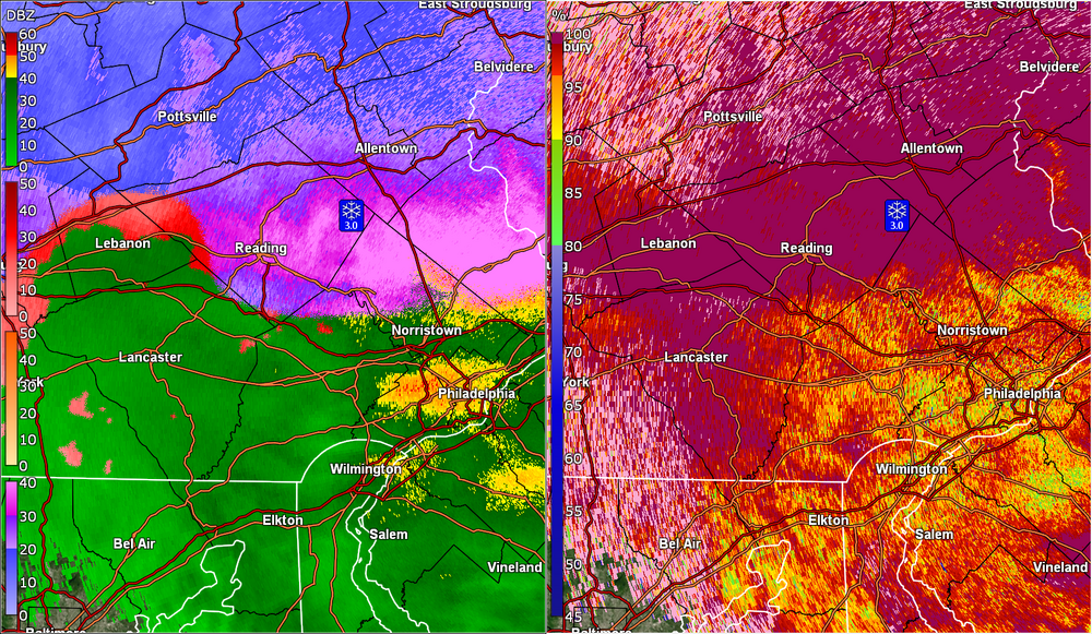
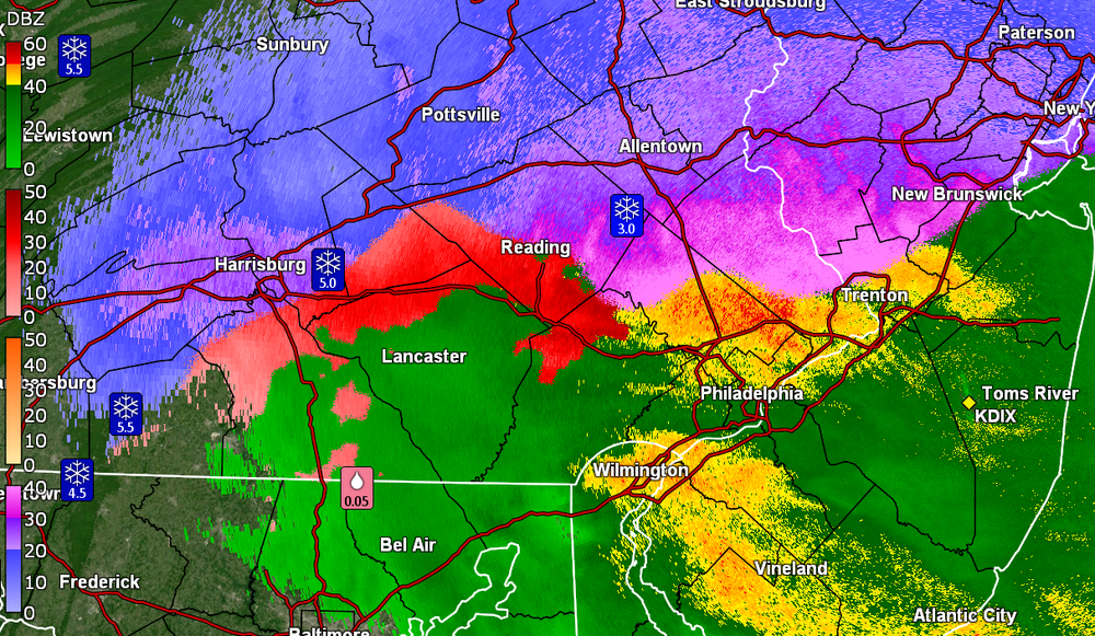
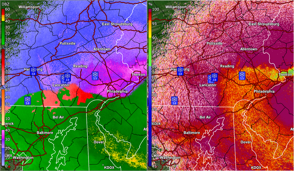
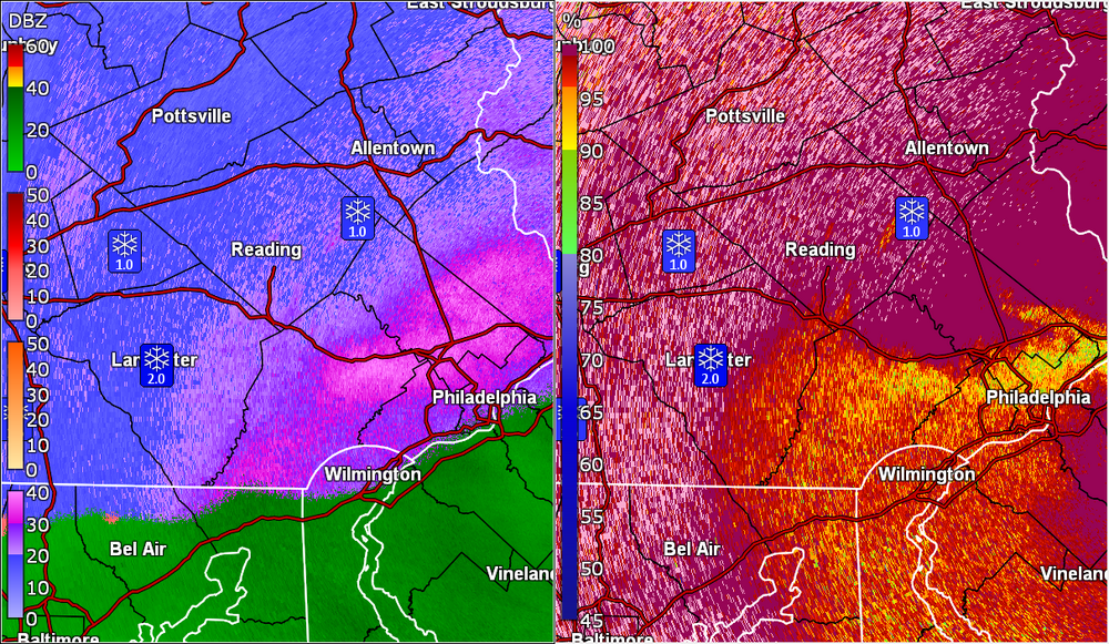
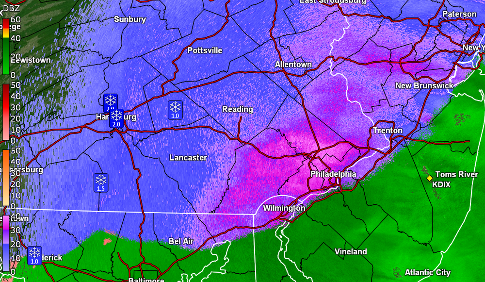
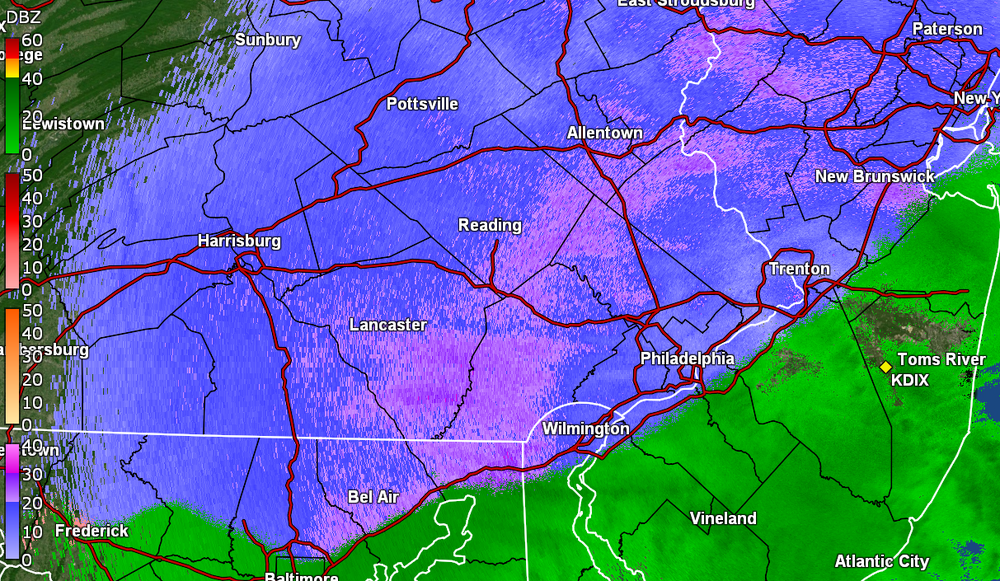
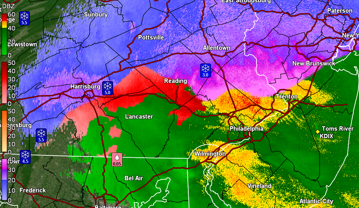
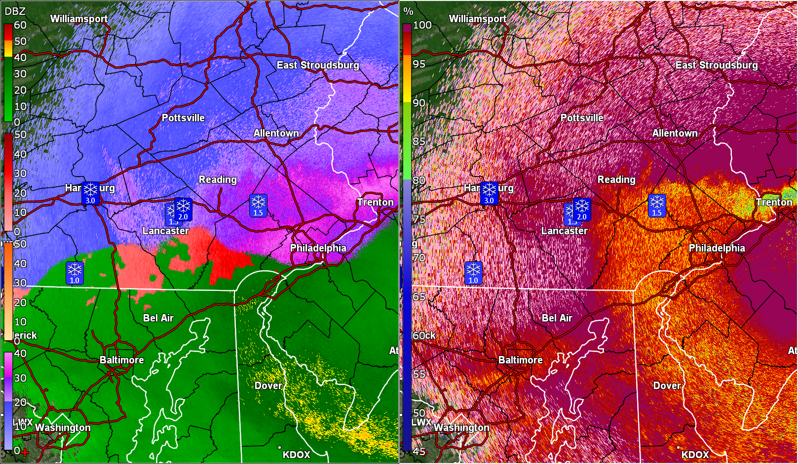
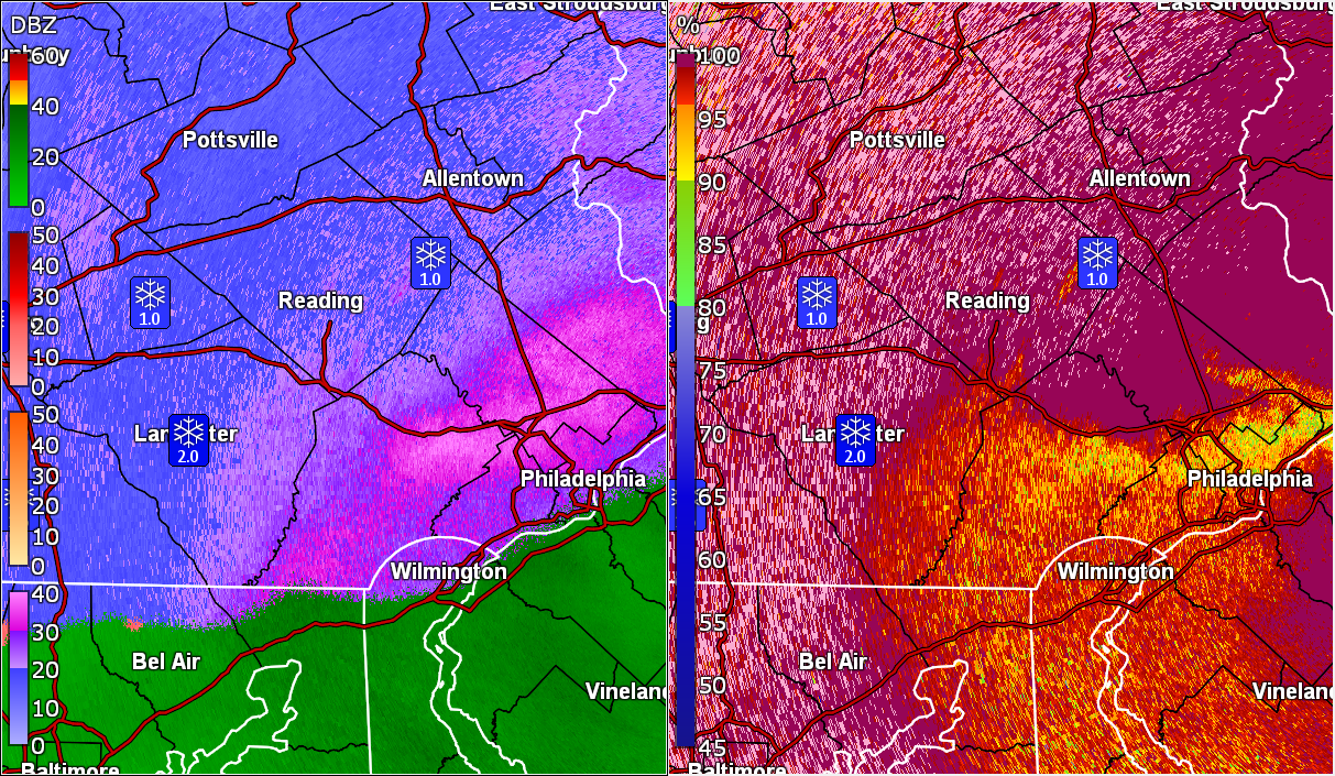
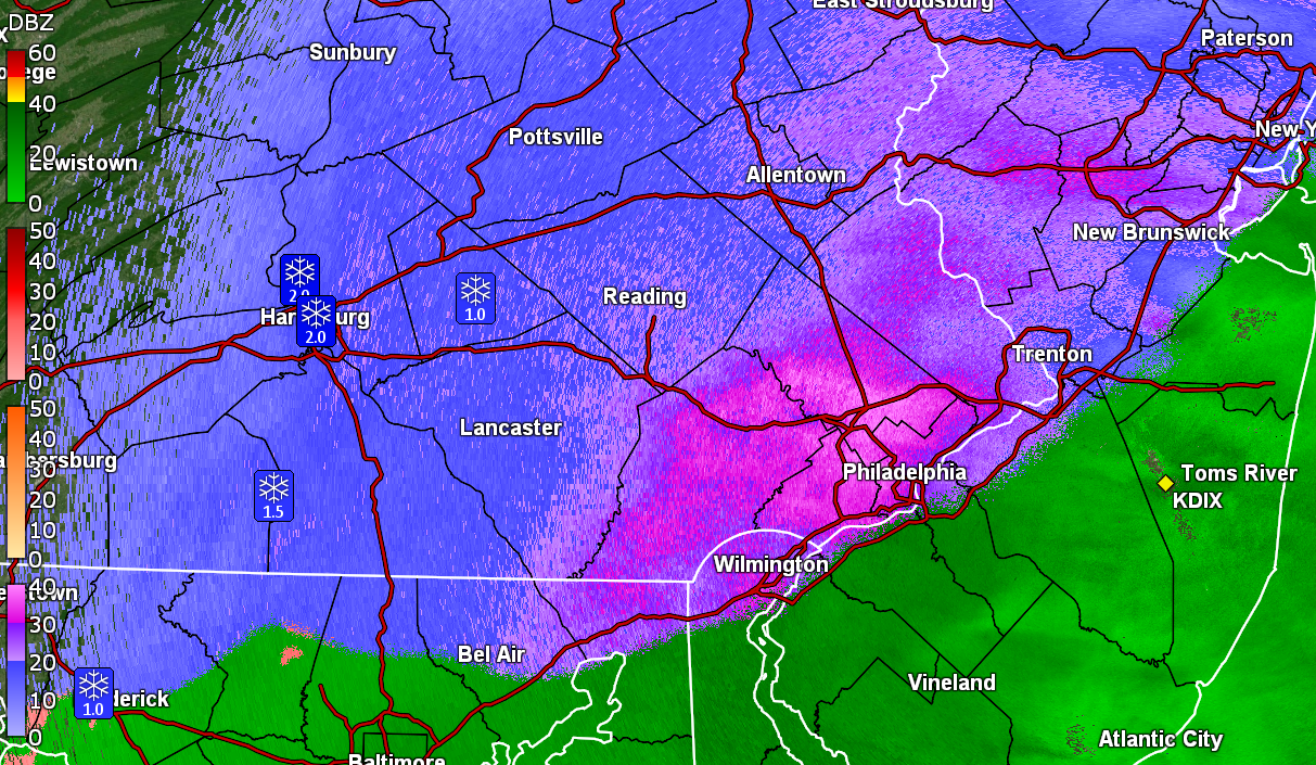
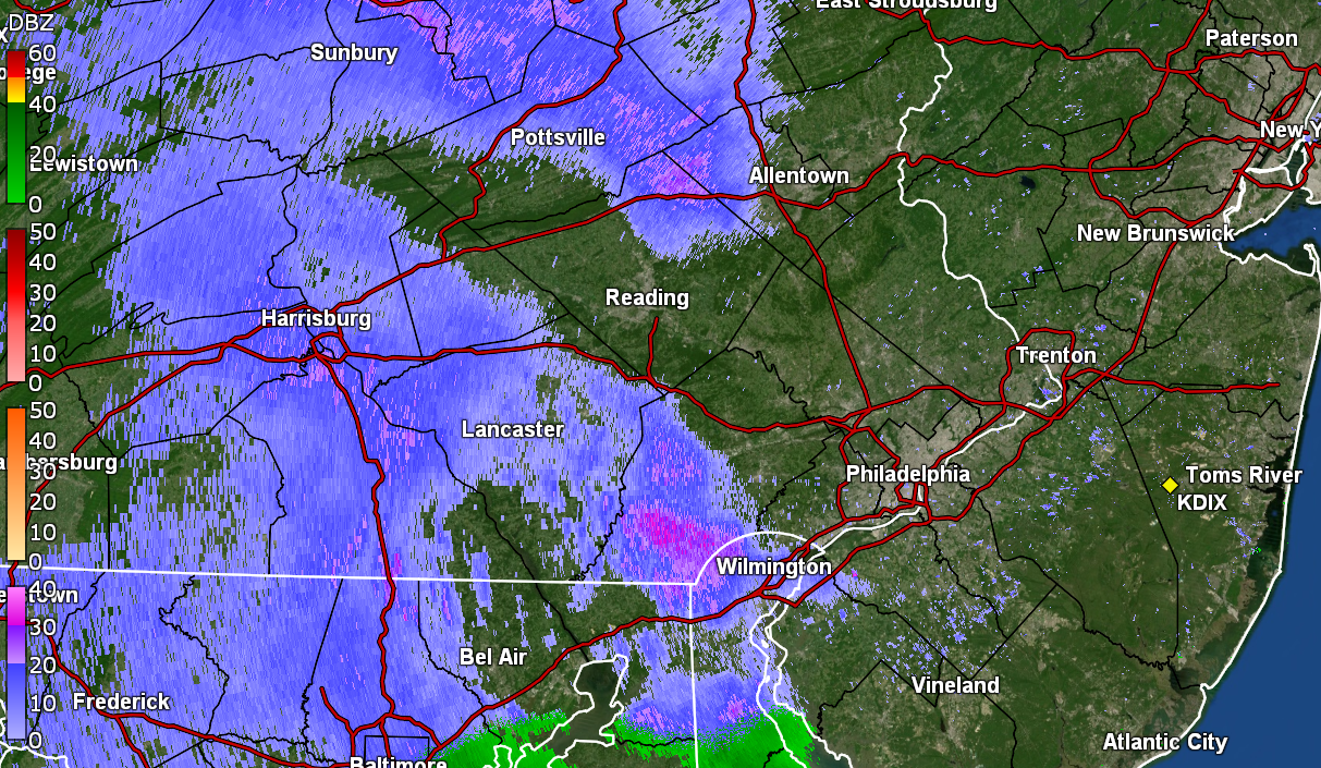
Classic sleet bright blob on the radar.
-
1 minute ago, BBasile said:
Well, I'm all rain now. It's accurate for here, anyway.
Thank you!
-
1
-
-
Still have light snow but now getting car topping of it as the flakes cool the surfaces. Temp now down to 32 with dp 30. Am seeing a heavier band to my west that some are under at the moment.
Need some Jersey input for how accurate (if at all) that rain/snow line is.
-
2
-
-
Have been getting variable rates/flake sizes but it's now starting to stick to the grass and mulched surfaces. Still holding at 33 with dp now 29.
-
Have flakage going on. So far melting on surfaces. Temp is 33 with dp 28. Upper Darby and Wyndmoor sisters reporting flakes as well.
-
Overcast and 31 with dp 28 here in NW Philly.
-
1
-
-
2 minutes ago, Lady Di said:
Graupel down here @ 9:45. 29 degrees.
First graupel sighting!

-
 1
1
-
-
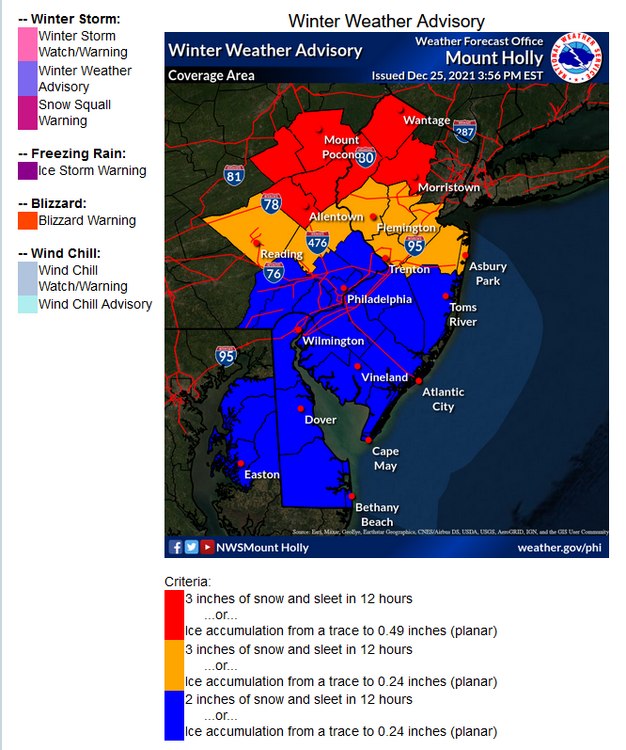
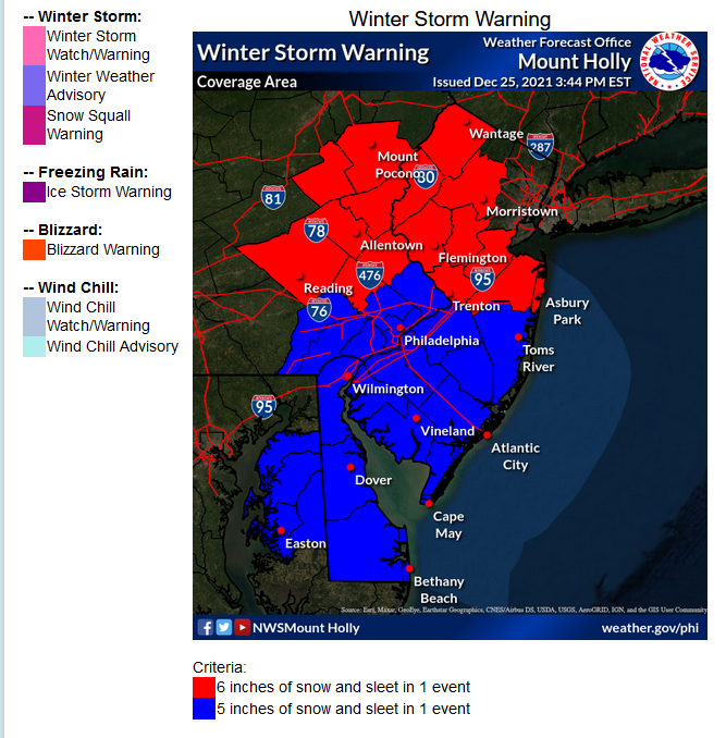
They have a graphic (with a mouse hover) that shows the criteria here
- https://www.weather.gov/phi/criteria-winter
-
1 hour ago, anthonyweather said:
Seeing this mornings mesos bring a lot of sleet now right on cue.
.12z 3k NAM has some ugly ice progged.

-
 1
1
-
-
Made it up to 36 for a high yesterday and bottomed out at 23 this morning around 2:15 am and the temp has been creeping up since ahead of the storm.
Currently overcast and 28 with dp 24.
-
3 minutes ago, Kevin Reilly said:
humidity values are 75-79% so precip should start rather quickly should not lose much to virga unless there is a dry layer.
Yup. That's what made me pull up the radar to see what was going on as I'm so used to dry air hanging on for dear life before trying to saturate ahead of storms.
-
1
-


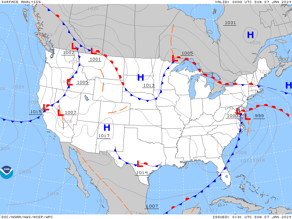
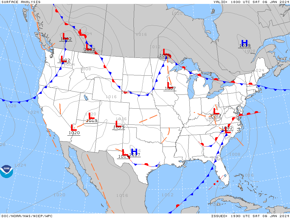
January 6-7 Winter Storm
in Philadelphia Region
Posted
Some junk-n-stuff incoming although 1 little band has started to fizzle as it approaches the city.
Currently, the temp here has dropped to 34 with dp 33 and I have picked a total of 0.11" of rain this morning from the light rain (2-day total 1.29"). Have a find mist/drizzle going on at the moment.