CT Valley Dryslot
-
Posts
345 -
Joined
-
Last visited
Content Type
Profiles
Blogs
Forums
American Weather
Media Demo
Store
Gallery
Everything posted by CT Valley Dryslot
-
I'm estimating between 18-20 right now. That pushes my snow depth to 21-25 (leftovers from last week)
-
Snow here looks like pure crystals. It's hard to describe. It just looks different.
-
Scanning the METARs the sleet line is still down at HPN.
-
I've heard no pingers.
-
It's a holdover from when I lived in South Windsor lol.
-
No, near Exit 67 on I-84.
-
I'm not noticing any dropouts on the Nexlab page. https://weather.cod.edu/satrad/nexrad/?parms=BOX-N0B-1-24-100-usa-rad
-
You know where Rt. 30 and 31 meet and there's those two gas stations? I live near there.
-
Closing in on 4" real soon. @Damage In Tolland how does that line up with what you have? I'm near the Tolland/Coventry border.
-
“Cory’s in LA! Let’s MECS!” Jan. 24-26 Disco
CT Valley Dryslot replied to TheSnowman's topic in New England
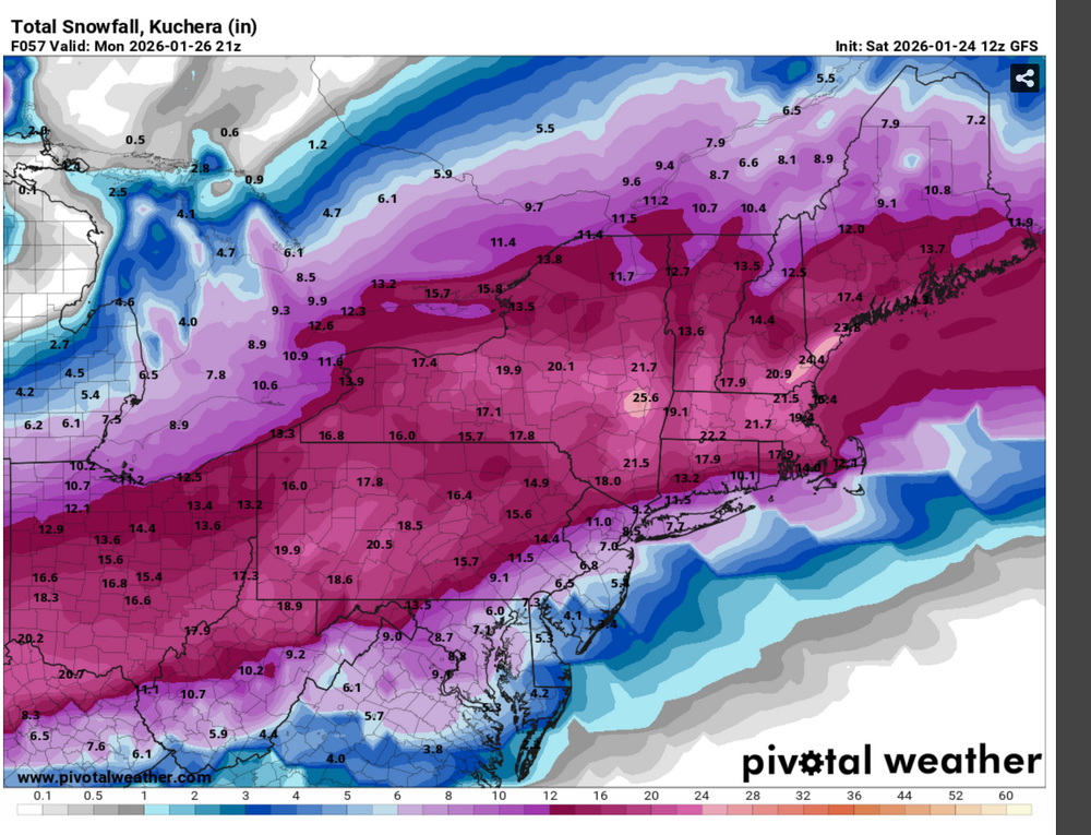
GFS Kuchera flirts with HECS numbers for BDL, ORH and BOS. -
“Cory’s in LA! Let’s MECS!” Jan. 24-26 Disco
CT Valley Dryslot replied to TheSnowman's topic in New England
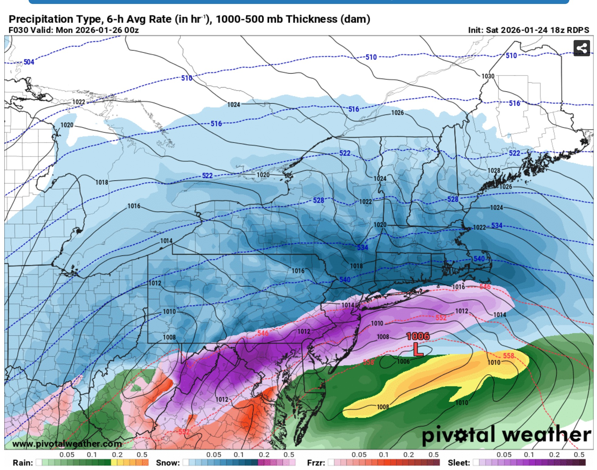
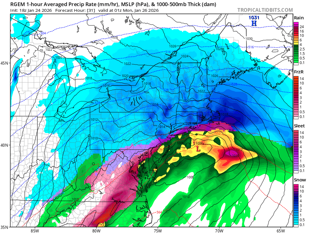
RGEM a tick cooler than 18z -
“Cory’s in LA! Let’s MECS!” Jan. 24-26 Disco
CT Valley Dryslot replied to TheSnowman's topic in New England
-
“Cory’s in LA! Let’s MECS!” Jan. 24-26 Disco
CT Valley Dryslot replied to TheSnowman's topic in New England
People have even been generating videos about this storm on Sora. -
“Cory’s in LA! Let’s MECS!” Jan. 24-26 Disco
CT Valley Dryslot replied to TheSnowman's topic in New England
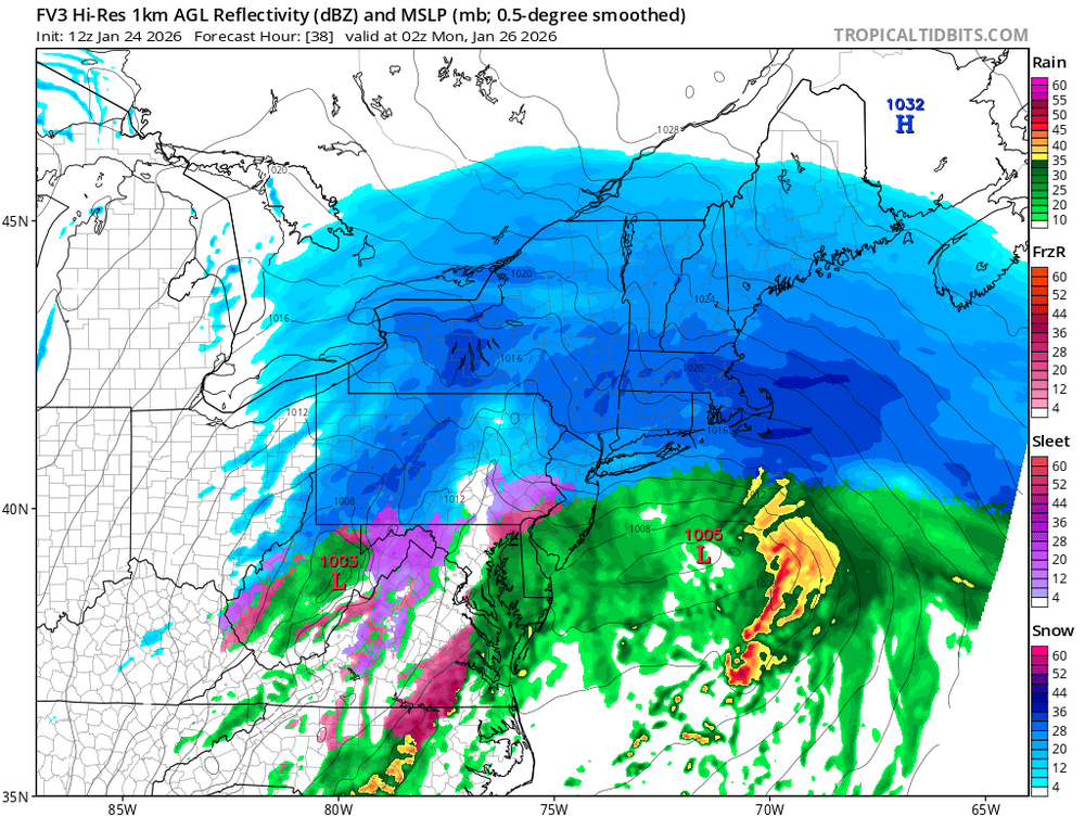
0z HRRR looks fantastic. All snow NW of GON-PVD-TAN -
“Cory’s in LA! Let’s MECS!” Jan. 24-26 Disco
CT Valley Dryslot replied to TheSnowman's topic in New England
Gave a thought to putting the front end of my car up on the ramps, but I'm not certain that we'll reach 18-24 here. -
“Cory’s in LA! Let’s MECS!” Jan. 24-26 Disco
CT Valley Dryslot replied to TheSnowman's topic in New England
-
“Cory’s in LA! Let’s MECS!” Jan. 24-26 Disco
CT Valley Dryslot replied to TheSnowman's topic in New England
-
“Cory’s in LA! Let’s MECS!” Jan. 24-26 Disco
CT Valley Dryslot replied to TheSnowman's topic in New England
Could it be trying to model some CAD down the CT River valley? -
“Cory’s in LA! Let’s MECS!” Jan. 24-26 Disco
CT Valley Dryslot replied to TheSnowman's topic in New England
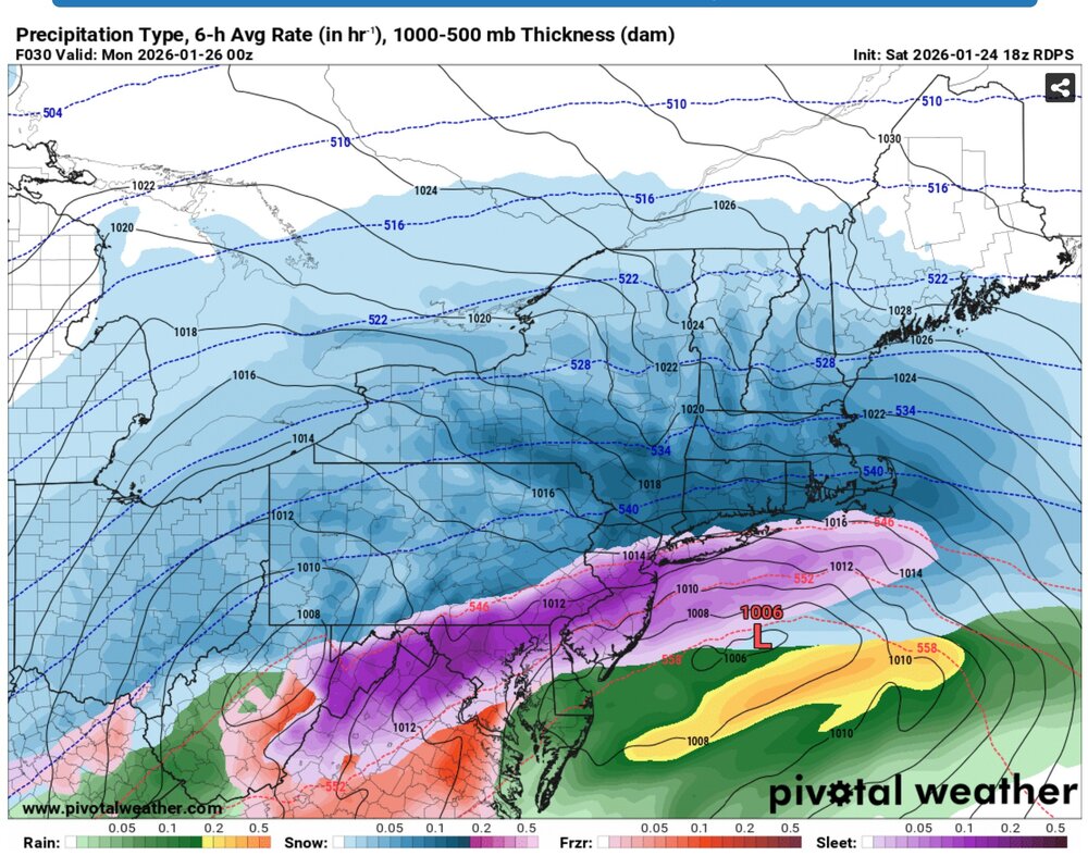
18z UKMET still cold -
“Cory’s in LA! Let’s MECS!” Jan. 24-26 Disco
CT Valley Dryslot replied to TheSnowman's topic in New England
I was just a teenager then, but I remember the TV mets increasing totals beyond 18" during the storm. -
“Cory’s in LA! Let’s MECS!” Jan. 24-26 Disco
CT Valley Dryslot replied to TheSnowman's topic in New England
2/11/06, maybe? -
“Cory’s in LA! Let’s MECS!” Jan. 24-26 Disco
CT Valley Dryslot replied to TheSnowman's topic in New England
Uncle: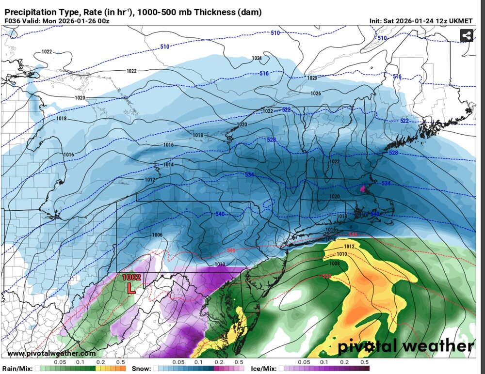
-
“Cory’s in LA! Let’s MECS!” Jan. 24-26 Disco
CT Valley Dryslot replied to TheSnowman's topic in New England
-
“Cory’s in LA! Let’s MECS!” Jan. 24-26 Disco
CT Valley Dryslot replied to TheSnowman's topic in New England
The fronto is north of HFD/PVD by the time it starts snizzling. -
“Cory’s in LA! Let’s MECS!” Jan. 24-26 Disco
CT Valley Dryslot replied to TheSnowman's topic in New England