

WxSynopsisDavid
-
Posts
426 -
Joined
-
Last visited
Content Type
Profiles
Blogs
Forums
American Weather
Media Demo
Store
Gallery
Posts posted by WxSynopsisDavid
-
-
-
ALEET ALEET……DT’s 1st guess map is coming shortly. He had to run to his local Wal-Mart and buy crayons
-
 1
1
-
 2
2
-
 1
1
-
-
Just now, Ji said:
Gefs went east lol
All is good with the world now. Until the EURO destroys it again
-
1
-
-
GEFS says “the whole sub forum can eat with this run”
-
2
-
-
Tasty….that’s a big south and east shift right off the coast
-
5
-
-
Well…….think the GEFS just said “hold my beer”
-
3
-
-
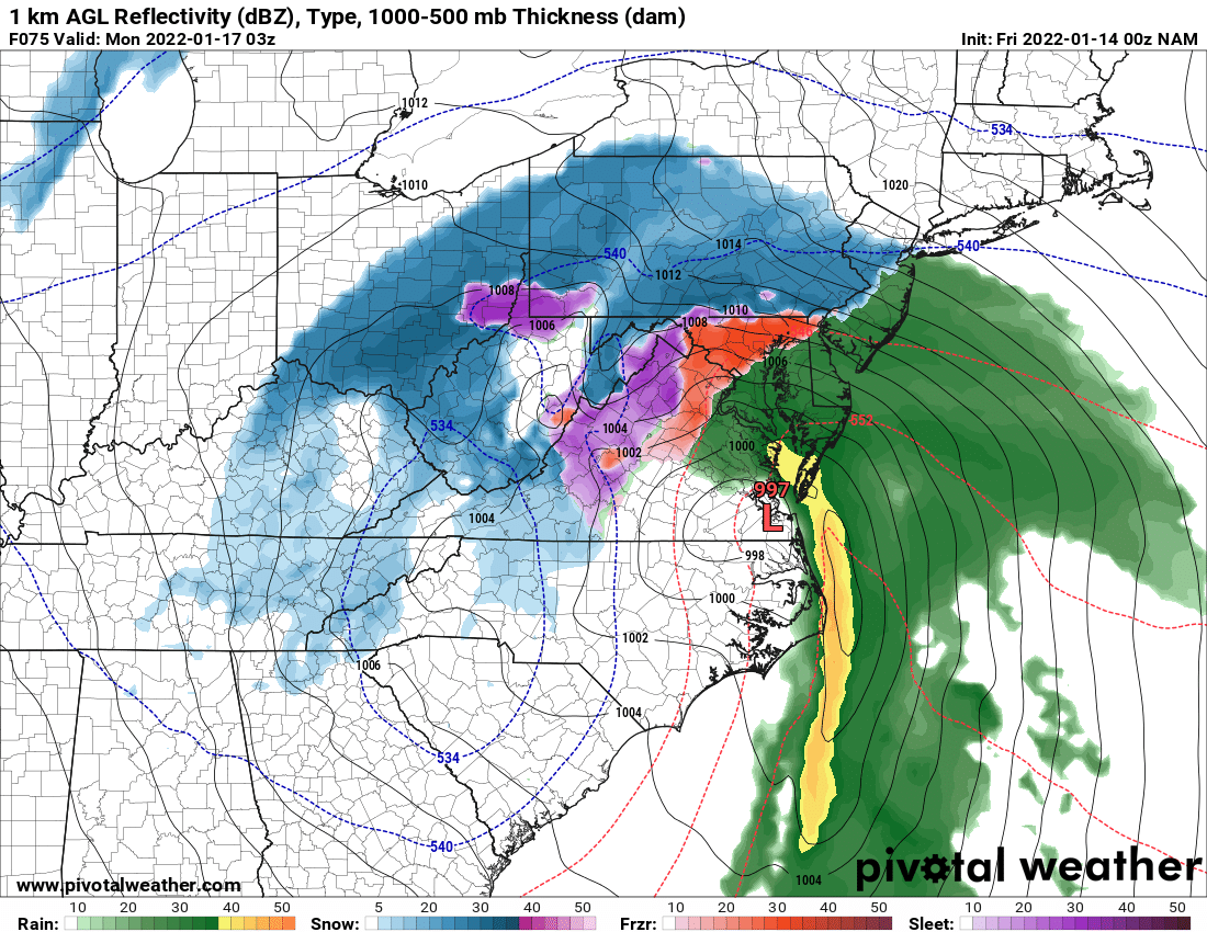
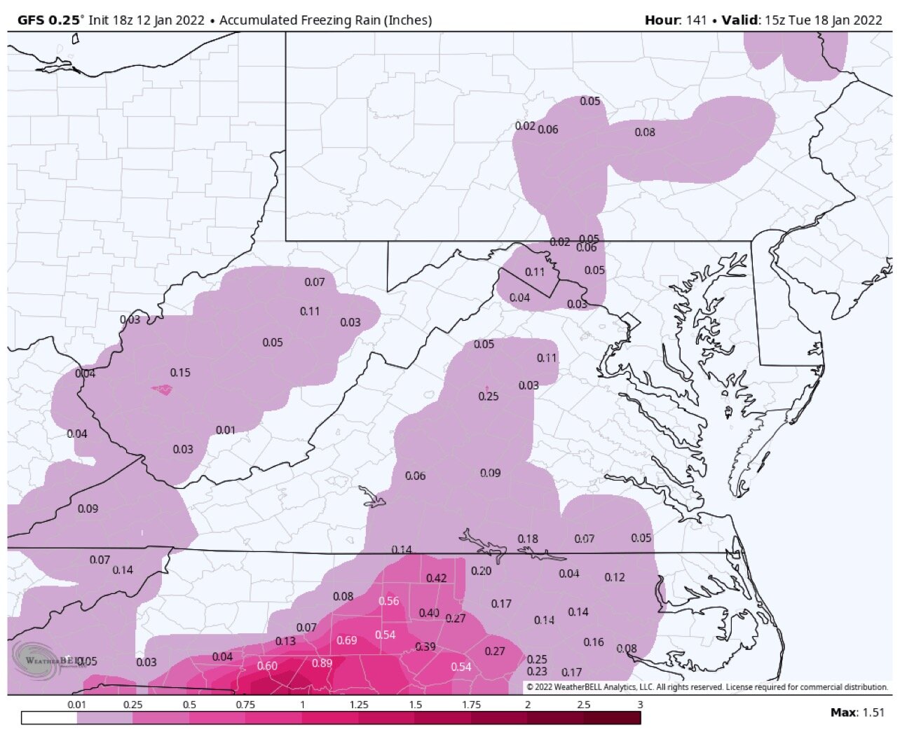
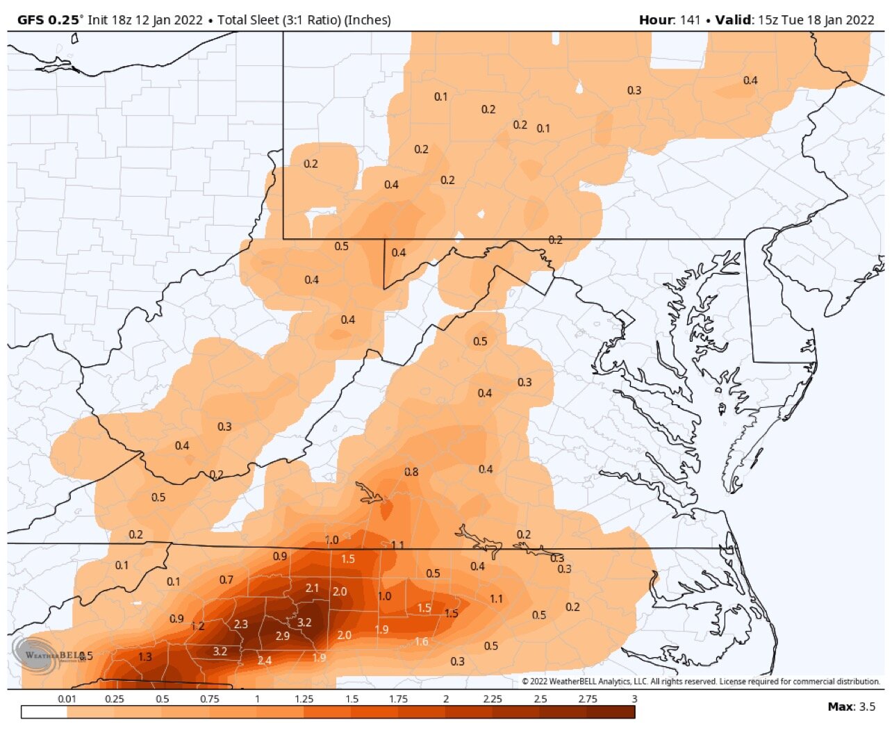
Seems odd to me, I would think this 00z run would produce more Ice
-
Just now, Ji said:
22 years of tracking heartbreaks
I’m right there with you. I’ll drink an extra one tonight for you
-
Just now, Ji said:
00z gfs-- hour 6-the tiny blip of precip in the southmost part of texas shifted by a mile
Trends are our friend tonight. Even if it’s 1 mile lol
-
1
-
-
1 minute ago, LeesburgWx said:
DT aleet for his website crashing


Oh for crying out loud. Cut me a break….welcome to the party DT. Pull up a chair and get comfortable. If I had a dollar for every message I received today on my Facebook page regarding Storm specifics I could probably afford a down payment on a car
-
2
-
-
1 minute ago, clskinsfan said:
I disagree. I think pretty much everyone sees a significant snow before any flip happens. A 3-6 inch thump is significant.
I can agree with that…but what I was saying is the current state of the model data we are 50/50 from swinging in either direction. Either the sub forum gets a big time snow or the sub forum gets a mixed bag precip event. Even with a mixed bag event, yes, 3-6 is doable.
-
1 minute ago, jewell2188 said:
Regardless of the airmass, doesn’t this map just look off given the track??? I find it hard to believe with a shitty track we even receive half of this….
Agreed. Climatology speaks volumes here, so do analogs. What is shown is not a typical end result to the depicted storm evolution and track
-
2 minutes ago, psuhoffman said:
18z euro control does the same thing the Gfs does. Cuts the low from Wilmington NC to Hagerstown MD. Lol.
It has the same improved look at 90 as the op but it seems the more amplified SW offsets those other improvements. The storm gets to eastern NC then goes nuts. By then the confluence is gone and nothing but ridging over the top so nothing to stop it from cutting due north.
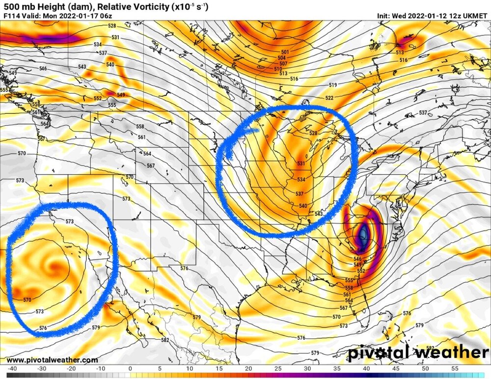
Still think the models are not handling the northern stream energy properly. Unfortunately we might not have a better idea until tomorrow or Friday when NWS ballon soundings are conducted and the data gets ingested. Honestly this is a close call right now for a large portion of this sub forum.
Either a big snow or a huge swing and miss with a mix bag. It’s like we are in the 9th inning, 3-2 count with the bases loaded. Tying run on first base, grand slam would win it. The pitcher is prime Randy Johnson and we are a rookie no name call-up from the minor leagues.
-
1 minute ago, WinterWxLuvr said:
Great second post
Just being truthful man, literally no positive trends right now. Pretty sad when I keep finding myself clicking on the NAM for a refresh (literally going to the last resort) but realizing “geez, it’s not even in range yet”
-
1
-
 1
1
-
-
But….wouldn’t be surprised to see the operational models tonight crap the bed and produce a cold rain with some sleet and ice for areas east of the mountains. One can hope
-
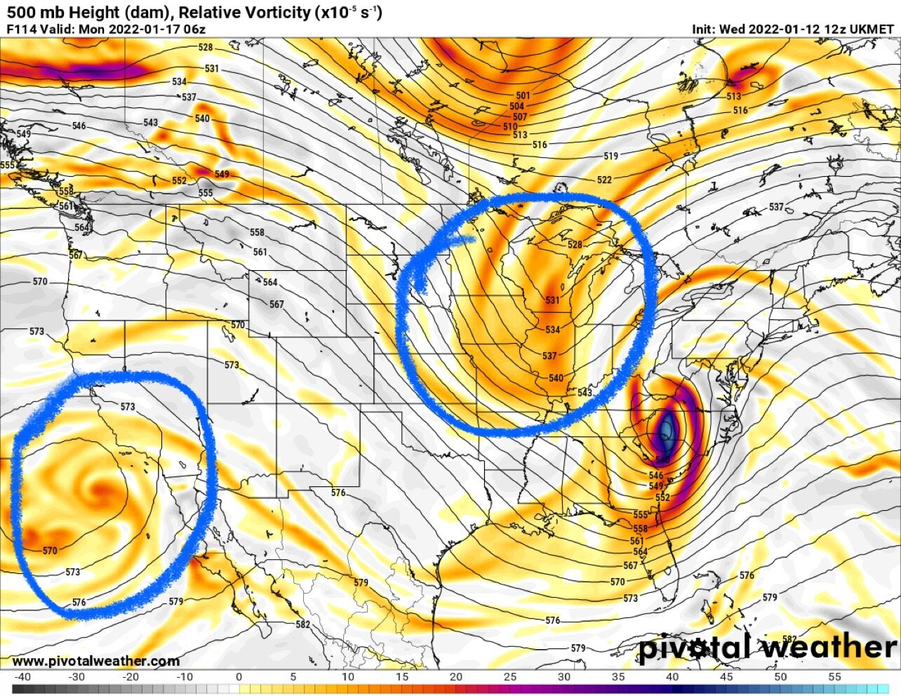
Another “fly in the ointment” with this forecast is the Baja Low. Operational models are having a hard time with it, along with the northern shortwave. Ensembles seem to be handling them better. Honestly…you would think that the expected trend is a crush job showing up with later model runs for NOVA


MLK 2022 Storm Potential
in Mid Atlantic
Posted