

WxSynopsisDavid
-
Posts
413 -
Joined
-
Last visited
Content Type
Profiles
Blogs
Forums
American Weather
Media Demo
Store
Gallery
Posts posted by WxSynopsisDavid
-
-
This might be the single most violent motion I’ve ever seen documented.
-
https://www.facebook.com/share/v/4Rkder71fihzG6BF/?mibextid=WC7FNe
Reed Timmer intercepted a large tornado just north of Topeka
-
3 hours ago, Chinook said:
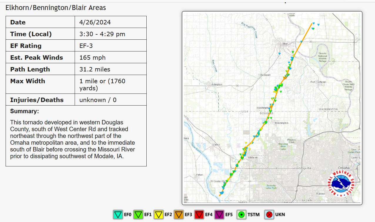
Only EF -3 for one of the largest ones near Omaha
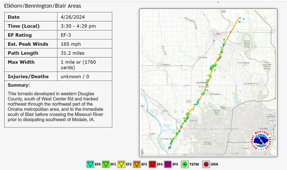
My understanding is that it is still preliminary. I believe Tim Marshall is going to Elkhorn tomorrow to survey. He was in Marietta today and his findings at the Dollar Tree Distribution Center was the reason that tornado got upgraded to EF4.
-
-
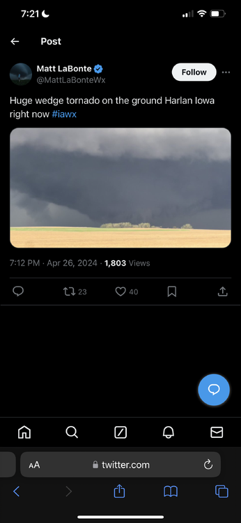
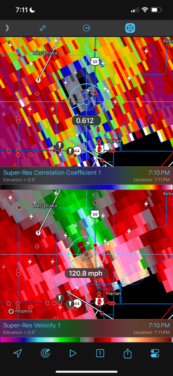
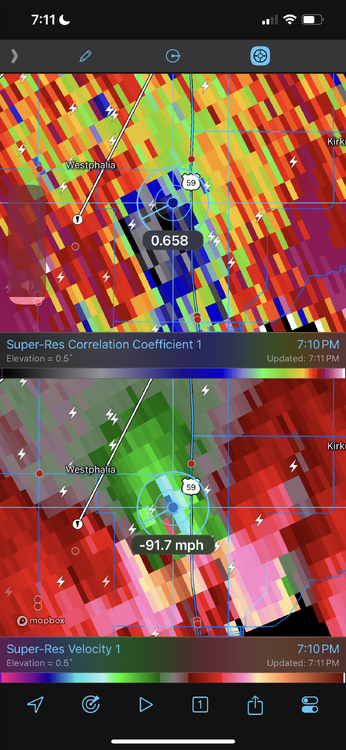
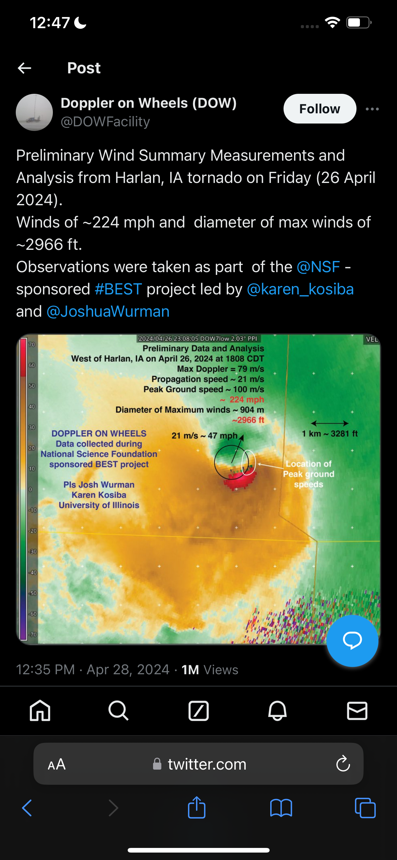
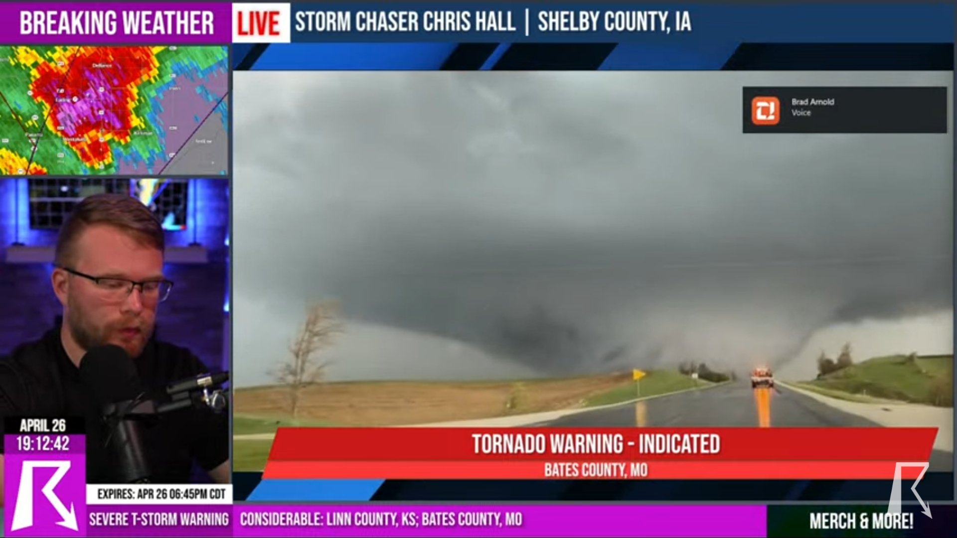
Though DOW measurements are not used in the surveys, this is a pretty impressive measurement. DOW measured 224mph winds inside the Harlan, Iowa tornado at its peak Friday night when crossing 59. Seems plausible surface winds were between 170mph-190mph.

-
 1
1
-
 1
1
-
-
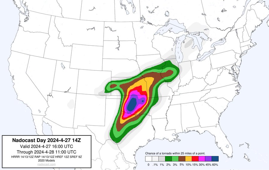
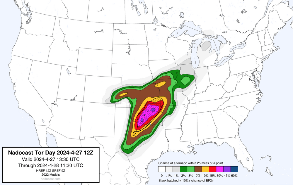
14z NADOCAST
-
1
-
 1
1
-
-
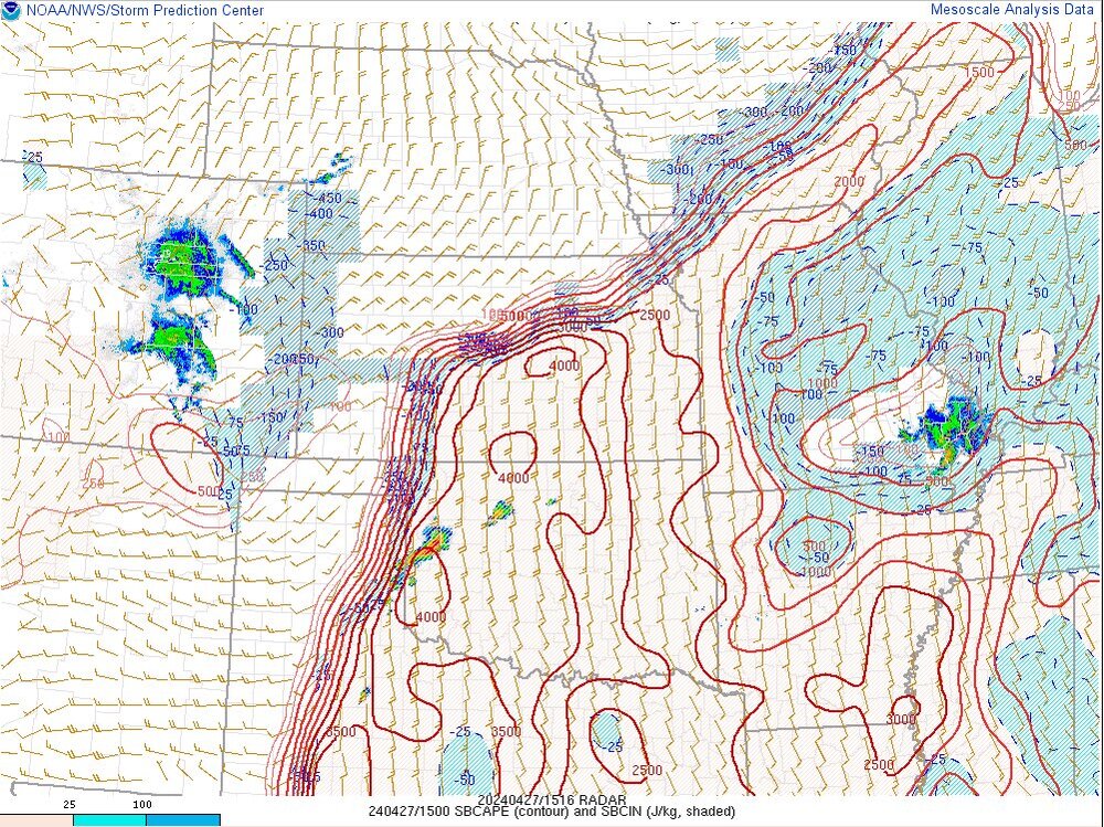
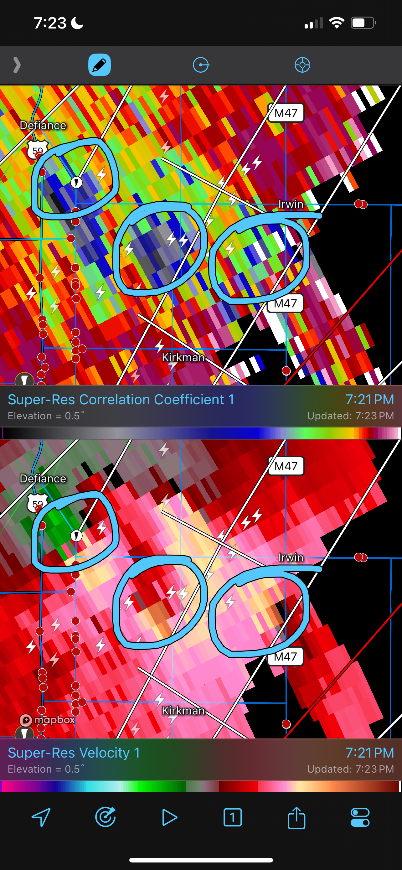
4000+ SBCAPE along the OK/KS border. Latest guidance showing a string of pearls. Supercells maintain separation and intensify as they enter into the Moderate Risk hatched area.
Nadocast really starting to go bonkers. Will be interesting to see what the NWS SPC does at next outlook.
-
1
-
-
Really got a bad feeling about this setup today. Everything seems to be coming together in all the wrong ways.
-
1 hour ago, Quincy said:
Yeah. Tomorrow looks ugly. If for nothing else, you could see a Moderate Risk, simply for the fact that the storms are likely, regardless of storm mode, supercell longevity, etc. Whether they are numerous or more isolated/intense, it seems like the overall probability of severe across central into eastern Oklahoma is quite high and may warrant higher severe probabilities.
Really the only things that could dampen the threat a bit would be a mass of early day storms and outflow, along with messy storm modes. Even in this “best” case, it seems probable that a storm or two threads the needle.
Buckle up.
I absolutely agree with your analysis so far. If storm mode is not messy later today, this environment has the hallmark and look of a classic tornado outbreak. Hard to imagine it surpassing what we seen yesterday. However, the parameter space is more significant. Very possible if things come together this could be a Friday repeat but over a much larger areal capacity.
-
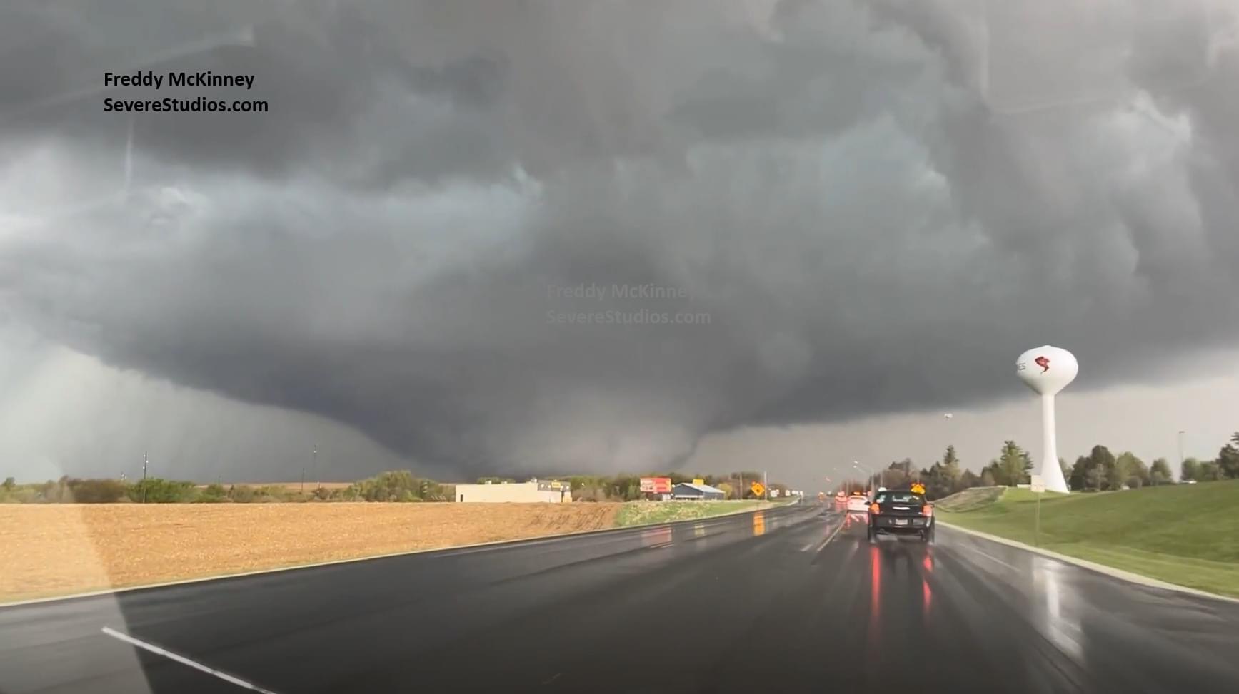
This shot from Storm Chaser Freddy McKinney, mark my words, will be in the history books. What a monstrous, powerful, and truly violent tornado. Photographed right as it peaked in width and intensity. This shot has Rochelle, Illinois vibes.

-
1
-
-
13 minutes ago, Witness Protection Program said:
Houses blown down to their foundations, is that common for EF3 or does that likely move it to a 4?
Depends on the construction of the house. A poorly constructed house can be leveled by an EF2/EF3.
-
Tornado intensity sheets can be generated through the NWS and NWS SPC websites. There actually might be some radar software that allows you to generate this. If I’m not mistaken, GR Level can populate this data sheet as well.
-
1
-
-
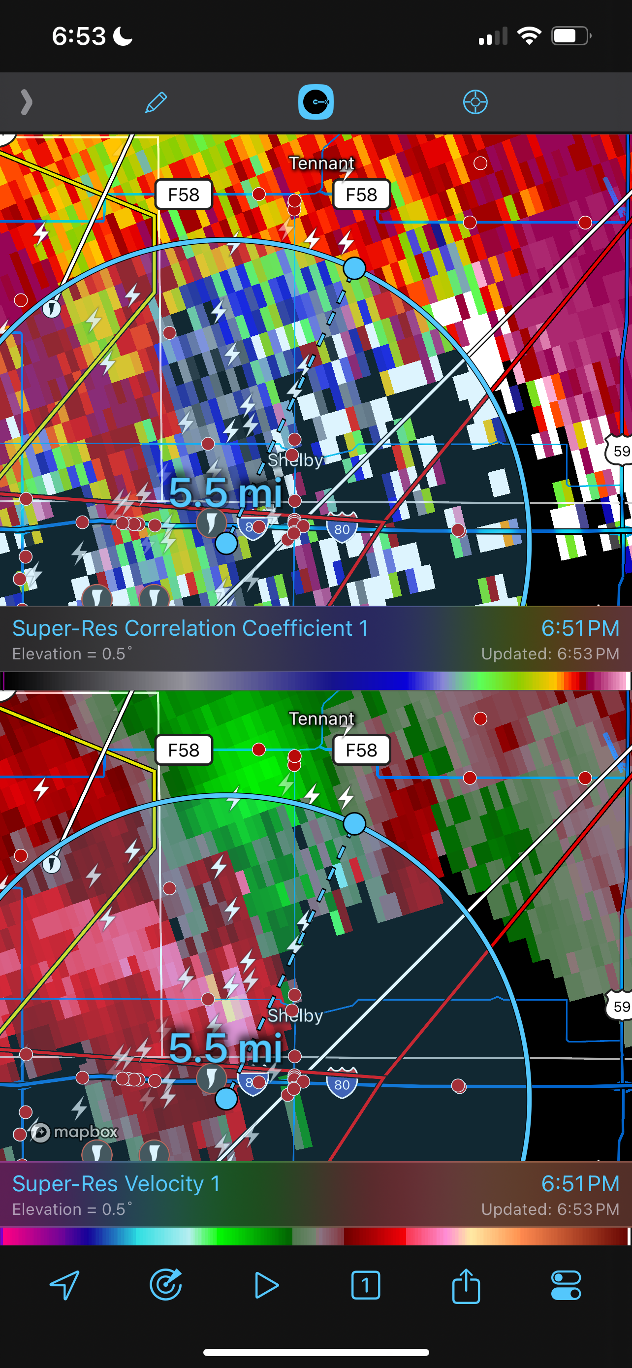
28 minutes ago, MidwestChaser said:
What's that from?
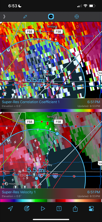
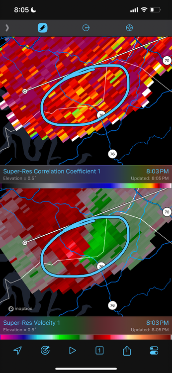
Radar estimated intensity for the Bennington/Blair tornado
-
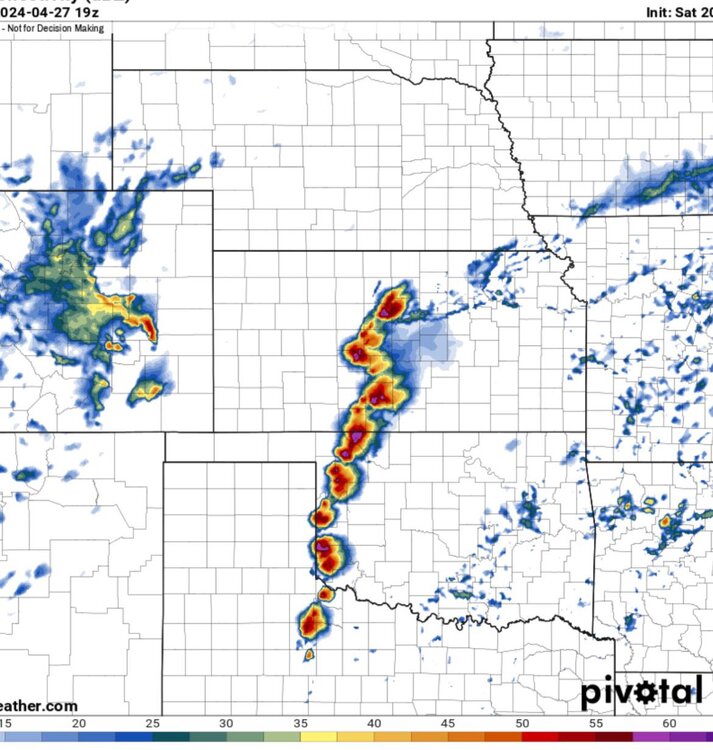
Minutes ago, looked as if there could of been a trio
-
1
-
1
-
-
Historically violent tornado….images are for the history books

-
1
-
-
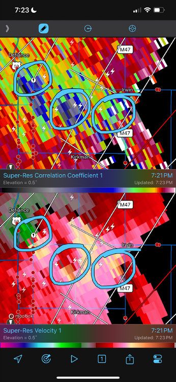
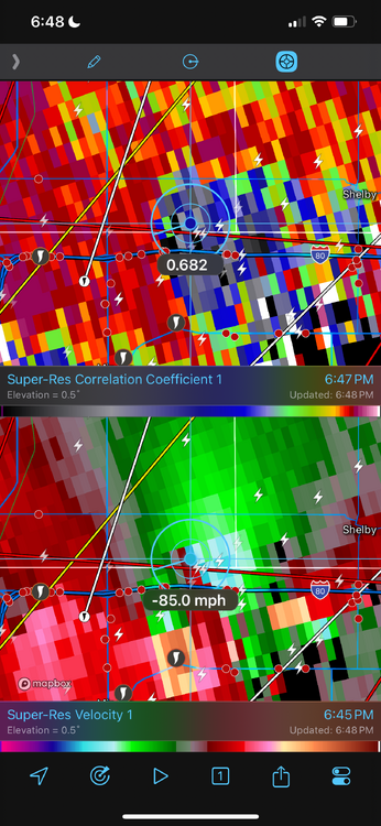
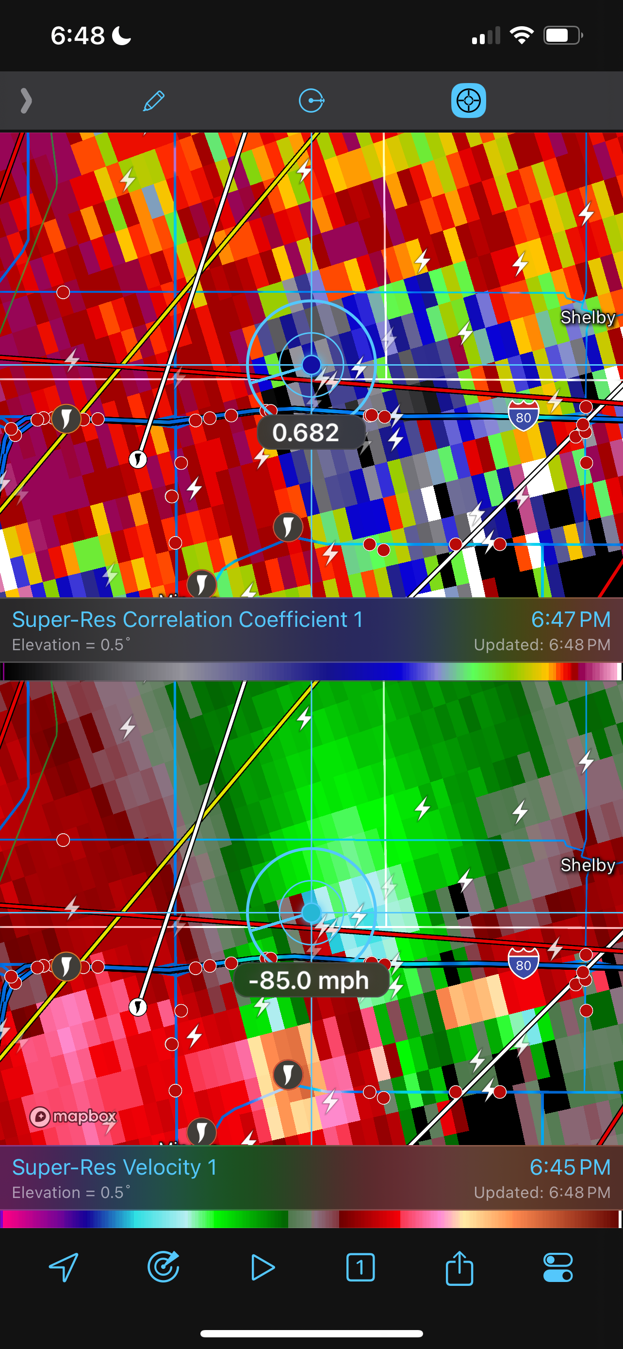
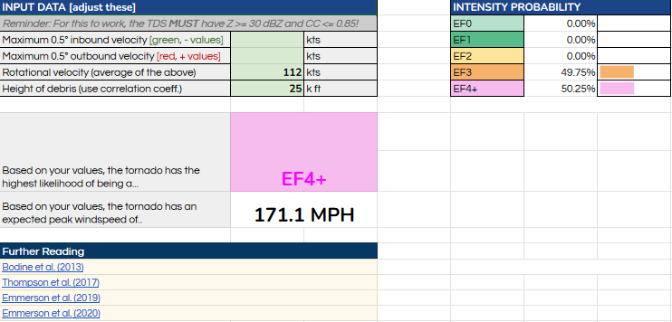
212mph gate-to-gate minutes ago
-
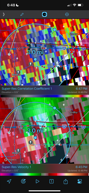
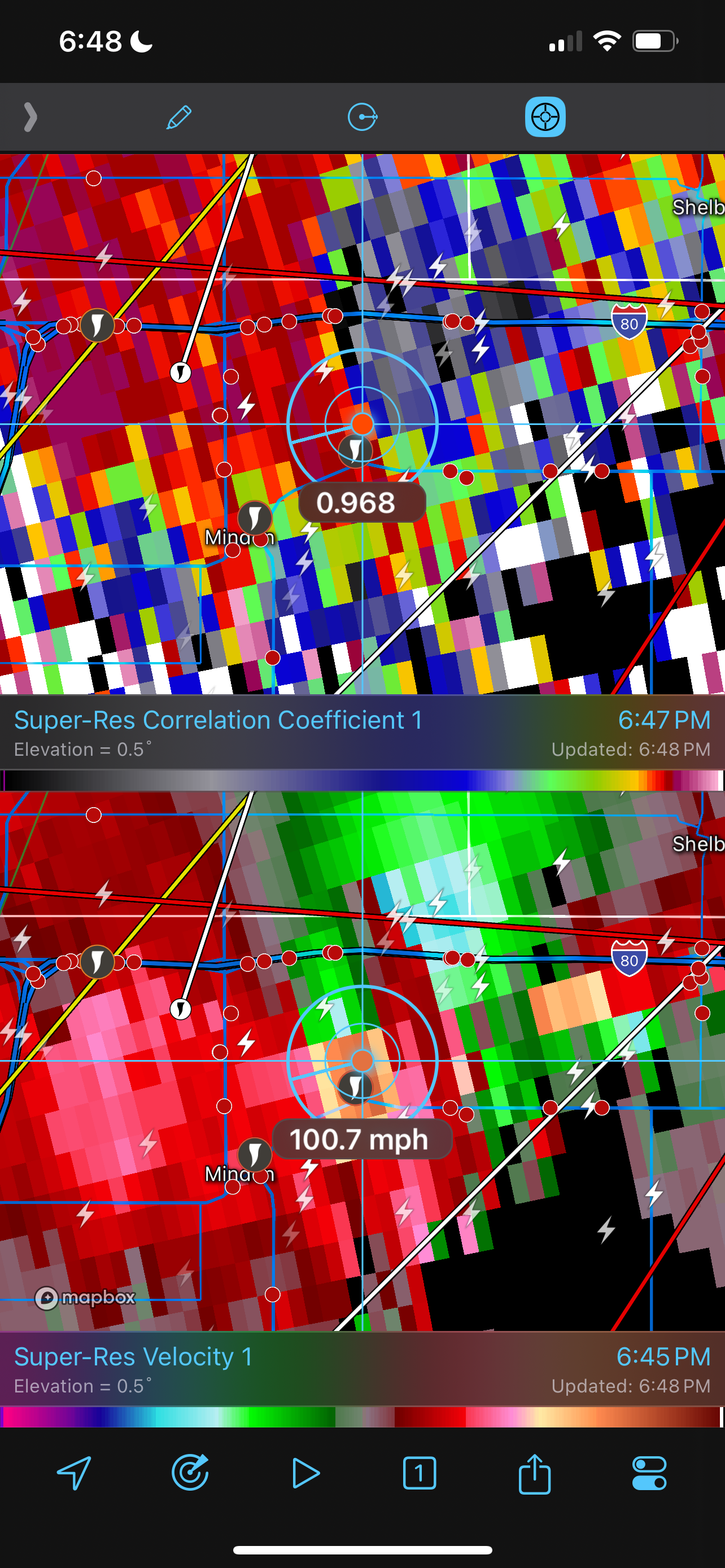
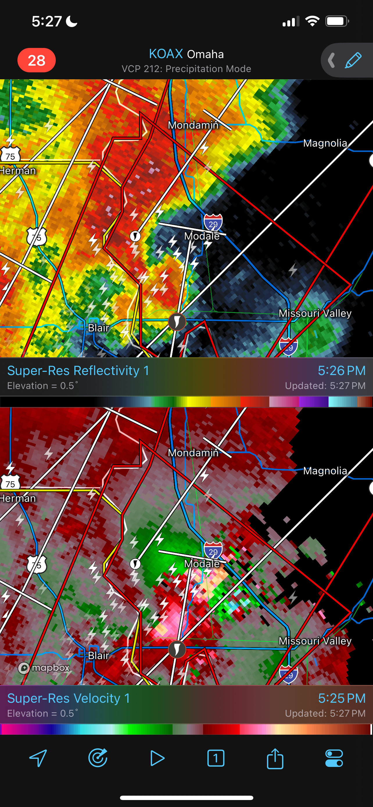
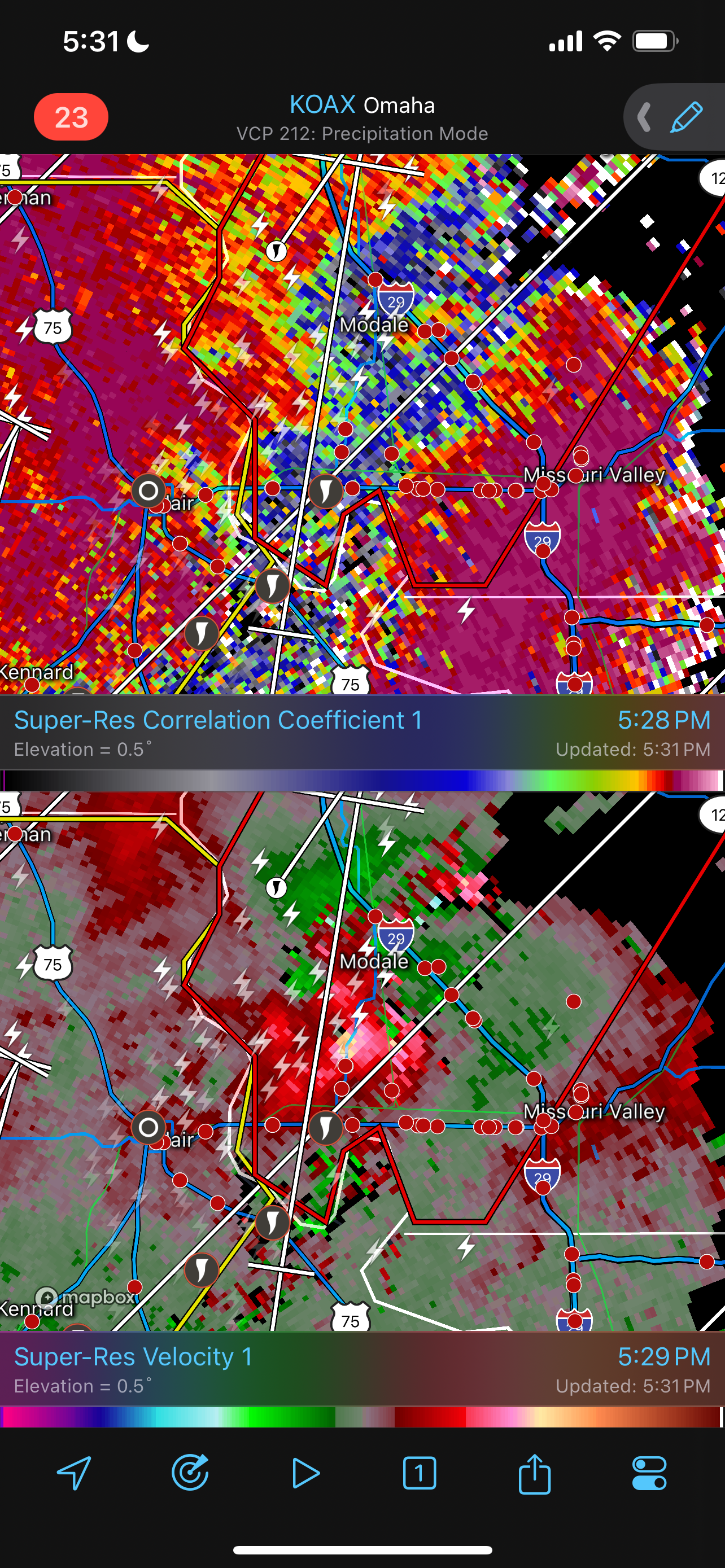
Minden, IA tornado peaked around 185-200mph. Debris ball was indicative of 3mi width. Debris ball was very large with debris being lofted well out ahead of the tornado. Classic multiple vortex based on videos I’ve seen on Twitter.

-
2
-
-
Btw…can anyone confirm if the Calhoun Nuclear Plant was damaged?
-
-
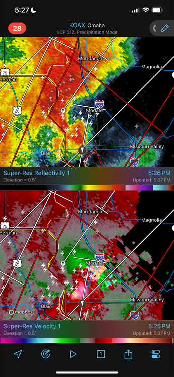
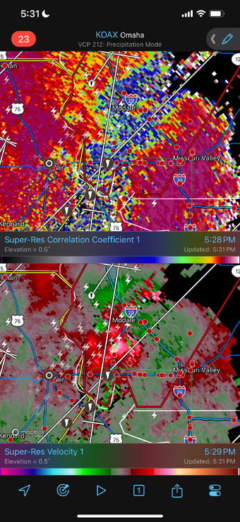
Classic, textbook hook echo and supercell. Very sickening and gut wrenching to see this evolve and take shape over populated areas.
-
1
-
-
Still don’t understand how there’s no tornado warning for this storm passing by Campbellsville, KY.
-
1
-
-
Just now, WxSynopsisDavid said:
Likely a tornado producing supercell south of Campbellsville, KY. Currently unwarned ATM.

It’s definitely producing now, still surprised at the lack of a Tor Warning.
-
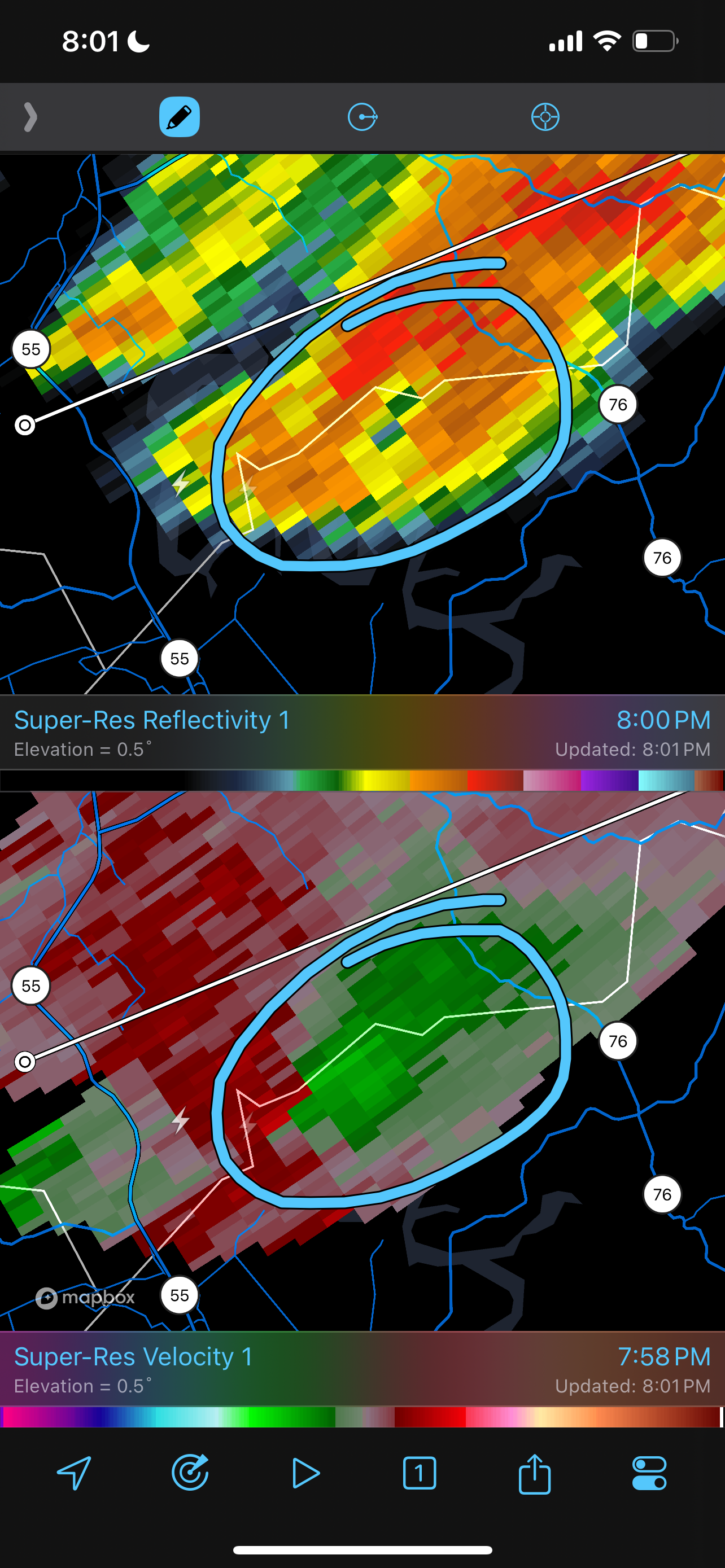
Likely a tornado producing supercell south of Campbellsville, KY. Currently unwarned ATM.
-
Interesting NOAA NHC 5pm discussion. Ophelia to continue intensification into landfall. No mention of impacts from shallow shelf waters, seems to indicate Gulf Current to mitigate shelf impacts.


Severe Weather 5-6 through 5-8-24
in Central/Western States
Posted
Shouldn’t the thread headline read “5-6-24” instead of “4-6-24”?