wehavemoves
-
Posts
4 -
Joined
-
Last visited
Content Type
Profiles
Blogs
Forums
American Weather
Media Demo
Store
Gallery
Everything posted by wehavemoves
-
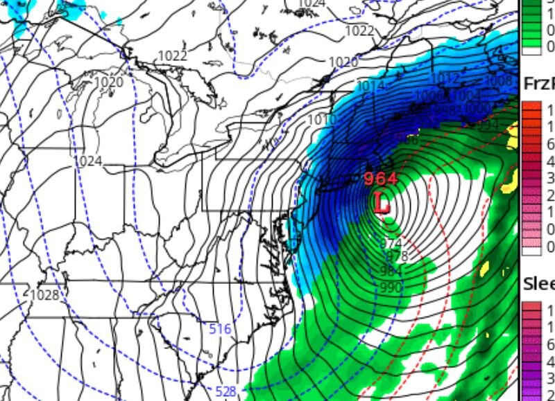
32k Nam looks Insane 964 LP ....... What time in EST did this come out ? It says Zero Z but not sure in terms of EST. Thanks
-
 All the short range models look impressive with the rain bands. Left side of this storm will outproduce rain expectations and the surge IMHO. https://www.tropicaltidbits.com/analysis/models/?model=wrf-arw2®ion=us&pkg=ref_frzn&runtime=2021082200&fh=14 https://www.tropicaltidbits.com/analysis/models/?model=nam®ion=us&pkg=mslp_pcpn_frzn&runtime=2021082200&fh=21 https://www.tropicaltidbits.com/analysis/models/?model=rgem®ion=us&pkg=mslp_pcpn_frzn&runtime=2021082200&fh=12
 -
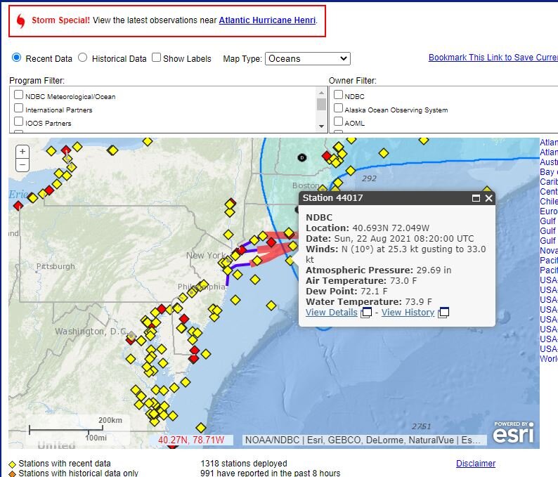
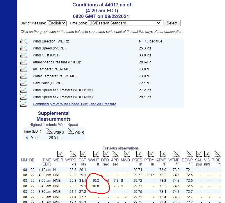
Seeing wave heights increase toward 10' way east of the storm https://www.ndbc.noaa.gov/station_page.php?station=44066