MDRandy
-
Posts
26 -
Joined
-
Last visited
Content Type
Profiles
Blogs
Forums
American Weather
Media Demo
Store
Gallery
Everything posted by MDRandy
-
30/13 SE Charm City
-
Prigel?!
-
33/31; light snow
-
I'm at 37/27 currently in the city.
-
41/25; Canton
-
39/24; already surpassed our forecast high
-
Which usually works out long-range wise, not so much short-range.
-
I appreciate his long-range forecasting, but his snow maps typically reflect his Richmond bias.
-
Is LWX going straight to advisories/warnings tomorrow?
-
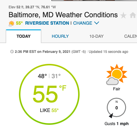
I guess the Riverside neighborhood has its own microclimate
-
It's down to 51 now, so I agree; seems like an unreliable station. Anywhere from 47-50 seems reasonable for downtown currently.
-
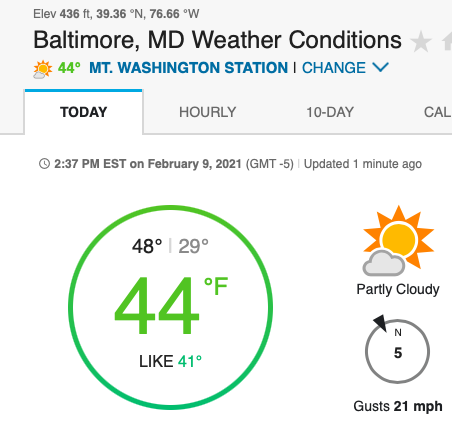
NW Baltimore is at 44; there's usually a 5-10 degree range between downtown and NW.
-
-
55 and climbing in the tropics of downtown Baltimore.
-
I will take responsibility for the Baltimore snow hole.
-
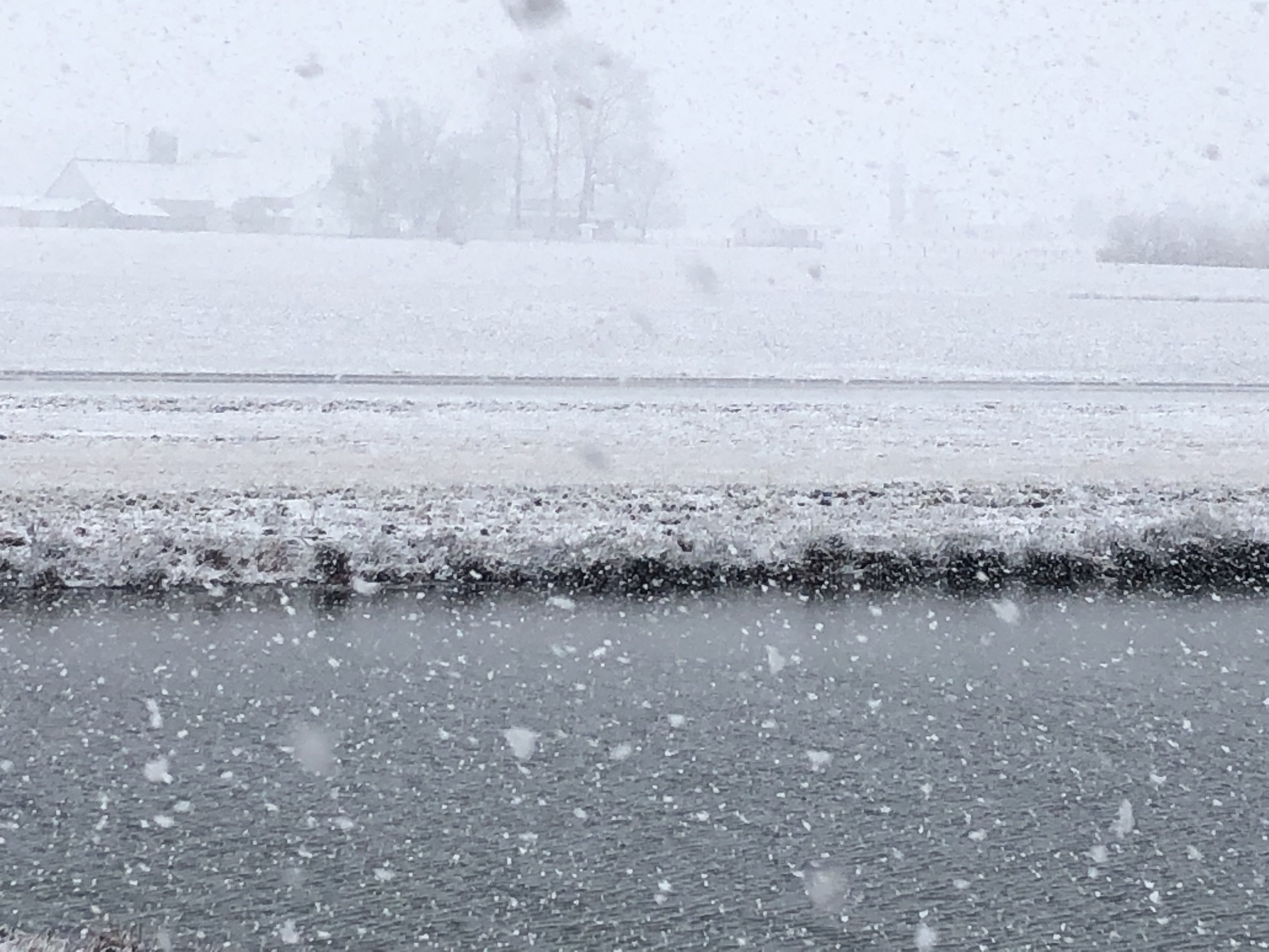
Another Sunday, another busted forecast for SE Bawlmore. 36/33 with a cold rain. Accumulated precipitation: rain puddles Looks like ol Kooky Uncle Randy's fears about mixing along the 95 corridor were justified after all.
-
Yes sir. NW Baltimore (Mt Washington) is reporting 33; I'm SE (Canton) at 41. Downtown is 42.
-
Balmy 41/28 in Charm City
-
You're gonna have the weenie police all over you for that post.
-
Do you think there will be enough blocking to prevent further NW trends? Just curious.
-
Not saying the genesis of the storms are similar at all - just noting the similarities in trends.
-
Another win for the Euro by the way. The GFS has had as much success at long-range forecasting as the Buccaneers are going to have slowing down the Chiefs offense on Sunday.
-
I'm a meteorological prophet.
-
Just like last week when model consensus at this time consistently showed double digit totals up and down 95.
-
One more tick NW - probably tonight or tomorrow - and the 95 corridor is just a rain/snow mix. This looks like a 81 corridor special