mannynyc
-
Posts
411 -
Joined
-
Last visited
Content Type
Profiles
Blogs
Forums
American Weather
Media Demo
Store
Gallery
Posts posted by mannynyc
-
-
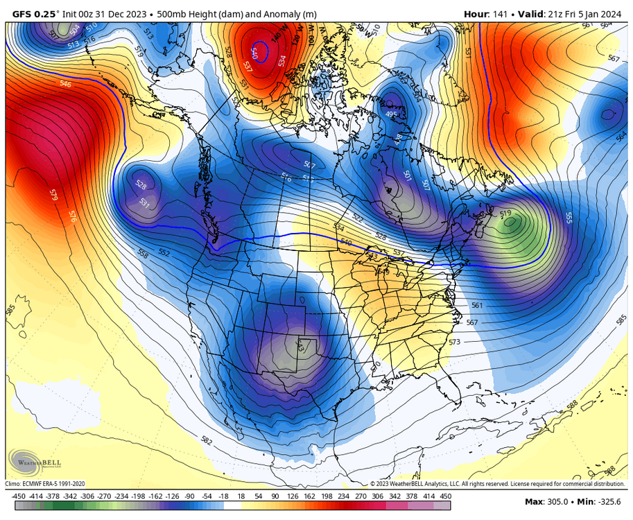
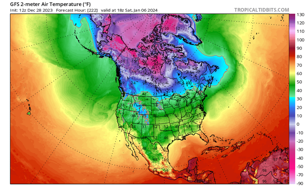
Even if we miss this storm good snowcover to our north will help with future cold air.
-
 3
3
-
-

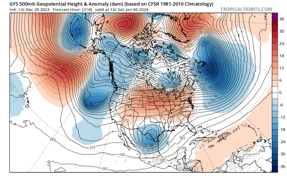
Euro with some inland concerns. Definitely not as good of a look. -
-
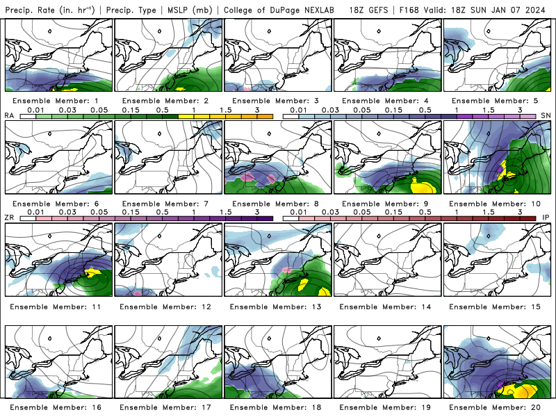
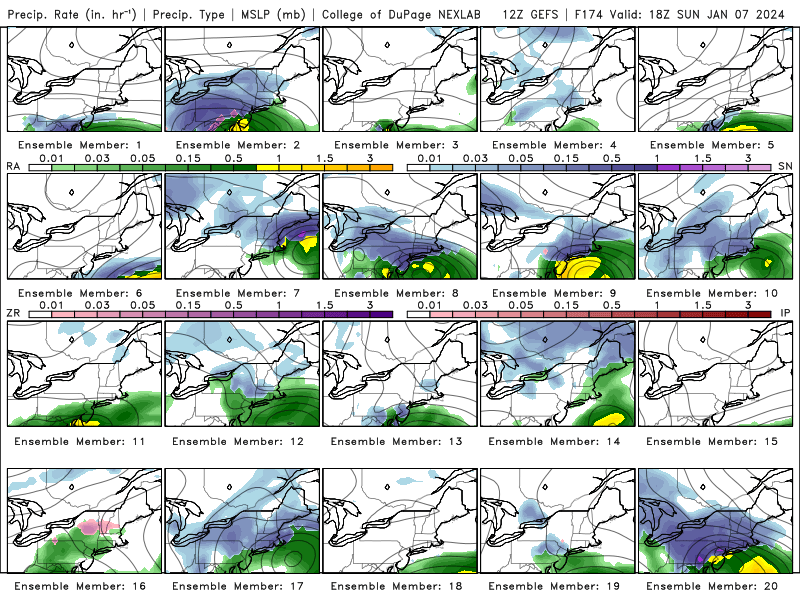
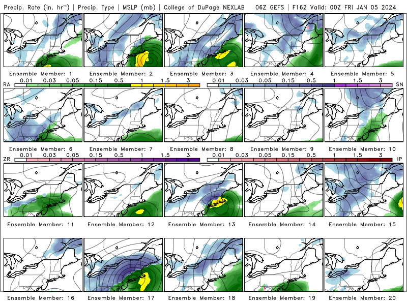
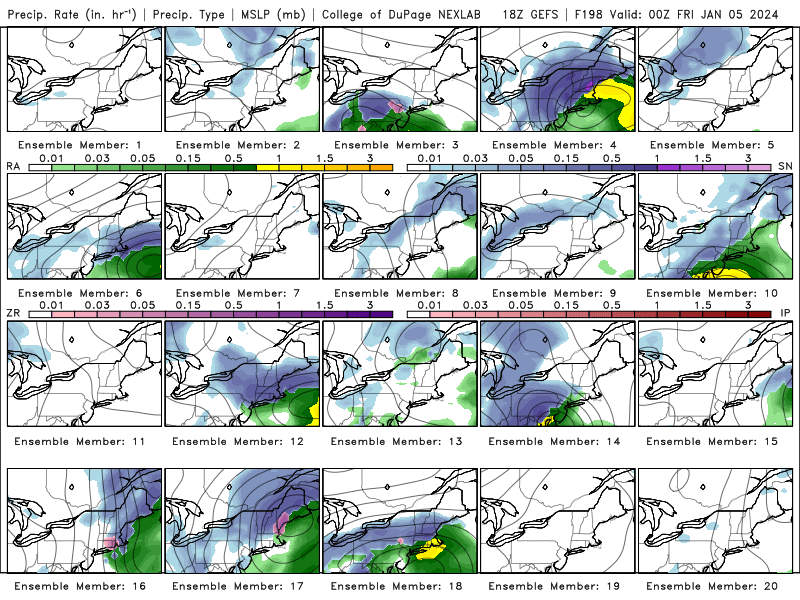
Here's the 12Z GEFS for January 7th.


-
1
-
 1
1
-
-
For 1/7
-
-
-
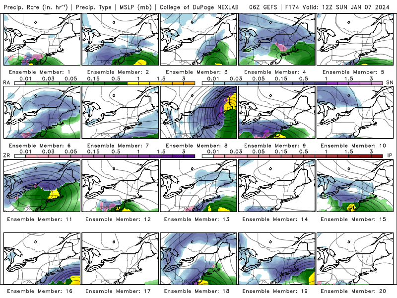
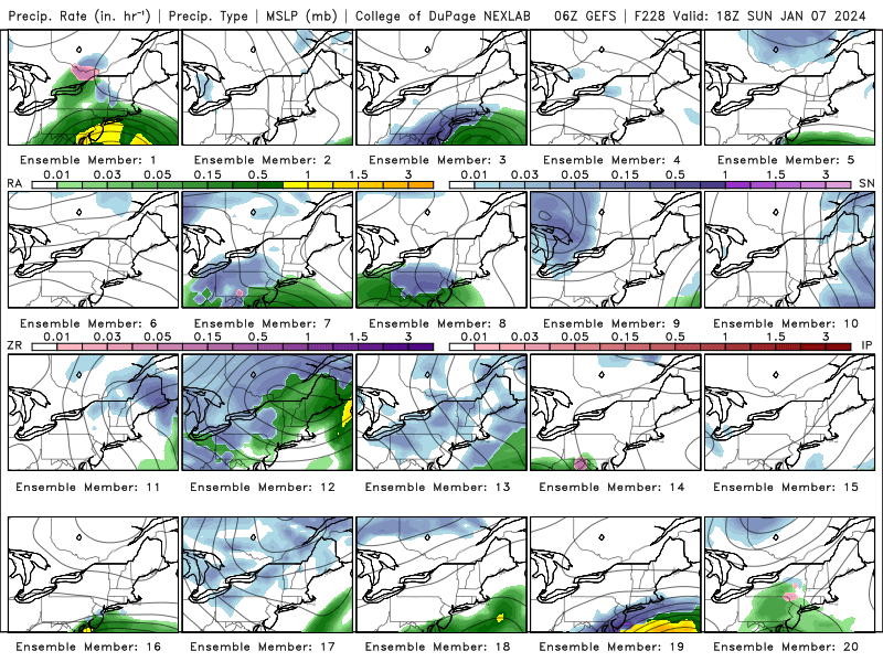
This is 6Z but this it's a good visualization of how many solutions are still on the table

-
Low placement looks pretty good on the EPS

-
2
-
-
-
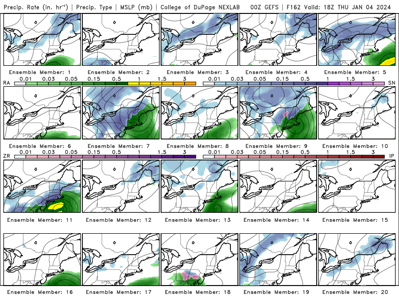
GEFS
HR 180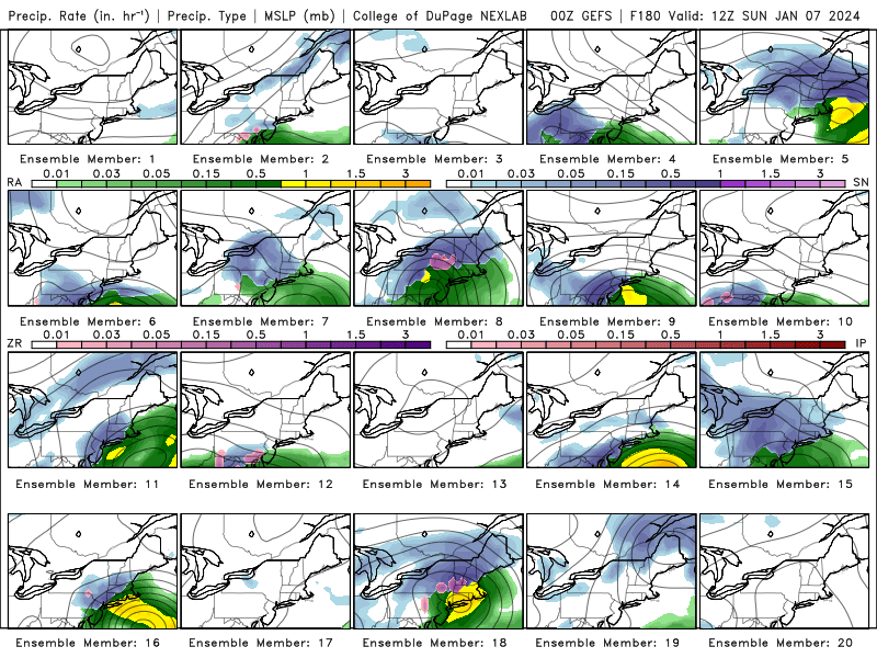
HR 190
-
1
-
-
19 minutes ago, brooklynwx99 said:
not to hype, but that 50/50 is classic. this is a legit threat

Great look -
We're so back.

-
 1
1
-
-
1 hour ago, Snowcrazed71 said:
So as of right now, is the 4-5 threat off the table? Or is it still a possibility in southern New England? The 6-7 threat looks like it's a non-threat right now... And that threat 11-12 still looks like the most potent at this point, correct?
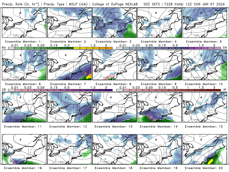
For reference the GEFS ensemble
-
1
-
-
Hard to get excited about the OP GFS when both storms are outliers in their own ensembles.
-
Suppression could be helpful here in getting us cold air. GEFS likes the low far off shore.

-
Two days of snow in South Dakota!
-
Just now, mannynyc said:
Better than nothing on the OP GFS


Can't say I'm a huge fan of the ensemble look but would rather at least have a coastal signal.
-
Better than nothing on the OP GFS
-
1
-
-
hmmmm

-
1
-
-
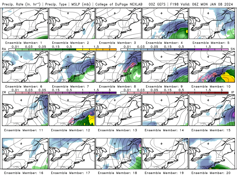
January 7th-8th is also an interesting timeframe to watch
-
2
-
-
1 hour ago, NEG NAO said:
This system coming up the coast late next week might have possibilities for NYC metro boarder line temps - nice track off the coast - climatology favorable

GFS ensemble

-
48 minutes ago, qg_omega said:
Ok, I could find many posts like this from you last year with no concern or changes but I regress. I’m not seeing the big flip at all nor do I see it in the teleconnections. It’s an ugly pattern out to the next two weeks and don’t see why week 3 or 4 would prove different
And yet


-
Total wishcast but don't hate this look from the GEFS.-
1
-


Two Mdt to high impact events NYC subforum; wknd Jan 6-7 Incl OBS, and mid week Jan 9-10 (incl OBS). Total water equiv by 00z/11 general 2", possibly 6" includes snow-ice mainly interior. RVR flood potential increases Jan 10 and beyond. Damaging wind.
in New York City Metro
Posted
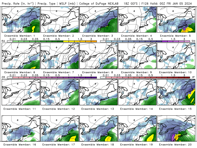
18Z GEFS members