

mannynyc
-
Posts
390 -
Joined
-
Last visited
Content Type
Profiles
Blogs
Forums
American Weather
Media Demo
Store
Gallery
Posts posted by mannynyc
-
-
4 minutes ago, brooklynwx99 said:
UKMET closes S of LI. MECS verbatim
.png.d1f3fc01fd4bff2dbed9a64672d30492.png)
Beautiful. Someone should frame it.
-
50 minutes ago, jm1220 said:
This one’s written off for the city and coast. No cold air source and SE flow out ahead of the system to keep it warm as precip advances. Maybe some white rain as it leaves. Chalk up another fail.
GFS is the only outlier and it always seems to be overamped. Oh well. On to the next storm
-
Way better looks from the GEFS compared to 12Z
-
 1
1
-
-
23 minutes ago, LibertyBell said:
I'm dubious of 1-3 inch amounts with that low temp of 33.
Dynamic cooling. It never got below 33 the storm a few weeks ago and we still got two inches.
-
 1
1
-
-
NYC's best shot looks to be early Saturday morning when the coastal low starts to take over. Depending on the model, rain should become snow in the city between 3 and 6AM, continuing until 10AM. This shift should happen a couple hours earlier in New Jersey, Upstate NY and Connecticut.
-
1
-
-

CMC has same trend as the GFS
-

GFS moves the low north east. That allows the city to get into heavier snow bands late in the storm.-
1
-
-
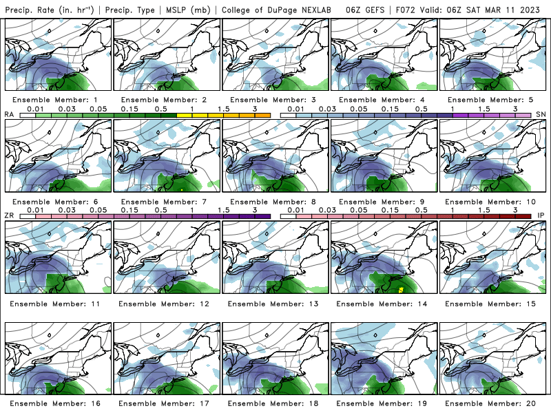
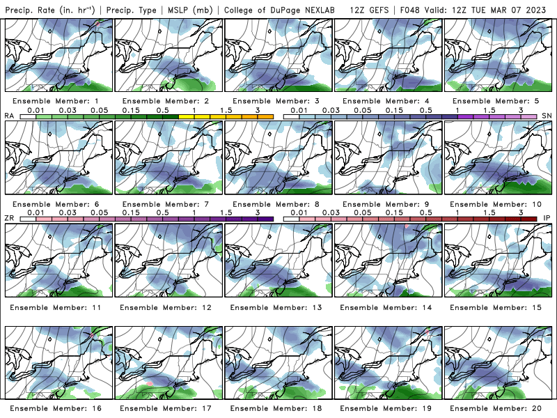
6z GFS ensembles. NYC right at the edge of a moderate snowfall
-
7 minutes ago, Winterweatherlover said:
RGEM looks decent for storm 1 too.
I wouldn’t put too much faith in mesoscale models this far out but there certainly is an increasing chance of storm 1 working out.
-
1
-
-
Officially .1 inch in Central Park. Surprised they measured anything, there was nothing on the ground in Midtown when I looked at about 5:30AM.
-
2
-
-
1 hour ago, snowman19 said:
NWS Upton is not buying any snow for Saturday. They are calling for rain even up here in Rockland County. No cold air
The NWS likes to be, for good reason, as cautious as possible with their forecasts, especially this far out with nothing close to model consensus. The cold air is certainly an issue, but it’s more fun to be optimistic than pessimistic. We aren’t the NWS. This weekend and next weekend are our bests shots for a moderate snowfall this year, but it is far from a sure thing.
-
1
-
-
It's beautiful
-
2
-
-
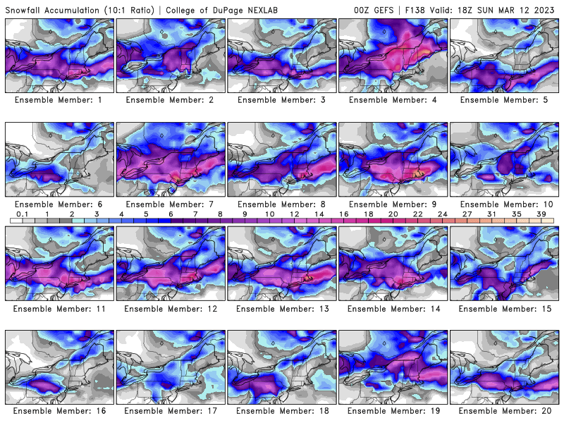
Ensembles look good. Not everything is going to be a hit this far out. We just want the signal for a strong coastal storm.
-
5
-
1
-
-

GFS moves north as well
-

3k NAM moved north, right over Central Park.
-
1
-
-
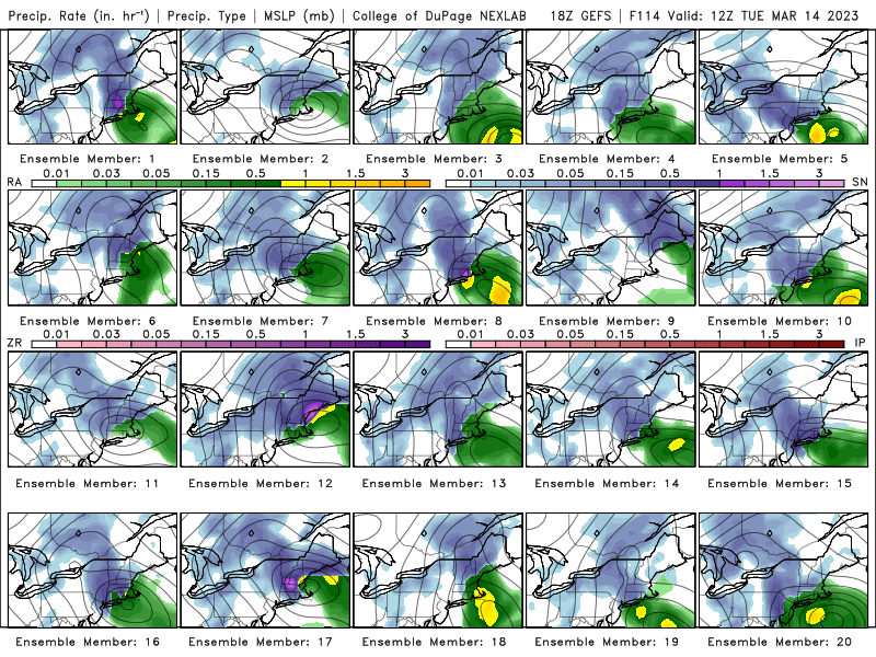
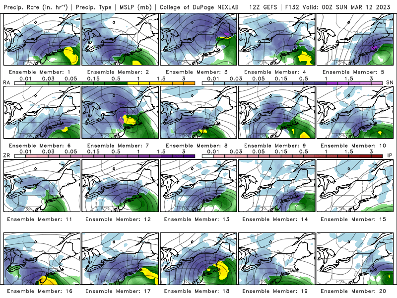
12z GEFS ensembles for Tuesday
-
1
-
3
-
-
The GEFS ensembles look really for March 11-17. 9 of the 20 members have signifcant coastal storms.
-
12z GFS appears to have moved slightly north, but not a significant change
-
Central Park officially measured 0.9 inches of snow at 12AM last night. 1.3 inches for the season. It snowed since then so that number should increase.
https://mesonet.agron.iastate.edu/wx/afos/p.php?pil=CLINYC&e=202302280621
-
1 minute ago, Bxstormwatcher360 said:
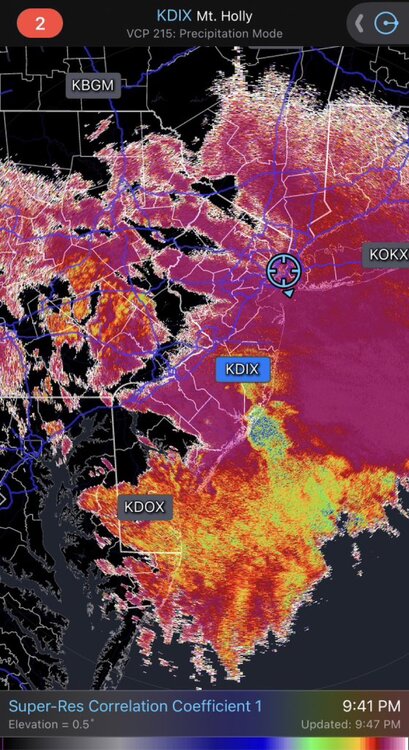
Winds are now northerly so that should keep areas with snow as mostly snow. The mix line seems to have stalled right over the south shore maybe trying to push back south a bit. Heavy precip is also coming in. Currently moderate anow here ..officially 2.1 here in the bx..
Looking good for all Snow in Central Park when they measure at 1AM. Side streets in Manhattan and even some sidewalks are starting to get covered.
-
Rain/Snow line continues to inch north, but the radar is starting to fill in again
-
-
Looks like one more band to come through NYC before a lull. Mixing line sneaking north.
-
-
1
-
1
-

March 11th storm threat
in New York City Metro
Posted
18z 3k NAM is signficantly colder in the City compared to 12z. Someone could be in for a surprise, but I wouldn’t hold my breath.