

mannynyc
-
Posts
390 -
Joined
-
Last visited
Content Type
Profiles
Blogs
Forums
American Weather
Media Demo
Store
Gallery
Posts posted by mannynyc
-
-
Taking stock with the 12z runs
Euro
GFS
Canadien
Icon
-
 1
1
-
-
Euro appears to be coming in warmer as well
-
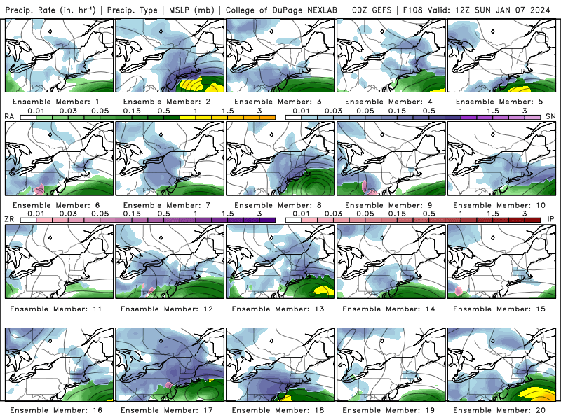
GEFS, still several good looks
-
1
-
-
-
-
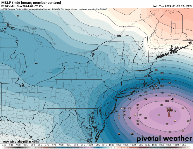
Euro is slightly east which brings heavier snow into the city.
-
3
-
 1
1
-
-
-
24 hour difference in GEFS is almost chuckleworthy.
Last night
Tonight
-
2
-
 1
1
-
-
-
-
6 minutes ago, MJO812 said:
Models look great tonight
Gfs and cmc
.thumb.png.1082428bb1186bddfbc45ac3d849ab9d.png)

Kuchera is probably better for analysis


-
1
-
-
-
-
GFS wants to make this a non event for basically everyone. Very weak
-
-
-
Just now, mannynyc said:
Euro and GFS solutions are different, though both have cold air issue. Euro has a weaker storm farther off the coast, GFS is a stronger storm farther inland.
-
Euro and GFS solutions are different, though both have cold air issue. Euro has a weaker storm farther off the coast, GFS is a stronger storm farther inland.
-
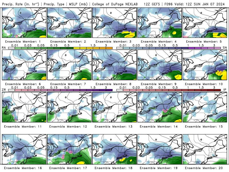
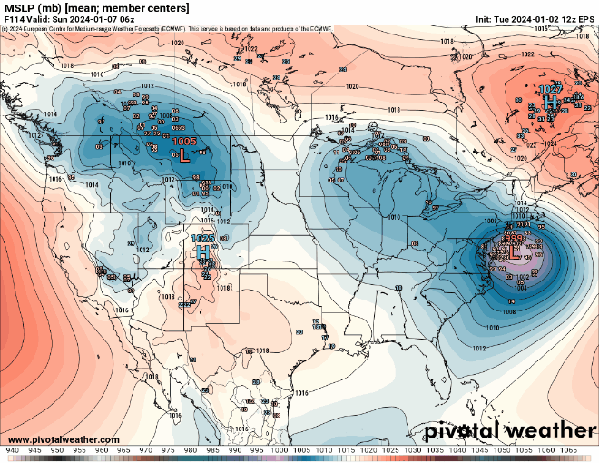
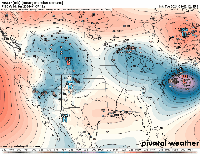
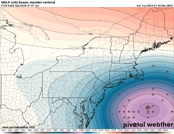
12Z GEFS members. Still several good looks.
HR 114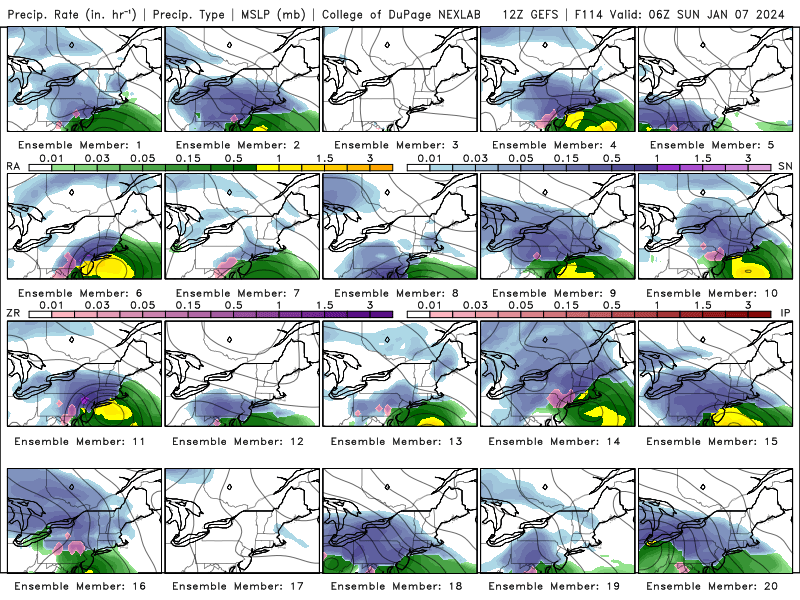
HR 120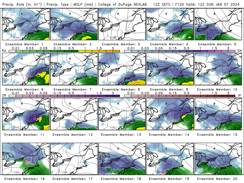
-
1 minute ago, NEG NAO said:
huh ? compare the Canadian with the GFS at 12Z
four model runs feel like a day. But the Canadien has been more consistent than the GFS and Euro north since Yesterday.
-
-
If these trend persist this will be a huge victory for the Canadien model which has been the north solution for days
-
2
-
-
Just now, Franklin0529 said:
Writings on the wall with this one. Unfortunately city east won't get much of anything. The high is retreating to quickly. These usually don't come back south
Trend is not our friend but these things tend to wobble in both directions.
-
1
-
-
2 minutes ago, Stormlover74 said:
Cmc and gfs are pretty similar. Just north of Driscoll bridge and nw of 95 6"+ but quickly drops off to nothing
CMC is much better for the coast than the GFS. Low is farther off shore and temps are 3 degrees colder.


.png.9a77786ddd193663ddefdcca447cfb37.png)


Two Mdt to high impact events NYC subforum; wknd Jan 6-7 Incl OBS, and mid week Jan 9-10 (incl OBS). Total water equiv by 00z/11 general 2", possibly 6" includes snow-ice mainly interior. RVR flood potential increases Jan 10 and beyond. Damaging wind.
in New York City Metro
Posted
Seems to me that the Canadien is the outlier now with a much stronger storm. Difference between the Icon, GFS and Euro is the placement of the low.