

mannynyc
-
Posts
390 -
Joined
-
Last visited
Content Type
Profiles
Blogs
Forums
American Weather
Media Demo
Store
Gallery
Posts posted by mannynyc
-
-
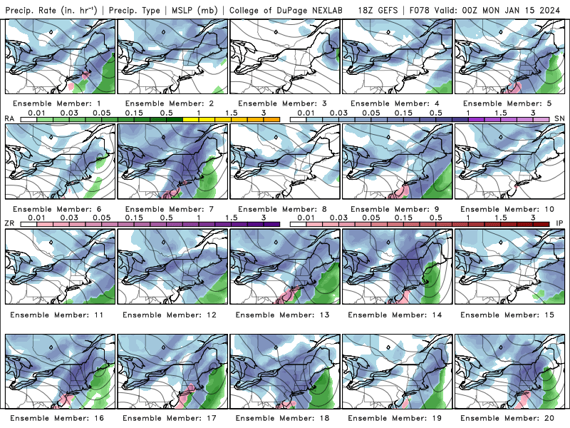
Sneaky snow shot on the 14th. Something to watch.


-
 1
1
-
-
-
-
-
3 minutes ago, snowman19 said:
Barely, nothing at all like yesterday. I thought this was the risk, suppression, OTS, not hug or inland run/cut. Same risk for 1/20 IMO
-
 2
2
-
-
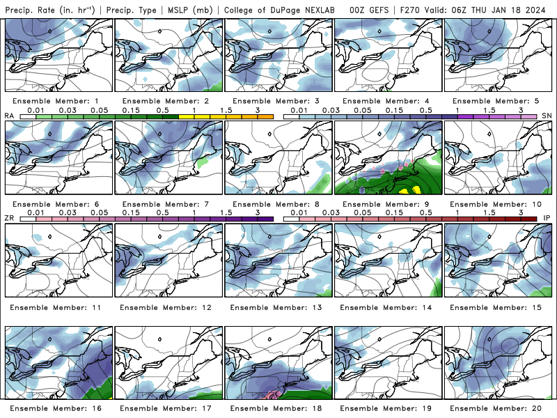
The system on the 16th is not a cutter on the Euro. A cutter has the low go over the great lakes and the Euro system doesn't do that.
-
1
-
-
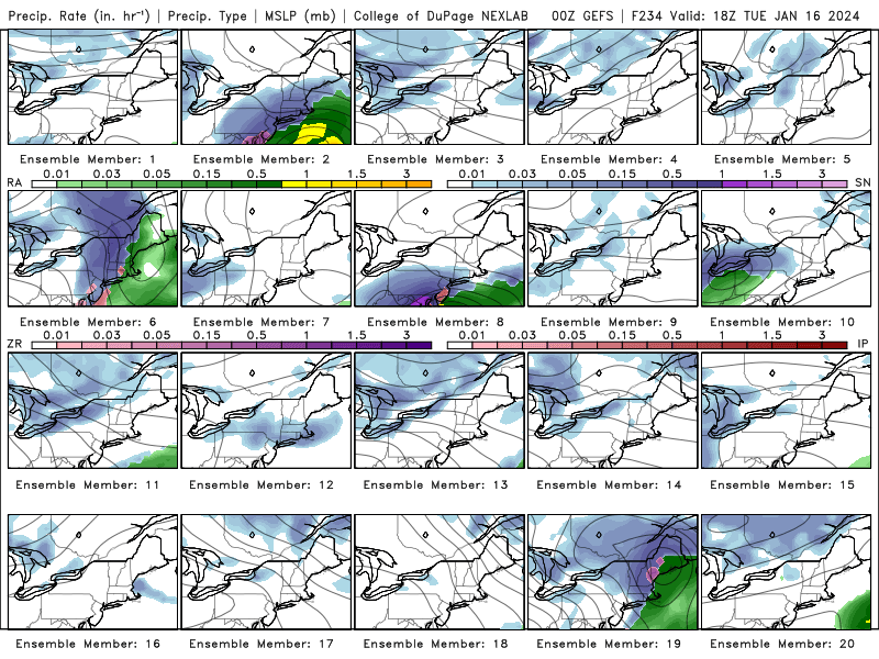
January 16-18 looks interesting deep in the long range, GEFS ensembles not picking up on any serious coastal threats for the 13th it seems
-
1
-
-
Just now, RU848789 said:
Central Park with only 0.2"? Does anyone on this board live anywhere near there to verify that? Thought I saw reports of it snowing there much of the day and people seeing some accumulation. I get the UHI, but that's crazy.
I live in lower Manhattan and that sounds about right. Nothing accumulated except on grassy surfaces, cars weren't even getting snow.
-
26 minutes ago, HVSnowLover said:
The Wed storm may be a huge problem for the interior if they are getting 12-18 inches of snow tonight followed by that kind of rainfall.
If the interior does well tonight does Wednesday start trending colder? (Not that it will make a huge difference)
-
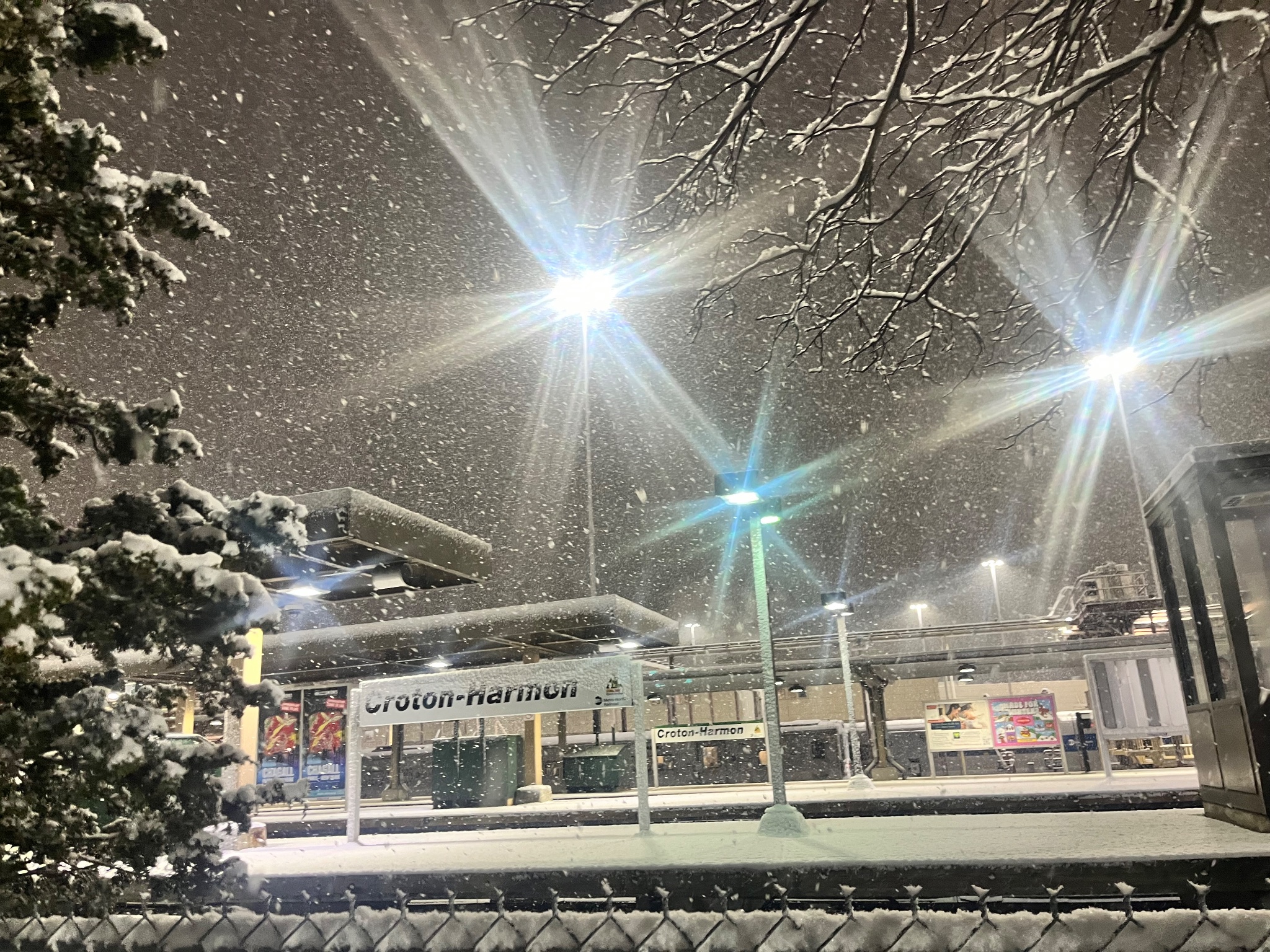
From Croton-on-Hudson earlier in the evening
-
5
-
-
Taking Metro North from Croton Harmon back the city, really amazing the differences in snow between Yonkers and Riverdale.
-
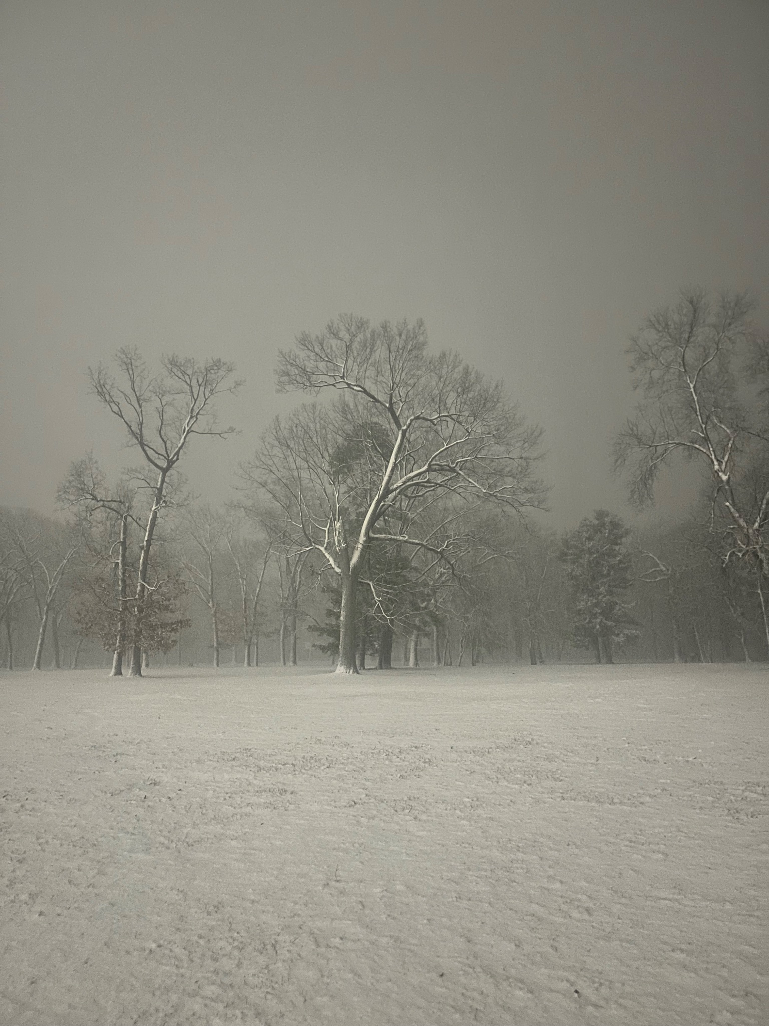
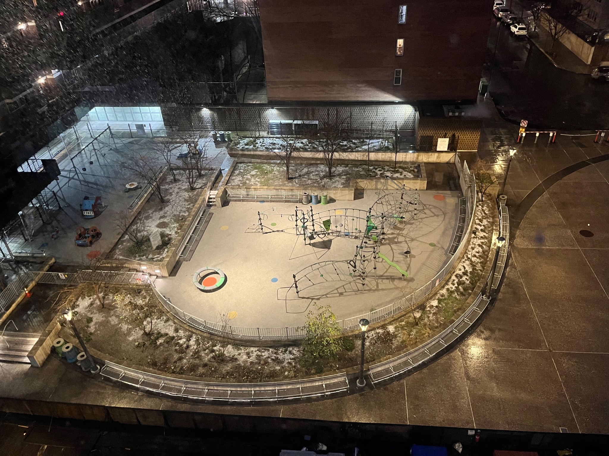
Park over my apartment in lower Manhattan.-
2
-
-
-
https://twitter.com/NWSNewYorkNY/status/1743750337817878719?
"Here are the latest snowfall totals at our climate sites as of 4pm EWR - 0.1 JFK, LGA, Central Park - T BDR, ISP - 0"-
 1
1
-
-
Here's a look at the rain snow line, just south of Staten Island-
3
-
-
Rain/snow line appears to be just south of Staten Island
-
Just now, Bxstormwatcher360 said:
Heavy echos overhead = snow sleet. The radar is exploding rn btw. Heading to the nyc metro in the next half hour
Going to be a battle, if it comes down heavy enough CPK could stay snow
-
Down to 35/29 in CPK per obs.
-
37/24 per latest obs in Central Park
-
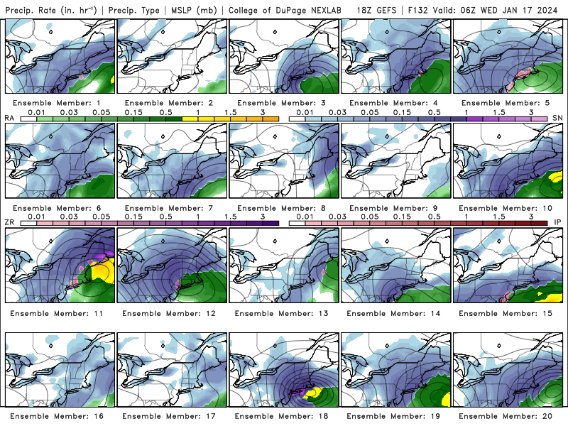
Something to watch (this is 8PM tomorrow night).


-
1
-
-
GFS is west for second wave it appears
-
1
-
-
RGEM also moved southwest so a good trend even if the snow map didn't change.
-
1
-
-
-
3k NAM real nice front end thump


Potential extensive winter event, I-95 west and with again a chance for NYC first inch(es) of snow Mon or more likely Tue Jan 16, 2024 (serves as OBS thread as well)
in New York City Metro
Posted
Nope, just develops the storm later