MocoMike
-
Posts
20 -
Joined
-
Last visited
About MocoMike

-
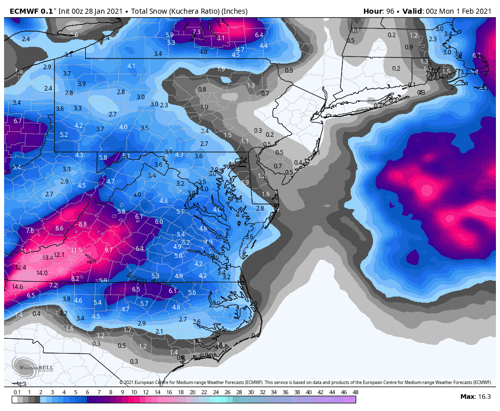
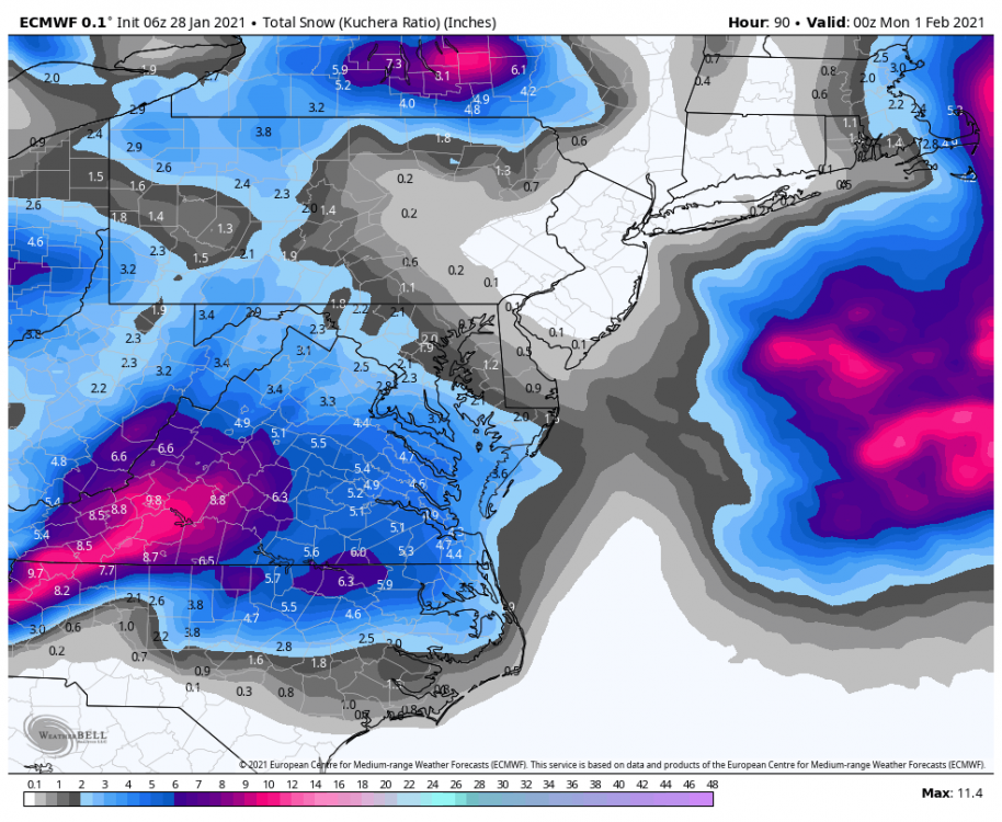
Light snow in NW DC, Dupont Circle, dusting
-
Ok cool. I was like...what am I missing?
-
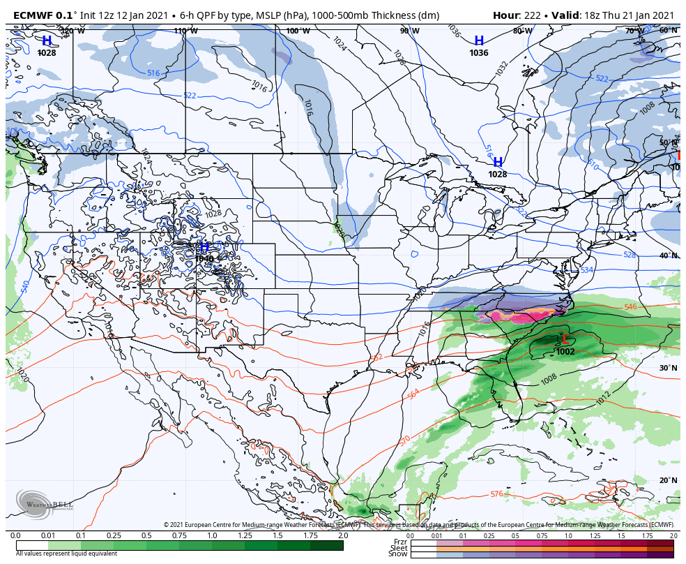
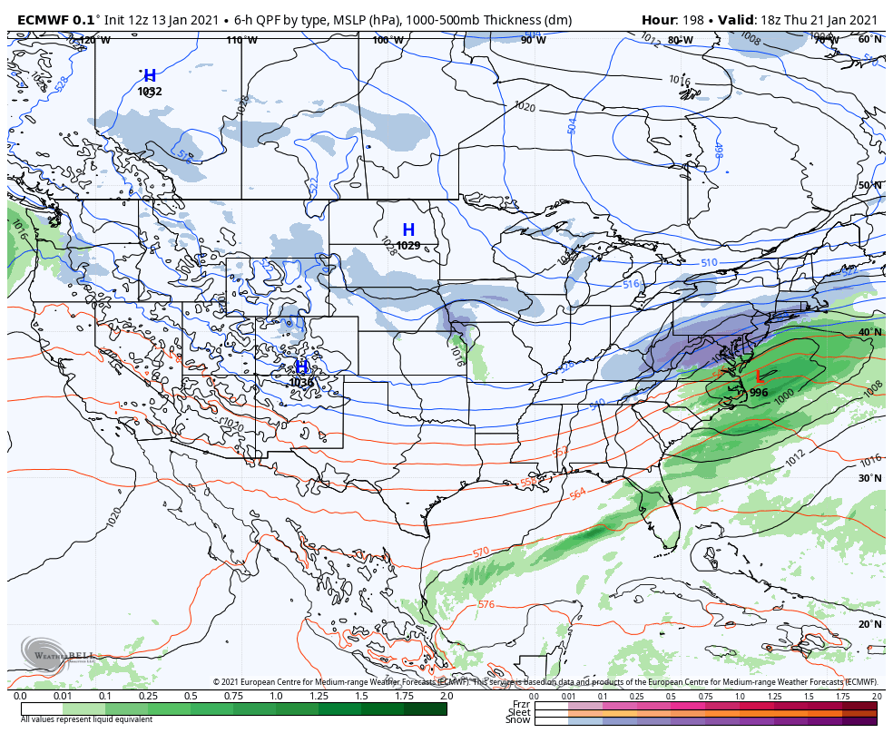
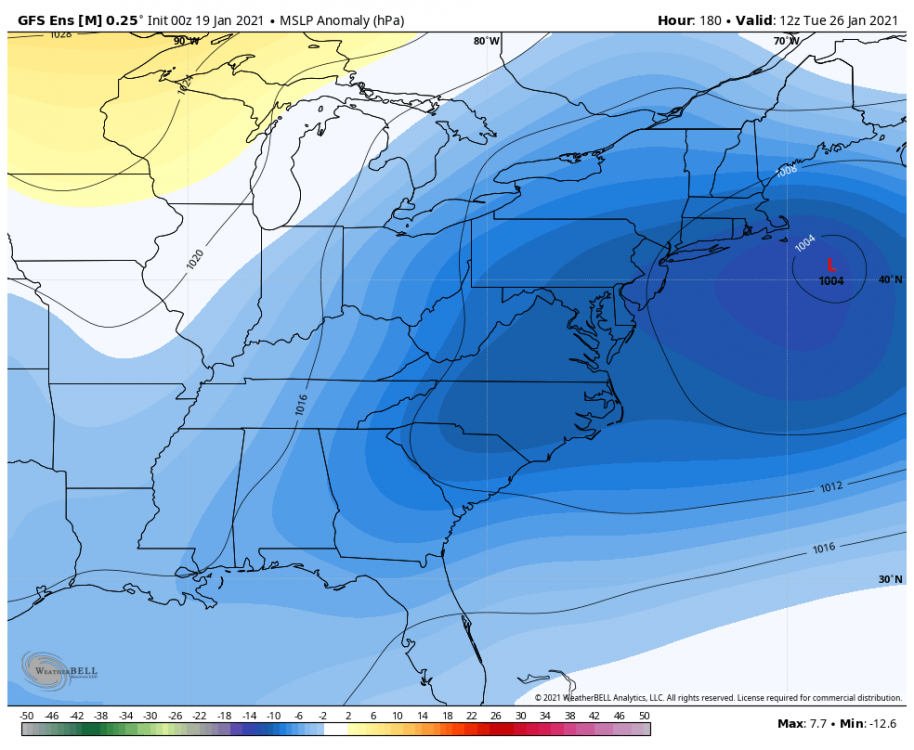
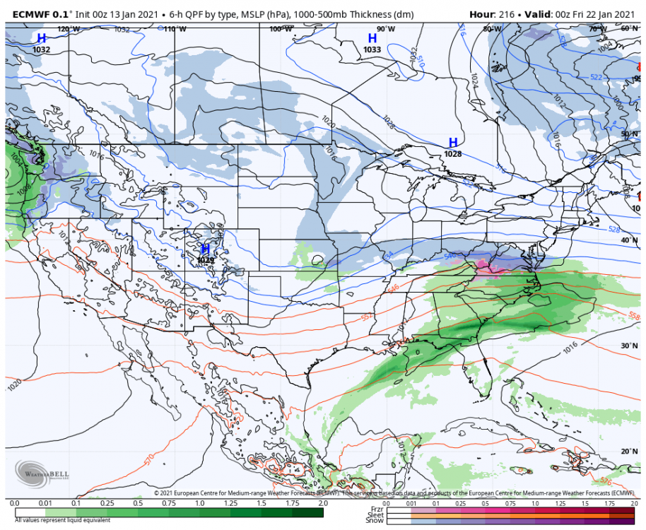
0z v 6z


-
I thought the thump looked more suppressed than 0z
-
Feb Long Range Discussion (Day 3 and beyond) - MERGED
MocoMike replied to WinterWxLuvr's topic in Mid Atlantic
6z GEFS looks south when comparing to 0z for 26/27th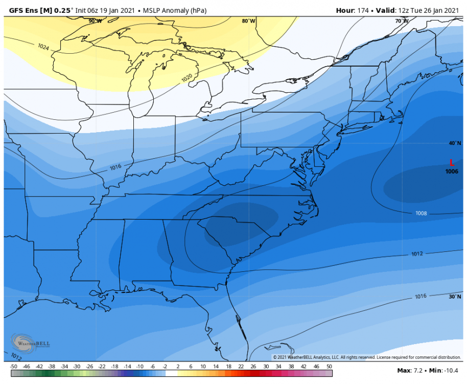
-
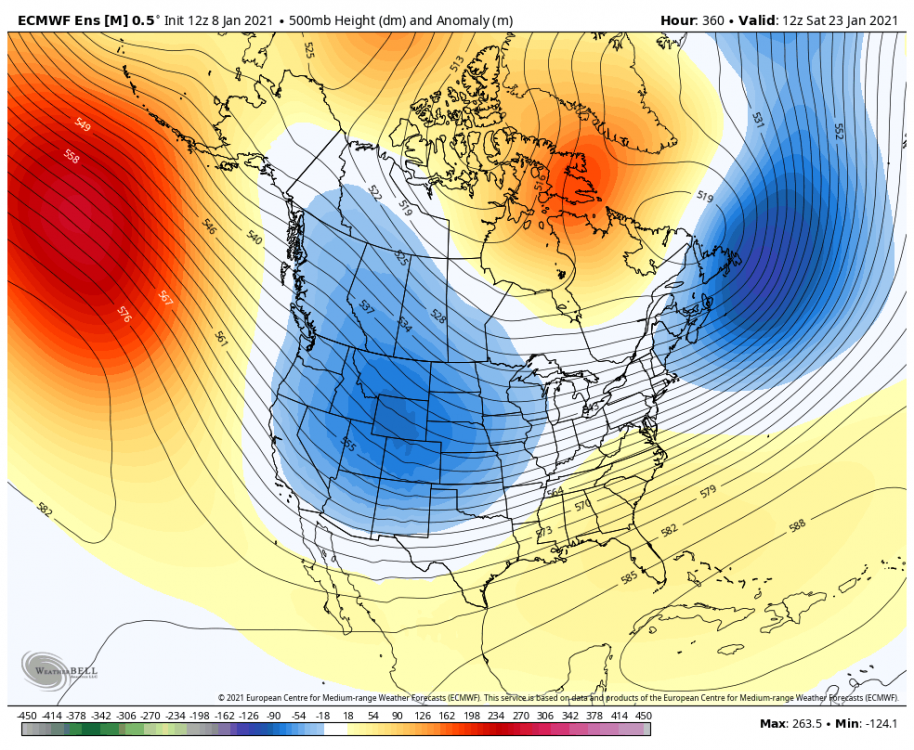
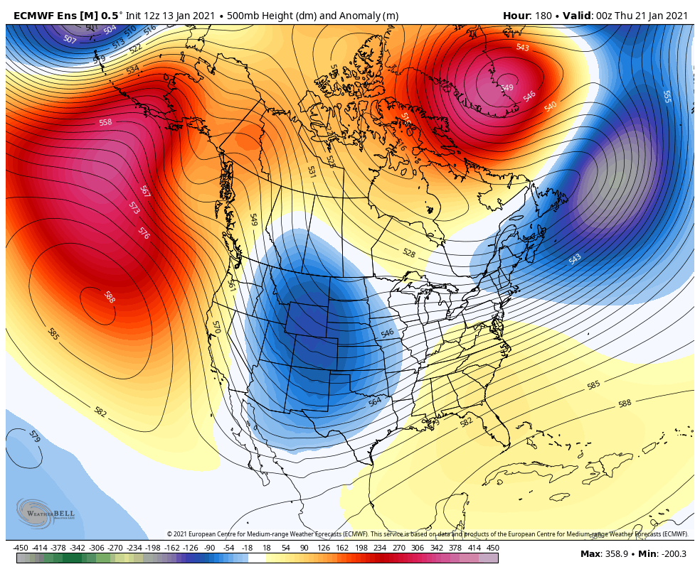
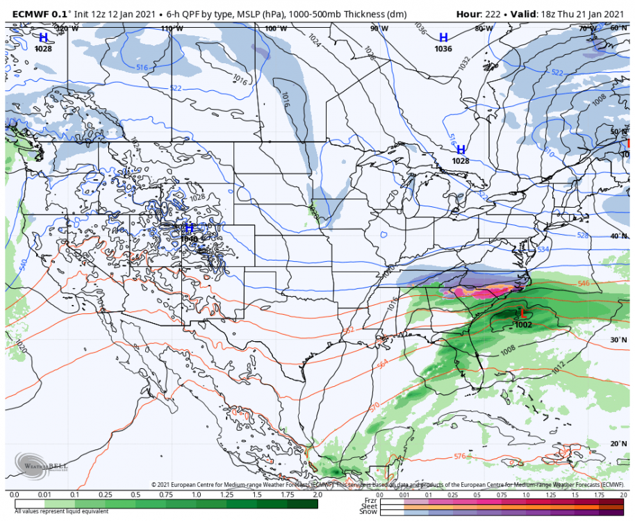
Does the SER ahead of this system keep it from being suppressed? When I look at this, I think it is going to cut. Thoughts?

-
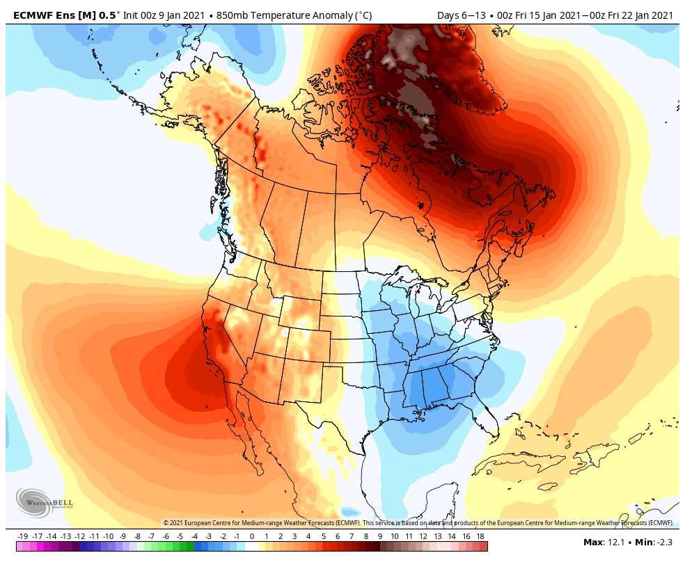
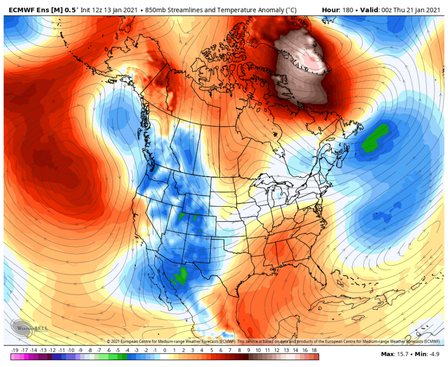
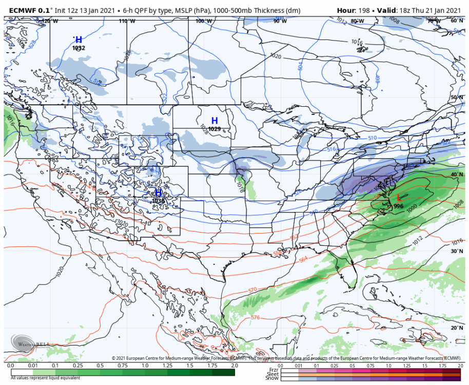
Last 24 hours of the Euro....Does it keep trending and go to our north or does the block do it's work?
-
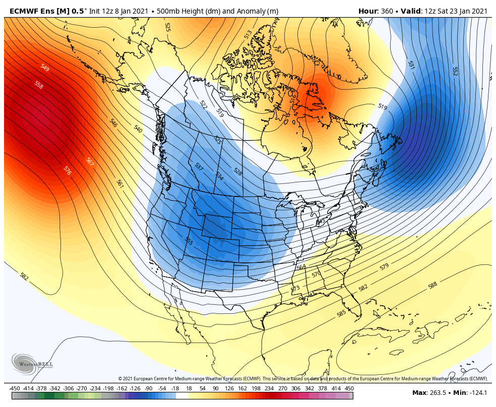
Hmm...from what I can tell, it did not. It actually looks a little better in the Pacific than 0z, no? 0z v 12z

-
Um yeah. I thought the same thing! If you are looking for increased chances of at least seeing some snow (far better than what we have seen recently), it looks great!
-
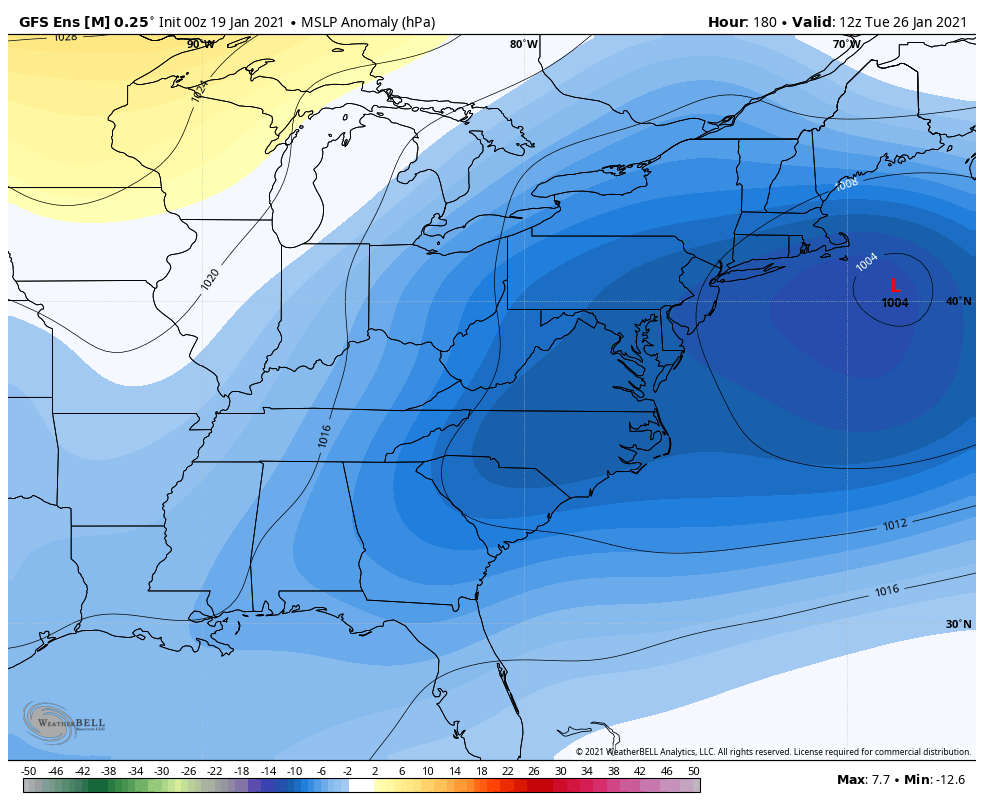
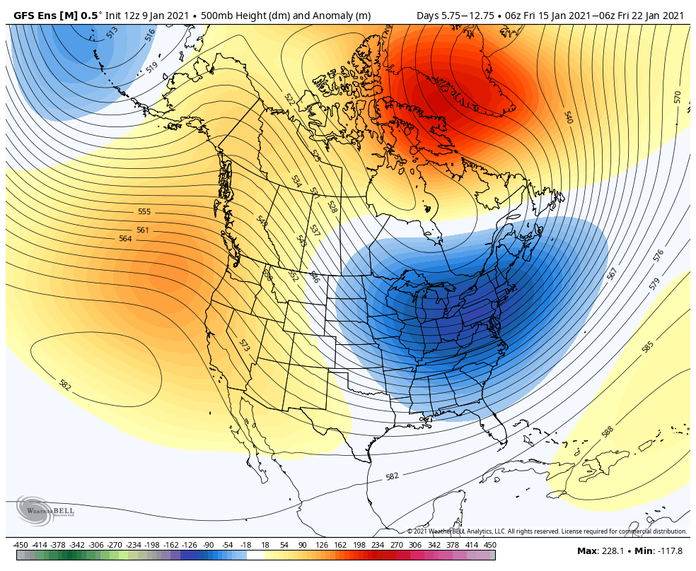
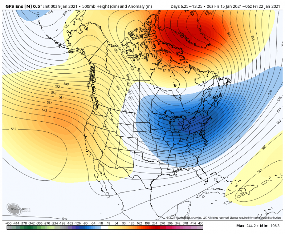
Love the retrograding L to the north on the GFS...interesting look lol
-
I would agree with this...and was also thinking the GEPS was leaning more toward the EPS than the GEFS with the long range. I’d imagine a compromise in the middle could be possible....I also wonder if that period is more questionable given we would be approaching the period for impacts, if any, from the SSW?
-
-
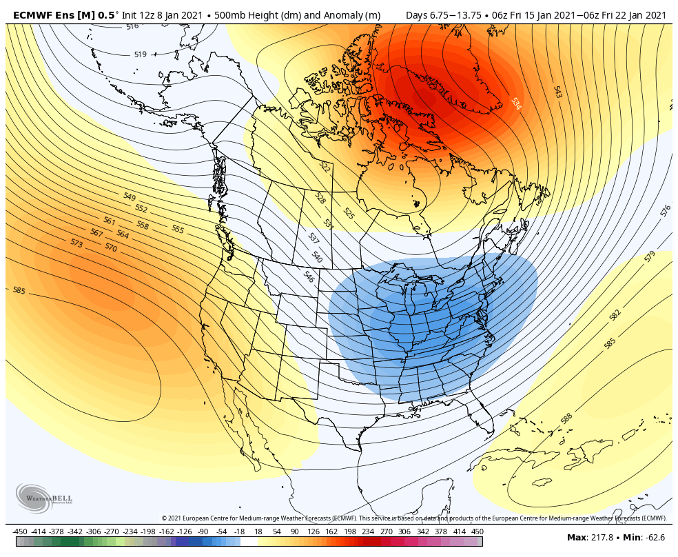
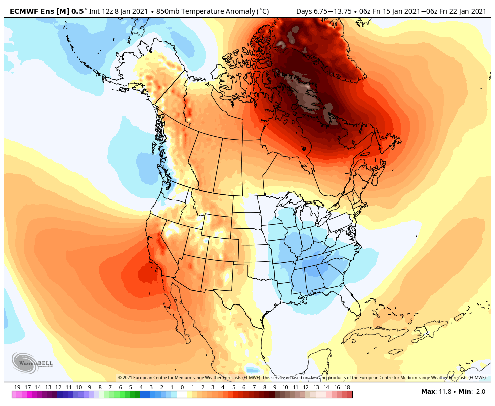
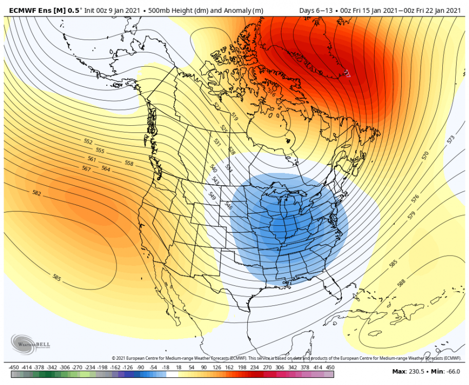
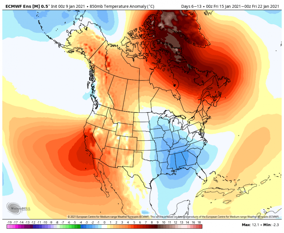
You can see the EPS moving toward what PSU was mentioning with the ridge in the Pacific retrograding, the NAO weakening, and the trough dumping in the west with a SER popping...