

greenmtnwx
-
Posts
572 -
Joined
-
Last visited
Content Type
Profiles
Blogs
Forums
American Weather
Media Demo
Store
Gallery
Posts posted by greenmtnwx
-
-
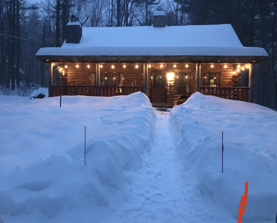
18 minutes ago, amarshall said:
In lake placid for a kids hockey tournament. Same scene.
.My son has on played in that a half dozen tines, no better place.
-
 2
2
-
-
10 minutes ago, ORH_wxman said:
Here's a map I just found of average leafout dates.....dark blue is the earliest while the yellows/reds are much later. You can see how late the Cape is (on par with NNE mountains) but areas further west on the south coast in CT are not.
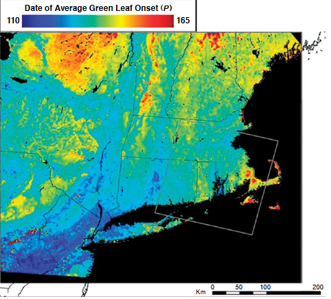
Man that’s nuts how late the cape is
-
2 hours ago, 40/70 Benchmark said:
I not trying to validate my ego, he is. I'm merely trying to validate my integrity and establish fact from fiction.
No surer sign of an ego in distress than the need to spend time seeking validation via the invalidation of others.
Listen you got a little twisted last winter due to your December forecast. Just settle down this year. It’s just weather.
-
 1
1
-
-
NYC won’t get more than .5”
Radar is broken and dissipating and that overnight low rain from RGEM etc is a unicorn. At best scattered showers and unsettled through tomorrow morning.
Where’s Forky? Can’t win them all lol.
-
1
-
-
1 hour ago, SnoSki14 said:
Many places are having the hottest and/or driest July on record.
Driest yeah, the heat, ehh.
-
 1
1
-
-
This summer has been very dry, last 4-6 weeks, but it hasn’t been oppressive heat. Quite nice actually aside from a few torrid days and very few triple H days. Today and tomorrow actually glorious summer days. Been so many deep blue sky days.
-
16 minutes ago, klw said:
Not as fat but the bear at the Mount Washington Hotel remains my favorite bear photo:
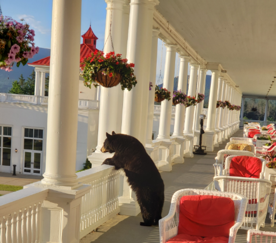 On 7/17/2022 at 8:30 PM, powderfreak said:
Biggest I’ve ever seen easily. 3-4 feet tall when on all fours and it’s stomach pretty much went to the ground. Paws were massive mits.
I read the black bear in Eastern US can get up to 500-600lbs? Seemed like a lot but this guy was at least four bills.
Sort of crazy though to have some 400+ pound wild animal wandering in your backyard. This one was on another level… no adolescent mischief. I was going in his direction and he wanted to pass me, so he just sat down while trying to figure out what to do, ha.
Walked away along the field edge, but passing by. Felt like a zoo animal was loose in the backyard.


Black bears here in NJ and the Poconos can get to 800+ lbs. I’ve had several 600+ in my yard this year.
-
2 hours ago, CIK62 said:
How do you spell Heat Wave?

please stop posting that ridiculous thing.
-
 2
2
-
-
10 hours ago, forkyfork said:
your nearest asos is running +1.4 so far this month against the warmest normals we've ever had. that's a summer of yesteryear?
Very mild summer. No heat, great breezes. Been beautiful.
-
1
-
-
7 hours ago, MJO812 said:
68 degrees here in the Poconos
It is so quiet up here
Wife and I rented a cabin for the week
I'm going to the Poconos again next month lol. Might as well buy a cabin lol
I’ll sell you mine lol
-
Absolutely no heat so far this summer and none in sight.
-
1
-
-
If long range is right time is gonna start slipping away on this summer. 72 at 1pm full sun in late June. Not heat next couple weeks puts us well into July. By August it obviously can be hot but some of the sting is taken out and thoughts turn towards school and fall. Heat has about a 6-7 week window right now and it don’t look great.
-
2
-
1
-
-
3 hours ago, donsutherland1 said:
The latest brief taste of spring that saw temperatures rise into the 70s under bright sunshine today will be a fleeting memory.
A coastal storm will bring rain, gusty winds, and cool temperatures to the region beginning tomorrow through Saturday. A general 0.50"-1.50" rainfall with locally higher amounts appears likely. The temperature could rise no higher than the lower 50s on Saturday.
Overall, the first 10 days of the month will probably feature a cool anomaly with temperatures averaging 2°-4° below normal.
During the 1991-2020 period, the April 25-May 5 period saw temperatures average 1°-2° below normal when strong blocking coincided with Niña conditions, as had been the case this year. However, the blocking has now come to an end.
Following such blocking cases, approximately 50% of such cases went on to see a warmer to much warmer than normal second half of May. The breakdown of blocking increases prospects for a warmer second half of the month and an overall warm monthly outcome. Some of the long-range guidance suggests that a dramatic and sustained shift to a warmer regime could develop after May 10.
The ECMWF seasonal forecast indicates that the summer will be warmer than normal throughout the region and across much of North America.
The ENSO Region 1+2 anomaly was -1.9°C and the Region 3.4 anomaly was -1.1°C for the week centered around April 27. For the past six weeks, the ENSO Region 1+2 anomaly has averaged -1.30°C and the ENSO Region 3.4 anomaly has averaged -0.93°C. La Niña conditions will likely persist into the start of June.
The SOI was +14.27 today.
The preliminary Arctic Oscillation (AO) was +1.955 today.
On May 3 the MJO was in Phase 1 at an amplitude of 0.625 (RMM). The May 2-adjusted amplitude was 0.194 (RMM).
Surprised at your forecast a bit Don. Seems light on precip. Models indicate a widespread 1-3” of rain and we know how wet these recent storms the last few years can be.
-
1
-
-
I would have thought the Subaru would have been official car of VT. Complete with a Coexist and I’m with her sticker.
-
1
-
-
-
1 minute ago, PhineasC said:
Don't like the posts, don't read them. You don't need to keep playing board daddy scolding everyone, you know. LOL
On your period Phin? Lol.
-
1
-
-
1 hour ago, snowgeek said:
Loved Big Sky. Went in 2018. I heard they are charging extra for the tram now? Hate that idea! Is it true?
It is true. $80 I believe it was. Biggest reason, trying to keep the jokers off of it. Not meant for most.
-
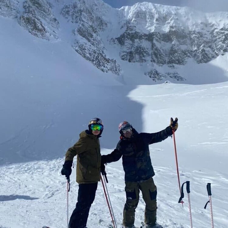
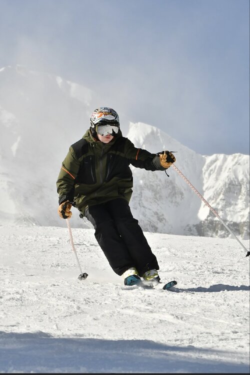
Big Sky MT
-
5
-
-
Greetings from Big Sky, MT

-
9
-
-
I usually give them credit but terrible job by NWS in NJ and Eastern PA on this one. Out to lunch.
-
NWS out to lunch here in NJ. They have WWAs up for the souther half of the state when this is just the opposite, a northern half moderate snow event.
-
5 hours ago, PWMan said:
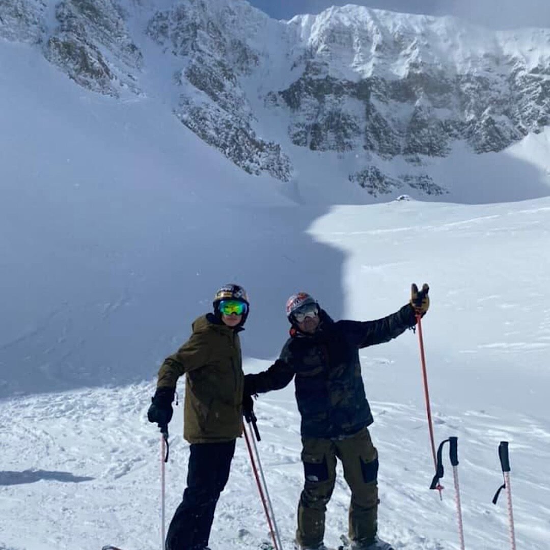
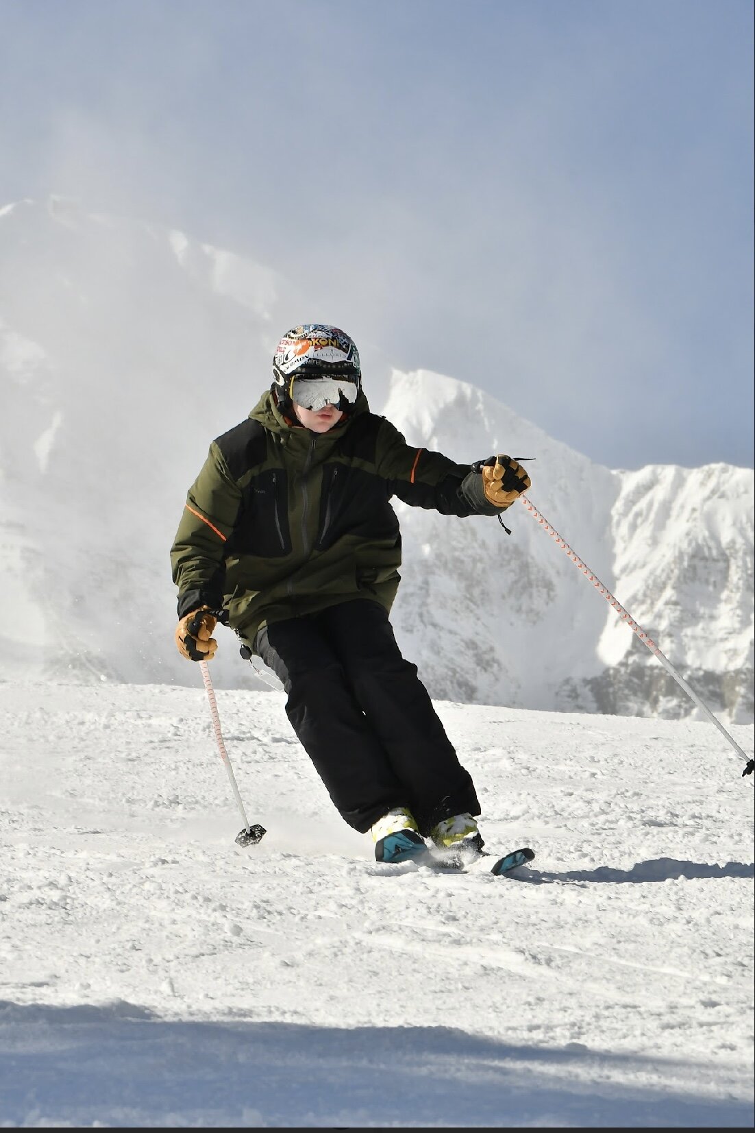
Almost afraid to say this out-loud in here, but I'm hoping for a pattern shift since I'm heading out to MT on the 19th for skiing and snowmobiling with family. They've had quite a snow drought after a good start to the season, and the next 7-10 days look like a continuation of very mild and dry conditions out there. The saving grace in the Rockies is that they don't generally get wet Grinch storms that wipe everything out....
I’m headed to Big Sky 15-21 and was hoping for the Western trough
-
Any thoughts on the southern green ski resorts: Stratton, mt snow? I know a lot of people headed up this weekend. Drive up Friday doable and they mostly snow?
-
Any thoughts on the southern green ski resorts: Stratton, mt snow? I know a lot of people headed up this weekend. Drive up Friday doable and they mostly snow?


November 2022 OBS/DISC
in New England
Posted
That se ridge fear really starting to rear it’s head. Trough to Cabo?