

Dabuckeyes
-
Posts
262 -
Joined
-
Last visited
Content Type
Profiles
Blogs
Forums
American Weather
Media Demo
Store
Gallery
Posts posted by Dabuckeyes
-
-
Zzzzzz
-
2 minutes ago, Ji said:
Do we need to worry that colder solutions are due now to storm is getting flatter due the se ridge getting flatter?
I don’t want some 2-4 all snow bsYes, always worry…
-
8 minutes ago, NorthArlington101 said:
barring getting lucky with some sleet/ice on the 5th/6th seems clear we’ll still be snoozing for a while… but do love seeing the EPS keep lighting up at range.
Dry af
-
 1
1
-
-
1 hour ago, mitchnick said:
850s start and stay nice thru most of storm. Lot of precip.
GFS 12z with a similar system. Slightly warmer.
-
 1
1
-
-
8 minutes ago, mitchnick said:
12z Gem won't look like the 0z unfortunately.
In honor of the legend…

-
2
-
 3
3
-
-
Euro AI is not gospel by any means (yet). It was pretty jumpy prior to the last 24-36 hours. Even now, it’s still moving certain features around. It very well could be right come game time, but for now it’s silly to jump ship at hour 180
-

Gotta show the GFS too -
33 minutes ago, CAPE said:
Drinking a DFH Fruit-full Fort. Good stuff. 16% typical. Great sipper with complex dark fruit notes. Puts you in a great place, much like drinking a 120.
Wait….so the Dewpoint Fahrenheit Humidity is 16% at hour 120?
-
But is the 3K good? Haven’t heard about the 3K
-
7 hours ago, A-L-E-K said:
give me the euro zzzzzs over what the gfs is selling
Live look at your keyboard

-
1
-
5
-
 1
1
-
-
13 minutes ago, psuhoffman said:
GEFS finally starting to show a snowy signal day 10-15
Need a Weather Will WB map or it doesn’t exist.
-
Serviceable 12z runs for most of the region
-
1
-
-
45 minutes ago, yohan said:
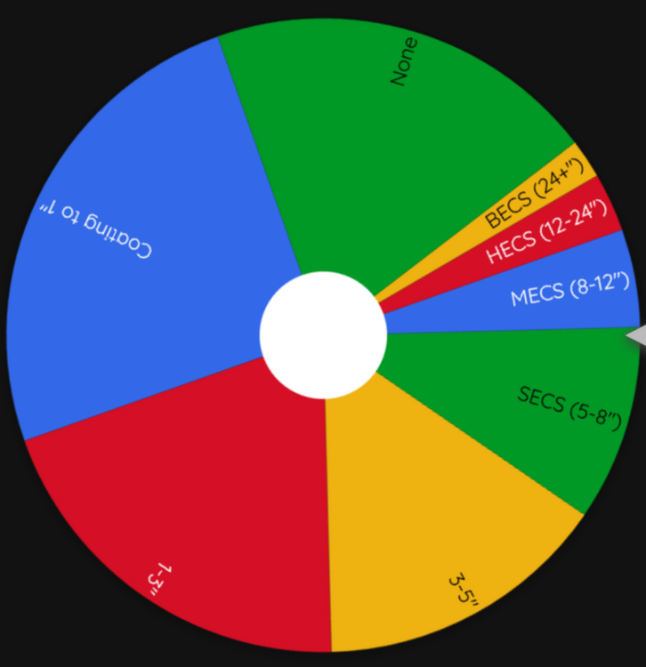
spin once and got SECS

-
7
-
-
7 minutes ago, Weather Will said:
Disappointed that I let myself get sucked in by the global models which are not worth a grain of salt outside 5 days. I will only post ensembles outside 5 days moving forward. Too much hype and false hope otherwise....
You gotta watch out for those WB models, they’ll get ya.
-
2
-
-
We were forecasted 1-3” in Columbus, OH. We are at 6” and counting. Banding made a huge difference. My point is you can’t trust the models completely.
-
15
-
-
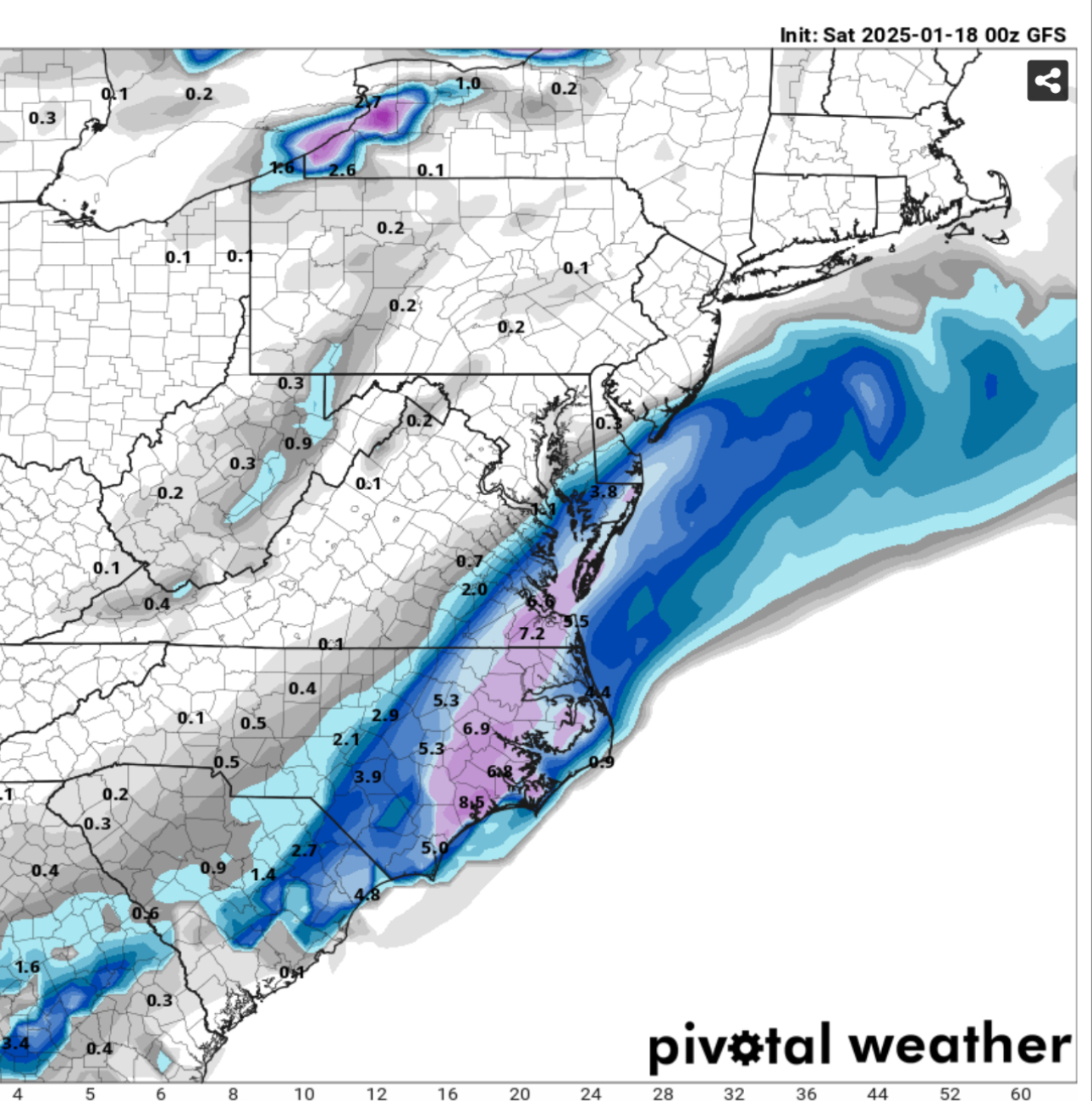
Exit stage right or does she come up the coast?
-
Banana High there? Looks like a great setup
-
4 minutes ago, Ji said:
Gfs
Cmc

Sent from my SM-A515U using Tapatalk
Pour North Dakota
-
1
-
-
9 minutes ago, MDScienceTeacher said:
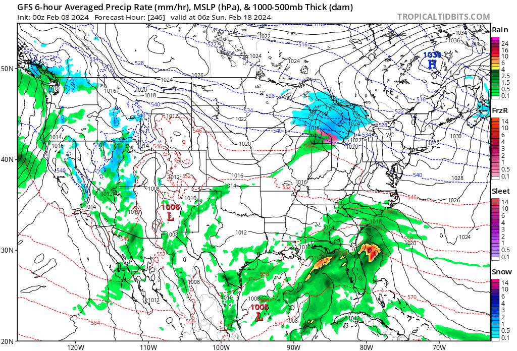
Um guys.. not sure if anyone is getting this faster.. but the GFS looks like it might go off again.. could be wrong. but that 1039 HP isnt really budging.

Not enough CAD to make that work this time around
-
Temps crashing at that point. Still in the mid 30s but rates could overcome
-
10 minutes ago, nmyers1204 said:
Or a happy ending

You rang?
-
3
-
-
Zzzzzz
-
1
-
-
1 hour ago, psuhoffman said:
I do not think Feb 1-10 will be a no hope torch. But, the pattern progression is being delayed by the slow down of the Pacific forcing migrating east. It's stalling in the western pacific for about a week. This is leaving us in kind of a blah pattern in early February. I could see an STJ wave cutting under and enough cold around with that PNA ridge to get something to work if we're lucky. But the PNA ridge looks rather modest now, and the +++NAO is likely going to make it difficult to be cold enough until we get the more ideal pacific, and its likely a moot point anyways because once the wave starts to progress into the central pacific it kick starts the process of tanking the NAO again anyways. We're likely looking at Feb 10-15th or so before the pattern gets REALLY good again.
I know this is not what anyone wants to hear, patience isn't the best virtue of some here, but Mid Feb is NOT too late to pull out a good finish. 1958 really got going mid Feb. And before someone says but its warmer now...2015 got going mid Feb too and that was not that long ago. You know I will lean on warming when I think its a part of the equation, but Feb and March are being affected by warming way less that earlier in winter...assuming the waters ever do cool...right now places in the tropical Atlantic are running normal temps for July FFS.
Ji, this is only two paragraphs. Are you cool with that?
-
2
-
-
1 minute ago, Ji said:
i need a 3 paragraph post from PSU about February
Use chatgpt
-
2
-


The Ledge Storm 19-20 Feb
in Mid Atlantic
Posted
Very similar to 6z run so far