

MarkO
-
Posts
3,337 -
Joined
-
Last visited
Content Type
Profiles
Blogs
Forums
American Weather
Media Demo
Store
Gallery
Posts posted by MarkO
-
-
20 minutes ago, alex said:
The Woods is open!
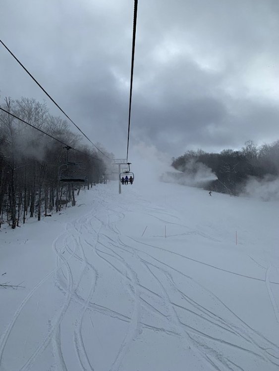
damn, that just looks brr... Looking forward to the new gondola and spending more days at the Woods this winter!
-
29 minutes ago, Hitman said:
Sugarbush bought by Alterra. No change to icon pass status this season.
Heard about that today. Kinda sad, but I guess it's a sign on the times. One of my all-time NE faves.
-
-10F, 80MPH sustained, gusts to 100, wind chill in -50's. That's pretty impressive for mid November.

-
 1
1
-
-
2" in Thornton as well. First flakes in Lowell as precip comes to an end.
-
After 1.5" snow yesterday, it appeared to flip to -ZR before back to snow. MWN profile shows the mid level warming has gone back under 32. 34.5/33 in Lowell.
-
Lowell 45.2/41, Thornton 30.4 1.5"
-
flipped to snow now. 33.2 Accumulating, unfortunately heading back to Lowell where it's 48
-
34.8 pelt. Temp slowly dropping
-
Only a dusting on top of a glaze at the cabin.
-
Temp down to 34.3 from a steady 36 about an hour ago. Rain mixing with snow according to the webcam.
-
I see vast improvements and more likely scenario with the latest model runs. That long strung out southern/northern confluence is hard to do. Usually there's one concentrated storm center (right?). I think it's only going to improve into more of a Miller B. Wiener, I mean confidence growing.
-
How do new members sign in?
-
2 hours ago, Damage In Tolland said:
Euro hit us good this week. That worked out how?
I guess they’ll say that’s also a meltdown post
Best threat we've had so far. Lot of model support sans FV3 lol
-
NAM definitely has more of a Miller B appearance than a wave.
-
Didn't we have a similar event last October around the 28th? I skied Wildcat where they got between 12-18". I think it was mainly an elevation event.
-
Kuchera humor

-
3 hours ago, LaxSki said:
It sure has.. I think I see 2 pair of rear entry boots
You said "rear entry".

-
3 hours ago, Sugarloaf1989 said:
Cannon also making snow.
Wildcat, Sunday River, and I'm sure a few in VT as well. If Bretton Woods or Wildcat open next weekend, I'm there. Cannon has a set date of Nov 23rd.
-
I'm sure this has been discussed. No
 support form GFS though :/
-
Yeah, Killington pounded all night. Still going strong. Noticed a bit of an inversion at MWN, but probably not enough to curtail operations. With the low dew's I wouldn't be surprised if Killington (and Sunday River too) blow snow all day/night. Good snowmaking weather continues into next week. Expect some resorts to open. I think Killington maybe as early as tomorrow.
-
GFS doesn't have to operate at a profit and I believe that is the main difference between it and the ECM.
-
1
-
-
I recorded a low of 28.60" in Lowell, seems a little low?
MWN had snow last night, but warmed up to produce rain. Looks like they should be flipping back to snow based on the soundings and current temp of 32.7F
-
First real gust just came through at 25 mph, pressure down to 29.12". I don't think I've ever gone below 29 here in Lowell.
-
5 hours ago, 40/70 Benchmark said:
I think it would be good for winter as a whole, but it could mean a slower start, too. But el nino is far from a given, as Will said. My point last week was just that it remains a plausibility.
Doesn't Modoki-weak Nino generally translate to above average snowfall for NNE, near average for CNE, and below average for SNE? Last year played out that way.


November 2019 discussion
in New England
Posted
Looks like snow has made it down to about 1500' in the Whites. Still raining at the cabin but 33.5F. MWN temp profile shows above freezing up to about 3500', but marginal (32-33) .