ORH_wxman
-
Posts
90,902 -
Joined
-
Last visited
Content Type
Profiles
Blogs
Forums
American Weather
Media Demo
Store
Gallery
Everything posted by ORH_wxman
-
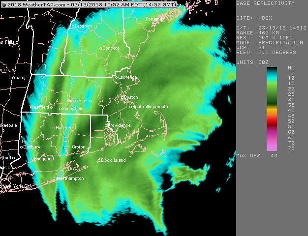
March 12/13/14 Blizzard/Winter Storm/WWA etc
ORH_wxman replied to Bostonseminole's topic in New England
Yeah there's gonna be some 20-burgers in N RI. -
March 12/13/14 Blizzard/Winter Storm/WWA etc
ORH_wxman replied to Bostonseminole's topic in New England
This helps make up for March 2013 in RI: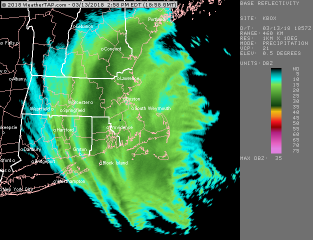
-
March 12/13/14 Blizzard/Winter Storm/WWA etc
ORH_wxman replied to Bostonseminole's topic in New England
Jack is gonna be SE ORH county to NW RI I think...ORH up through 495 northeast will be pretty close, but prob a bit less. But we'll see....that 495 band is just absolutely puking flakes and it's moving pretty slow.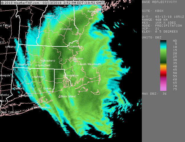
-
March 12/13/14 Blizzard/Winter Storm/WWA etc
ORH_wxman replied to Bostonseminole's topic in New England
It wouldn't surprise me if there were an inch or two tonight from that. The ULL goes right over head too which will help with the snow shower activity. -
March 12/13/14 Blizzard/Winter Storm/WWA etc
ORH_wxman replied to Bostonseminole's topic in New England
There's still solid 700-500 frontogenesis occurring over E MA, so the bands will likely produce for the next several hours. -
March 12/13/14 Blizzard/Winter Storm/WWA etc
ORH_wxman replied to Bostonseminole's topic in New England
Big time snows for 495 to ORH right now. And N RI.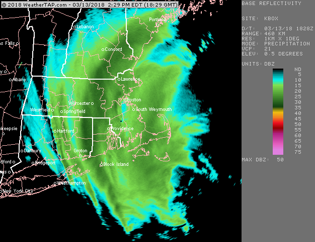
-
March 12/13/14 Blizzard/Winter Storm/WWA etc
ORH_wxman replied to Bostonseminole's topic in New England
Band congealing near and just E of ORH....that is impressive looking....BOS finally getting out of the exhaust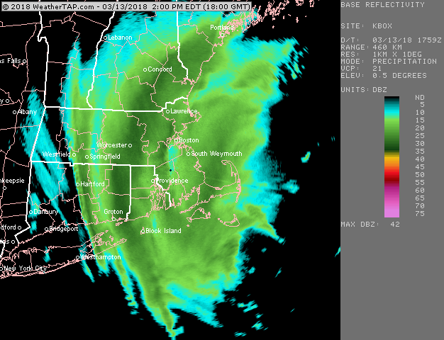
-
March 12/13/14 Blizzard/Winter Storm/WWA etc
ORH_wxman replied to Bostonseminole's topic in New England
ORH band starting to reform a bit eastward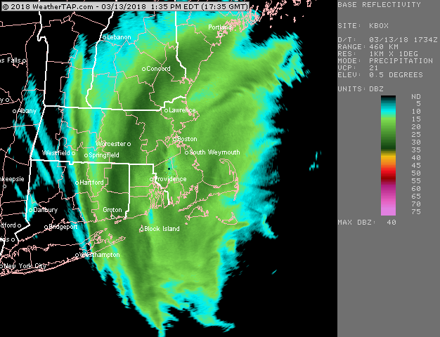
-
March 12/13/14 Blizzard/Winter Storm/WWA etc
ORH_wxman replied to Bostonseminole's topic in New England
Your area is def looking good for the next several hours. The new band forming in metrowest and the ORH/ASH bands slowly starting to move E after the pivot could congeal near you over to Essex county and down toward BOS eventually if things work out right for a good finale. -
March 12/13/14 Blizzard/Winter Storm/WWA etc
ORH_wxman replied to Bostonseminole's topic in New England
Another band is def forming in metrowest now...BOS into a little screwjie for a bit (though it will be temporary)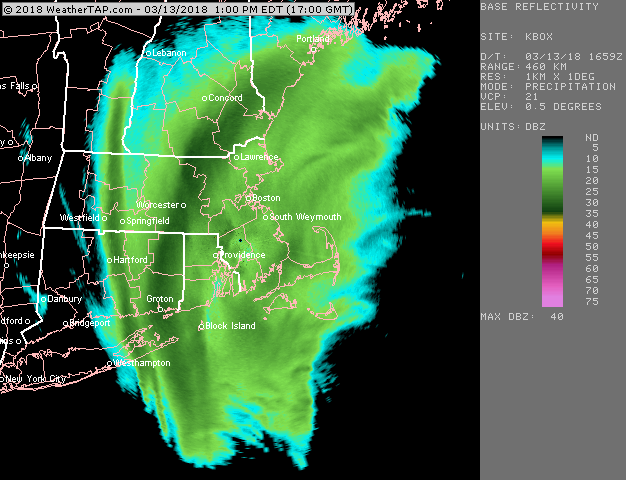
-
March 12/13/14 Blizzard/Winter Storm/WWA etc
ORH_wxman replied to Bostonseminole's topic in New England
When the ORH/Windham county band started pivoting, that screwed you and Kevin's hood....just choking on the exhaust. You may finally get some goodies for a few hours when that collapses....the whole thing is slow to leave, so you could get a few hours of decent rates. -
March 12/13/14 Blizzard/Winter Storm/WWA etc
ORH_wxman replied to Bostonseminole's topic in New England
#IstoleJayKenney'sSnow -
March 12/13/14 Blizzard/Winter Storm/WWA etc
ORH_wxman replied to Bostonseminole's topic in New England
It's already been stationary over central areas for almost 2 hours now...so even if it moves east, it definitely pivoted there. Eastern areas will get back in on the good banding though for sure. They already had a mini pivot earlier mid-morning from that really nasty band before it dissipated. -
March 12/13/14 Blizzard/Winter Storm/WWA etc
ORH_wxman replied to Bostonseminole's topic in New England
So much for the KASH screwjie....pivot pandemonium instead -
March 12/13/14 Blizzard/Winter Storm/WWA etc
ORH_wxman replied to Bostonseminole's topic in New England
Since you asked me earlier for a GYX shot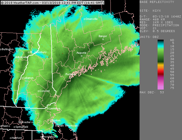
-
March 12/13/14 Blizzard/Winter Storm/WWA etc
ORH_wxman replied to Bostonseminole's topic in New England
Looks like the lower half of the band down in far SE CT is starting to lose longitude....I think the max westward pivot has occurred in ORH and Windham counties...still looks like its trying to push a bit further west up in NH.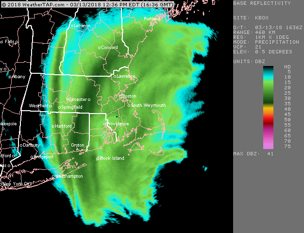
-
March 12/13/14 Blizzard/Winter Storm/WWA etc
ORH_wxman replied to Bostonseminole's topic in New England
About 27 inches. -
March 12/13/14 Blizzard/Winter Storm/WWA etc
ORH_wxman replied to Bostonseminole's topic in New England
14.5" in Holliston now....just cleared out the end of driveway to get back on the road for a weenie drive later. -
March 12/13/14 Blizzard/Winter Storm/WWA etc
ORH_wxman replied to Bostonseminole's topic in New England
That ORH to windham county band has been pounding for over 90 minutes now. There's def another one trying to form again in metrowest now though....we'll see if it blossoms up to previous heights. -
March 12/13/14 Blizzard/Winter Storm/WWA etc
ORH_wxman replied to Bostonseminole's topic in New England
ORH band still pounding but looks like some forcing is translating east now...you can see new elements forming NW of Taunton and N RI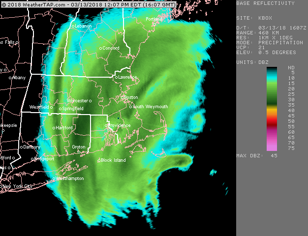
-
March 12/13/14 Blizzard/Winter Storm/WWA etc
ORH_wxman replied to Bostonseminole's topic in New England
Band reformed....ORH finds a way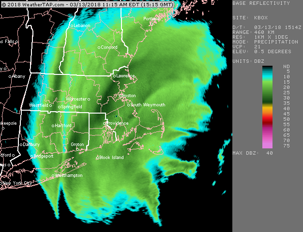
-
March 12/13/14 Blizzard/Winter Storm/WWA etc
ORH_wxman replied to Bostonseminole's topic in New England
Might be even more than that or will be shortly...the band I was in earlier was 3 inches per hour and the woodstock band looks even a bit more intense. -
March 12/13/14 Blizzard/Winter Storm/WWA etc
ORH_wxman replied to Bostonseminole's topic in New England
The poster modfan's old stomping grounds getting destroyed near Woodstock and Putnam. -
March 12/13/14 Blizzard/Winter Storm/WWA etc
ORH_wxman replied to Bostonseminole's topic in New England
Man, windham county getting destroyed right now...band reforming there and looks like expanding up to ORH -
March 12/13/14 Blizzard/Winter Storm/WWA etc
ORH_wxman replied to Bostonseminole's topic in New England
About 3" in the past hour....new one redeveloping in ORH county down to windham county and up into SE NH.