Stormfly
-
Posts
1,574 -
Joined
-
Last visited
Content Type
Profiles
Blogs
Forums
American Weather
Media Demo
Store
Gallery
Everything posted by Stormfly
-
Total bust for us as expected. Not even a quarter inch of rain. Yesterday's activity was much better. And even that was lackluster. Looking forward to possibly the best Labor Day Weekend weather in a while, however.
-
#eventcancel
-
In this region replace ironic with typical. These outlooks bust more often then winter events in this area. Which is good and bad. Bad being that (non weather) peeps are so accustomed to warnings that when a legitimate warning (and absolutely necessary action to protect life/property) occurs, no one will take it seriously. Boy meet wolf. I wouldn't be surprised if there is less activity today then yesterday. Does it mean we should let our guard down? NEVER! No doubt with soundings someone will score today, just don't expect it to be a widespread outbreak. EDIT: 10% TOR, especially our area, is nothing to sneeze at! Don't forget to wear a mask!
-
404, severe not found. We were in a yellow box. Torrential downpours, max wind 18 mph, some lightning and thunder. Heavy thundershower is what we call it. Tomorrow is the 3rd ENH for this area so far this year? Can you call drizzle and fog enhanced? Oh the moss is growing on three sides of our barn. Now that is definitely enhanced!
-
Here's my contribution! And look at that, some showers showing up now with maybe a bit of Zeus'ing going on! Speaking of fans, we do have a bigass fan, 18' in the main hangar. Had to run it nearly WOT due to humidity!
-
You can tell it's September when you still hear crickets singing at 10AM...
-
That's a lot of flyswatters!
-
Just got power back. It was a ridiculously weak storm to knock out power for over six hours but there it is. Another 17 gallons of diesel. Peak wind speed 42.9 mph. Meh indeed! This is probably a fire drill for what is to come tropical wise. About six minutes before power went out...
-
Hmmm, may actually get more than thundershower out of this! EDIT: Racquetballs in Cecil!
-
Figured as much. We get about two ENH a year and this is our second. All they'd have to do is move MD down to the gulf, Laura would fall apart faster than a Harbor Freight vacuum cleaner!
-
Typical MD "severe". The best ones come out of nowhere, lots of times we're not even marginal risk LOL.
-
And that's a GOOD thing! Being in a storm heading to shelter while your house is coming apart is terrifying. And going in the attic afterward and it looks like you have a dozen skylights but they are holes from giant hail... Granted I was 12 when that happened but I remember it well. All the insurance adjusters, contractors, et al. And my parents complaining about higher insurance premiums! Now they live in FL and (still) complain when it goes up. LOL In these parts it seems we do get legit severe but you have to be in the bullseye.
-
Did someone say Jonas? I enjoyed that storm, earliest lock in memory and it just snowed its ass off! I'd rank it only behind 1996 because of the second storm after that overperformed. Of course overall, best winter by far was 09-10. Just don't see that around this area. Have to head up to the lakes for that.
-
This expected warmth and expectation of a snow less winter may be just what snow lovers want. After all, it seems when we expect the worst (or the best) the exact opposite occurs. In any case, our plows and blowers are always ready for whatever may come this way.
-
Another 1995 or 2005 with record US landfalls is going to make insurance go through the roof for everyone! Hopefully there won't be another China [sheetrock] syndrome!
-
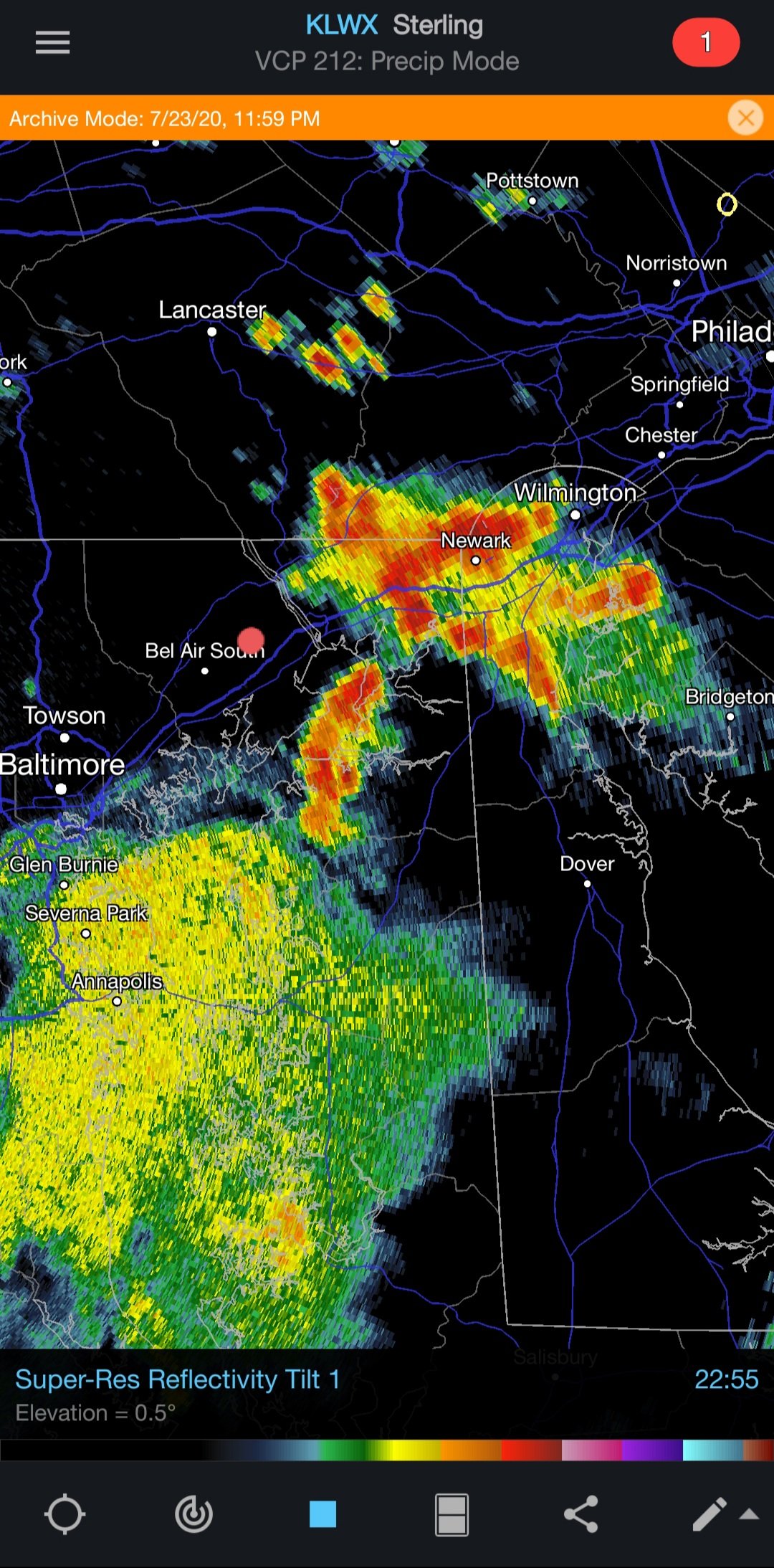
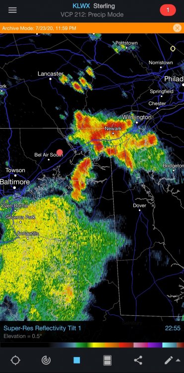
What a great light show last night! And a soaking rain. The video below shows the lightning from the cluster over Cecil Co. and western DE. The red dot in this radarscope screen capture is where the camera is:
-
No SVR but 2.36", nice T&L and some breezes. Interestingly enough, yesterday's was nothing in comparison here, just .11" and two cracks of thunder but more gusty. (31 mph peak today vs. yesterday's 42 mph peak) I was driving through this around 16:45 and passed some serious streams running through the edge of fields. The ground is so dry here that those deluges unfortunately are running off instead of soaking in. The backside had a nice round of lighter rains that did give a decent soaking. 1" hail today not 1/4 mile from here. That's OK, even though 1" isn't too much prefer not to have it. Nothing tops the five minutes of tennis ball stones and 109mph gust on June 15, 1980 for us. That's real severe usually more common in the plains... So far in 2020 this has been the best round of heavier thunderstorms for us.
-
High risk of bust here.
-
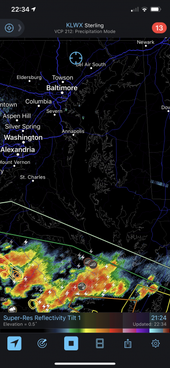
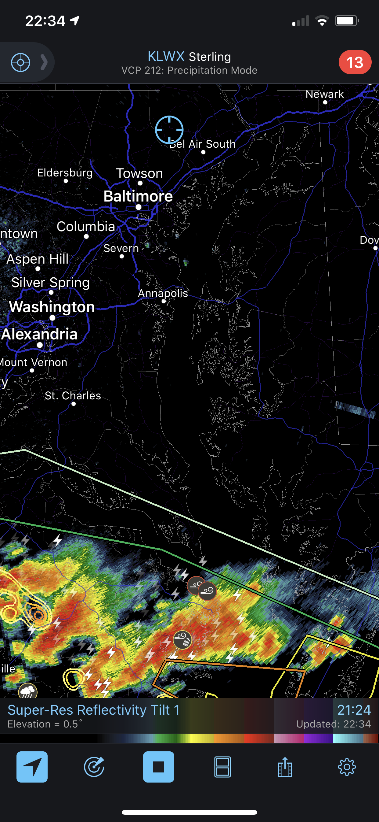
All bark, no bite here as usual. I have to wonder where the actual severe weather was as we were in a yellow for nearly an hour. Barely qualifies as a thundershower. Meh
-
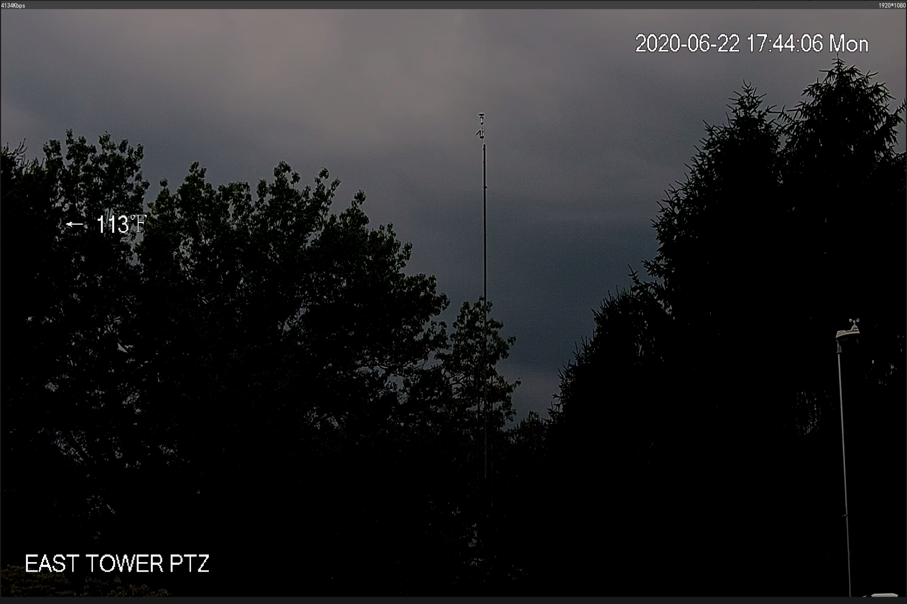
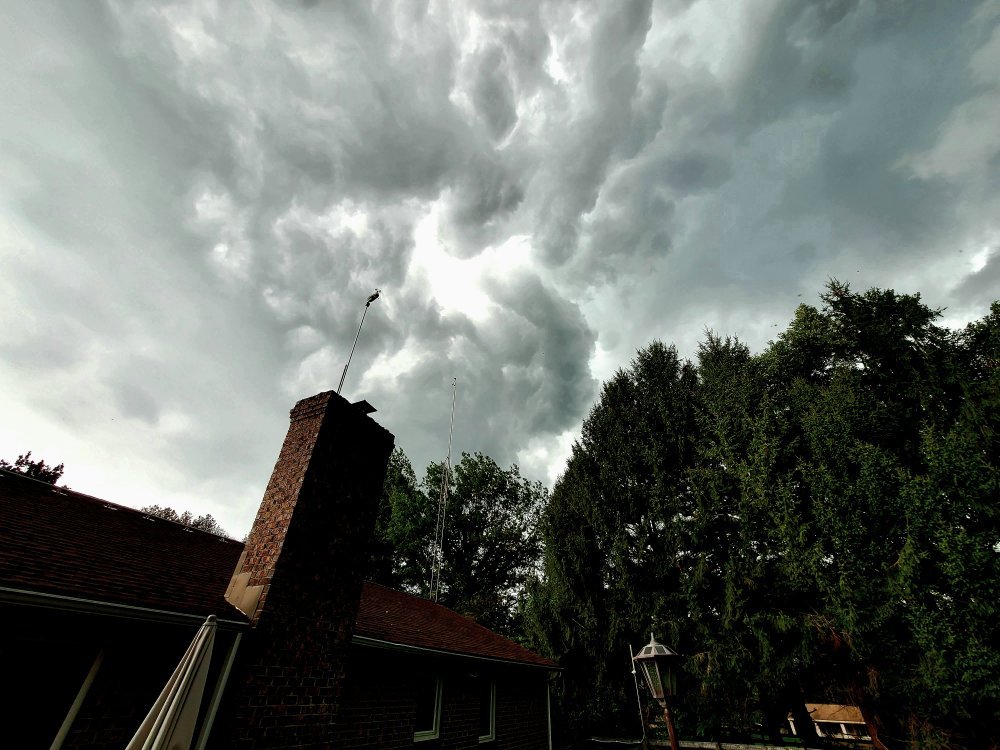
Looking a bit ominous to the west from the tower cam here!

-
I expect the storms to dissipate within minutes now seeing that yellow circle which we are in the middle of, pop up! Yes, another slight. As in slight push closer to the edge of (fill in the blank!) Seriously though, it looks like it could be a busy evening.
-
Yup, getting hammered here. Like Friday's storm, heavy rain and better lightning. Just hope no more trees get hit. Just got finished up cleaning up the mess. Balsams suck when they get hit although the smell is nice.
-
First rumble heard inside here. When lightning is detected within 20 miles of the sensor it points the PTZ in the direction and it's active. Seeing nice flashes and can make the outline of the cb cloud nicely.
-
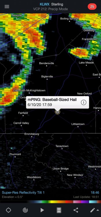
Ok who reported that? :-D
-
Yeah what I meant was if I was outside watching that lightning and didn't have access to radarscope, I'd guess it was in Calvert! That PTZ is about 25' off the ground on a tower. I want to get it up higher. It will bounce more in the wind but the view will be worth it. It that point I should clear the trees and see TV hill. Back in the 80s when these trees were either saplings or non existent we could see TV hill tower strobes at night just standing in the driveway. And the video: