
WHEATCENT
-
Posts
284 -
Joined
-
Last visited
Content Type
Profiles
Blogs
Forums
American Weather
Media Demo
Store
Gallery
Posts posted by WHEATCENT
-
-
37 minutes ago, Floydbuster said:
Holy crap. What day would the worst be?
if any of this verifies Thursday and thru Friday Morning
Canadian also smacks us.

-
13 minutes ago, Floydbuster said:
Local Northeast Ohio Facebook friends keep sharing model maps of 10-15 inches of snow for Cleveland/Akron in a week. Are they getting too hyped?
Its very early but things are trending south.
.thumb.png.6e63bd1f6da87de66361f152216df294.png)
-
30 inches over my ohio county 4 days out oh myyyyyyyyyyy

-
 1
1
-
-
every model with a CLE bullseye 4 days out......

-
9 minutes ago, LakeEffectOH said:
That's a little surprising because yesterday, it looked as the lakeshore was where the bands were more organized.
they were but farther north/east/, I imagine perry/madison and into (ashtabula counuty) geneva got a few more inches.
-
1 hour ago, LakeEffectOH said:
No snow whatsoever (except a few light flurries) here since Monday. I wonder how much the lakeshore towns such as Mentor & Painesville have gotten since Monday...Anyone have any idea?
I'm in extreme north mentor near fairport and grand river and we've gotten maybe 2 inches since Monday
-
 1
1
-
-
ohio gfs bullseye 200 out lets lock it in...haha

-
Interested to see how low we get tonight already at °7
-
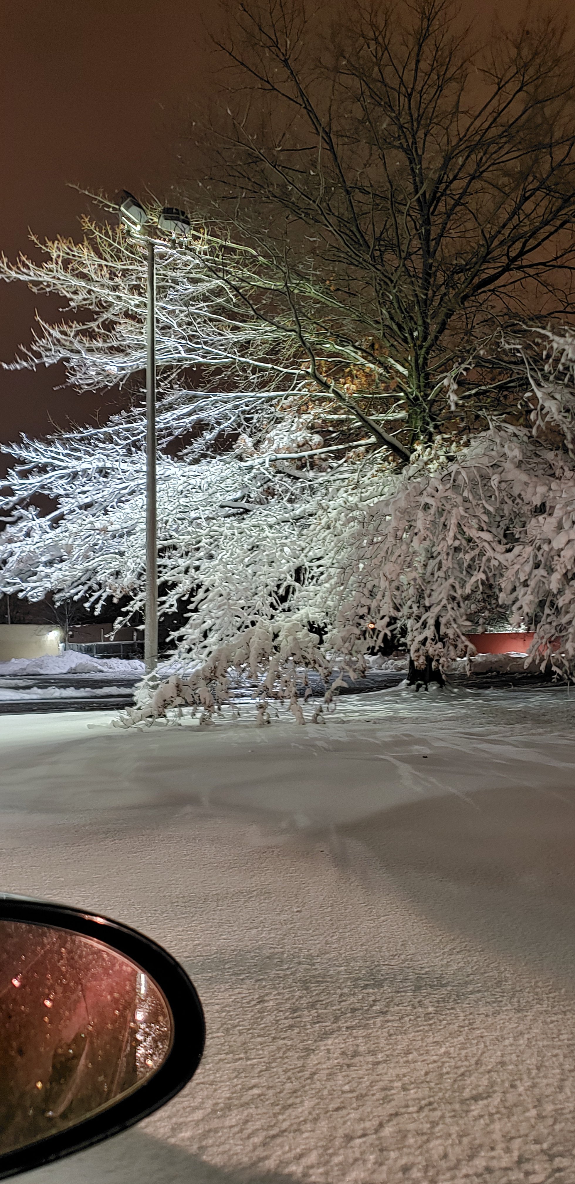
Very light snow and sleet mixing right now in mentor
-
Those totals on the NAM lol
-
1 minute ago, OHweather said:
Copying over from the other Ohio thread...
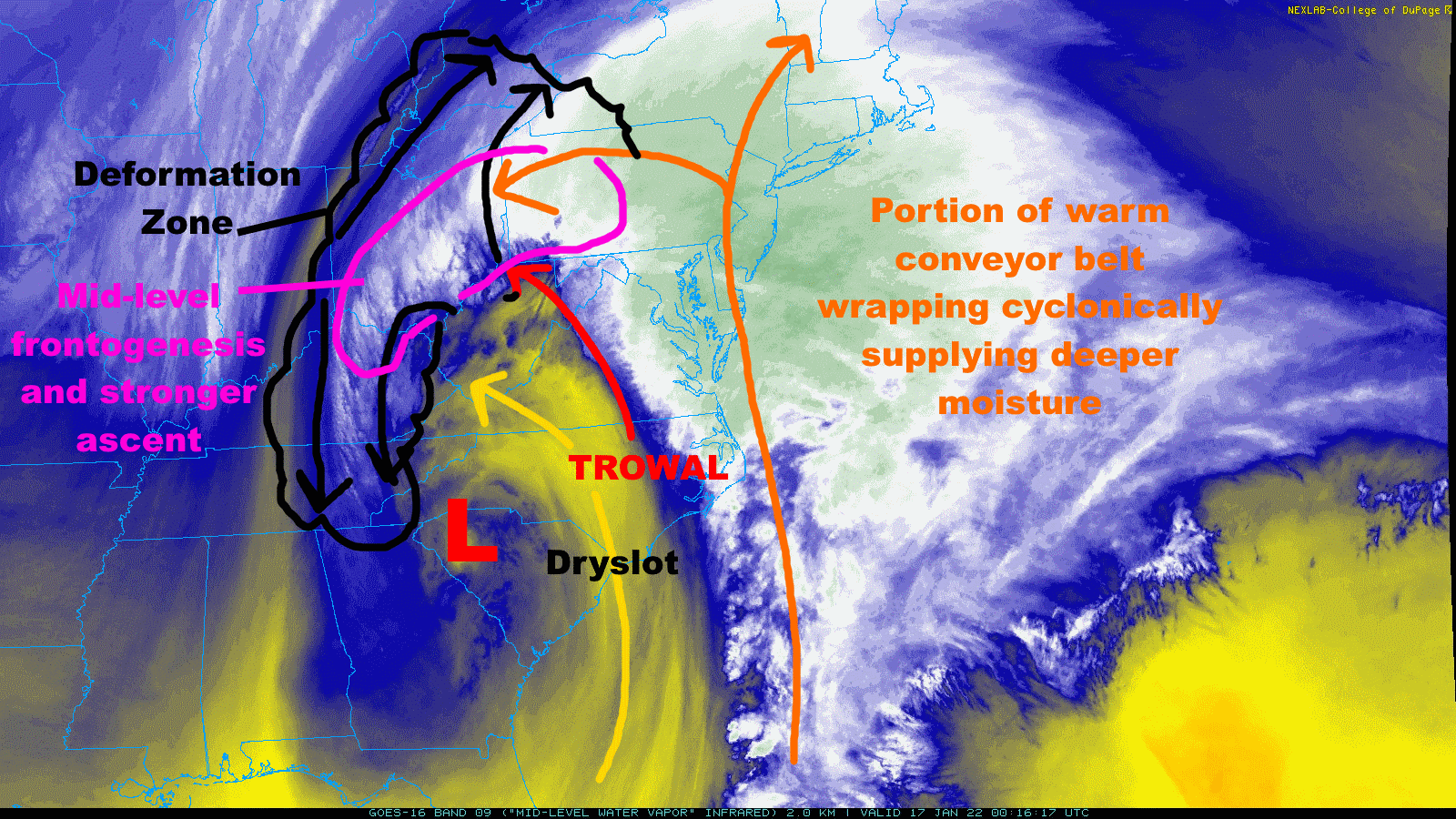
Big snow band starting to take shape parts of southern and eastern OH, and will ramp up more over the next few hours as it slowly moves north-northeast
Multiple things contributing...THIS IS CLASSIC...you have weaker stability on the edge of the dry slot which can allow for slantwise convection (which is what typically occurs in mesoscale banded snow). You also have a TROWAL nosing in from the east (trough of warm air aloft), enhancing the mid-level temperature gradient. You already have a nice deform zone and some mid-level fgen, and that means ascent/rising air, which will cool the atmosphere further (and should gradually cause any pockets of mix to go away through the evening). This cooling will also increase the temperature gradient on the edge of the TROWAL, strengthening the fgen further and causing the band to really rip. Definitely some positive feedbacks here. The branch of the warm conveyor belt wrapping cyclonically into the deform zone is adding some deeper moisture to. Parts of eastern Ohio will absolutely rip snow this evening into the overnight. Travel will be nearly impossible, this is a high-end set-up for our region (and this will go into W PA, W NY, and eventually S Ontario too).
The very heaviest may be east of CLE and CAK but this is an outstanding synoptic snowstorm for this region. I feel silly for being timid on the west trend pulling this into CLE until today. Sort of makes up for the last 6 weeks of not snowing at all.

My totals on lake county have continually risen on rap and hrrr!!
-
HRRR and RAP just went higher on my totals lol
-
Wonder if we'll sleet up here
-
5 minutes ago, dilly84 said:
That's what it looks like. Low riding the coast, then the low moves further inland at hr 21 from Philadelphia to Gettysburg then moves north through State College.
Wonder how much more we'll lose out through today. Obviously I'm farther north and east.
-
Looks like nam 3k shifted back east.

-
EURO gives me 16 LOL
-
Watch every model be wrong and long range hrrr be right
-
Don't know how to feel about the NAM totals has lake at over 15 inches but only WWA issued lol
-
Hmm NWS only pulled trigger on WWA for lake
-
euro has me at 9 in ohio but the hrrrr gives me 0 from the entire storm......i hate these differences lol
-
Don't know what to make of the long range HRRR probably not reliable at that range?
-
4 minutes ago, Bubbler86 said:
Trend Watch. New HRRR will be out shortly but the 6Z continues to strengthen the original Vort as it climbs West of us and is blocked before it goes beyond our latitude. Actually has it crawling easterly under the M/D line for a bit. I suspect it is not programmed properly to anticipate the transfer to the coastal but if it holds at 12Z, its a valid way the LSV can get back into the real game. It would initially stick it to Erie as there is never a deform band from a strengthening coastal. The type of progression would lessen the speed and depth of an easterly breakdown of the LSV column.

Are these models worth looking at at the far end of their runs?
-
yeah 6z gfs and granted its long range but rap and hrrr not good at all for ohio
-
man these mesoscale models out this far really screw ohio they must know something....
.png.9efd24f02e5d21d7fdcc3f0cdedc29b7.png)

Feb 1 -3 GHD III
in Lakes/Ohio Valley
Posted
That gfs puts 24+ in my ohio backyard lock it in")