

timp
-
Posts
106 -
Joined
-
Last visited
Content Type
Profiles
Blogs
Forums
American Weather
Media Demo
Store
Gallery
Posts posted by timp
-
-
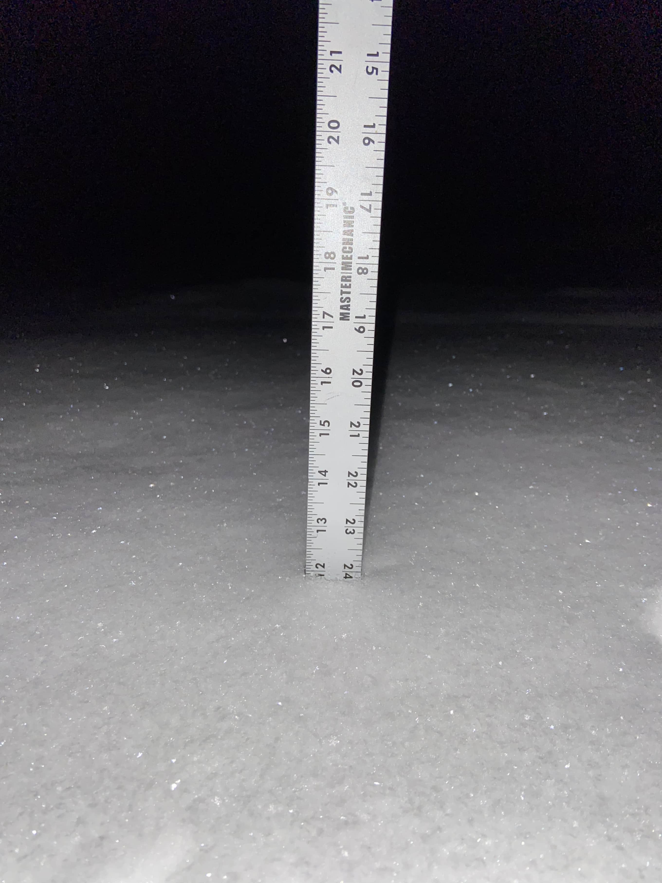
4” now but doesn’t look like much more to come. Have been very happy with my first winter in this new house. Wasn’t sure what the upslope potential would be but I have been keeping up with @powderfreak and @J.Spin so I think I will be OK lol.
I grew up 10 minutes from the Nazareth, PA that just recorded 36” from the big storm last week. Definitely disappointed to have missed that but last winter was so historically bad down there they deserved it. With plenty of cold and snow chances coming up it will be a fun stretch for all.
-
 1
1
-
-
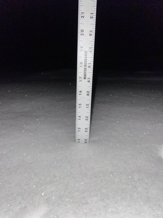
Just measured 3” and still coming down lightly. Snow growth is great. Pack is over 20” and had to rake my roof today with how well it’s been stacking up. Would love for a large synoptic event but with all this bread and butter I’m pretty full.
-
Used to live in Kutztown and grew up in the Lehigh Valley. Happy you guys are getting crushed. Most of my friends and family are near Bangor, Northampton County and reporting about 24” so matches ABE pretty well. Epic stuff.
-
1
-
-
Falling fast down to -2 already. Should be the coldest night of the winter so far.
-
Was ripping pretty good and put down a quick 2”. I think the next few days will produce nicely with some solid ratios.

-
1
-
-
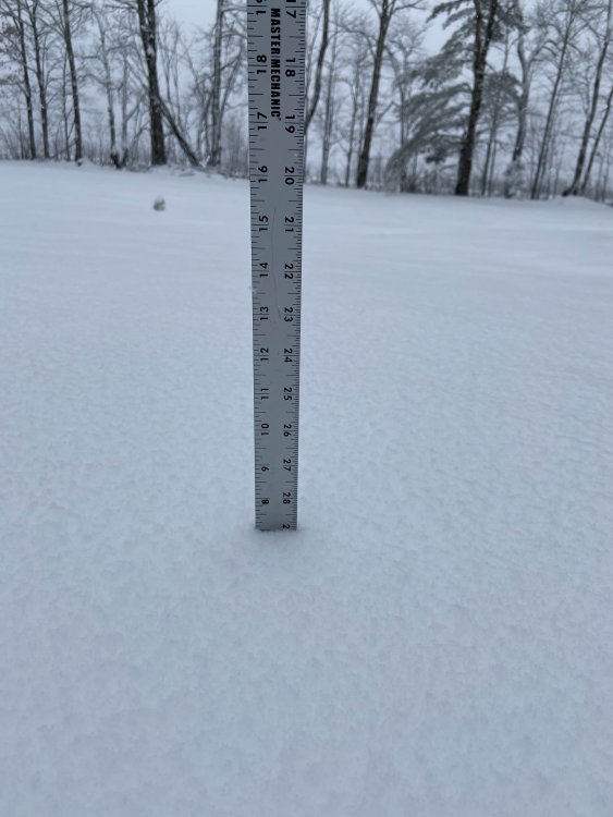
12” pack and 16° out there. The stars are out but snow is still falling so it’s a perfect night. Definitely what I imagined when I moved up here.
-
2
-
-
Pretty fun day out there. I’m at about 900’ and had a couple periods of heavy snow with massive flakes but it was so warm it was melting instantly. It’s about 2” of glop now. Rained a bit when the precip got lighter. Definitely going to build a nice base. Hoping for the upslope to really crank tonight and tomorrow.
-
7” on the dot here in Hyde Park. Snow just picked back up with maybe a little upslope beginning.
-
1
-
-
A solid dusting and a little gusty tonight. Probably as exciting as the next week gets. The area in PA I moved from is about to jackpot from the upcoming storm and it has me feeling some type of way.
-
3 minutes ago, Wentzadelphia said:
How many times does the gfs do this in big storms. It’ll catch up with other models eventually. You guys are fine up there. Eps destroys the GFS with QPF at least down here in Philly. I’m probably headed to Allentown or something.
Get a little elevation and head to Mt. Pocono area. They are going to get absolutely crushed.
-
About 1.5” of fluff here. Glad it finally looks like winter again. Still snowing lightly.

-
1
-
-
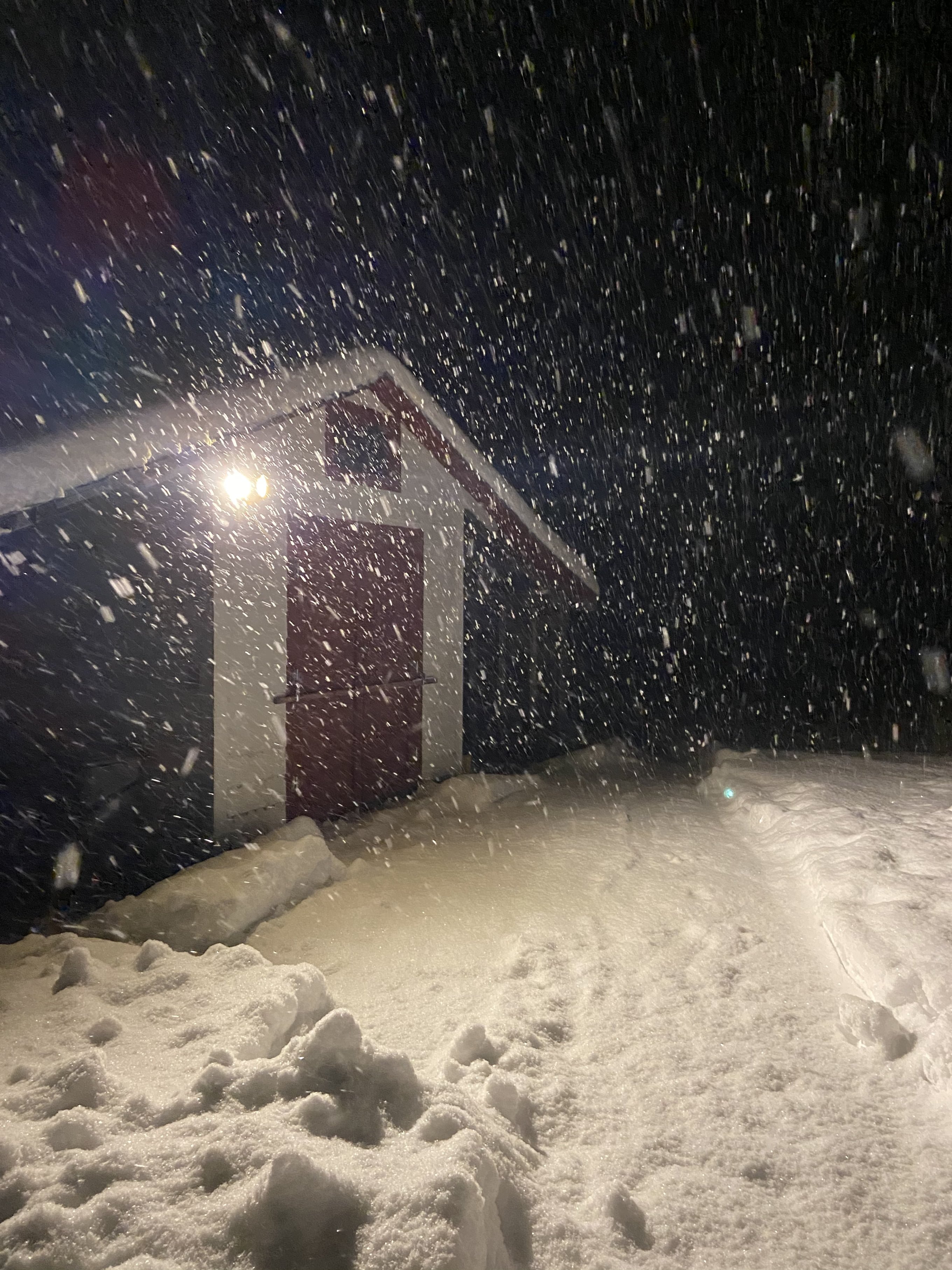
Absolutely pounding here. Just turned on the light and I would say a quick 2” is down. Sitting at 28° and snow growth is great.
-
1
-
-
Nice to see everyone up north get some snow today. Ended up with around 4” in Hyde Park for round one. First upslope event at this house and seemed to perform well in this setup. Hoping to beat that 4” tonight.
-
1
-
-
15 minutes ago, ORH_wxman said:
Looks like an excellent weenie spot. A bit over 900 feet nestled in the upslope corridor
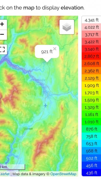
Yeah I’m pretty excited about the spot. The goal was to buy a place closer to Burlington for work but the prices are just insane. Now I’m out here basically in the NEK.
-
First freeze and some colors really starting to pop.

-
1
-
-
2 minutes ago, powderfreak said:
Awesome! Every mile north in latitude is a bit snowier.
I’m very excited to get this winter started. This was May 9th just after I moved in and I couldn’t believe it. Can’t wait to learn the nuances of my local and be more active on the forum.

-
2
-
 1
1
-
-
Hey y’all. After the discussion yesterday about NNE microclimates I wanted to say hi. I moved to VT last year from PA and bought a house in Hyde Park this past spring. I have been a member of the forums since Easternwx. I spent last winter at my apartment in Stowe and excited to be in my own home and not post the same obs as PF now lol. I attached a crappy google maps screenshot of where I’m at. I look forward to enjoying the cold and snow with you all this year. Sitting at 34F right now.

-
4
-
-
This seems pretty up in the air still but I think the icing threat is pretty significant for the Lehigh Valley and Berks. I don’t see the 5-10” verifying and think 3-6” is the better call for the front end that will come down fast and stick immediately. Seems like Mt. Holly is underplaying the freezing rain threat right now with only 0.1” mentioned in the watch but maybe they are seeing something that signals more sleet or we really do just go to plain rain. If I were to guess we never get above freezing and there is pretty decent ice accretion up this way. Hopefully the biggest story with this is the extreme cold on Monday though and not power outages.
-
Kutztown, PA 8” of snow and now over to mostly sleet. Feel bad for all those trying to get home right now.
-
7” in Kutztown now getting absolutely smoked
-
4.5” in Kutztown and will probably be at six within the hour. Looks like Berks and Lehigh could have been thrown in the WSW.
-
1
-
-
6 minutes ago, Voyager said:
I was kind of shocked, honestly. We're all snow now, but the initial shot was pellets.
Same thing happened where I’m at in Reading but quickly went all snow and now it’s moderate with all surfaces covered.


NNE Cold Season Thread 2020-2021
in New England
Posted
0°F already with a 20” pack. Let’s see how low we can go tonight.