

SouthCentralWakeCo
-
Posts
68 -
Joined
-
Last visited
Content Type
Profiles
Blogs
Forums
American Weather
Media Demo
Store
Gallery
Everything posted by SouthCentralWakeCo
-
Mid to Long Term Discussion 2019
SouthCentralWakeCo replied to Upstate Tiger's topic in Southeastern States
It saved my old caption for one of my last posts. Idk why. Thanks -
Mid to Long Term Discussion 2019
SouthCentralWakeCo replied to Upstate Tiger's topic in Southeastern States
-
Mid to Long Term Discussion 2019
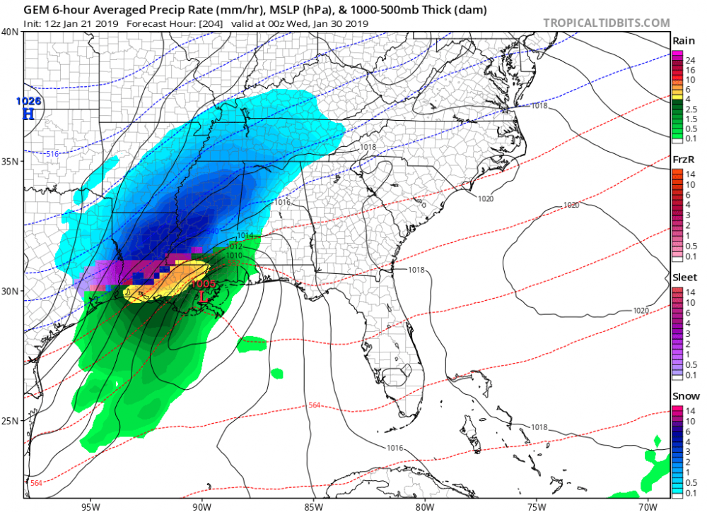
SouthCentralWakeCo replied to Upstate Tiger's topic in Southeastern States
18z GFS for next Thursday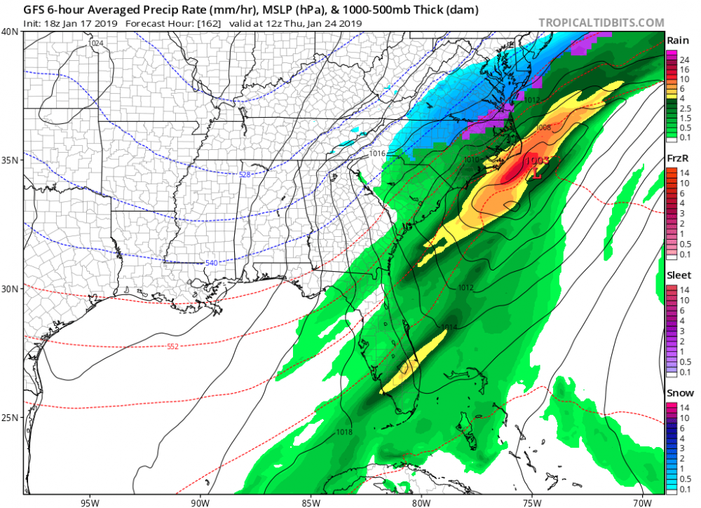
-
Mid to Long Term Discussion 2019
SouthCentralWakeCo replied to Upstate Tiger's topic in Southeastern States
e18 please! -
December 8-10, 2018 Winter Storm
SouthCentralWakeCo replied to Orangeburgwx's topic in Southeastern States
02z HRRR has it more of a sleet fest instead snow on the previous runs. 02z HRRR at hour 12: 01z HRRR at hour 13: -
December 8-10, 2018 Winter Storm
SouthCentralWakeCo replied to Orangeburgwx's topic in Southeastern States
If this ULL overperforms, it is going to shock a lot of people. Not many local mets talking about it... -
December 8-10, 2018 Winter Storm
SouthCentralWakeCo replied to Orangeburgwx's topic in Southeastern States
Good to know. Checking in on the HRRR for tomorrow, this is the 01z run. -
December 8-10, 2018 Winter Storm
SouthCentralWakeCo replied to Orangeburgwx's topic in Southeastern States
Okay thanks for clarifying. Wasn't sure. -
December 8-10, 2018 Winter Storm
SouthCentralWakeCo replied to Orangeburgwx's topic in Southeastern States
True, but it is interesting. Didn't the NAM verify the best for the last nights/today's band of snow/sleet/freezing rain? And didn't it nail the warm nose? Don't know for sure, but I think it did better than any other model. -
December 8-10, 2018 Winter Storm
SouthCentralWakeCo replied to Orangeburgwx's topic in Southeastern States
It has been consistently showing this, though. -
December 8-10, 2018 Winter Storm
SouthCentralWakeCo replied to Orangeburgwx's topic in Southeastern States
Would be awesome to end this event with some snow. Just watched the NWS briefing issued at 4:30 pm and he said that the models over the past 24 hours have trended toward more wintry precipitation throughout the day tomorrow. He said we need to watch it closely and to "not let your guard down." -
December 8-10, 2018 Winter Storm
SouthCentralWakeCo replied to Orangeburgwx's topic in Southeastern States
Now it’s confirmed Wake County getting snow -
December 8-10, 2018 Winter Storm
SouthCentralWakeCo replied to Orangeburgwx's topic in Southeastern States
-
December 8-10, 2018 Winter Storm
SouthCentralWakeCo replied to Orangeburgwx's topic in Southeastern States
Not good -
December 8-10, 2018 Winter Storm
SouthCentralWakeCo replied to Orangeburgwx's topic in Southeastern States
-
December 8-10, 2018 Winter Storm
SouthCentralWakeCo replied to Orangeburgwx's topic in Southeastern States
If Wake Co gets an inch I’ll be happy -
December 8-10, 2018 Winter Storm
SouthCentralWakeCo replied to Orangeburgwx's topic in Southeastern States
See you guys next potential event to be let down again! -
December 8-10, 2018 Winter Storm
SouthCentralWakeCo replied to Orangeburgwx's topic in Southeastern States
Wake County the cutoff line? Not surprised haha


