.jpeg.fb71a75fc71475b59e72598d4a9a6f88.jpeg)
TJW014
-
Posts
1,138 -
Joined
-
Last visited
About TJW014

- Birthday 10/14/2001
Recent Profile Visitors
5,911 profile views


-
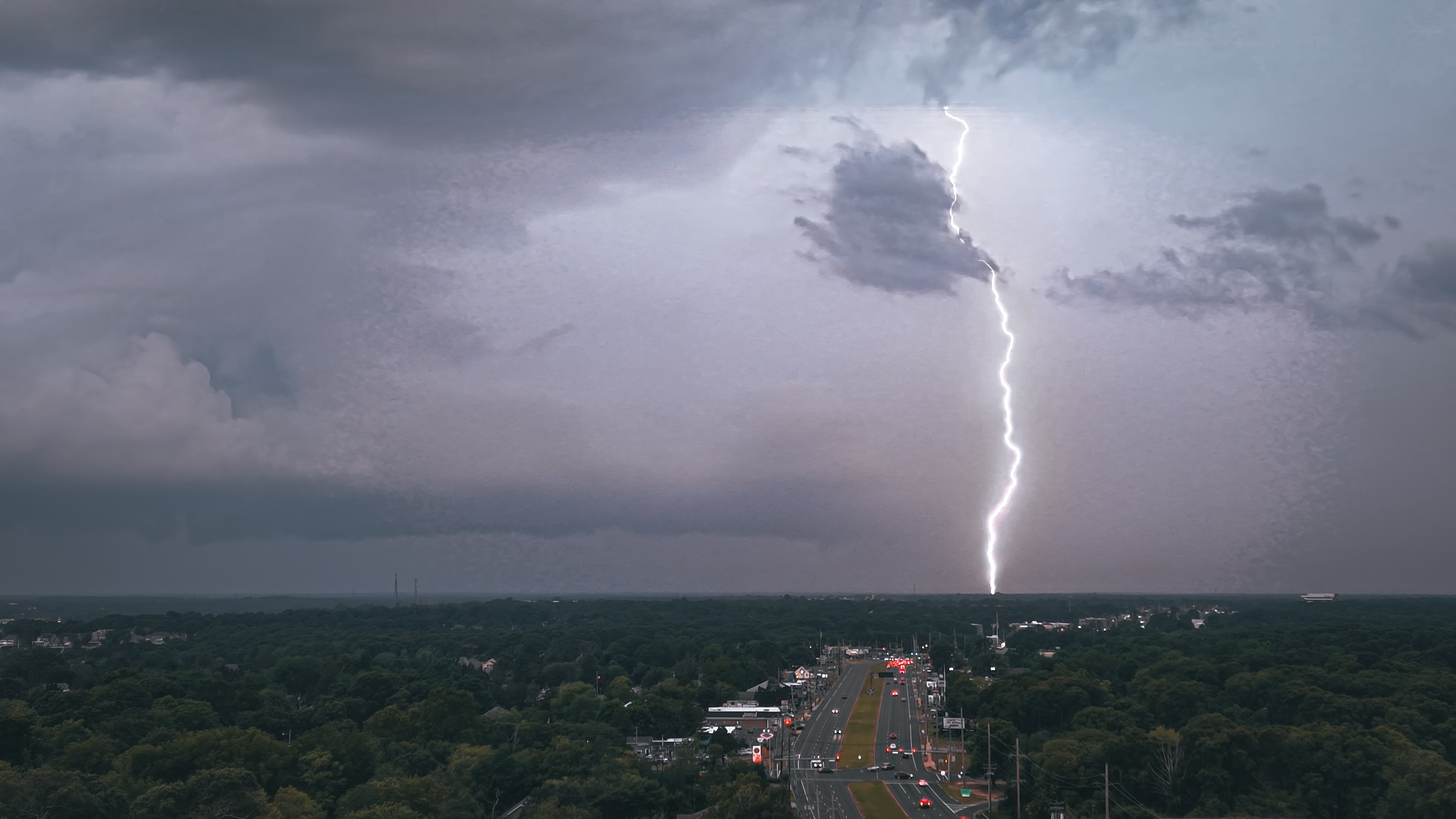
Captured with my drone before the squall line came through.

-
Pine Brook
-
Full blue sky. Let's go.

-
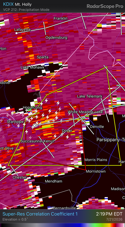
Tornado reported in Troy Hills, NJ
-
I'm seeing 51,000 ft on Radarscope and WeatherFront
-
Warm fronts are fun...
-
Light rain developing along the sea breeze front will put a hamper on things down here for a while.
-
Looks like some potential debris being lofted.
-
Nice rotation aloft over Budd Lake
-
NJ gov says state offices will close at 2 PM
-
Island Beach SP closed on Saturday due to "nearby thunderstorms" when the nearest lightning strike was 55 miles to the north and any threatening rain was still west of Baltimore.
-
South wind starting to crank up.
-
Big time boom or bust potential tomorrow. It all hinges on how fast can we clear out after the warm front lifts through
-
Absolute gangbusters there. Should've made the drive down.
-
1.25" hail in Warren Grove
.thumb.jpeg.f5c6ba9d911ec96b3b124f8606aee58e.jpeg)