Araqiel
-
Posts
41 -
Joined
-
Last visited
Content Type
Profiles
Blogs
Forums
American Weather
Media Demo
Store
Gallery
Everything posted by Araqiel
-
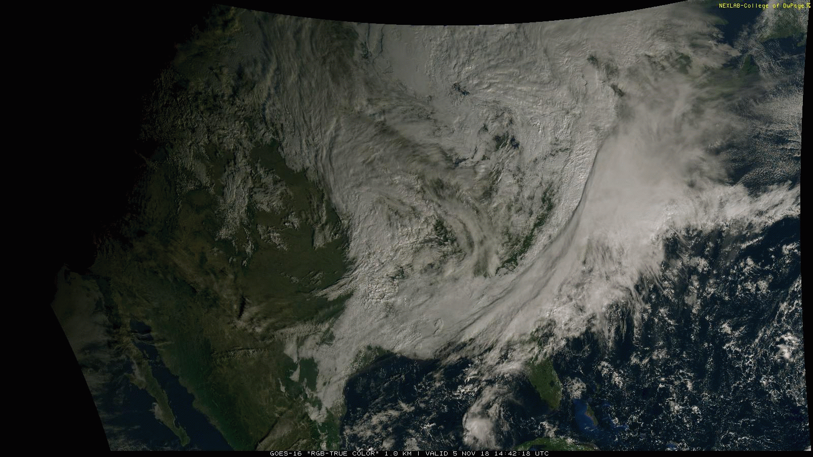
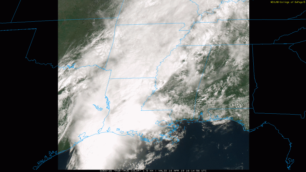
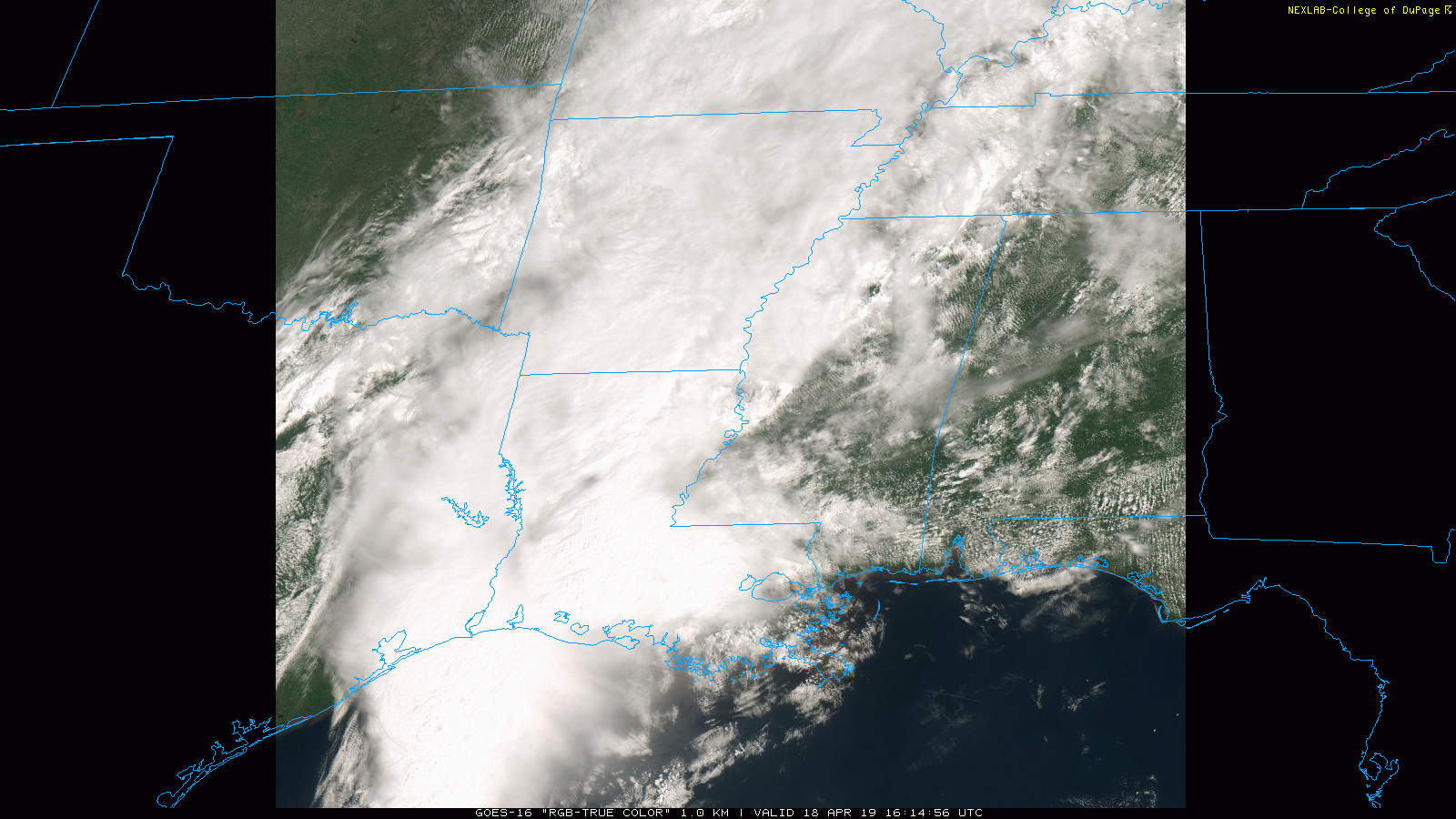
The MCV that tracked across central MS in the last couple of hours formed right along the boundary in the image I posted earlier (and below, reaching from around the LA/MS border near Natchez MS, NE to where the MCV is now, in slightly wavy form at the time). GOES-16 is love.
-
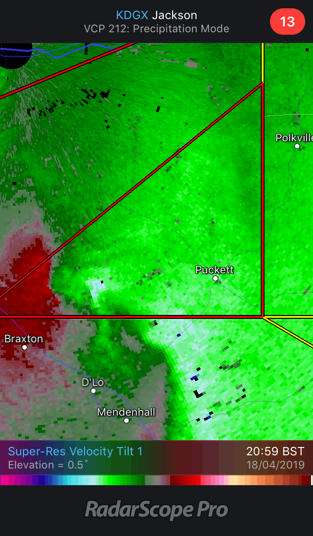
Longer loop of that weird northward-jogging Puckett rotation - has now merged into a much larger circulation, somebody please school me on wtf is going on here.
-
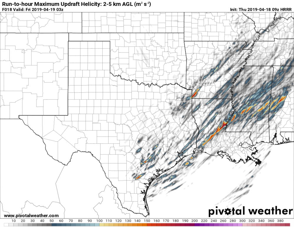
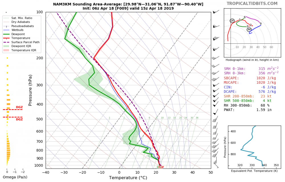
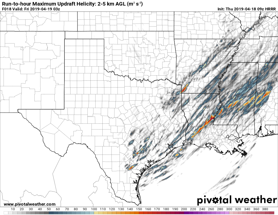
From MCD #390: "Observational trends in KDGX and KLIX VAD profiles have shown a large increase in low level hodograph curvature and SRH." Just as model soundings were showing earlier, then. That 09Z HRRR UH isn't looking too shabby in relation to the current warned storms over MS either.
-
???

-
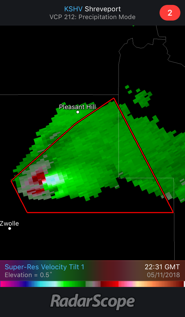
Yeah that PDS warning went away pretty fast and the CC drop was minimal at best - haven't seen much of a sustained tight couplet on anything yet tbh, just the MCV-associated rotations. And right as I say that the one SW of Puckett tightens up.
-
Especially when the HRRR has been showing some decent UH tracks today - guess the other HREF members didn’t agree.
-
Looks like the low has trended further south in the last few HRRR runs - now centred over southern rather than northern MS by 00Z.
-
High UH track across the MS/AL border on the latest HRRR lines up nicely with what appears to be a boundary on visible sat (look at the bubbling cumulus to the south vs waves to the north) - was a similar example earlier on the LA/MS border that's now cloud-obscured, my post in the Central/Western forum thread for this event has the images for that one.
-
HRRR has been semi-consistently painting out this long UH track in central LA this morning, looks like a nice boundary setting up right through there now - easiest to spot on the meso sector loop. GOES-16 image is marginally too big to upload so linked instead. Apologies again if this is the wrong forum, SE only seems interested in NC for some reason. GOES-16 Visible
-
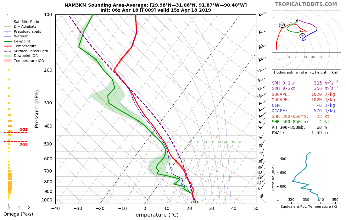
That funky wind profile sure seems to improve as the day wears on - putting this here because the SE forum doesn't seem that interested and the best discussion/info always seems to be here.
.thumb.png.cc3b41ca42f8a43e45a8ea4094804f62.png)
.thumb.png.12c542e4dca3a65053485358b2ef74db.png)
-
Looks nasty.

-
Whole lot of cloud around today.
-
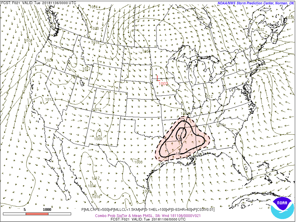
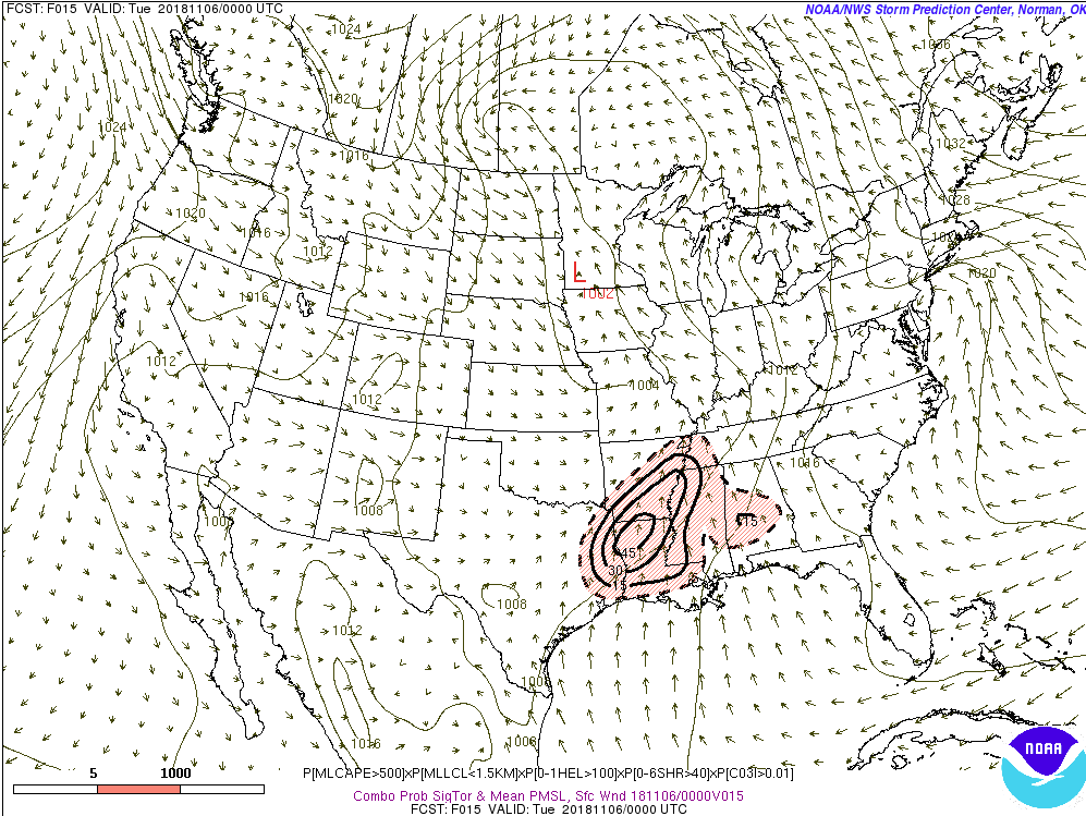
And the 10% hatched returns. =) Quite a shift in the focus of the earlier stuff too.

-
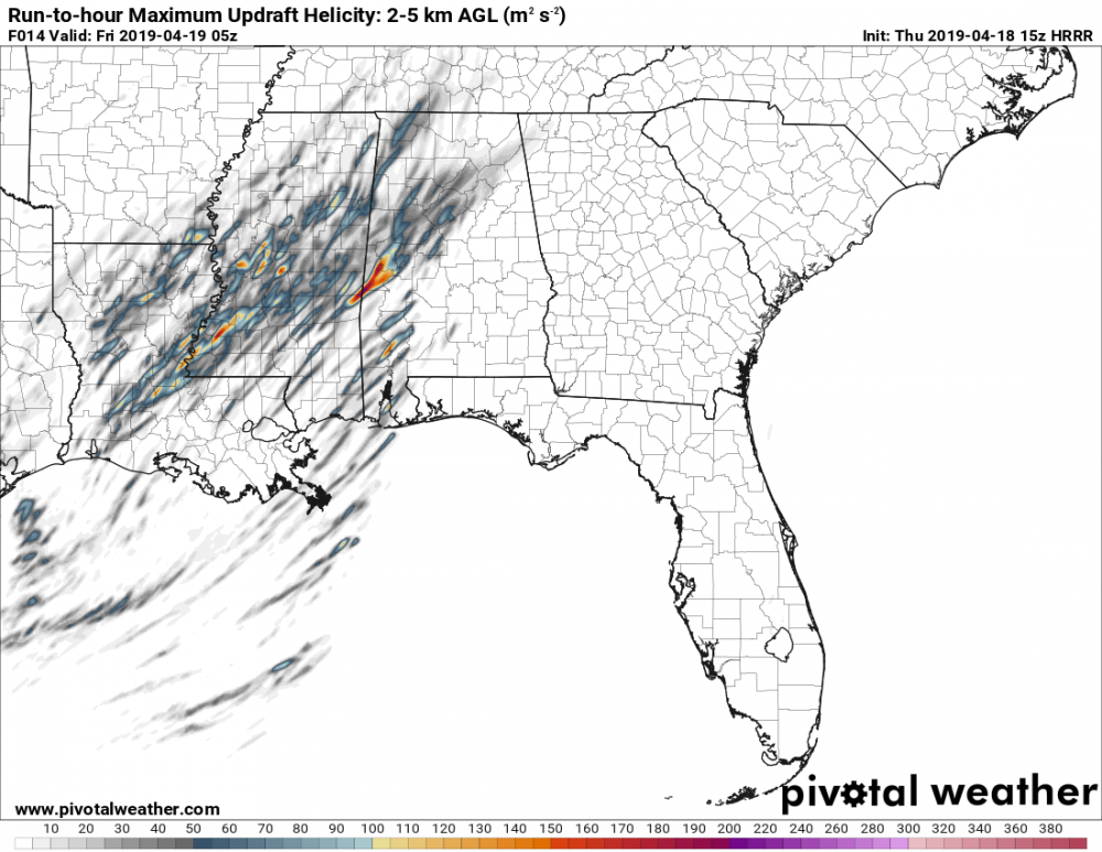
That figures, 2018 gonna 2018 after all. 06Z HRRR still looks better than the NAM I'd say but probably not enough to get me up at 3AM to see whats going on.
-
So uh did they forget the SIG hatching again in today's 06Z D1 then? >_> Long-time lurker finally got around to making an account btw so hi all.


.png.e072050f3c5aed6ec2f457774940aa4a.png)
.png.887e12b78e4a9eeb2a39415c31da9751.png)