CIK_62
-
Posts
25 -
Joined
-
Last visited
Content Type
Profiles
Blogs
Forums
American Weather
Media Demo
Store
Gallery
Everything posted by CIK_62
-
On beach in CI for 1st. time this year. Just hit 90 at 2pm---reading my thermometer remotely----but a sea breeze just started too---after hot but dry westerlies.
-
On beach in CI. My T read remotely is 81*(@2:30pm) with continuos sw breeze keeping it tolerable.
-
On beach here in CI (1st. TIME)and my T read remotely from phone APP is stuck at 80* (3pm)for hours, since I left house. Slight sea breeze. 81* by 4pm.
-
December 2020 General Discussions & Observations Thread
CIK_62 replied to bluewave's topic in New York City Metro
The next 8 days are averaging 31degs.(27/35). Making it 26degs., or -10.0. Month to date is 42.9[+2.8]. Should be 36.8[-1.8] by the 23rd. Snowstorm for Wed 6pm-Thurs. 9am Estimates: All models are about 12"-14" with 20-25mph non gust wind. Enormous snow rates for a few hours produce most of the total. You better use your snow blower at least once over night or you may have problems in the morning. Watch out for a reverse Jan. 1978 forecast fiasco. Then it was 3" snow turning to rain and we got 14". Rain/Snow line kept wrinkling up the Jersey coastline, only to be forced south again. Got to within 15 miles of Sandy Hook. 34*(54%RH) here at 6am. 33* at 7am. 35* at 9am. 37* by Noon. 38* at 1pm. 39* at 2pm. 41* at 2:30pm. -
Anyone know what to the 'SPC SREF PLUME' experimental website? Getting 404 error now, was OK this AM.
-
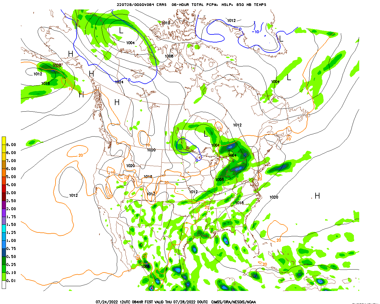
http://cimss.ssec.wisc.edu/cras/cras45_NA/12/images/cras45na_pcp_084l.gif
Can any expert explain the significance of this output. This model seems to pre-process input data differently and comes out with a favorable outcome for the northeast. Thanks.
-
http://cimss.ssec.wisc.edu/cras/cras45_NA/12/images/cras45na_pcp_084l.gif
Can any expert explain the significance of this output. This model seems to pre-process input data differently and comes out with a favorable output for the northeast.