

JakkelWx
-
Posts
3,287 -
Joined
-
Last visited
Content Type
Profiles
Blogs
Forums
American Weather
Media Demo
Store
Gallery
Posts posted by JakkelWx
-
-
2 minutes ago, NorthArlington101 said:
Bad news folks - EURO doesn't look like the UKIE. Went north and joined the screw NYC crew
hope it ends up all rain for them

-
 2
2
-
-
man what a brutal loss
-
-
1 hour ago, WinterWolf said:
The irony is, if a troll posted saying the GFS looked like trash, he wouldn’t have weenied them. Very telling.
and its the same two people reacting weenie to your post.
birds of a feather flock together
-
 1
1
-
-
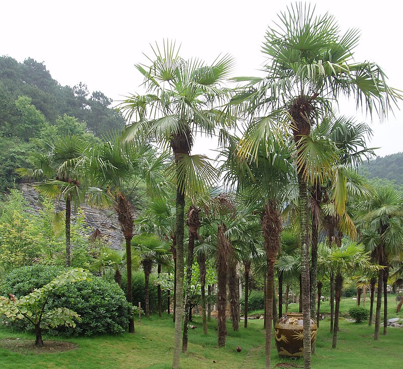
speaking of palm trees, trachycarpus fortunei seems to be cold hardy down to zone 7a (0-5 F)
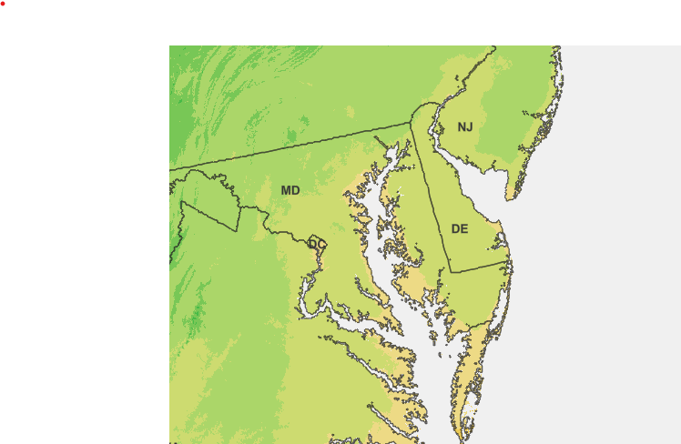
the brighter yellow shading right along the bay is zone 8a according to this:
https://planthardiness.ars.usda.gov/
but it still has to be protected during an exceptionally severe cold snap
this seems to be the palm tree mentioned as shown on wikipedia:
-
8 minutes ago, mappy said:
Happy Thanksgiving friends! Spending ours at home with just us three, not hosting, didn’t have to clean, will make a small feast, in my pjs, drinking all day with no stress whatsoever. Fantastic
Happy Thanksgiving and may everyone be blessed with endless amounts of deviled eggs. They're da bomb!
-
 4
4
-
-
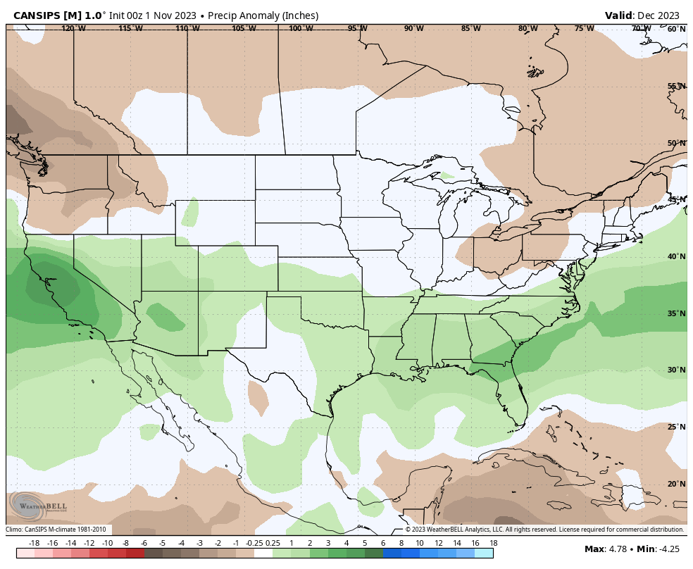
On 11/21/2023 at 2:10 PM, stormy said:
The latest CANSIPS paints that perfectly for December.
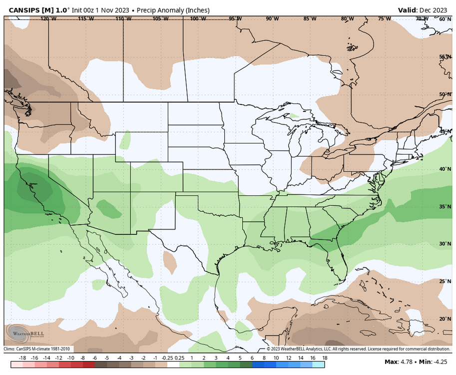
I would rather take my chances with that, based on how past storms trended north as we got closer in time. It seems easier for north trends to occur rather than south trends, which we've seen many times! It's reassuring that this El Nino is legit this time, rather than the fake-out that was 2018-19. It's been too long since we've seen a proper El Nino.
I was pleasantly surprised at today's ECMWF polar vortex model run, which made the PV even weaker than yesterday's run. Not to mention I was already surprised at that.
The MJO seems to want to enter the COD before going into the warmer phases, and the extended euro ensemble wants to gravitate the MJO back towards the colder phases mid month. We will probably see a warmup the first week of December, but even that seems more muted now compared to a couple days ago. Encouraging signs.
-
7
-
-
3 minutes ago, WxUSAF said:
Someone make an obs/nowcast thread. Need to track DCA temps and Pittsburgh pressure.
What's the temperature in short pump right now?
-
1
-
1
-
-
-
Why is there sounds playing when I open this thread

-
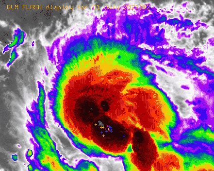
New burst of lightning in the SE eyewall.
-
-
11 minutes ago, SnowenOutThere said:
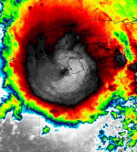 Looks like the eyewall is almost fully wrapped and an eye is trying to form? Might just be over-analyzing considering its Friday and nothing is happening in class but I dunno looks like an eye.
Not an eye. The actual center is still squarely over the island, not just off of the island.
.gif.db799a652ccd75eeae3704b53192652d.gif)
-
...GRACE RAPIDLY INTENSIFIES INTO A MAJOR HURRICANE...
...LANDFALL EXPECTED IN MAINLAND MEXICO LATER TONIGHT...


SUMMARY OF 1000 PM CDT...0300 UTC...INFORMATION
-----------------------------------------------
LOCATION...20.7N 96.3W
ABOUT 75 MI...120 KM ESE OF TUXPAN MEXICO
ABOUT 105 MI...165 KM N OF VERACRUZ MEXICO
MAXIMUM SUSTAINED WINDS...120 MPH...195 KM/H
PRESENT MOVEMENT...W OR 270 DEGREES AT 10 MPH...17 KM/H
MINIMUM CENTRAL PRESSURE...967 MB...28.56 INCHES
-
07L GRACE 210821 0000 20.7N 95.7W ATL 105 967
-
Grace is really getting her act together on visible and IR satellite.
-
-
what the hell?
-
4
-
2
-
-
These are very impressive lightning bolts coming from this storm and it's still a few miles away. Beautiful anvils.
-
4 minutes ago, CAPE said:
Could still get a splitter lol.
Whether I get 2" or a tenth, it wont make much difference in the ultimate outcome for the grass, but a good storm with some booming T&L would be fun. Seems like its been forever. The remnants of Elsa late last week was a good soaker, but totally boring otherwise.
Usually there are a bunch of towering cumulus that look like they might become storms at 1 PM, only for the entire cumulus field to slowly fall apart by 5 PM. The sun gets progressively more clouded as the anvils from thunderstorms out west inch their way over and the final outcome is a couple lightning bolts, moderate rain and cool clouds to boot.
That's at least how it was half the time back on the Delmarva
-
20 minutes ago, turtlehurricane said:
Well, that aggressive outer band fell apart, and all we got was a sprinkle around sunrise. Now a very light easterly wind and sunny.
That being said, we're getting tons of daytime heating now, and when the next convergence bands roll in it will probably be an explosive squall event. Might take till many hours from now for that to happen tho, since radar is pretty much empty between here and Cuba.
I guess the real storminess will start here tonight once Elsa enters the Florida straits.
But aren't you in space?
-
What is this
-
dafuq?
-
 2
2
-
 1
1
-
-
4 minutes ago, Prospero said:
Getting that scarier look now.


March 2024 disco/obs
in New England
Posted
same here.
its just snowman19 projecting because he's a shit poster who adds nothing objective of substance to this forum.