

Miss Pixee
-
Posts
216 -
Joined
-
Last visited
Content Type
Profiles
Blogs
Forums
American Weather
Media Demo
Store
Gallery
Posts posted by Miss Pixee
-
-
1 hour ago, ravensrule said:
This place is more depressing than a masturbators anonymous meeting with no porn.
Depression over cold water? Nah...I can get a glass of that in my kitchen with some ice!
-
On 3/1/2024 at 1:27 PM, MDstorm said:
Reading this thread over the last few weeks, I have come to the following conclusions:
that beaten horse has rot...
-
Y'all could've trimmed this by 100 posts if you'd just listen to Phil and his predictor. He said early spring but NOOOO everyone tracks patterns, agonizes over climate changes and posts historical data and analysis. Tsk tsk.

-
 1
1
-
-
Pass the salt, please. With a side of pickles and a glass vinegar on ice. Yum!

-
28/15D
-
Drum's been beat so hard the skin is coming off.
-
 1
1
-
-
17 hours ago, Random Chaos said:
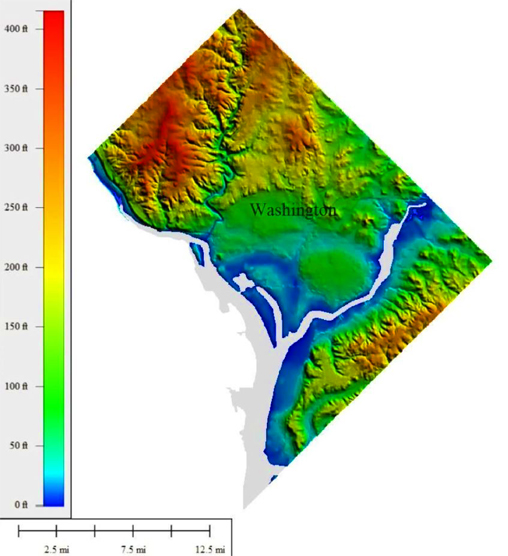
If you’re not familiar with Maryland’s lidar map, it includes DC and is awesome: https://geodata.md.gov/topoviewer/
What's also cool is if you stand at where old Barney Circle was before crossing the Sousa bridge looking across the Anacostia river the entire horizon is elevation that goes up, from Deanwood NE down 295 South to the Naval Base! The whole area leading right into Maryland. Once called "far SE".
-
Potato dust. *yawns*
Eh, I'm ready to chuck the models and just look out the window at this point. Another cautionary tale of getting too emotional about snow. Enjoy it when it happens and if it doesn't...go find something else to do. Weather patterns don't have joy or sadness. Snow lovers are getting conditional (and desperate) in their demands about type of snow, duration, etc. You get what you get! Chaos rules and we've become tools.
Besides, Phil said it all at a press conference. No shadow!


-
1
-
1
-
-
-
38/24D. Falling.
-
1
-
-
40 minutes ago, jaydreb said:
We need an eyeroll smiley...
-
1
-
-
42/22D currently.
-
2 hours ago, EHoffman said:
"High elevation" being a relative term...but yeah people forget upper NW is quite hilly. If you go to Fort Reno Park they have a little placeholder for the highest elevation point in dc. It's...underwhelming.
Because with elevation you need sight lines and flat land flat to compare it to. It would be like living on the upper level of a building with no staircase or windows, there's no reference point.
-
For all the DC yappin' gone off the rails...just thought I'd post up this ditty. Bears reminding based on where you are.
"The highest natural elevation in the District is 409 feet (125 m) above sea level at Fort Reno Park in upper northwest Washington. The lowest point is sea level at the Potomac River. The geographic center of Washington is near the intersection of 4th and L Streets NW."
Topographic map below. DC is a combo of appalachian ridge and plains. Like a bowl, edges are high, middle part low. Mt parents and grandparents said the mall was swampy at one time. I saw an old pic of cows grazing on the WH lawn! Crazy stuff. NW is large areas of high elevation. SE is a staircase that keeps going up and most of the streets are hills in all directions. My neighbors can sit on their front porch and see the Cathedral in NW clear as a bell. On Howard road SE you have a clear site line to the monument like its a mile away. Wild.
We now return to your regularly scheduled snow channel...
-
7
-
 4
4
-
-
1 hour ago, pazzo83 said:
gotta come up to 350-400 ft up here in Tenleytown
Same here in SE...can range from 120 to 290 and more. Topography is a bowl not a flat plain.
-
On 2/13/2024 at 4:08 PM, psuhoffman said:
.thumb.jpg.b5aab85f91f9f94d4dba708e99181af9.jpg)
.jpg.52fa0f73541324fa103e7923089d98f9.jpg)
Reminds me of an atmospheric turbine engine.
-
18 hours ago, psuhoffman said:
Not yet but the trends are not encouraging
The MJO stalling and then suddenly tanking instead of going through 8/1/2 seems to have timed up with the collapse of the pattern on guidance.
Something is destructive interfering with a Nino pattern. It happened in 2019 also. Remember how all the guidance looked epic at day 15 all winter. The guidance is based on sound science. There is a reason both years this happened. The guidance saw what we saw when we made snowy winter forecasts and expected the typical response. But something in 2019 and this year seems to be running interference. That block in Jan collapsed so fast. It’s almost unheard of after a SSW for that kind of block to break down so fast.
I wonder if Chuck isn’t into something with the expanded Hadley cell disrupting things. You know how @brooklynwx99 was saying the gfs progressive bias was likely causing it to miss the block. That logic was sound. A more progressive jet would destructively interfere with blocking. But the expanded Hadley cell is also causing a more progressive jet. In the end maybe that was the right solution and the gfs bias allowed it to pick up on it.
What is this Hadley Cell? Not familiar.
-
20 hours ago, snowmagnet said:
I don’t understand why people have given up on the rest of winter when the models can’t predict anything in less than 24 hours.
I think folks overthink things when it comes to snow and presume too much based on every model they see. Wild mood swings over snow indicates something else going on not related to weather. Our historical sample size of patterns on a geological time scale is minuscule at best...long term planetary/solar cycles and CC are impossible to predict long term. Changes are not neatly packaged for convenience and results vary. I don't envy anyone in the field trying to analyze or give projections based on models at this point.
Also, snow has nothing to do with winter. That association only comes from places that get snow.
-
2
-
-
Welp, whatever happens must happen quick! Because Phil says...

-
1
-
 1
1
-
-
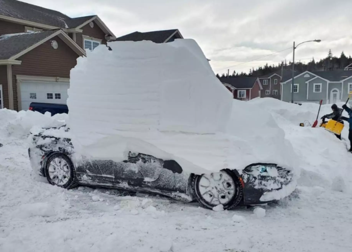
2 hours ago, Jebman said:
Where is that? Imma gonna go there and dig lots of snow and pile it high!
I think it's Newfoundland...lol
-
1
-
1
-
-
ENOUGH.
Stock up now. Stop whining...and get a good load of dynamite.
-
4
-
1
-
-
The "SECS is 8 inches" got my attention immediately...
")
-
1
-
-
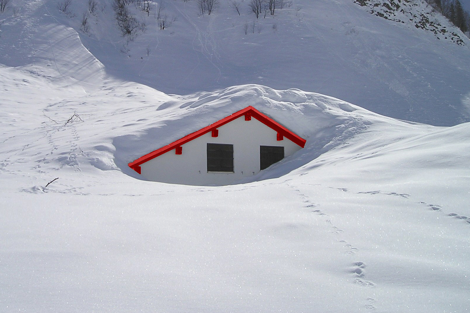
Still have a great deal of snowpack. Melted areas/ black ice treacherous tho. 28 degrees and a bag o' chips.
-
Temps still falling...now 18/DP7 windchill -11
Hoo Ha. Rump buster
-
1
-
.jpg.4cbf98f3206dcbace03cb1c0e10c640a.jpg)
March Discobs 2024
in Mid Atlantic
Posted
Sunny, cold and WINDY. Crazy gusts beating against the walls. 43 degrees.