

purduewx80
-
Posts
1,554 -
Joined
Content Type
Profiles
Blogs
Forums
American Weather
Media Demo
Store
Gallery
Posts posted by purduewx80
-
-
1 minute ago, Stevo6899 said:
Disappointing this turned into a weak turd. Looked promising for a few runs a couple days ago on the euro. It seems every event that shows promise in SEMI this winter turns to poo. All were asking for is one solid event in a 4 month span nov-feb.
Hanging your hopes on one operational model run will usually end in disappointment.
-
 1
1
-
-
Doesn’t quite go out that far, but GHD 1 is showing up as the number 3 CIPS analog for Wed eve.
-
1
-
-
3 hours ago, RobertSul said:
Alaska was glacier free during the last ice age and roughly averaged two degrees WARMER than today. I guess even in extreme long term patterns, a warmer Alaska meant a colder CONUS.
Alaska was most definitely not ice-free. The mountains were glaciated, while the interior was ice-free because it was a desert. Moisture sources were farther removed due to much lower sea levels.
-
7 hours ago, WestMichigan said:
Never heard of that. Interesting to see the connection.
Not sure I've ever seen it, but it's similar to when we have a connection to another Great Lake (Superior-to-Michigan, Huron-to-Erie/Ontario, etc). In this case, the heat, moisture and ice nuclei from smokestacks is pre-conditioning the atmosphere, so the band ends up being stronger.
-
1
-
-
There should be a 3/4hr
 band where the 850-700 frontogenesis sets up - easy over on ratios there. Northern parts of the modeled QPF have the forcing above the DGZ, so those areas would be pixie dust. Pretty wild to see another winter event with summer-like 700-500mb lapse rates.
-
1
-
-
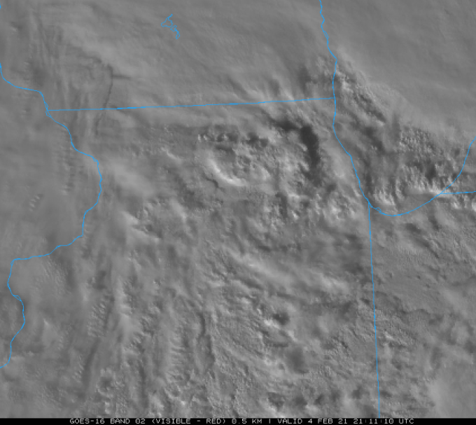
Kinda hard to see on the composite, but the TMKE terminal Doppler reveals that industry in WI is contributing to the heavier lake effect bands affecting areas near and NW of GRR this morning.

-
2
-
 1
1
-
-
2 minutes ago, MIstorm97 said:
I'd take that HRRR run all day. Low gets cranking as it over CLE and is a great hit for the SEMI crew. Feeling optimistic with this one. Felt good for the last storm too and it played out how I thought it would. Bring it
First call: 5"
Having a hard time buying the forcing lasting into eastern MI. Most guidance has an energy transfer to the coast which is why the snowfall amounts should gradually taper from what IA/NE see.
-
5 hours ago, Thundersnow12 said:
Just cherry picking the 3z RAP and a sounding up this way, you get a very deep DGZ/isothermal layer. If this were true you’re probably talking close to if not 20:1 ratios.
Just poked through that 06Z HRRR run, wow. Pretty much ideal for at least 20:1 - light winds, lift in the DGZ (which is 9k-10k feet thick!) and 700-500mb lapse rates 6.5-7.5.
06Z NAM frontogenesis at both 700 & 850mb would also imply a swath of heavy snow across IA into far S WI, N half of IL/IN and S 1/3rd MI.
-
2
-
-
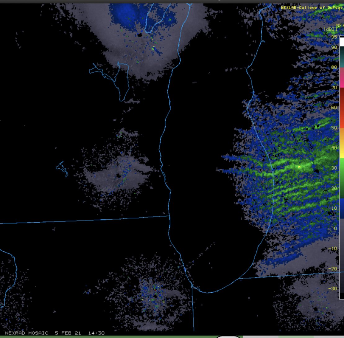
Nice convective look to the vis shot. Just saw a flash NE of BMI. Should be some bursts of +SN the next couple hours in Chicago. Gonna be nasty if/when everything freezes up later in the eve.
-
5
-
-
Just now, A-L-E-K said:
starting as flakes out at the office near ord
same here in the city. how...shocking.
-
29 minutes ago, Hoosier said:
Btw, ORD has torched up to 38, so gonna take some extra work to cool off toward freezing.

-
 1
1
-
-
3 minutes ago, ChiTownSnow said:
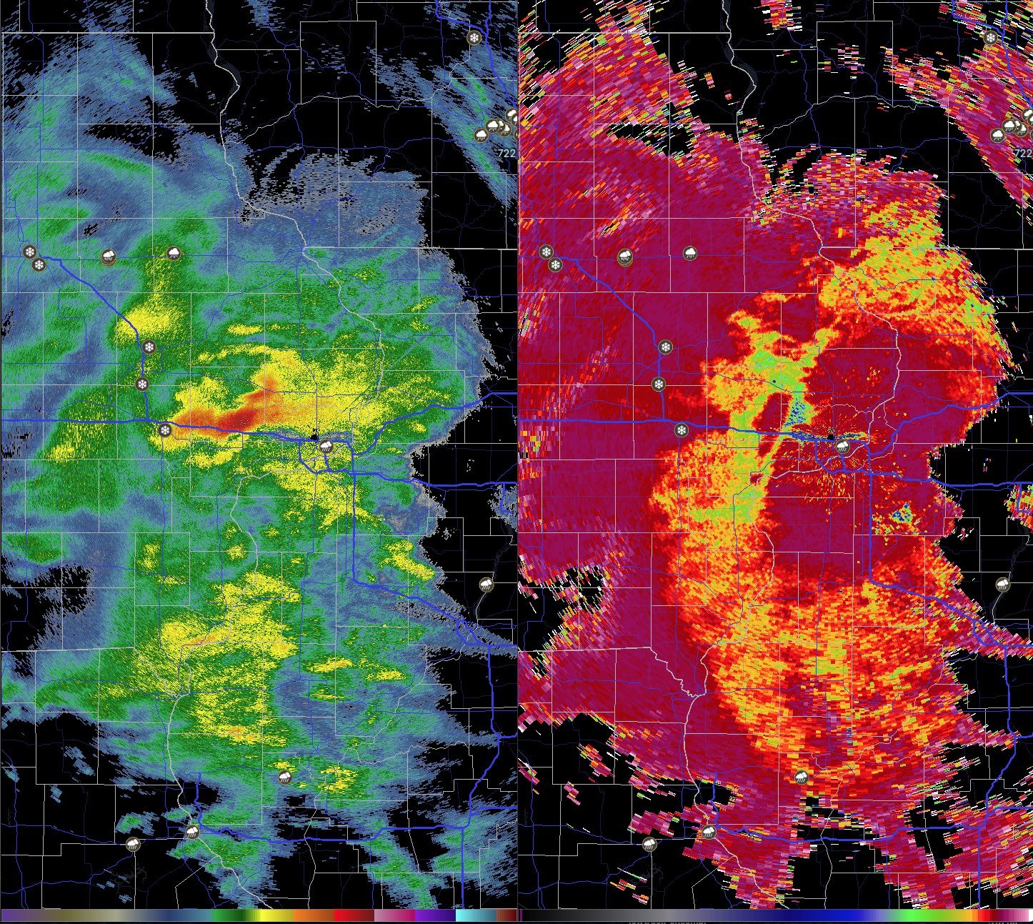
Looks like a straight thunderstorm just east of Iowa City? At least on radar
That's bright banding, where precip is mixing and/or snow is melting. No lightning in that area though the precip is convective.
-
3
-
-
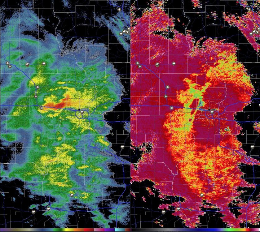
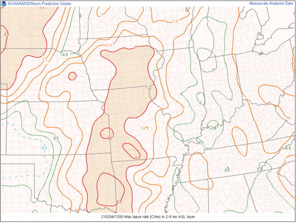
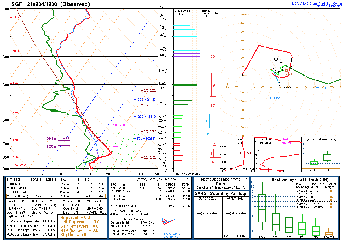
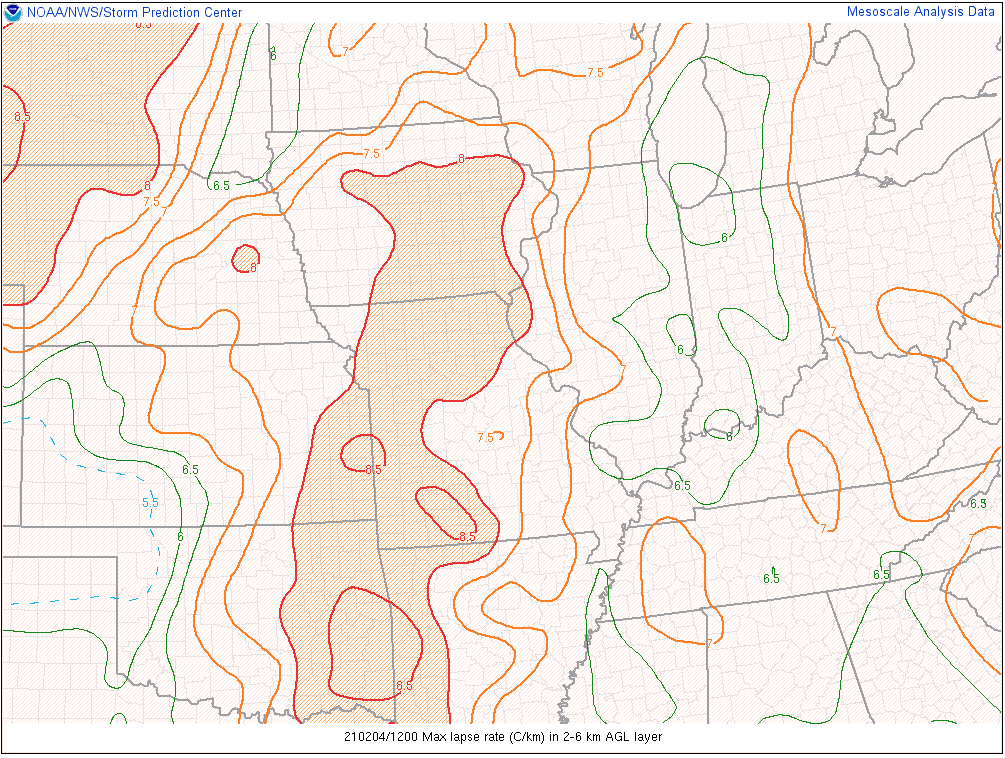
About as good as it gets w/ lapse rates at SGF this morning, though dry air is factoring in. 8.9C/km max mid-level lapse rates, and 8.3 from 700-500mb, w/ 147 J/kg of MUCAPE.

Max lapse rates 2-6km are similar in a pretty large area of the warm sector.
-
1
-
1
-
-
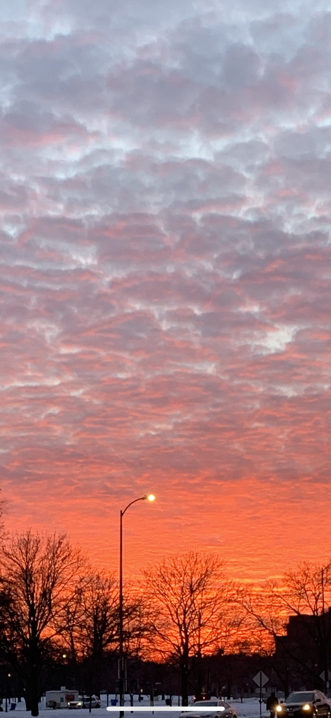
Nice altocu field at sunset this evening, indicative of the already steep lapse rates below 500mb.

-
9
-
-
2 minutes ago, Powerball said:
I'd keep an eye out for TSSN on Thursday afternoon/evening too, as looks like some pretty decent mid-level instability is showing up.
Hahaha beat me to it.
-
1
-
-
Feeling pretty good about seeing some TSSN in the region tomorrow. Will want to see lapse rates verify on the 12Z TOP and SGF soundings. At the very least some swaths of 1-2”/hr rates are probable.
-
3
-
-
1 hour ago, Hoosier said:
Would be getting into legit "where to put the snow territory" around here. Even accounting for some settling/compaction, that would result in depth I have never seen before.
Giving me 07-08 vibes when I lived in Madison.
-
3
-
-
Won’t hear me complaining about 35 and sun prior to a weekslong bullshit air mass. Go outside.
-
4
-
8
-
-
3 minutes ago, beavis1729 said:
Ha. Now that there is extensive snow cover, I'd rather put all of our chips in on the cold. But if the choices are "cold with snow" or "extreme cold with not as much snow"...can't go wrong wither way.

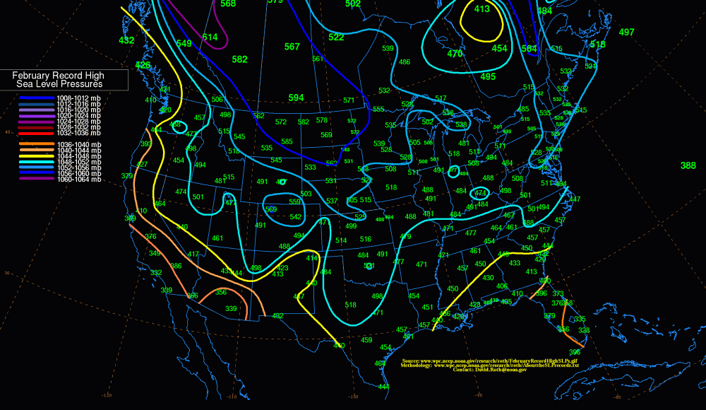
Nice 1060 high in MT at Day 8-9 on the 12z GFS; the Euro showed something similar yesterday. I'm sure there are maps showing this data...but I don't think the lower 48 has ever had a pressure this high in February in recorded history. Fun times ahead...
Correct! Looks like it's 1058.5 mb
-
4
-
2
-
-
Energy looks strung out and less phased, so it’s overall not as warm ahead of the front aloft nor does the low deepen as much. Still will have some areas that cash in on a few hours of mod/hvy snow tomorrow.
-
1
-
-
Lake effect belts should do extraordinarily well over the next week or two. Probably talking several feet of snow given the air mass and vortex just north of the Lakes.
-
2
-
-
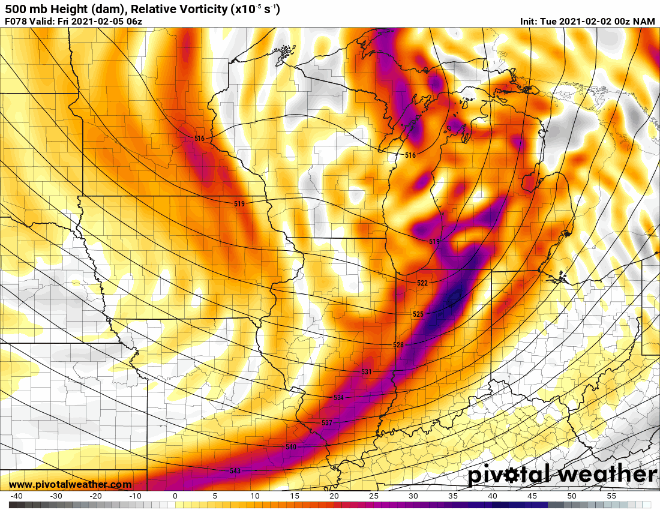
21 minutes ago, McHenrySnow said:
No major changes on the 18z NAM it appears.
Pretty big changes upstairs (see below), but it didn't really translate to much difference at the surface. The splotchiness of snow accumulations in these parts is indicative of dynamic cooling. Probably going to have to rely on that south of ~88/290 as others have mentioned. Don't think we should disregard that scenario given the ingredients showing up on a lot of guidance: steep lapse rates, 500-250mb left exit region dynamics, highly focused WAA, but air temps will almost certainly be above freezing for at least a few hours S/SE of wherever the surface low ends up tracking. Whatever snow ended up falling in those areas may not accumulate on roads (unless it's heavy) but could add to the snow depth a bit.
-
3
-
-
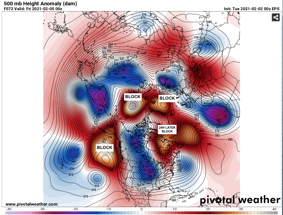
12 minutes ago, Angrysummons said:
There is no block.

-
1
-
9
-
-
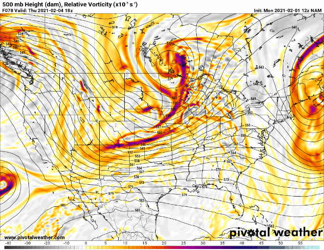
4 minutes ago, hawkeye_wx said:
12z NAM has jumped nw big time. Models will need more time to figure this out.
It is totally different with the upper energy on every run. Most of the short waves involved still aren’t in its domain so it will probably jump around for at least another 24 hours.
-
3
-

Feb 6-7 storm?
in Lakes/Ohio Valley
Posted
What’s your flake quality like?