purduewx80
-
Posts
1,705 -
Joined
Content Type
Profiles
Blogs
Forums
American Weather
Media Demo
Store
Gallery
Everything posted by purduewx80
-
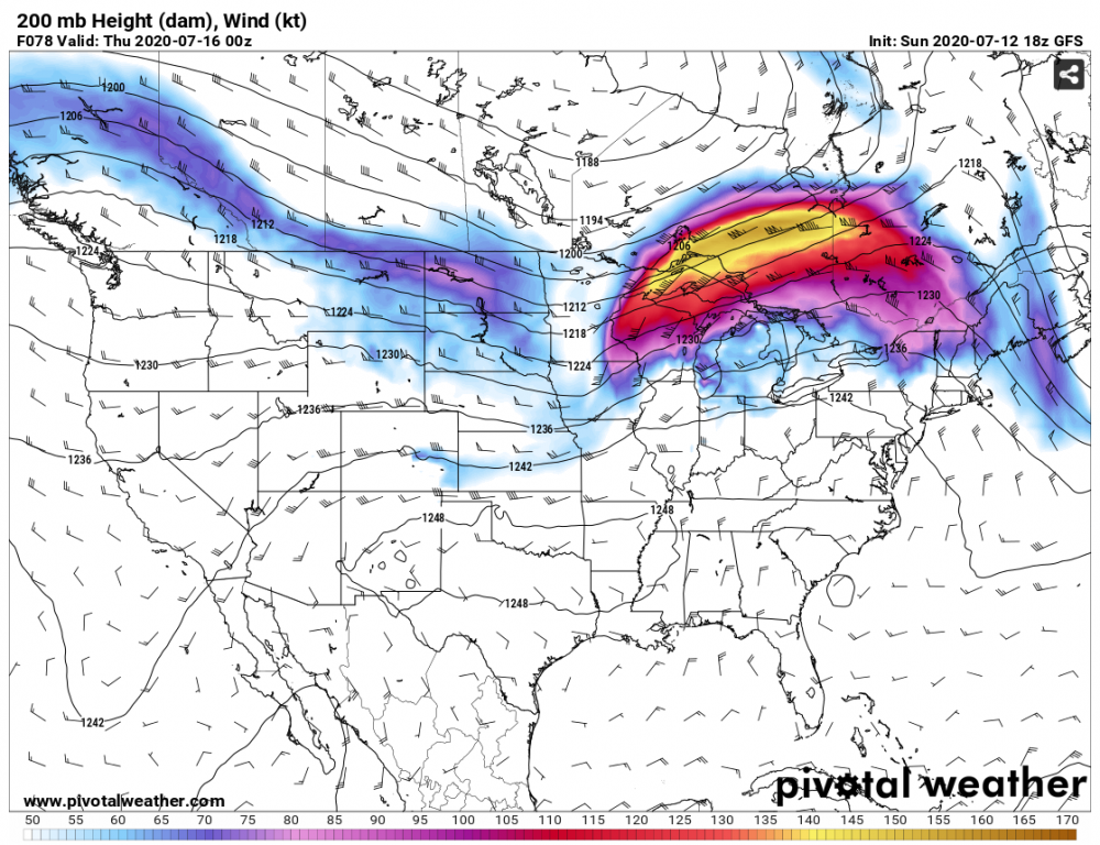
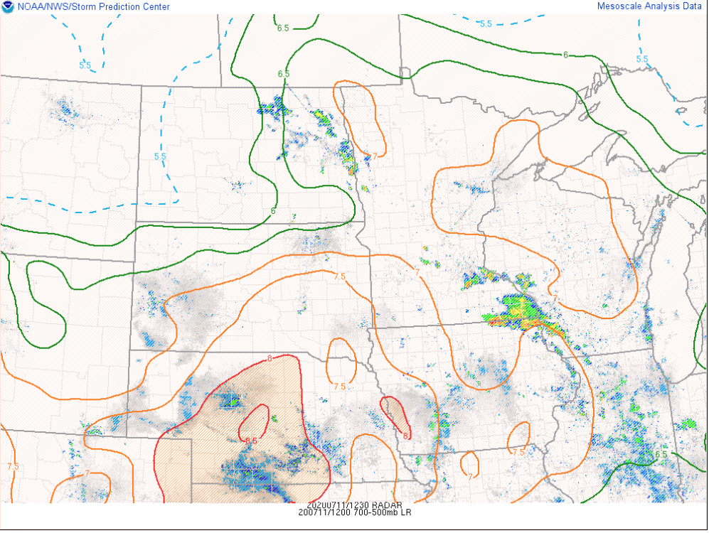
MCV + 2" PWATs....gonna be some flood threat too. Also...this is unreal for July. Phenomenal jet dynamics in play.
-
this explains a lot about your position on the virus and economy.
-
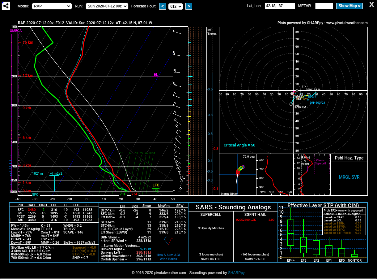
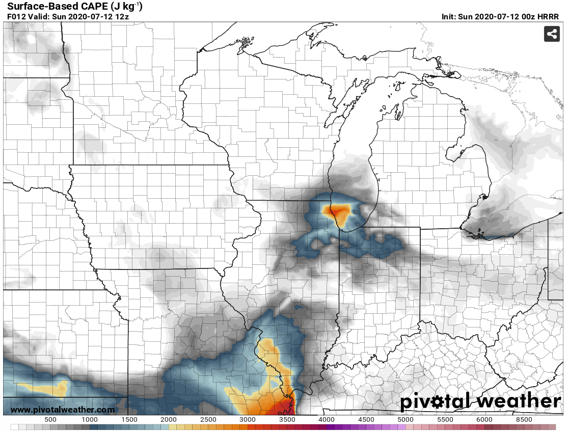
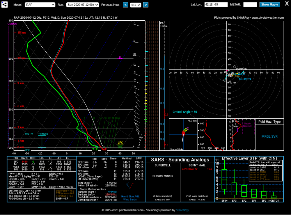
This RAP fcst sounding from the southern tip of Lake Michigan at 12Z tomorrow morning is nothing short of impressive. That's lake-induced CAPE...suspect there will be some waterspouts out there in the morning. Can't rule out a thunderstorm making it into parts of Chicago and NW Indiana as the surge of cooler air moves in. 00Z HRRR valid at 12Z:

-
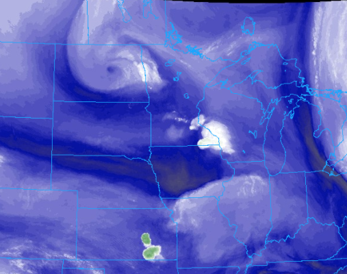
upper low moving in will support destabilization. projecting out cells in NE IA now...they would be here closer to 11-12, but there could be some development out ahead of it. Cu growth has occurred so you can see the signs of instability building behind the AM activity.
-
Could be an enhanced wind threat in western parts of the area later this afternoon and evening. That potent upper low in the Dakotas will drag the EML into IA, MO and IL and likely result in a bowing line or two later on.
-
Hope so. Tourists are back at Willis Tower today. Fortunately, everyone I saw in line was wearing a mask properly.
-
IL ramping back up now, too. Numbers from these states that opened early should've been the first clue that this would happen. https://www.nbcchicago.com/news/coronavirus/illinois-reports-highest-daily-number-of-coronavirus-cases-in-more-than-a-month/2303179/
-
Nice...definitely getting into ring of fire, possible derecho, season with that potent e-w ridge over the CONUS. Just looking at the overall pattern, you're going to have some faster mid-level flow with how strong the ridge is and any energy that runs over the top.
-
-
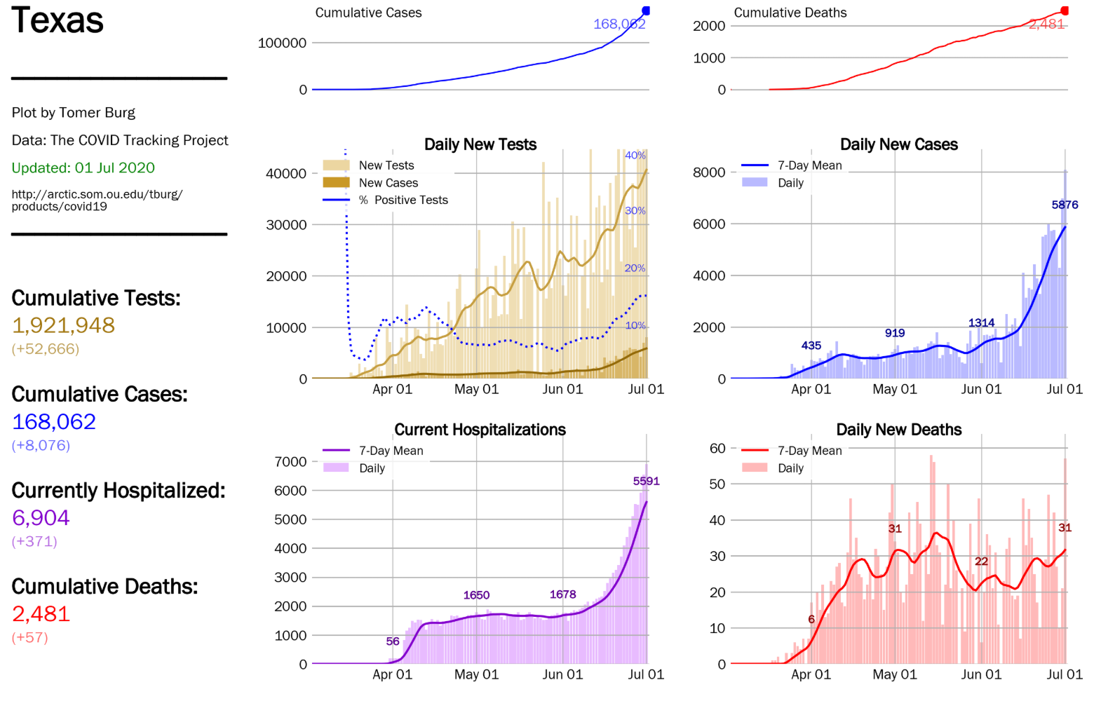
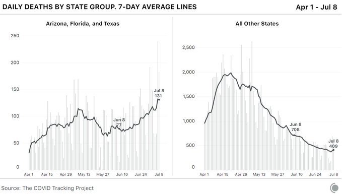
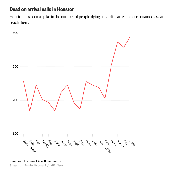
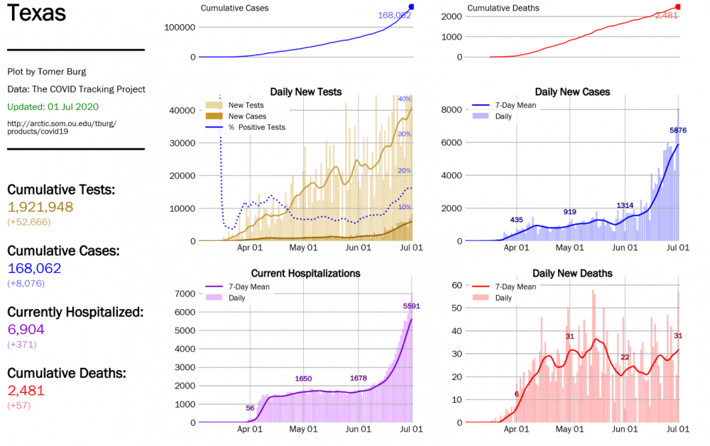
Similar to what happened in NYC, at-home deaths are seeing a spike in TX. Hard to know how much of this is people afraid to go to the ER/doc vs. true COVID-19 deaths, but it's still alarming.
-
More new details about the potential long-term effects are super concerning for those of us who've had the virus already.
-
We already learned in the NE that reacting to sharp rises in cases means any mask or shutdown measures are too little, too late. Now is the part where pre symptomatic or asymptomatic people are infecting their friends and families. The longer we keep making these mistakes, the longer it will take to get back to business “as usual”.
-
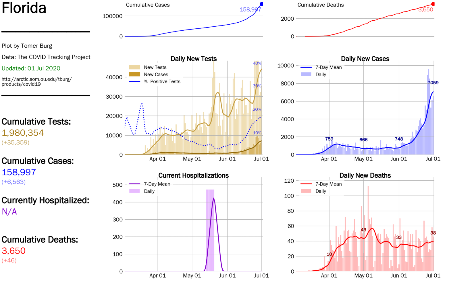
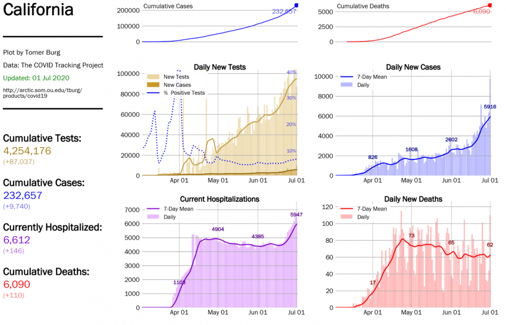
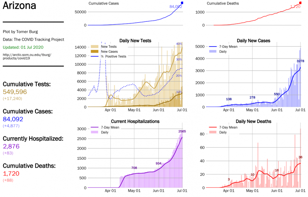
Already seeing that trend up in AZ and TX. FL and CA will probably follow shortly.

-
bUt DeAtHs aRe StIlL tRenDiNg DoWn
-
Good luck with a national mask law. Public shaming/cancel culture seem to be making progress. If that won’t work, more lockdowns will do the trick.
-
new study in Nature today:
-
oh i definitely understand, but what can i say? freedom isn't free. all of what you describe is more a disruption to capitalism than anything else. it's what we have to figure out how to deal with now.
-
I caught it back in March when I still lived in NYC, most likely from community spread. At the time, it was unclear what was going on because we weren't aware of all the symptoms people were experiencing. Never had a fever or cough. I was fortunate to not have it as bad as some, but I was still sick for almost three weeks. The most alarming symptom for me was having zero sense of smell. My boyfriend did not fare as well, but he made it out ok, too. I'm still wearing a mask when in public since we don't actually know how long immunity lasts, or if everyone even becomes immune. It feels important to normalize wearing masks in public because that is literally our best bet to get past this. It's unwise to assume you won't catch it in your small towns (which by the way are adjacent to busy interstates with restaurants and gas stations you may use, no?), especially with folks traveling more now. The only thing I fear personally is further economic collapse caused by the entirely preventable spread of this virus. I suspect we should remain concerned about our shitty healthcare system becoming overwhelmed, too.
-
This was the entire point of my so-called "baiting". Thank you for explicitly stating it. Wear a mask. Normalize it until this is over. edit to add that opening the entire economy up now is obviously ill-advised after the recent surge in cases.
-
Unabridged capitalism and our modern “need” for immediacy will obviously not work with everything going on. There may be some happy medium between short-sighted open-everything-now and careful, long-term planning to get us through all this, but we can’t just assume a vaccine that doesn’t exist yet or herd immunity are going to work. There’s a shit ton we still don’t know about it. I’d loooove to know how many of the people in favor of letting old folks die consider themselves pro-life.
-
This thread about how masks prevent droplets from escaping during speech is wonderful. It's all hard science, easy to follow and not anecdotal. https://threadreaderapp.com/thread/1274036544387477504.html
-
yes, they absolutely are.
-
IL requires them in public spaces when you can’t social distance, so maybe that’s why? Most airlines are requiring them on the plane, but not sure how that works in airports since they’re a mix of federal, state/local and private property.
-
There is literally no point in arguing with pig-headed science deniers. Let them live their fearless, ignorant lives.
-
beavis for prez.