Climate175
-
Posts
304 -
Joined
-
Last visited
Content Type
Profiles
Blogs
Forums
American Weather
Media Demo
Store
Gallery
Everything posted by Climate175
-
Feb 22nd/23rd "There's no way..." Storm Thread
Climate175 replied to Maestrobjwa's topic in Mid Atlantic
If it still shows it at 18z (not holding my breath), that would be absolutely hilarious though. -
Feb 22nd/23rd "There's no way..." Storm Thread
Climate175 replied to Maestrobjwa's topic in Mid Atlantic
The tug of war continues lol. -
Feb 22nd/23rd "There's no way..." Storm Thread
Climate175 replied to Maestrobjwa's topic in Mid Atlantic
A cave is gonna happen in one direction or another. GFS vs Euro tug of war LOL. -
Feb 22nd/23rd "There's no way..." Storm Thread
Climate175 replied to Maestrobjwa's topic in Mid Atlantic
I was thinking this lol. -
Feb 22nd/23rd "There's no way..." Storm Thread
Climate175 replied to Maestrobjwa's topic in Mid Atlantic
LOL. -
Feb 22nd/23rd "There's no way..." Storm Thread
Climate175 replied to Maestrobjwa's topic in Mid Atlantic
Stranger things have happened LOL. GFS not backing down. It’s either going to get clowned or was on to something. -
Flip flop, flip flop lol.
-
Good comedy on this forum when nothing going on lol.
-
What a gradient!
-
Winter Storm Threat *Technical* Discussion. No Op Run PBP or Snow maps
Climate175 replied to CAPE's topic in Mid Atlantic
I believe this was a smart idea. As we can see with the response to the 12z Euro, we need a place to read analysis without the volatile reactions LOL. -
Too suppressed or too warm. It’s all about timing for these storms here lol.
-
Winter Storm Threat *Technical* Discussion. No Op Run PBP or Snow maps
Climate175 replied to CAPE's topic in Mid Atlantic
For those with more knowledge, did the GFS and ICON at 12z show a type of Miller A situation? -
It would be nice to see a happy Beethoven avatar before the season is over lol.
-
True that LOL.
-
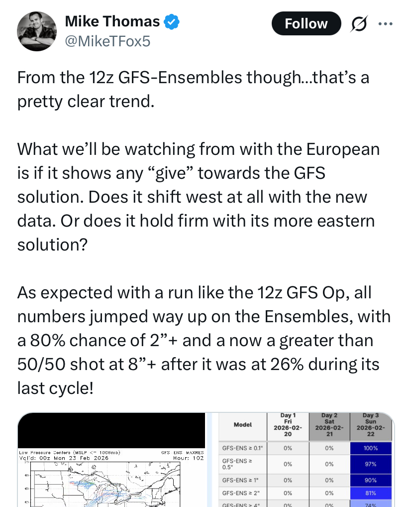
CMC and Euro are next on the model train. 12z GFS definitely took a change that can’t be dismissed as small.
-
I’m liking where this is heading…
-
Already a noticeable difference seen between the 06z and 12z.
-
Let’s see if GFS and Euro do anything similar lol.
-
Thanks for sharing your thoughts even it’s not what people want to hear LOL.
-
It’s all good. Just ignore the people making a big deal out of a minor mistake. We all make mistakes. I read more than post, but I’ll also post images from time to time. I read from those who understand the models better than I do LOL.
-
Wouldn’t that be something…
-
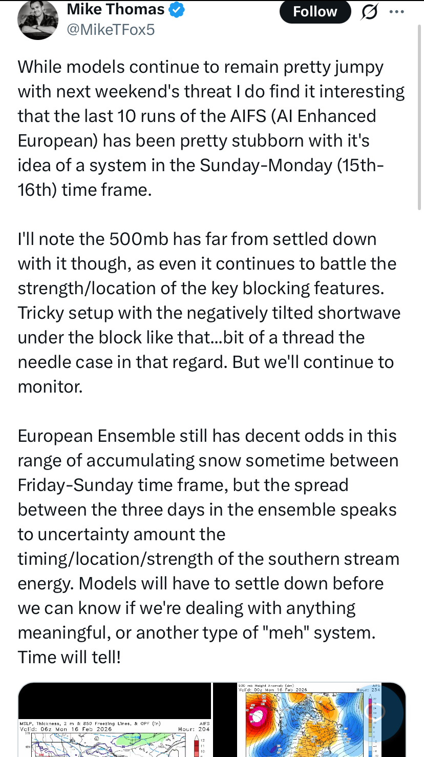
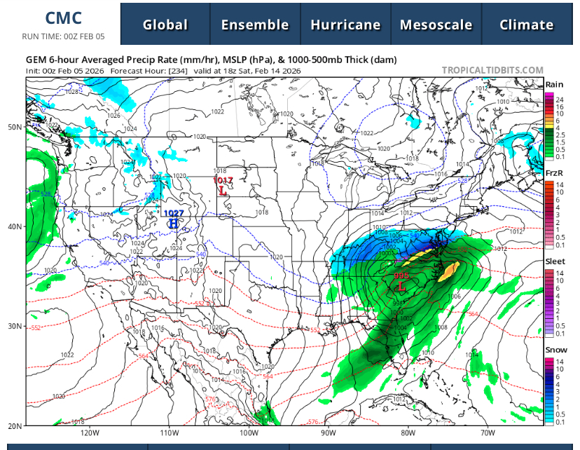
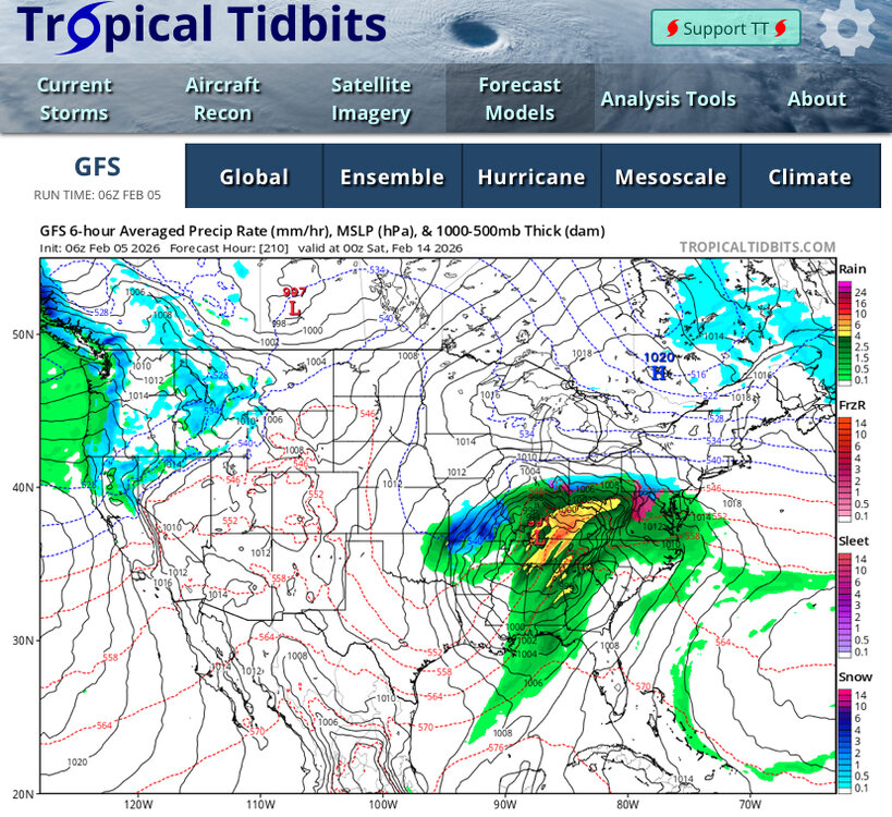
Whatever becomes of this potential storm, it looks like the major global models are at least indicating it will have a lot of moisture to work with.
-
This. GFS, EURO, CMC and their ensembles are now all showing a potential storm Feb 14th-16th. That’s the only thing to conclude. Trying to figure out where the rain/snow line, totals, etc will be 9-10 days out is unwise. That convo starts to make more sense like 2-3 days out.