

Albedoman
-
Posts
843 -
Joined
-
Last visited
Content Type
Profiles
Blogs
Forums
American Weather
Media Demo
Store
Gallery
Posts posted by Albedoman
-
-
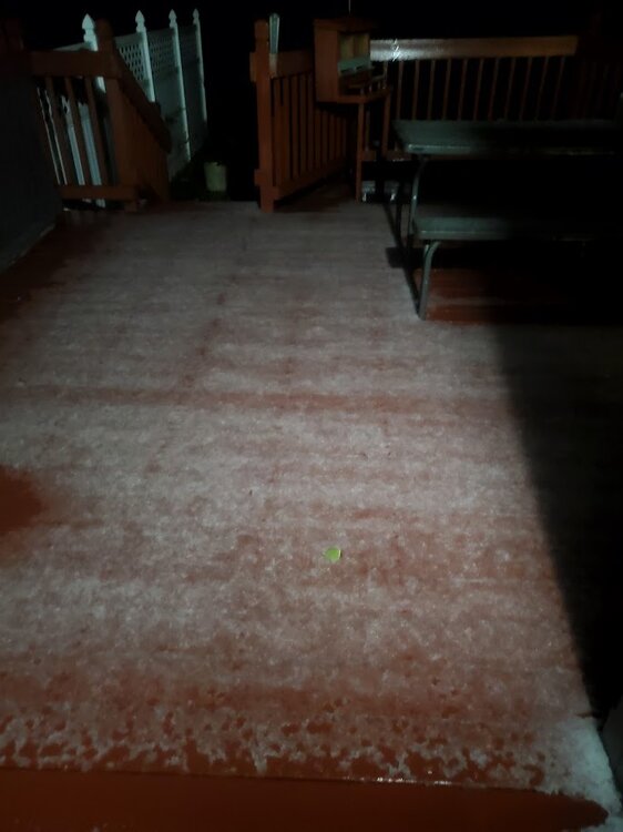
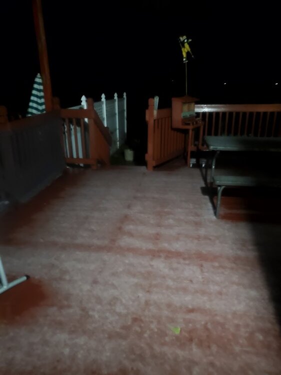
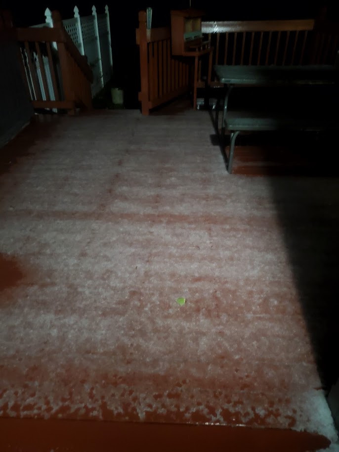
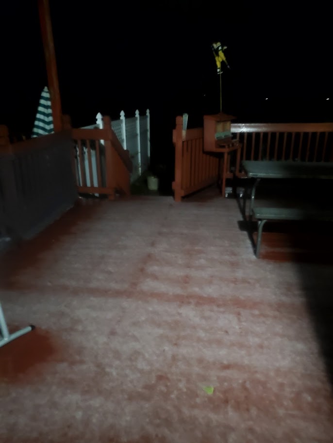
I tried copying the camera shot from phone the first time. I deleted it and reloaded it. One hell of a graupel thundershower. Ground was white and the cars.. Whole house shook. This was about an hour and half ago in Macungie PA
-
 1
1
-
-
It is pouring agan here in Lehigh county. I should 4 inches easily in the next few hours
-
the drought guy here is drowning LMAO. 3.24 in of rain in the last 24-36 hours. Little Lehigh is flooding , Roads closed and farms fields underwater. Farmers say it will at least 2 weeks before they can get in the fields to plant. Its time for a good long warm dry spell. Since December, we have had nearly a years worth of precip (snow and rain) in Lehigh County already
My thoughts-- eerily similar setup in this current weather pattern for continuing this wet spring and for an early tropical storm formation like Agnes in 72. A wet spring followed by an early tropical storm would be devastating for our area. https://www.washingtonpost.com/climate-environment/2022/06/19/hurricane-agnes-susquehanna-50years-storm/
-
 1
1
-
-
1 hour ago, Birds~69 said:
Drought guy will have a fit.
Appears (cold) rain starts around midnight...hopefully it rinses the pollen and crap off the car.
41F/Cloudy
no way in hell will I have a fit. It will take three months of below 1 inch of rain before the groundwater level and stream levels would even approach drought warning conditions. The local springs are up big time and the base flow of the Little Lehigh Creek in my backyard is still at bank-full. I expect flood warnings to be issued for the Trexlertown area at 1.5 inches of rain as the ground is still saturated tomorrow. I am more worried about more dead ash trees falling from the gusty winds as the soils are supersaturated. I expect Spring Creek rd to be closed by tomorrow afternoon too from the flooding. If a drought were to occur, drought warnings would not be issued until late August at the earliest. July is usually are heaviest precip month too. Weather world is in another world
-
1
-
-
another sunny day that has become cloudy. Please make this stop. Its been doing this since last June and the smoke fires.

-
 2
2
-
1
-
-
10 hours ago, canderson said:
Why didn’t you take a trip out there? It’s epic stuff!
you could have saved a bunch a money and visited macungie two weeks ago to see those rates LOL
-
1
-
-
what a dud- brief squall line of 45 mph winds. No t storms and heavy rain ended in three minutes. Too much hype. The rolling thunder this morning in the showers was the highlight of this event.
-
woopee, first t -storm of the new year- in February to say the least. It was nice to wake up hearing rolling thunder with the windows open. I miss the humidity. This is the first time in the past 30+ years I can remember a t storm in Feb but I may be wrong. More to come this afternoon.
-
2 hours ago, Ralph Wiggum said:
The warm days, the cloudy days, and the abundant rains are all trademarks of a Nino fwiw. Kind of surprised how this winter played out here. What surprised me most is the lack of Southern snows along NC/SC a few times during a Nino. Didn't have that this year. I wonder if that feature has shifted N over the years to our region? We usually don't see the week-long stretches of winter but rather one big one in Feb or March. Interesting that Nova Scotia got an anomalous 5' + snowstorm a few weeks back. Hmm, maybe everything did shift N this year. Wonder if that's a sign of the times/change?
yes I agree with El nino pattern statement should be expected rains and warmth but not to that extreme that we all experienced. December had the most rain ever recorded in the LV which rivaled good hurricane season rains and flooding was unbelievable. I am also sure it was the cloudiest periods ever for the winter season. Somebody needs to find this out. We went in 5-6 day mostly cloudy stretches for at least two months with no 2-3 day consecutive sunny days That should have been a good tell how this winter was going too.
-
well for macungie, I still rate it a C- even with the nice snowfall event on Saturday and the previous week. The temps have been cold this week and for one week in January but what strikes me about this winter was the amount of warm temps and rainfall from late November into January of nearly 15 inches. Furthermore the excessive cloudy days throughout the entire winter season did a number on my utility bill trying to keep the house warm. This winter sucked except for the last week. A couple of weeks of winter simply does make up for the flooding rains and cloudy days, especially at Christmas time.
-
2
-
-
32 minutes ago, MAG5035 said:
I’ll do a late progress report as it pertains to meteorological winter (DJF)
1. C-D ish on average. I think most generally expected a warmer start to winter and the potential for storms and cold to be later in the winter. I did not anticipate the warm December the CONUS ended up with at all, that probably should’ve been a hint. We have had opportunities and some of them have delivered but it has just not wanted to be cold for any longer stretches this winter. And we’ve had a couple bigger storms but we haven’t had pattern alignments conducive for phasing, and it’s been mostly either southern or northern stream waves… which limited opportunities for a KU type event.
2. C+. The pattern itself has been overall more favorable than last year, especially with storm track. Most events have went under or tried to go under PA (transfer). We’ve only really had maybe a couple straight up cutters, and one of them ended up delivering my biggest snowfall of the season to date. There’s just been no cold air, there’s no persistent ridging in the PNA/EPO realm to help deliver any cold when it has actually been in Canada outside of the middle of Jan.
3. B. I’ve personally had two winter storm warning verified events and 4 other advisory caliber ones at my home, which isn’t half bad to this point. A one off big hitter sometime in March (like a March 22, 2018 or better) would get me to a total I would consider to be in the average range here. Same could be said anywhere else in C-PA and the northern Mid-Atlantic. And of course there’s that stripe of eastern PA in the Lehigh Valley/Poconos that is already near or at average. Honestly, that we’ve achieved that considering how warm the winter has been temp wise in the northern half of the country is a small miracle.
4. D. I’m big on pack retention, and this winter hasn’t been a good one for that. The middle 10days or so of Jan and getting to snowboard Blue Knob at 100% twice saves me from giving this criteria an F.
5. F. There just hasn’t been any cold pattern that has stuck this winter. The one we did get in January was delayed. The Jan 6 and 9th storms came before it was actually cold, and the below normal stuff came mainly centered on about 5 days or so, where we scored a couple decent advisory level northern branch systems. The MJO’s two week+ meandering in Phase 7 after running thru 4-5-6 and then subsequent failure to run thru 8-1-2 despite what is likely an all time record reversal of the SOI from Jan to Feb probably has a part in what sunk this month overall for any kind of a truly cold pattern.
6. F-. The hype in late Jan for what was being shown at the time in the weeklies/ long range ensembles was off the charts. Not necessarily in here, but some folks were all in on that 2010, 78, 58 type pattern. Reality ended up being meh but it’s been way worse in the snow dept, but the expectation of a big storm pattern and cold made this month a huge disappointment and later in the winter was where forecasts were being focused on for delivering the goods.
If winter ended now I’d give it a C-, aided mainly by the snow we did get. But we got March, and I’m not writing anything off in that month yet.. esp second half of the month.
nice report card synopsis I would change the grade for No 6 however from F- to withdrawn or incomplete. We must grade properly now. By the way, maybe some of the courses were audited so a satisfactory or unsatisfactory maybe more appropriate. I would say no. 6 falls in the category too. LMAO
-
11 minutes ago, zenmsav6810 said:
Indeed, it was a good measurement. Unbelievable how localized the totals were.
thanks for your confidence in me. Last night single digits back up the snow pack too. I just wish everyone would have received the same amount. Its not fair as I feel as I am the one that got served surf and turf while everyone else got mac and cheese.
I warning many of those who think winter is dead based on the upcoming weather patterns. A dying el nino pattern usually brings a significant snowfall by mid to late March for our area. My 30+ years, I have observed this phenomenon. The problem is that it will all melt right way because of the sun angle but I still think about it. The 60+ degrees in early March will be replaced by cold rainy April too.
-
1
-
-
down to 9 degrees in the LV this morning. Snow pack has helped. Yesterday, I got down to 8 degrees
-
3
-
-
11 hours ago, Itstrainingtime said:
Good, because I'm already down to 28.
Of course, it's still Monday so there's that.
I see the single digits are shown over the snowpack areas of the LV. Pretty accurate. Already 20 degrees
Got down to 9 degrees this morning under the snow pack. 14 degrees right now.
-
1
-
 1
1
-
-
7 hours ago, zenmsav6810 said:
This did not disappoint. The 13.8" in Macungie lived up to the hype at Bear Creek Mountain Resort-- deepest fresh powder I've ever skied. It was like the perfect amount. Definitely the light fluffy high ratio stuff!
I am an official spotter for the NWS for the last 25 years or so. I reported that measurement. I do not hype measurements. I was not kidding with all of observations about the snowfall and snowflakes. I live about two miles from the resort. The total after the snow squalls was over 14 inches. I still have 10+ inches on the northern side of the house. The southern facing sides lost all but about 6 inches.
-
1
-
1
-
-
2 minutes ago, Itstrainingtime said:
If the airport in Thomasville (York County) had similar snowpack to what you do - they would likely hit zero or below tonight. It's amazing how favored areas do with snow cover on optimum radiational cooling nights.
I'm curious to hear what your low is tomorrow morning.
I am being very conservative. It would not surprise me though to be near zero if the winds decouple at sunset
-
1
-
-
I expect to be in the single digits tonight again. Saturday night was 8. Last night was 18 with some cloudy skies. A foot of snow pack has greatly helped with raditional cooling and I am in a deep valley. My predicted low tonight will near 5-10 degrees
-
4 minutes ago, LibertyBell said:
Mansfield OH.... wow, they should have 3 feet of snow by now and they don't even have 8 inches!
I have had 35.5 in of snow thus far. The 14 inches I had on Saturday helped. This would rank near the top 5
-
1
-
-
32 minutes ago, TheClimateChanger said:
reached 35.5 in of snow thus far with Saturdays snow event in Macungie. That is our average snowfall for the year here with another month to go
-
31 minutes ago, MJO812 said:

wow, if threw in Macungie in this list , we would be 7th highest on the list Just the fact that allentown has had the most snow in PA on the list is so rare
-
3 minutes ago, Ralph Wiggum said:
Don't know if this is the one or not. But I'm confident we haven't seen the last of the winter weather for the season. Hey, if you get forecast for double the amount expected at my locale again, you got a spare room? Might need to chase

sure. You can help remove the snow from my deck LOL
-
1
-
 1
1
-
-
At 36 inches for me in Macungie
-
got down to 8 degrees at the house last night- coldest of the year with a nice 20+ inch snowpack in the area to aid in the raditional cooling
-
2
-
1
-
-
1 hour ago, Itstrainingtime said:
On the bright side, your tried and true methodology of forecasting meant that you weren't surprised.
")
I knew Sat mornings storm would overperform in our area but to the extent of the meso banding setting up right over my backyard for 4+ hours at 4-5 inches per hour, now that was unexpected 14-15 inches of the fluffiest snow I have seen in many years was a nice surprise- just like getting nearly 15+ inches of rain in December. I guess what to expect in the upcoming months- a severe ice storm,or a severe t- storm with hail/ tornadoes in March is not out of the question at this point. LOL


E PA/NJ/DE Spring 2024 OBS/Discussion
in Philadelphia Region
Posted
all I can say it is way too cold. Cloudy with 45 degree temps for mid April during the day- BS. Give my heater a rest. No worry with pollen, the drizzle and cold temps keeping the windows shut for now. I see no 75+ degree days until mid May and chance of killing frost or freeze next week. Not a Spring to remember for sure