
Southern stream
-
Posts
44 -
Joined
-
Last visited
Content Type
Profiles
Blogs
Forums
American Weather
Media Demo
Store
Gallery
Everything posted by Southern stream
-
March 17-18 Severe Weather Event
Southern stream replied to DanLarsen34's topic in Southeastern States
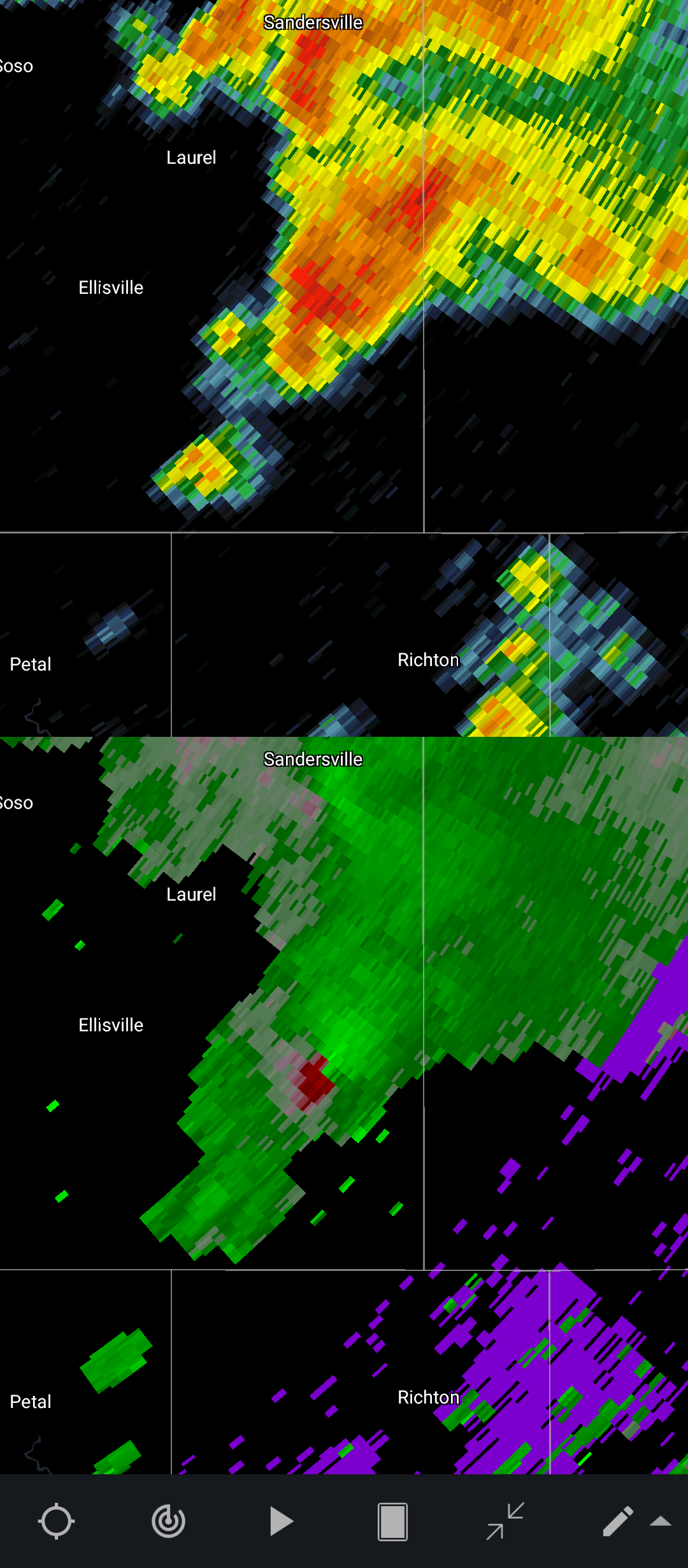
Impressive, SE MS rapidly becoming active.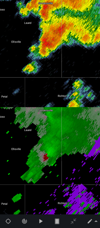
-
March 17-18 Severe Weather Event
Southern stream replied to DanLarsen34's topic in Southeastern States
Agree! I would honestly say throwing out predicted numbers and intensities is altogether, irresponsible. Just the fact that alot of this event will occur in the evening/overnight makes it a very dangerous situation. -
Spring 2021 Medium/Long Range Discussion
Southern stream replied to madwx's topic in Lakes/Ohio Valley
Although this is no promise of active weather, definitely a step in the right direction.
-
Spring 2021 Medium/Long Range Discussion
Southern stream replied to madwx's topic in Lakes/Ohio Valley
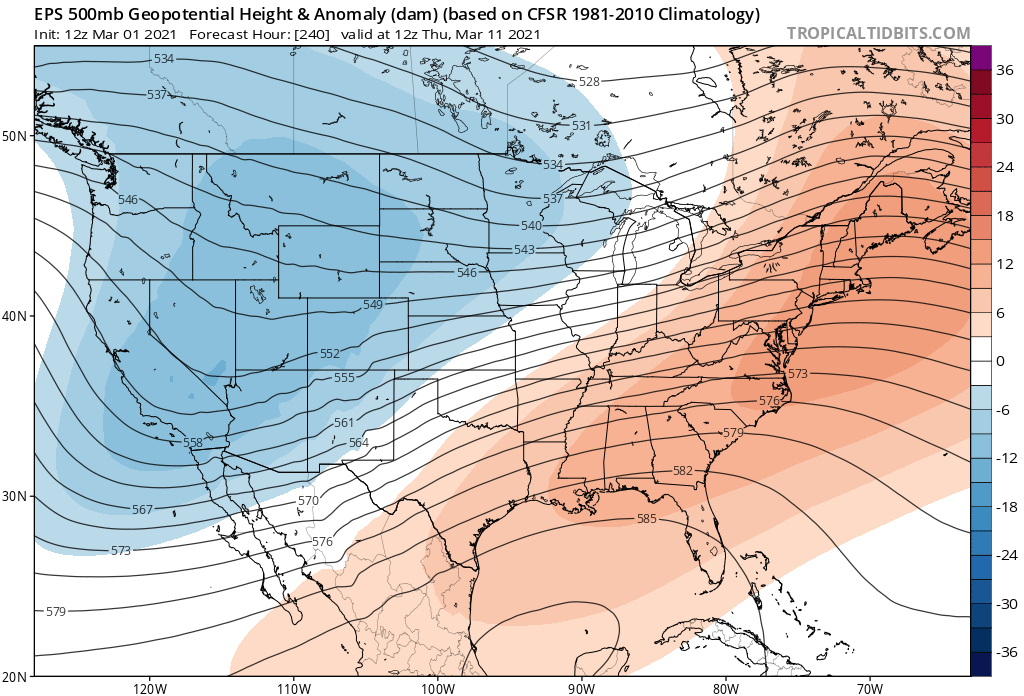
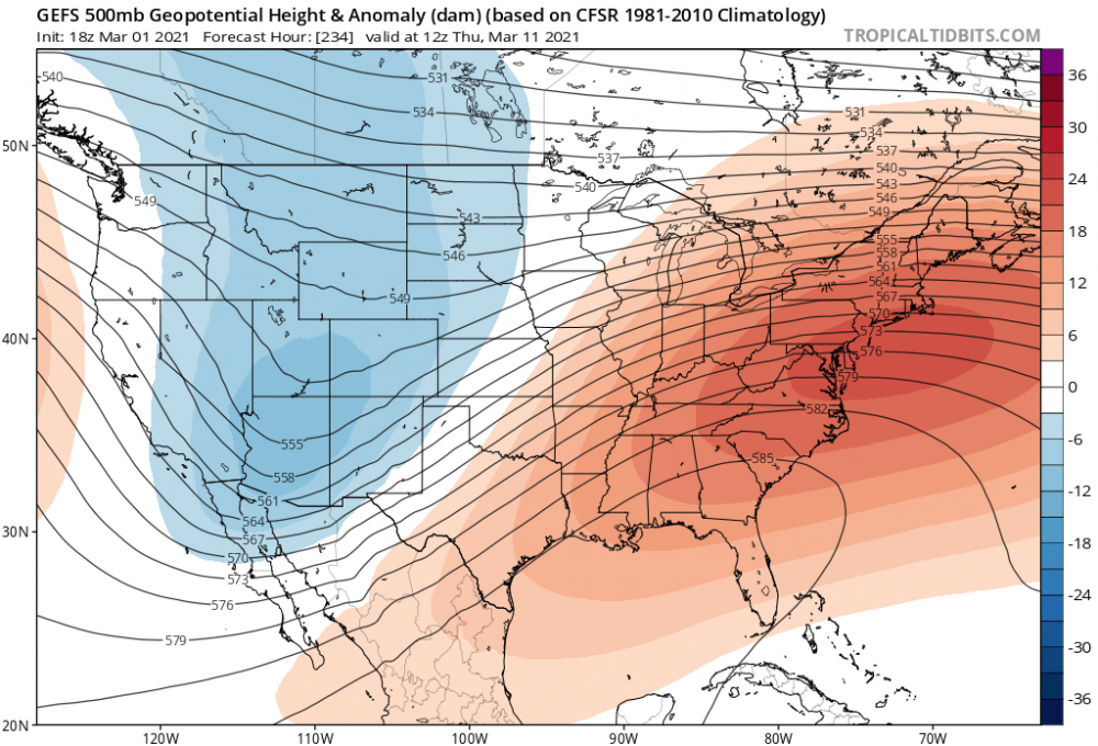
With all of the historic flooding around here, many of us need a break for the next several days so no complaints here. Height anomalies look encouraging toward mid March. More of a typical trough west/ridge east scenario. Jet pattern really amplifies around that timeframe. -
PAH and LMK will more than likely up areas to warning headlines by morning, based on the 0z runs a good (maybe even conservative) 6-10"+ swath looking probable considering the ratios we will be dealing with in an arctic airmass. Hopefully you peeps up to my north/northwest can get in on the action too.
-
Okay, I noticed there is a relative lack of southern/eastern sub-forum members posting on this event so I decided to hop in. Long time lurker of 6 years, from NW KY. It's been quite awhile since I have seen this much consensus on a 6"+ storm for the Lower OH Valley. Excited to say the least! Was somewhat questioning last night's 0z GFS sporting the progressive bias, but pretty much all late evening runs have corrected back to the west. Thankfully this go around we won't have any icing issues in my vicinity, received almost .50 of that from the ice storm a few days ago.